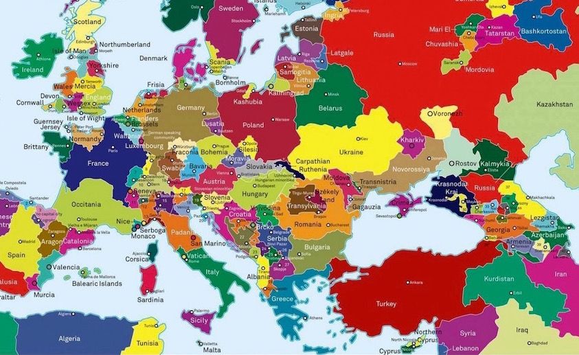
Basically, what Europe would look like if every secessionist movement is successful.
(I wonder what the EU will be like in this timeline...)
The Text and Graphics are by Theo Deutinger, Filip Cieloch and Lucia de Usera
Mapped: What Europe Would Look Like if All Secessionist Movements Succeeded
The independence movements in Catalonia and Scotland have grabbed a lot of headlines in recent years, but what about Brittany and Transylvania?

 )
)