Map Thread XXI

Status
Not open for further replies.
Crosspost from Vider Avan i Sur: Oblasts and Okrugs of Russia 2039-
okrugs 3.png

Administratively, Russia is divided into thirty-four oblasts (области), which are then subdivided into okrugs (округи). Certain okrugs with large minority populations are termed autonomous okrugs (автономный округи); these have the power to set languages other than Russian. The present oblasts were formed in the 2030s after the mass consolidation of federal subjects (oblasts, krais, republics, federal cities, and autonomous okrugs) and the absorption of western and southern parts into the United States of Europe and secession of eastern parts.
 
Because that's the term that's been used to describe it? It's important to note that the Latinization of Kyiv being switched to Kyiv only happened, like... a month ago.
Except that:

a) That article you cited points out that "Kyivan Rus" is a viable alternative

b) The use of the name "Kyiv" in Ukrainian dates back way before "a month ago", being named after the legendary founder of the city Kyi

c) The name "Kiev" is derived from Russian and not Ukrainian, so it doesn't make sense for this timeline to use it, given that it's supposed to be more heavily Ukrainianised

d) Trying to cite how things went in OTL as a justification doesn't really work here, since your map has 1012 AD as the POD, and the article you cited also points out how the term "Kievan Rus" only originated in the 19th century by Russian historiographers (which would explain why the Russian version of the name became standardised for it IOTL)
It's really not a big deal, Kiev and Kyiv are both fine spellings. In the TL in question, given how far back the POD is, it would almost certainly be pronounced differently by its residents than it is in either Russian or Ukrainian OTL
 
Except that:

a) That article you cited points out that "Kyivan Rus" is a viable alternative

b) The use of the name "Kyiv" in Ukrainian dates back way before "a month ago", being named after the legendary founder of the city Kyi

c) The name "Kiev" is derived from Russian and not Ukrainian, so it doesn't make sense for this timeline to use it, given that it's supposed to be more heavily Ukrainianised

d) Trying to cite how things went in OTL as a justification doesn't really work here, since your map has 1012 AD as the POD, and the article you cited also points out how the term "Kievan Rus" only originated in the 19th century by Russian historiographers (which would explain why the Russian version of the name became standardised for it IOTL)
Kievan Rus' is the preferred academic term for the historical state in the English language. It has been used in the overwhelming supermajority of all historical texts written in English.

Ukrainian historiographers don't write Kyivan Rus', they write in Ukrainian because they're Ukrainian. What did the people who lived at the time call it? Not anything close because they didn't speak English, wouldn't have needed to clarify Rus', and didn't speak Ukrainian or Russian anyways, but Old East Slavic. Kievan Rus' is not a Russian version of the name, but just the regular English version of the name. If you are concerned about Russian derived spellings of a thousand-year-old state then you should really be watching out for Kiyevan Rus' (from Russian Киев), which is how it would be transliterated based off today's standards.

Wait until you hear that our transliteration of Ukraine is derived from the same linguistic standardization policies that gave us Kiev. Is Ukraïna more accurate?

The map exists in our world, so using our most common historical term for the state makes the most sense. If you apply your standards equally every timeline would have to be in the most common language at the time, or in a different version of English. Should we criticize timelines that use the words "Han China" instead of Hàncháo?

In any case, I think you missed the forest for the trees in your criticism. The map is clearly friendly to Ukraine, not Russia.
 
So the POD for the top Ukrainian one is that Ukraine does a Poland and repels the Soviets and then as a result the Weimar Republic survives and there's a general war against the Communist powers?
Yeah that's the general idea for that one. A "Democracies vs Communists in a WW2 analogue" is a little overdone in my opinion, but works for helping Ukraine in this scenario.
 
A re-projection of Jean Lattre's 1762 world map, by Ashtagon
A re-projection of Jean Lattre's 1762 world map.

Technical notes: Unlike previous reprojections of Renaissance/Early Modern maps, I used georeferencing rather than my previous "patchwork quilt" approach. This is a LOT faster and less laborious. However, a) I suspect the lines of latitude may need an extra step of adjustment; there is a noticeable seam where the latitude lines don't match up; I had to georeference the source image in two halves, as the system does not understand interrupted maps. b) There is a flaw in the final image just to the NE of Australia, so I may need to split the eastern hemisphere into two separate files for georeferencing. c) This map is just begging to have a bizarro Antarctica from another early modern map pasted in to the south.

Jean Lattre 1762 K7.jpg


Jean Lattre 1762 globes.jpg
 
Last edited:
View attachment 725928
The next instalment in my Big Nations seires, was gonna work for 10 of them to be finished, but it was taking a while, so here's 8.
Ottoman australis a name given by Westerns? What is the Ottoman terminology for this area? It is a bit strange that Ottomans would name their American colony by a perversion of Antilles but use pure latin in case of another.
 
Ottoman australis a name given by Westerns? What is the Ottoman terminology for this area? It is a bit strange that Ottomans would name their American colony by a perversion of Antilles but use pure latin in case of another.
So for the Antilles, I tried to find the Ottoman name for the Americas, eventually settling on what I found. But to be honest about Australia, I didn't really try.

I don't know very much about Turkish naming conventions, and to be honest I wanted to get these out fast, so forgive me for the lazy world building.
 

Deleted member 108228

I'm intrigued. Will there be a part three?

EDIT: I wanted to add that the whole description from "sixty million souls" on is bone chilling. It really makes you feel the deep hatred of this long war.

Fill us in on a little more of the history please? What happened to Ethiopia? I think I can tell what happened to Germany, but what exactly happened with Japan? And what on Earth did you do to Iran? What's going on with Brazil?

For sure, though the *total* deaths are 100 million. The whites are separated in the death counts due to how absolutely hated they are in post-Draka Africa.
 
Last edited by a moderator:
This map is just begging to have a bizarro Antarctica from another early modern map pasted in to the south.

View attachment 726047

View attachment 726048
Notably it looks like the map was made prior to the circumnavigation of New Zealand, and thus they could not rule out that this (rather than Australia) was a promontory of Terras Australis.

Do you have any idea what that little caption south of those *Alaskan islands at the edge of Terra Incognita reads?
At the time the map was made, the only European exploration of New Zealand was by Tasman in December 1642, who landed on the NW coast of South Island and then moved northwards. Tasman's voyage is the expedition that confirmed that Asutralia was not connected to the then-unverified south polar continent. The name New Zealand first appeared on maps in 1645. James Cook wouldn't visit the islands until 1769, seven years after the map was made.

Terres bassesoues par les Russiens: Land (something) by the Russians. Presumably a reference to the Russian colonisation of North America, which began in 1732.
 
At the time the map was made, the only European exploration of New Zealand was by Tasman in December 1642, who landed on the NW coast of South Island and then moved northwards. Tasman's voyage is the expedition that confirmed that Asutralia was not connected to the then-unverified south polar continent. The name New Zealand first appeared on maps in 1645. James Cook wouldn't visit the islands until 1769, seven years after the map was made.
Yes, I'm well aware on both counts. I just love that concept of New Zealand being a promontory of Terras Australasia, and it gets overshadowed a lot in Age of Sail punk maps by Australia filling the same role.
 
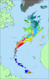
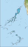
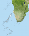
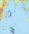
Some while back @Peppe posted a series I rather liked, unfortunately they were not in Q-Bam.
I have added them all to my base-map for use by anyone who likes the idea.
I hate to think of the climate changes, gulf stream would probably melt the ice pack over Greenland so I've added my patch for there.
I imagine the Sahara airstream would circulate up towards Europe, keeping that temperate but what would happen to the Roaring Forties? Maybe Western Australia would be greener but possibly a new ice-shelf extending East from the new landmass.

1647302753533.png1647302765678.png1647302725903.png1647302663945.png1647302621746.png

g56Ol4f.png


greenland- no ice-  based on map by northking1.png
 
Status
Not open for further replies.
Top