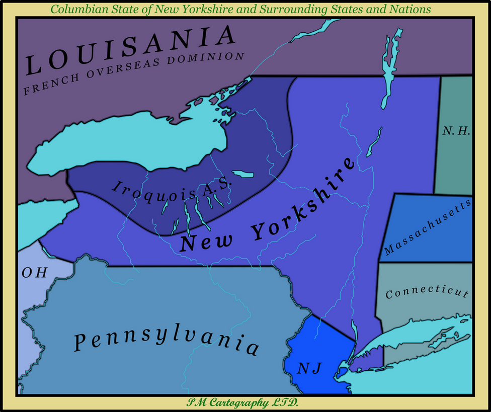
One of the original 12 colonies in the Columbian Revolution, New Yorkshire was named after the English county of Yorkshire, where its founder was from. The state was one of the first states to properly join the United States of Columbia in the mid 1780's, after the constitution was redrafted. It shares a border states with the USC's first Autonomous State, Iroquois, and the French Dominion of Louisiana, as well as six other full states in the Union. It is best known for its industry and manufacturing, but is in competition with the Midwestern states and maybe overtaken in the next few years in terms of manufacturing and consumer output.