I wonder, what is the general level of technology ITTL? Especially military technology. For example, weapons that Japan and China used in war? Jet fighters, jet airliners, battleships, SSNs, guided missiles, balistic missiles, cruise missiles, aircraft carriers, helicopters, radar, strategic bombers etc.
 
Last edited:
I wonder, what is the general level of technology ITTL? Especially military technology. For example, weapons that Japan and China used in war? Jet fighters, jet airliners, battleships, SSNs, guided missiles, balistic missiles, cruise missiles, aircraft carriers, helicopters, radar, strategic bombers etc.
I imagine it being similar to OTL, but that's more because I haven't really thought about it all that much.
 
I'm thinking of doing an update on the Philippines either for the next one or one of the ones after that. However, I doubt the British would've kept a name that originated with a Spanish monarch, so I'm trying to come up with alternate names for the archipelago. I generally have a butterfly net outside of The Americas until the French Revolution, which includes monarchs, so they could name it after King George III, who'd be the monarch when they acquire the islands from the Spanish (The Georgine Islands? Georgin(i)a? Georgia?), or they could give it some generic name like the British East Indies. If the alt-Philippines want a new name after independence, names I've thought of include Austronesia, Luzon(ia) , Insulindia and Nusantara or names from OTL like Indonesia or Malaysia (or Malaya). I'd like to hear from you guys if you have any ideas, though.
Maybe even Georgia? Considering that there's no OTL Georgia IIRC?
 
Part 148: Pearl of the Orient
Greetings, readers, and welcome back to the world of EC/FC. Today’s update takes us to the far east, as we talk about the eastern islands of the Malay Archipelago. Spanning 1,000 miles from north to south, these islands had originally been under the control of various native states and organizations, with foreign influence coming from China, mainland Southeast Asia and India. This would begin to change in 1521, when Portuguese-born, Spanish-hired explorer Ferdinand Magellan landed in the isles. While he didn’t make it out alive, it brought the islands to the attention of the Spanish, who would go on to conquer the region later on in the 16th Century, giving it the name of the Philippines (or Las Filipinas in Spanish). Spanish rule in the Philippines would last for nearly two centuries, with the islands being incorporated into the Viceroyalty of New Spain due to its trade connections with Mexico. Spanish influence would make its way into the culture of the islands, most notably with the conversion of much of the archipelago to Catholicism, though large areas of the Philippines remained unconverted (as well as some parts of Mindanao that were majority Muslim).
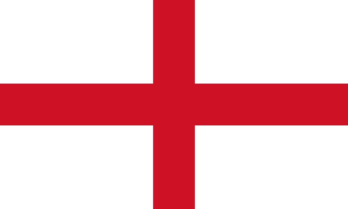
Spanish rule of the archipelago would end during the Seven Years’ War, with the British capturing Manila towards the war’s end. News of Manila’s fall reached Europe just before the signing of the peace treaty (in contrast to OTL, where it arrived just after the peace treaty was done), and the British would insist upon the handover of the islands. After intense negotiation, the Spanish would agree to hand over the Philippines, in exchange for the British repaying the Spanish monetarily and ensuring that the Catholic Church would be allowed to operate unimpeded. Thus, the Cross of Burgundy would be replaced by the Union Jack in this section of the East Indies. Not only would the flag of the islands change, but so would the name. The British found it unfitting that one of their colonies would bear a name coming from Philip II of Spain, so the name of the Philippines would be changed to the Georgines, after the current monarch George III (who still exists ITTL due to my butterfly net extending up until the French Revolution). Thus, the Georgines would become yet another jewel in the crown of the British Empire, upon which the sun would never set.
Thus, British rule in the Georgines would begin in earnest. Manila was to become the capital of the colony, as well as the Royal Navy’s main base in the Far East, as well as a key port for trade with China. The colony would be ruled through a Viceroy appointed by the crown, as it would be impractical to rule directly from London, in addition to significant involvement from the East India Company. Speaking of the EIC, the Georgines would become a secondary source of cash crops found in India and the Caribbean such as sugar, coffee, tobacco, cotton and various spices, along with less fancy crops like rice. British involvement in the islands would extend beyond economic control and into the realm of cultural influence. Protestant missionaries would make their way into the Georgines, working to convert mainly those who hadn’t been converted by the earlier Catholic missionaries. As a result, northern Luzon and Mindanao would become majority Protestant, though the Catholic Church would also have a presence in those regions, whether from native Georgines spreading the faith or from overseas Catholic missionaries, who in this case would mainly be of Irish origin. Missionaries and church organizations would also open up schools to educate native Georgine children, both in religious studies and in secular topics like reading, writing and English, which was becoming the colony’s lingua franca.
Speaking of English, the total Anglo (British, American, Australian etc.) resident population in the Georgines numbered about 50,000 in 1950, out of a total population of about 20 million. The largest population of Anglos in the Georgines was unsurprisingly in Manila, with half of the Anglo population in the country residing in Manila. Another preferred destination for Anglos were the highlands, as the cooler climate was more comfortable for Brits or Americans than the tropical lowlands. Hill stations like Baguio, Tanay and Sagada became favored locales for Anglos due to the mild climate and beautiful scenery. Other major Georgine cities like Cebu, Iloilo and Davao also had small but influential Anglo populations.
Much more numerous than the full Anglo population, though, were the Anglo-Asians, a mixed race group similar to the Anglo-Indians or Dutch Indos. There were far more white men than women in the Georgines, and since both the Anglos and the natives shared the same religion, most Anglo men who moved to the colony married native women and had mixed-race children. While the number of whites in the Georgines was the aforementioned 50,000 figure, the Anglo-Asians numbered 250,000, both from first-generation intermarriages and native-born Anglo-Asians having their own children, often with other Anglo-Asians. Anglo-Asians would go on to form an important class within the Georgines, being the bulk of the homegrown upper class. Many Anglo-Asians served as administrators, politicians, businessmen or landowners, and also as intermediaries between the White Anglos and native Georgines. Another important facet of Georgine society was the large Chinese minority. Full-blooded Chinese numbered several hundred thousand as of 1950, while millions more had some Chinese ancestry. While not as high status as the Whites or Anglo-Asians (two groups with whom the Chinese often intermarried), the Chinese, as in much of Southeast Asia, served as a middleman minority, often working as businessmen or merchants. The native Austronesian Georgines that made up most of the population were much more rural and poorer than either the Whites, Anglo-Asians or Sino-Georgines, though Georgine cities were still generally majority native and a decent amount of natives had become successful.
There was also a sizable Georgine diaspora, numbering two and a half million as of 1970. The largest Georgine diaspora population was in the Commonwealth of America, where they numbered just a tad over one million as of 1970, the largest of any Asian nationality. The majority of Georgines in the Commonwealth unsurprisingly resided on the West Coast, particularly in New Albion. Georgines had been brought into New Albion to work on rice farms in the Central Valley, and when you add other, more recent immigrants, over 400,000 Georgines lived in New Albion, or 40% of the Georgine population in the Commonwealth. Over 100,000 people of Georgine origin lived in San Francisco alone, particularly in the Little Manila neighborhood, the economic and cultural center of the Georgine population in the Commonwealth. The other West Coast provinces of Oregon and Columbia had brought in Georgine immigrants to work in the lumber industry, fishing or agriculture, and each province had Georgine populations over 100,000. Outside of the West Coast, Georgines either mostly lived in major cities or in areas where they could fill some sort of niche (for example, cultivating rice in the southern Ozark province). As for the status of Georgines in the Commonwealth, they were looked more highly upon than other East Asian groups like the Japanese or (especially) Chinese due to being mainly Christian and culturally Anglicized to a degree, but still faced prejudice from many, particularly on the West Coast where they were most numerous. In spite of that, many Georgine Americans had become quite prosperous, often owning their own homes or businesses, though poverty was common in more rural areas. With Georgine immigration to the Commonwealth increasing as more Georgines had the means to come to America, the Georgine diaspora in America was only set to grow over time.
The second largest Georgine diaspora population was in Australia, where the owners of cash crop plantations had brought them in as migrant workers. While some did return home, the majority of them stayed in Straya, resulting in nearly half a million people of Georgine origin in Australia as of 1970, around 5% of the population. This was higher in the tropical north of the country, as northern two provinces of the country had Georgine populations well into the double digits. The relations between the Georgine-Australians and the Anglo-Celtic majority were… complicated. Georgines were certainly looked better on than the Aboriginals (not like that’s a high bar to clear), and some had even intermarried with the white majority (marriages between Georgine and Irish Catholic were rather commonplace where the two nationalities lived in close proximity), but as in America, they did face a good deal of prejudice. Also as in America, though, many Georgines prospered in the Land Down Under, or were at least far better off than their relatives back home, and also as in America, Georgines continued to settle in Australia in large numbers. Other places with large Georgine populations included the British protectorate of Hawaii, where they’d been brought in to work on tropical cash crop plantations and made up a sizable portion of the population. Natal in Southern Africa also brought in Georgine agricultural workers, though South Asians were more common there. Georgines even made it as far as Patagonia or Britain proper, as they made up a sizable portion of the Imperial Navy’s sailor base, particularly in the Pacific.
I think I’ve covered the colonial era in the Georgines in good enough depth to move on to the country’s independence, so let’s get to that now, shall we? The population of the Georgine colony had begun to grow rapidly as modern medical advances sharply reduced the death rate while the birth rate hadn’t dropped nearly enough to compensate. With this growth in the population also came a growth in Georgine nationalism, as many concluded that they no longer needed (if they ever did) to be ruled from halfway across the world (though very little of the everyday governance was actually done from Britain, most of it was handled by the colony’s Viceroy in Manila). The population of 20 million in 1950 went up to 35 million by 1970, and would only continue to surge during the coming decades. Georgine nationalism of this era was split into two camps, one in favor of a dominion status like that of America, Australia, Patagonia or Natal, while the other advocated full-on separation from the British Empire. With the Hindustan War breaking out in the late 1950s, the British decided to avert another potential conflict by granting The Georgines independence as a dominion, with the British monarch remaining head of state but all the real governance being done locally. So, on New Years’ Day of 1958, the Dominion of The Georgines was proclaimed a fully self-governing country, with the last of the colonial administration pulling out by the middle of 1960. The two national languages were Tagalog, the language spoken natively in the Manila area and English, which had become the lingua franca of the archipelago over the course of the colonial era. Other languages like Bisaya, Iloko and Ilonggo were represented on local and regional levels of government, though movements to make them nationally official languages may arise in the future. The government was structured similarly to other countries who’d been British colonies, with the British monarch being the head of state and the head of government being the leader of the governing party/coalition in parliament. The first government was appointed by the crown to carry out the transition, with Anglo-Asian native Francis Murray becoming the first head of government (couldn’t decide on the official name). The first post-independence elections would be held in July of 1960, where the first elected government was formed, though Murray would remain head of government. Elections would be held every three years, so 1963, 1966 and 1969 (nice) would all hold elections. Over the course of the ‘60s more and more native Georgines would come to hold political office, including the election of the first native head of government, who shall remain nameless due to my uncertainty regarding TTL’s Filipino/Georgine naming conventions (there’s no Spanish governor to assign them Spanish last names ITTL).
Economically, the post-independence Georgines began to see strong economic growth. With the advent of air conditioning, a young population and strong political and cultural ties to some of the world’s economic giants, British and American companies began to establish factories and facilities in the Georgines. These mostly consisted of low-level industries like textiles and basic consumer goods, which could be produced much more cheaply in Manila than in Manchester or Massachusetts. Like their counterparts in Britain and America before them, Georgine industrial workers would work long hours doing monotonous tasks for little pay. In spite of the low wages and often subpar conditions, Georgines flocked to these new industrial jobs, since it was preferable to working in the rice fields. With the influx of industry, the major cities of the Georgines boomed. This was most pronounced in the capital city of Manila, which was quickly becoming one of the premier cities in the far east. Over 10% of the national population lived in the greater Manila area by 1970, with the city’s landscape ranging from the Spanish walled city and British colonial mansions to the shantytowns that had popped up on the outskirts as rural migrants flooded in faster than proper housing could be built. This influx of new residents was also felt in the country’s secondary cities like Cebu, Iloilo and Davao, which also began to grow massively. To keep up with this population growth, the Georgine government would invest heavily in improving their infrastructure, whether it be roads, railways or airports. For example, an airbase outside of Manila was converted into the city’s, and thus the country’s, main airport. The airport was complete with a brand new, state of the art (for the time) terminal, with flights both within the country and to places as far off as London or San Francisco (though a stop was needed to refuel for both of those). Ground infrastructure was also improved, with new highways and railroads being built across the country. Most notable of these was the new metro system in Manila, which officially opened in 1968.
While the Georgines were still a rather poor country, things were really starting to look up. Independence was achieved, the economy was growing and the international profile of the islands was growing. During the colonial era The Georgines (Manila in particular) had become known as the Pearl of the Orient, and while the country may not be anything too special right now, it definitely has the potential to shine. This update has been a long time coming, so I hope it’s been worth it. Between this and UOTTC, I will definitely have more content coming in the near future, but until that comes out, I shall bid you all adieu.
Yes, definitly interesting update.
A few things:
1) I would expect that Georgines would have responsible government even before independence, maybe even start of the 20th century, being anglicised?

2) do they have same problem with Moros on the south?

3) are they a federation or unitary state?

4) what are their relations with China? Disputes about South China Sea islands?


5) level of economical development in Georgines? Better than OTL?
 
Last edited:
I think that British rule in India could be a template for rule in Phillipines. So, if they didn't assign surnames there, they might not do the same here. On the other hand, having surnames is important for taxation and general administration. Also, Christian proselitysing might be additional impetus.
 
More Possible Revisions
A couple of thoughts regarding this TL:
  • First, I'm going to reduce the Commonwealth of America's population. I've set the current Commonwealth population (190 million in 1940) to be unrealistically high, for a few reasons. First, the Deep South being controlled by the French and later Floridians will mean less slavery, and thus a smaller African American population. While there will likely be a substantial amount of Afro-Caribbean immigration to the Commonwealth down the line (as is the case with OTL's U.S., Canada and Britain), that wouldn't be enough to match OTL's Black population. I expect TTL's Black American population to be somewhere around 25 million, much less than OTL's Black American population of 45 million. Secondly, I expect the Commonwealth's immigration policy to be more ethnocentric than OTL's United States. European Protestants are going to be heavily favored when it comes to immigration. This will mean both less Southern and Eastern European immigration around the turn of the 20th Century and less non-western immigration from the late 20th Century into the present. This doesn't mean that the Commonwealth will be some sort of WASP ethnostate, but it does mean that non-western immigrants are more likely to have some sort of pre-existing tie to the Anglo-American empire in order to immigrate. All in all, I expect the population of the Commonwealth to be somewhere around 250-300 million by the present day, significantly lower than the 370 million residents of OTL's U.S. and Canada.
  • Second, I've considered some more major changes to the Commonwealth of America. First of all, having the date of independence be July 4th, 1776 is a bit too much parallelism in retrospect. I'll definitely retcon that to something different. The same could go for the Commonwealth's flag, though that is less likely to change than the date of independence. Finally, I'm thinking of changing the Commonwealth's name. Most of these TL's that involve an American dominion keep the name America for the country, and I want to change things up a little bit. I'm leaning towards Avalon as a name for the Commonwealth, since it would make a lot of sense for a more British-influenced America to have a name deriving from British mythology, and also to reduce parallelism to OTL. Finally, I’m planning on having the Commonwealth’s capital moved from Albany to OTL’s Chicago at some point in the mid 19th Century, though the name of what TTL’s capital city in Chicago would be named. I could name it after whoever the reigning monarch at the time was, or I could go with Camelot if I wanted to keep the King Arthur theme. Or it could just remain Chicago, since Canada and Australia both used indigenous names for their capitals IOTL. Regardless, I’ve got some big changes planned for America.
  • The third thing I’ll talk about has nothing to do with America, but rather has to do with a decision I’ve made thus far in the TL. A keen observer may have noticed a distinct lack of vertical tricolor flags ITTL, and that is no coincidence. Because the French Revolution is butterflied, I’ve decided not to use vertical tricolors, since they were popularized by said revolution. However, I still think vertical tricolors could come into popularity even without the French Revolution, since they’re a simple yet attractive design. There are examples of vertical tricolor flags predating the French Revolution, such as (ironically) the French East India Company, so it’s not like they originated in 1789. I might do a poll on this topic, so keep your eyes peeled for that.
  • For my last thing, I might break up some of the multiethnic states I’ve made in Europe. An obvious example would be Austro-Bavaria, which I got pushback on back when I created it, and in retrospect it might not have been the most sensible decision. Other examples of mutliethnic states that could be split up would include Carpathia (basically Czechoslovakia plus southern Poland) and Illyria (basically Yugoslavia), since neither union lasted IOTL (though maybe TTL could be different).Splitting up more of Latin America is also a possibility.I’ve already decided on making Chile independent from La Plata due to geographic factors (even today the Andes are quite a significant barrier, let alone 100 years ago) and other divisions like splitting Venezuela from New Granada are both historical and could make geographic sense (same thing with splitting OTL’s Bolivia from Peru and La Plata). The borders in Asia could also use a revisit in the future, I haven’t really given it as much thought as it deserves.
I hope you guys won’t mind these revisions. I know we’re very far into the TL, inching ever closer and closer to the present, but these things have been nagging at me for a while. Some of these changes are most likely going to happen, while others are far from certain, but either way, I wanted to run these proposed changes by you guys before I enact them. I’m currently working on the next Union of the Three Crowns update, which should be out by the end of the month, but EC/FC is far from over (content most likely coming in August). I promise to one day have that Maps & Graphics series out as well, but that’ll probably still be a while off. This whole spiel has been the length of some of the proper updates this TL has had, so I figure it’s about time to wrap this up. Rest assured, though, this will be back before too long.
 
Personally I agree with most of the changes except for the changing of the name. Avalon & going for a King Arthur theme just sounds really cringy to me. I see no reason why they wouldn't just stick to America as a name. Or even North America. Heck, even Columbia could work. Avalon just makes no sense to me. Britain never went a naming scheme like that in OTL and I see no reason why they would do so now. The colonies were seen as "American" colonies so I personally think the name would stick.
 
Last edited:
A few things, IMO, population of CoA should be about OTL population of these areas. So about 210 mil. With larger population of other British colonies.
South Africa, Australia or elsewhere.
Division of New Zealand is IMHO wrong. I think that the either France or Dutch might get it. Others are too small peas.
Same with Australia, I think that British will get the most, except for maybe Western Australia (again maybe Dutch or French).
IMO Patagonia is too big. I'm not sure that British would bother much more than securing both shores of Magellan Strait and a base for RN.
 
@Gentleman Johnny


Avalon was one of the earliest names given by Britain to the Americas
From the Wikipedia article you linked, it seems like Avalon was only the area that is today Newfoundland and Labrador. Even still if you Google search "Avalon Peninsula" you see that it is still referred to as such. However, Avalon was never used to refer to all of North America & it still doesn't make sense to me to rename the Commonwealth to it.
Thanks for the information though, I learned something new today.
 
71iVFsMTuWL.jpg

I just realized that this TL turned five years old a couple of days ago. This timeline has been part of my life for half a decade. Happy Birthday, EC/FC!
 
71iVFsMTuWL.jpg

I just realized that this TL turned five years old a couple of days ago. This timeline has been part of my life for half a decade. Happy Birthday, EC/FC!
Congratulations! (I also realize this wording is true, word-for-word, for one of my timelines and myself too, funny to think we started them so close to each other)
 
Congrats on your hard work on this TL even though I am sad it will come to an end fairly soon.
Don't be so sure of that. I've had to continually push back the end of the TL as I've found more and more stuff to write about. Even after I'm done writing the TL, there will be a Maps & Graphics spinoff exploring the world of EC/FC in the modern day.
 
Part 149: The Windy City
Hey there, guys. It’s been a while since I updated this TL, but I figured it was about time I got back into working on my signature work, especially since it just celebrated its fifth birthday. More specifically, I’m gonna do something I’m pretty sure I’ve hinted at before, that is a fairly major retcon regarding the Commonwealth of America. I had placed the capital of the country in Albany, New York due to its central location within TTL’s Colonial America and OTL’s Albany Plan of Union, but I’ve had the idea to have the capital moved to Chicago in the mid 19th Century for a while now. I originally planned on implementing it in the Maps & Graphics spinoff I plan to create once the written TL is over, but I’ve decided to implement it in the written TL via a significant retcon, as I did for German New Zealand and border modifications in Patagonia and Australia. I may also rework the political map of the Commonwealth of America in the future, redrawing the internal boundaries and changing location names, but that’ll be something for another day. For now, though, let’s get into the history of the Commonwealth of America’s new capital city.
Even before the white man arrived, the site of the Commonwealth of America’s capital city was an important place. The site had an incredible geographic position, with the portage from Lake Michigan to the Mississippi River basin being a mere six miles. This made it an important trading location for the natives of the region, and the early Anglo explorers in the region quickly noticed its strategic qualities. The portage would become a highly utilized route by explorers and traders traveling between the Great Lakes and Mississippi Basin, and soon a trading post and fort would be built upon the location. Visitors to the area remarked that it could one day be a great city, and while it would take a while, said visitors would eventually be proven correct.
It would be in the mid 19th Century that the westward movement of Anglo-American settlers would reach the area. Cities and towns were being founded left and right, surrounded by farmland that would turn the central part of the Commonwealth into one of the world’s great breadbaskets. With the advantageous location, a city would be established at the location of the portage, taking the name Chicago from a native name for the wild garlic plants that were abundant in the area. Immediately the city began to grow rapidly, as its location would soon make it a logistical hub in the center of the country. A canal was built connecting Lake Michigan to the Mississippi River basin, allowing direct water transport between the two largest watersheds in the country. The growing rail industry would also take advantage of the location, with the new city quickly becoming a regional rail hub. Things were really looking up for the new city, and it was quickly becoming a boomtown.
And that was before the government got involved.
The capital of the Commonwealth upon its formation had been placed in Albany, which was located at a roughly central location within the country at that time and had been the center of older plans to unify the colonies. Even in its early days, though, prominent figures in the Commonwealth made proposals for a new capital city to be built in the west. With the location and explosive growth, moving the capital to Chicago became a topic of discussion in Parliament heading into the mid 19th Century. Sure, it would cost a lot of money and take decades to fully build out a new capital, but it would also give them the chance to build a world class city from scratch, not to mention the more central location this city would have once the country expanded from coast to coast. Thus, in 1855, the Parliament of the Commonwealth of America would narrowly vote to move the capital of the country from Albany to Chicago, with a new governmental district being established to incorporate the city and surrounding area. The city by this point had a population in the tens of thousands, and upon finding out the news the city erupted in celebration (Albany, on the other hand, was quite disappointed to put it mildly). Soon the area around the existing city would become a construction site. A plan for the new city was drafted and adopted, one that included grand boulevards, ornate architecture and abundant greenspace for the citizenry. If all went to said plan, Chicago could stand toe to toe with any of the great cities of the Old World, making up for lack of history with sheer grandeur and beauty.
The transition between Albany and Chicago being capitals would take nearly 20 years to fully complete, as numerous structures would need to be erected in the new capital. For example, the new Parliament building would take 12 years to construct, starting in 1856 and ending in 1868. Placed at the center of the new government sector, the Parliament building was a neo-gothic marvel modeled off of the great cathedrals and palaces of medieval Europe, but with 19th Century architectural methods and technology. Other notable government buildings in Chicago included the head of government’s mansion, the High Court building and a palace for the royal family when they were to visit the city. Apart from government buildings, notable landmarks in the city included Saint Peter’s Cathedral, Commonwealth Station and the Institute of Fine Art. A large pier would also be constructed, not just for shipping but for entertainment and leisure as well.
By 1860, Chicago would have a population of 120,000, which would grow massively to 390,000 by 1870. Explosive growth would continue throughout the remainder of the 19th Century, with a population of 805,000 in 1880. By 1890 it’d grown to 1.4 million and in 1900 the city had grown to 2.1 million, making it the second largest city in the country behind New York (I’m also going to make retcons to the Commonwealth’s demographics, BTW). 80 years prior it was sparsely inhabited frontier land, now it was one of the world’s 10 largest cities. Not only was it now the home of the national government, but it was also one of the country’s top industrial and transportation centers as well. The canal between the lake and the river had become a bustling industrial zone housing all sorts of warehouses, factories and logistical hubs, and there were several other large industrial areas in the city as well. Shipping traffic was still going strong between the Great Lakes and the Mississippi Basin, which had led the canal to be deepend and expanded on several occasions. Multiple rail lines intersected in the city, making it possibly the country’s biggest rail center, with the aforementioned Commonwealth Station being one of the biggest and busiest train stations in not just the country, but the world. The city had also opened its first underground line in 1892, becoming one of the first cities in the world to have a metro system. Chicago had also become home to major financial and business institutions, such as banks, stock exchanges and company headquarters. Chicago had already become a major cultural center as well, with the city’s arts and athletics already becoming world famous by the turn of the century, though I will get back to that later.
Outside of the major landmarks and institutions, Chicago was developing a unique and recognizable urban landscape. Miles upon miles of row houses and flats would be constructed to accommodate the ever increasing population. In the wealthier sections of the city large, opulent mansions lined the lakeshore, mansions that would be the homes of some of the most influential figures within the Commonwealth. Various neighborhoods within the city had become ethnic enclaves, home to differing nationalities and ethnic groups. Irish, Italian, German, Polish, Black and Asian quarters had all popped up within the city, giving sections of the city a unique character. I think I’ve talked enough about the city as it existed at the turn of the century, so let’s fast forward to mid century and see how things were going then.
The first half of the 20th Century would see a continuation of Chicago’s 19th Century growth, with the city having a population of four and a half million in 1950. By this point pretty much the entire capital district had been developed, and the urban area was rapidly spreading into the neighboring provinces. As a result of the district (whose boundaries matched that of the city) being completely filled in, the population of the city proper would flatline after this point, with declines being recorded in some parts. Chicago in 1950 was one of the world’s premier cities, with some of the world’s tallest and grandest buildings being located in the city. Chief among these was the Royal Tower, which stood over 1,200 feet tall, capped off by its rooftop beacon. The city had hosted the Summer Olympics in 1948, getting a new, state of the art Olympic Stadium for the competition. Sporting a grand, monumental exterior and seating 80,000 spectators (think something like OTL’s LA Coliseum), the Olympic Stadium was sure to be around long after the games had come and gone. Several other large stadiums were located in the city, home to teams and clubs from a variety of sporting leagues. Beyond athletics, Chicago was home to a wide variety of cultural institutions, such as theaters, opera houses, museums, universities and various forms of media. With its location as the national capital, Chicago was home to the Commonwealth Broadcasting Center, or CBC for short, the country’s public news outlet. Capital University, in spite of the centuries long head start the colleges out east had, was now one of the Commonwealth’s most prestigious universities, attracting some of the brightest minds (and richest blue bloods) the country had to offer. The city’s transportation infrastructure had continued to grow over the first half of the 20th Century as well. Commonwealth Station was still one of the premier rail stations in the country, serving passengers for both short and long routes. The metro system had grown to encompass pretty much the entire city, with many of the lines running above ground as well as below. Several other forms of transportation were also used in the city, such as streetcars, regional rail, buses and private autocarriages (TTL’s term for automobiles). With the advent of commercial air travel around this time, a new airport was in the process of being constructed at this time, which when completed would be among the world’s largest. The new airport could accommodate everything from short flights to nearby cities and towns all the way to transcontinental marathon flights once the technology would allow it.
Demographically, the over four million residents of the windy city came from a wide variety of backgrounds. As with the country as a whole, the largest share of Chicago’s population in 1950 were White Protestants. White Protestants in the city were found among all social/economic classes, but were more likely to be middle or especially upper class than the other groups that I’ll mention. The wealthiest neighborhoods in the city were dominated by the traditional WASP elite, who were aristocrats in all but name (or they may actually be aristocrats ITTL if the Commonwealth grants noble titles). While the middle class wasn’t as skewed in favor of the WASPs, the bulk of the middle class in the city belonged to that demographic.
The next largest demographic group in the city were Catholics, who made up 18% of the city’s population, more than their national share of 12%. The ethnic quarters I mentioned earlier had long been the primary locations of Chicago’s Catholic population, who were historically working class and were often looked down upon by the Protestant majority. In spite of that, many Catholics had ascended up the economic ladder and were entering the middle class. The other major religious minority in Chicago were Jews, who were 5% of the city’s population. In spite of anti-Jewish sentiment being common in America, things were better in the Commonwealth than they were back in Europe, so Jews were able to become successful in America as they had back home. As with Catholics, Jews traditionally lived in their own neighborhoods of the city, partially due to them preferring to live around other Jews and partially because many neighborhoods of the city forbade Jews from living there (similar practices existed with regards to Catholics, though to a lesser extent than with Jews and another group I’ll talk about shortly). There was a wide degree of variation within Chicago’s Jewish community when it came to religiosity, with the majority of Jews within the city being Reformed, with more modernized practices when compared with the more traditional Orthodox Jews. There were also a sizable number of Jews who were irreligious but were still culturally and ethnically Jewish. There were a smaller number of other religious minorities like Eastern Orthodox Christians, Buddhists, Hindus, Muslims and Sikhs, though combined they were only 3% of the population, as well as the small but growing numbers of the irreligious, who were also in the single digits.
Now that we’ve gotten through the religious minorities, let’s now talk about the city’s ethnic minorities. The strong majority of the Commonwealth’s population was of wholly or primarily European descent, and the same was true with the windy city. About one in six residents of Chicago were non-white, a bit more than the national average of one in eight. Most of these in both cases were Black Americans, the descendents of those taken across the Atlantic in chains centuries prior. Even after the abolition of slavery in the mid 19th Century things hadn’t exactly been peachy keen for them, as they were for the most part an underclass. This held true in Chicago, where their share of the city’s population had grown over the preceding decades as more Black Americans moved out of the Southeast to other parts of the country. In 1900 Black people were 4% of the city’s population, while in 1950 they were 14.5%. The growth of the Black population didn’t sit very well with the White majority, who would usually vacate entire neighborhoods en masse if more than a handful of Black families moved in. Even with that said, there were a number of successful Black people in Chicago, whether they be local shop owners in Black neighborhoods or cultural figures like musicians, artists and athletes. The remaining 2% of the population were a mixture of East/Southeast Asians, South Asians, non-white Latin Americans and multiracials.
As the present point of this timeline is around 1970, I’ll briefly cover the city’s development up to that point. The population of the city stayed roughly stable, but the demographics were continuing to shift. White residents of the city were continuing to move to the suburbs outside of the capital district, while ethnic minorities were taking their place. This wasn’t just in the increasing presence of Black residents, but a large influx of loyalist South Asians that came after the Hindustani War of Independence. As a result, a large Indic neighborhood was developing in Chicago, one of the largest concentrations of South Asians outside of the Subcontinent. East and Southeast Asians, particularly Georgines, were also continuing to move to the city. This shouldn’t be overstated, though, as in 1970 Whites still made up nearly 80% of the city’s population, with the suburbs being (even) whiter than that.
Chicago, which in 1820 had been a sparsely populated frontier, was one of the largest and grandest cities in the world just 150 years later. This paralleled the development of the country, which had grown greatly over its lifespan. The next update is going to be a very special one, Part 150. In this update (or series of updates if it gets too long), I will give a summary of the world as it stands in 1970 before finally moving the timeline forward into the late 20th Century. I will also try my best to get a world map out. I may also do some additional retcons, though I will run those by you, my loyal readers, before I implement them. Regardless, it feels good to get back to writing this TL after such a lengthy absence (to work on my other TL), and I sure hope it won’t be two months before the next EC/FC update drops. Hopefully it won’t be another 150 updates and five years before this TL reaches the present day, though considering we’ve only got 50 or so years left to go I doubt it. Well, it’s been great to get back into working on TTL, and I hope you guys thoroughly enjoyed this update. Well, it’s about time that I bid you all adieu, so I wish you a good start to autumn (or spring if you’re from the Southern Hemisphere) and an all around good day.
 
Top