Collaborative timeline: Dunes of the Desert, a Timeline without Islam

Chapter 59: Establishment of Manicheism in India
  • Let´s take a look at the Indian Subcontinent, shall we? In the south we have the Buddhist kingdom of Ceylon ruled by the Lambakannas. Further north the Chola Empire is the dominant power of southeastern India, dominating the trade over the Bay of Bengal. The staunchly Hindu kingdom of the Cholas is the dominant bastion of Hindu revival in the south of the Subcontinent. The Cholas rule also over Hoysala, Andhra and smaller realms along the Malabar Coast. The entire Keralan coast by now is populated by St. Thomas Christians, a local Christian community dating their origins very early, since the time of the apostles. In terms of jurisdiction, they belong to the Church of the East, as the Metropolitan province of Beth Hinday, with the Metropolitan seated at Cranganore.
    1024px-Airavateswara_Temple%2C_Darasuram_in_Thanjavur_District.jpg

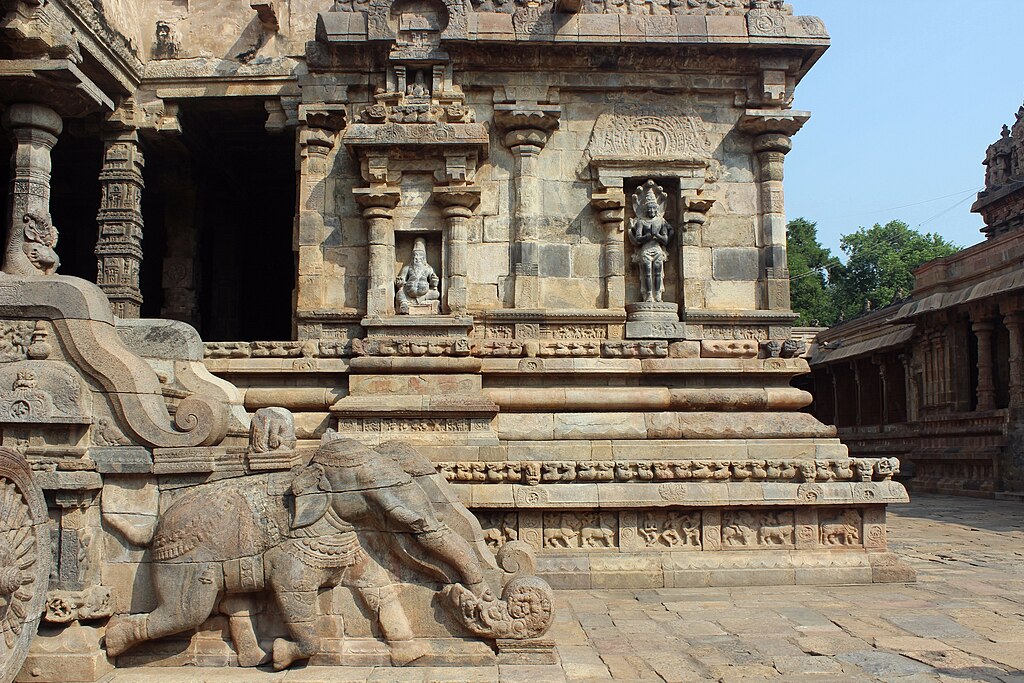
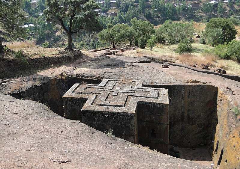
    Airavateswara Temple: an exmaple of Chola architecture
    The western Deccan plateau is still dominated by the Chalukyas. The Chalukyan dynasty are not that staunch Hindus, and have been patronizing all religions within their realm. They themselves appear to be very sympathetic to Jainism, which is still prevalent in the region; Buddhism has greatly declined in the region, to such extent that it cannot be seen on the map of the religions any more.

    The northeastern Deccan plateau has always been described as more barbarous than other parts of the Subcontinent. These regions are still home not only to northern Dravidian peoples, but also to earlier Munda peoples speaking Austroasiatic languages (similar to those spoken by the Khmer). These peoples are collectively known as the Adivasi, and have been living in tribal societies outside the caste system.

    The peoples of this area known as Gondwana, after the predominant Dravidian people of Gondi, would not practice Hinduism. Rather, their religion was Sarnaism, a very ancient religious tradition, whose places of cult were placed in hallowed groves.

    The combined region of the Ganga and Brahmaputra Deltas was ruled by the Pala Empire. The Palas remained major patrons of Mahayana Buddhism. While Buddhism has been declining in almost every other part of the Subcontinent, in the Pala Empire, it prevailed. This was caused also by its urban nature: the regions further south were mostly rurally based, and Buddhism was very much connected to the urban civilization of the Gangetic plain.

    Buddhism was also in decline in the lands of the neighbouring Gahadavala dynasty, controlling the Middle Ganges River. Its rulers, while mildly sympathetic towards Buddhism, would prefer Hinduism instead.

    Northwestern India, places like Gujarat, Avanti and Rajputana also witness the predominance of Hinduism. Any remaining Buddhist communities are squeezed under the foot of the Himalaya Mountains. Jainism is also retreating southwards.
    upload_2019-8-9_21-53-10.png

    Trade routes in India. Source: A Fascinating Map of Medieval Trade Routes (note: all other images are mostly wikipedia, maps are mine)

    The coastal regions of Gujarat were involved intensive westward trading. Particularly important were the ports of Diu, Cambay, Baruch and Tanah. Mazouni merchants were in frequent contact with this region; ultimately the cosmopolitan nature of the area resulted in a rather widespread conversion of some coastal communities to Mazdakism (1).

    Further northwards we arrive into the region of Sindh. The area based along the Indus Delta had been exposed to frequent contact with Mazoun. Previous centres of Mazdakism have expanded substantially, as had the Nestorian community a little further south.

    As for the Indus valley, it has been severely hit by the conquests of Zaku of Jaguda. Zaku of Jaguda was ruling in regions of Zabulistan and Kabulistan,that is on the eastern fringes of the Iranian Plateau. He was a devout Manichean and was prepared to invade the Indian Subcontinent. He did dedicate quite a lot of time to see where Alexander the Great has failed and prepared not to make the same errors. The traditions surrounding Alexander the Great in the region of Zabulistan and Kabulistan were very strong, and he was viewed as a very positive figure. The name "Sicandar" would be used not as a name, but rather as a title, similar to that of Caesar in the west.

    Crossing the Khyber Pass into Peshawar, Zaku´s Turkic armies had followed the footsteps of many before them. The Shahi dynasty, originating in Kabul, was easily defeated by Zaku, allowing him to seized Peshawar and Multan.

    Zaku of Jaguda managed to crush most of his enemies in northwestern India. Many cities were sacked, and the loot was taken to Jaguda. The worth of the loot was difficult to enumerate. Many especially Hindu and Jain temples were looted; Buddhist not so much. The treasures were concentrated in Jaguda, which would attract many scholars and poets. New colleges, caravan hotels and gardens were founded in the heart of the realm.

    The western and northwestern parts of the Jagudid realm were lost to the Seljuqs, forcing the Jagudids to concentrate more on India. The effective border would be the (almost) impassable Hindu Kush. Many Manicheans from the Bavandid realm, now overrun by the Seljuks , would arrive in the Jagudid realm.

    The Jagudids themselves had by this time thrown away any Turkic cultural traits, and greatly adopted Persianate culture. The heirs of Zaku of Jaguda would not focus that much upon conquests, but rather would seek to bring the word of Mani to the Subcontinent. Manichean clerics could build upon the pre-existing Buddhist traditions of Gandhara and Multan. Buddhism as mentioned was in decline in India at this time, as it had become detatched from the people.
    upload_2019-8-9_21-37-26.png

    Manicheanism has established itself in the Indus Valley
    The conquerors sought to take advantage of this situation, use the already existing layer of Buddhist traditions, and present Manicheism as something new. These policies resulted in an even faster decline of Buddhism in Gandhara and Punjab; meanwhile Hindu temples were very often targeted and destroyed or sacked, be they in or outside of his realm (2).

    Ultimately, the Helmand Valley, Kabulistan and Multan had become Manichean with a few generations. Buddhism continues to survive in the region in the less accessible mountainous regions. The region of Makran to the south of Zabulistan manages to remain a backwater; local Zuni beliefs are intertwined with Buddhism and Zoroastrianism to a greater part; the southern coastal areas around Gwadar, under Mazouni influence, have converted to Mazdakism.

    Local tradition in Kashmir had it that Jesus had visited India in prior to his ministry, where he ought to have been instructed by Buddhist monks. Hints were found by critical later scholars, who found that Christian “innovations” to the Old Testament were very similar to Buddhism. While Manichean clerics did not comment much on the issue whether He visited Kashmir or not, this tradition also aided them in converting the people of the region. After all, the messages of Buddha, Zoroaster and Jesus were from the same source, remember (4).

    Beyond the Himalayas, there is the Tibetan Plateau. It has been described by some as the Roof of the World, located beyond the Himalayas, bordered on its north by the Kun-Lun Mountains, separating it from the Tarim Basin. Interestingly enough, the Himalaya Mountains, the highest mountains of the world had been more often passed than the lower mountain ranges of the Tibetan Plateau.

    This can be explained, that heir northern slopes descend again into the upper Brahmaputra and Indus valleys, which are home to major centres of Tibetan civilization, such as Lhasa or Leh. Indee, the two upper river valley had become two major cores of Tibetan culture: Guge and Ladakh on the Upper Indus, while Lhasa on the Brahmaputra.
    Aba_County_Aba_Prefecture_Sichuan_China.jpg

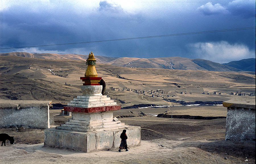
    A Tibetan Stupa at Ngawa, Tibet
    The plateau had formerly been united by the Tibetan Empire until the 9th century. The 10th and 11th centuries are subsequently known in Tibetan historiography as the period of fragmentation. The 11th century is known as the Tibetan Renaissance, which I know nothing about, am too lazy to do research, and anyway it happened the same way as it did, didn´t it?

    (1) The nature of the Mazdaki religion by this period has severely changed. More information about it will come when we start discussing Mazoun.

    (2) Indeed, the Jagudids did have a Manichean worldview J

    (3) There is an alleged tomb of Jesus at Rozabal, Srinagar, Kashmir

    (4) Mani claims that Zoroaster, Buddha and Jesus all received the true message, which was summarized by him, of course. It reminds me Muhammad claiming succession to the Prophets and Jesus…
     
    Last edited:
    Chapter 60: Nomad, Speak Turkic
  • So folks I am back, so let us take a look at Central Asia, shall we?
    upload_2019-8-24_18-5-11.png

    A political of the area discussed: Cumania (orange), Bolgharia (green), Baskhiria (yellow-green), Kimek Confederation (green in KLazakhstan), Karakhanid (olive) and Qocho Uyghurs (Blue in Xinjinag)
    Beginning in the East we have the Uyghur Kingdom of Qocho, still ruling the Dzungar basin. Not much to say here, just that the Uyghur language (1) has come to dominate the entire Dzungar basin. In religious terms the realm witnesses a sort of synthesis of Buddhist and Manichean teachings; the Toxoxian sect of Manicheism which prevails in the Kingdom of Qocho has many strong Buddhist influences.

    Further westwards was the Kara-Khanid realm. The Karakhanids were a Karluk Turkic tribal Confederation controlling the lands from Jaxartes estuary into the Aral Sea to the Balkash across the Tengri Mountains to include the western edges of the Tarim Basin. The Tarim basin had been populated by the Saka, an Iranic people practising Buddhism (2).

    During the mid-eleventh century, the Karakhanids had lost to the Seljuks, and were forced to pay tribute. Furthermore, they had also lost some of the most valuable parts of their empire: most importantly Khwarezmia on the lower Oxus, as well as the hearland of Sogdia itself.

    The later Karakhanid khans would stick to Nestorian Christianity, which would become the predominant faith in the realm (3). The Church of the East would have erected two Archdioceses or Metropolitan provinces, at Navekath and Almaliq. An Archdiocese would also be set up at Khotan; however the people would continue to practice Buddhism.

    From the linguistic point of view, we can observe a rather diverse realm: the Ferghana valley continues to speak Sogdian (which is the predominant language among the “sart”, or settled urban population, consisting of artisans, merchants but also farmers in the oasis. On the other hand, the Karluk dominate the steppe north of the Jaxartes River, as well as the region of Zhetysu and the Tengri Mountains (4). Ultimately you have the Sakas speaking an Iranian language in the regions of Khatan and Kashgar (5).
    Cuman_warrior.jpg

    Horse-riding: a typical trait of Steppe culture
    Further northwards we enter into another nomadic realm, the Kimek-Kipchak confederation. The Confederation extends over most of the central steppe, from the Aral Sea to Lake Balkash and northwards to the confluence of the Ob and Irtysh rivers. While Manicheism had been prevailing in the eastern part of the realm, Nestorian Christianity spread rapidly throughout the western parts of the realm, practically eliminating original Tengri shamanism (although many practices remain ingrained in the folklore).

    Further westwards we have the Bashkirs, who have not done anything of significance.
    220px-Baba_010.jpg

    Cuman statue, not far from
    The western steppe had come to be dominated by the Cuman-Kypchak Confederation, another nomadic empire based around the lower Itil River (6), and stretching to the Don estuary. . In general, one can claim, that they were the geopolitical heirs of the Khazars. The Cumans have thus taken advantage of the Don portage. Their political system was however never centralized; rather it consisted of loosely interconnected tribal units, with the military being the sole unifying institution.

    The area they ruled had already a significant Christian presence; the incoming Cumans were however mostly Tengri pagans; and Christianity remained practiced mainly along the coasts in areas with strong contact to the Rhomaic Empire.

    The lands between the Dnieper and the Eastern Carpathians were held by the Pechenegs, another nomadic Turkic tribe of the Oghuz branch this time.

    The Crimean Peninsula remains populated predominantly by Crimean Goths, a Christian Eastern Germanic people. Its southern coast is controlled by the Rhomaic Empire.

    The North Caucasus remains essentially a tribal region: with the two powers in the region being a Christian Circassia on the northwestern slopes of the Caucasus, a Christian kingdom of Alania beyond the Darial Pass and ultimately a smaller duchy of Sarir controlling the inland mountainous Daghestan.
    %D0%A5%D1%80%D0%B0%D0%BC_%D0%90%D1%80%D1%85%D1%8B%D0%B7_2.jpg

    Christian architecture in Alania
    Sarir was a Christian realm. Christianity arrived to Sarir either from neighbouring Alania or more likely from Georgia beyond the mountains. The entirety of the northward side of the Caucasus was thus fully within the gravitational sphere of the Rhomaic Empire; the sole exception was the Khazar Coast.

    The Khazar Coast could be found between the estuary of the Itil River southwards along the coast of the Caspian Sea to the eastern end of the Caucasus Mountains.

    Further northwards we of course have the Kingdom of Bolgharia controlling the confluence of the Volga and Kama rivers. It has grown into a major power in this part of the world, and has also subdued (or forced to pay tribute) the Permic tribes at the upper Kama.
    upload_2019-8-24_18-7-15.png

    Linguistic map of central Eurasia. You may also notice some "refuge" areas of the Iranic peoples:Burtasia (south-central Russia, just next to the Mordvins), Alania (North Caucasus), Ferghana, Khotan and
    As you can see, the Eurasian Steppe populated almost fully by various Turkic peoples. The Turkic peoples had been at first deemed by historians to have had a common ancestor with Mongolic languages. Nowadays, however the similarities are explained rather by multiple phases of close contact.

    Linguists divide the Turkic languages into five major branches, out of which one is very divergent. This divergent branch is known as Oghur Turkic, and apparently developed in the western Steppe. By 1100 AD this branch is present in the form of the Bolghar language at the middle Volga and the Khazars on the Caspian coast.

    The remaining four branches appear to have descended from Common Turkic and are: the Kipchak (Northwest Turkic), Oghuz (Southwest Turkic), Karluk (Southeast Turkic) and Siberian (Northeast Turkic).

    The Kipchak languages are now prevalent in much of the western and central steppe: spoken by the Cumans and the Kimek. The Oghuz peoples, originally dwelling between the Caspian and the Aral Sea, will be dealt with in the next update. The Karluks have their own state : the Karakhanid Khanate. Ultimately, the Siberian Turkic peoples include the Uyghurs of Qocho, the Yenisei Kirgiz, the Khakas and the Sakha.


    (1) The Old Uyghur language belongs to the Siberian Turkic family.

    (2) In OTL, these conquests were viewed as jihad and there was much fanaticism. Here, the conquest of Khotan happens nevertheless but is motivated more by economic factors, keeping the Buddhist culture of the Tarim Basin intact. Controlling the passes of the Silk Road means economic profit.

    (3) Caused not only by royal patronage, but also by population dynamics and general teachings of the faith. While Christianity teaches: “Be fruitful and multiply”, Manicheism has a negative attitude to sexuality and earthly material matters. Therefore, should you have devout believers of both faiths, the Christian faith would eventually prevail. Of course, the local tradition also incorporates quite a few Manichean elements.

    (4) Simply said Kyrgyzstan

    (5) The linguistic shift doesn’t happen, as their culture is not destroyed.

    (6) Around Astrakhan

    upload_2019-8-24_18-9-51.png

    The golden blob of nomadic society looks nice, dont you think?
     
    Last edited:
    Chapter 61: The Seljuqs - Nestorian Shahanshahs of Persia
  • Moving southwards we enter the cultural region of Greater Iran. The region had been struggling for unity. At the very beginning of the 11th century, there are two major powers holding onto the Iranian Plateau: the Jagudid dynasty in the east and the Bavundids ruling over the western parts of the country.

    Bavundid inquisition in Media has severely reduced Manichean presence in the area, with many Manicheans preferring baptism and conversion to Christianity to acceptance of Zoroastrianism. Their aim to restore the Zoroastrian traditions of ancient Persia would however be interrupted by some Turkic nomads to the north.

    Originating from the very same area called Dihistan, the invasion route of the Seljuks just repeated the path of the Parthians a couple of centuries earlier.

    The Seljuks were a clan of the Oghuz Turks, dwelling at the eastern shore of the Khazar Sea (1). The Seljuks were devout Nestorian Christians (2), and sought to liberate their fellow brothers in faith from the rule of the Manichean Jagudid Empire. This task was accomplished without much difficulty under the leadership of Tughril Beg, who won two major battles at Dandakan and Nishapur. This was around the year 1040.
    85px-Seljuqs_Eagle.svg.png

    Coat of arms of the Seljuqs
    His conquests would also have included Sogdia and Khwarezmia; and by the mid-eleventh century, he ruled over a realm extending from Khorasan as far as the Jaxartes. Roughly ten years later, he decided to take over also the western portions of the Iranian Plateau, and liberate the Patriarch of Qtēspōn (3). After all, it was an insult to all Nestorians that their Patriarch is a vassal of an infidel, right? (4).

    The Bavundids would be defeated and the entirety of Mesopotamia, just up unto the Rhomaic borders, was conquered by the incoming Seljuqs. This also means that the Assyrian kingdom around Niniveh was conquered as well (5).

    Being Christians, the Turks know how to behave themselves (6). This does not prevent them from invading Armenia, which they view as a natural defensive obstacle for any Rhomaic army. The smaller Armenian kingdoms and lordships would have to accept Seljuk suzerainty, while their local lords remained in place. The Armenian duties would be restricted to the maintenance of fortresses and garrisons.
    Kharaghan.jpg

    Kharagan towers, the tombs of Seljuq princes
    The heir of Tughril would later gain the honorific title Alp Arslan, heroic lion. Alp Arslan set out from Mesopotamia westwards into Syria to challenge the world hegemon in the form of the Rhomaic Empire. The Seljuq military of course relied on able rapid cavalry, namely horse archers. Such formations take advantage in a vast inland country, such as Persia. Turkic cavalry had a tactical advantage over the light infantry formations of the Rhomaic Empire.

    The two forces met at the western outskirts of Hierapolis (16). The battle was a brisk Seljuq victory, and opened them the doors into the Levant. That was indeed Alp Arslan´s vision, to conquer the entire Levantine coast and claim the city of Jerusalem. On the northern front, Alp Arslan subdued Georgians as well, and the borders with the Rhomaic Empire were established on the Upper Eughrates. Further conquests also subdued the Kartvelian realms south of the Caucasus.
    220px-Alp_arslan_sultan.jpg

    The statue of Alp Arslan
    The loss of the entire Levant will of course cause internal unrest among the Rhomaic generals, as well as challenge the loyalty of Kemet to the Rhomaic Empire.

    While geopolitically very similar, culturally it was different from both earlier incarnations of Persia and from an alternate Turkish empire. The rulers of the Seljuq realm did not bear the title “Sultan”; rather they titled themselves as “Shahanshah”, which is the Persian title for emperor. The Oghuz tribesmen rapidly adopted very much of Persian culture, from things like the gesture of prostration before the ruler, to the celebration of Nowruz.
    upload_2019-8-25_22-0-4.png

    Feudal blue now dominates Iran. Nomadic golden in places where Turkic tribes settled; also take a look at republics (pink) and the theocracy of the Patriarchal State (grey).
    Contrary to previous empires in the region, the Seljuqs did not adopt the Sassanid way of state administration. Rather, the realm was divided among the members of the ruling dynasty as appanages, thus establishing a sort of feudal society in Iran.
    upload_2019-8-25_21-55-23.png

    The division of the Seljuk Empire. Dark purple is the Patriarchal State of Qtespon.
    Upon the death of Malik Shah, the westernmost portions of the empire split apart. The Georgian and Armenian statelets reassumed their independence; while independent Meliks (Kings) rose up in Niniveh and Syria (Tutush I.). The fragmentation also resulted in the independence of the counties of Anbar, Nehardea and the Patriarchal State.

    The adoption of Persian as the official language of administration in non-ecclesiastical matters means a step forward for a rapid assimilation of the civilian Turkish populations, and the elite. Turkish remains of course the language of the military.

    Taking a look at the regional scale, what can we see? Beginning in the northeast we can see Khwarezmia on the lower Oxus. In this region, the local Khwarezmian Iranic language is under heavy pressure from neighbouring Turkic languages (7). Khwarezmia is still one of the few predominantly Manichean parts of the world.

    Further southeast we arrive into Sogdia (8). This area is still a multireligious and multicultural; however population dynamics, especially birth rates have shifted the religious mosaic considerably. Due to its ascetic nature and antimaterialism, Manichaeism has had a negative attitude to sexuality. After a few centuries, this has led to a decline of Manichaeism, dropping to a mere 30% of Sogdia proper (9). Manichaeans have been outnumbered by Nestorian Christians, numbering as much as 42%. Smaller communities in Sogdia proper still include Mahayana Buddhists (11%), Zoroastrians (8%), Jews (4%), Jacobites (4%) and other immigrant communities (such as Orthodoxes, Chinese, Indians, 1%) (10).
    upload_2019-8-25_21-56-26.png

    Religious structure of Greater Iran: Nestorianism (purple) dominates Mesopotamia,the Gulf Margiana and Dihistan. Manicheism (beige-light golden) present in prts of Khoroasan; another variety present east of Lake Urmieh. Zoroastrianism (olive green) to be found throughout Iran. A Miaphysite belt extendsfrom the Red Sea across eastern Syria to Armenia.
    Ruled now by a Nestorian Turkish empire, the Nestorian faith will now be promoted even more. Earlier Sogdian tolerance and openness will soon be challenged by these changes, and some kind of confrontation between Christians and Manicheans in Sogdia is not out of question.

    The mountainous regions of Tukharistan (11) on the upper Oxus valleys remain a clearly Buddhist area, one of the few refuges of western Buddhism (12). Buddhism also remains in place in the mountains of Hindukush to places like Bamyan.

    While the region around Merv (Margiana) had a mainly Christian presence (13), Khorasan also known historically as Parthia had a Manichean majority. This was also partially a legacy of the Jagudid conquests; the Seljuqs however funded the consruction of a large number of Assyrian monasteries in the region, especially in the proximity of Herat.

    The Khorasani language, formed by the mixing of Old Parthian and Oghuz Turkic is once more exposed to Turkic influence. It becomes hardly intelligible with Persian.
    upload_2019-8-25_21-54-44.png

    Linguistic structure of Greater Iran
    Many Turkic clans have settled in the lands of Persia proper, not only in Pars, but also in a few regions along the Silk Road. Some retain their nomadic lifestyle, while others become the new urban elite. This elite takes up, as mentioned, local customs quickly; however what they don’t give up is their religion. Conversion to Christianity is encouraged by taxation benefits, although Zoroastrianism is not openly persecuted, it is not state-sponsored anymore (14). The previously predominantly Christian city of Reyy has become the capital of the Seljuq Empire.

    While looking at northwestern Iran, one can observe a strengthening of Zoroastrian presence, especially in the region of Media (where the Manicheans had been force-converted under the Bavundids).

    As for Mesopotamia, the region welcomed the Turkish invaders (15). As mentioned, the Nestorian patriarch makes a deal with the Seljuqs, and the “Donation of Tughril” includes the city of Qtespon itself, Babil region as well as the regions to the north of Qtespon.

    Mesopotamia sees again all of its Manichean and Zoroastrian populations kicked out; while the Jews continue to live in a handful of cities to the west of Qtespon. Assyrian science continues to flourish. The Academy of Gundeshapur in Elam is matched by a Patriarchal Academy at Qtespon, as well as further educational institutions at Nisibis, Nishapur and Reyy. Persian-Assyrian science had proceeded mainly in astronomy, mathematics and medicine.

    The sole part of the Iranian Plateau unconquered is the region of Hormuz, which remains independent (yet tributary) of the Seljuqs.

    (1) Caspian Sea

    (2) They were so in fact, before converting to islam

    (3) Yes, the campaigns happen in a very similar way, but the motivations are different.

    (4) We can see a Carolingian sort-of situation, complete with a “Patrimony of Mar Addai”; a sort of theocratic state being established in parts of Mesopotamia.

    (5) There is however no major reason to invade

    (6) And do not commit barbarous massacres for no reason. Especially not to Christian cities.

    (7) Are going to have an English-like scenario? With a half-Germanic, half-Romance language? I don’t actually think so, for the Iranian culture is more sophisticated than the Turkic one.

    (8) Synonymous with Uzbekistan south of the Kyzilkum plus the Tajik Ferghana panhandle, should I be correct.

    (9) This is however not comparable with earlier statistics, for those included also Bactria and Tukharistan. Including these areas results in following figures: Manichean 35%, Nestorian 33%, Buddhist 21%, Zoroastrian 6%, Judaism 3%, Jacobite 3% and immigrant 1%. These population dynamics are not explained only by birth rate differences, but also by conversions and mixed marriages.

    (10)Tengri pagans in Sogdia have almost all adopted some major world religion. Should some of them still be around by 1100 AD, their numbers negligible

    (11)Known previously as Bactria, corresponding to Tajikistan except the Ferghana panhandle plus NE Afghanistan

    (12) At its greatest extent, Buddhism reached as far west as the Aral Sea. Places like Sogdia get conquered far too often, but backwater mountain valleys increase the chances of survival for Buddhism. You know, mountains and Buddhists go together … *me thinks of Tibet*

    (13)Especially Turkmenistan and northern Afghanistan.

    (14)The Seljuq state stops all sponsoring of Zoroastrian religious institutions and clergy; these must be now sponsored by their believers. In modern terms, you could say that the religion is restricted to the private sphere; essentially an American system of congregation funding. I would not call this a Ctrl+C Ctrl+V from the Dhimmitude system, as there was no harassment of Zoroastrians here.
     
    Chapter 62: A Century of Weak Emperors
  • Although my intent was to cover all of Asia first, it has become clear that an update on the Rhomaic Empire will be necessary before moving elsewhere. In the early 11th century under Emperor Basileus, the Empire is the uncontested hegemon, with the Eastern Mediterranean Sea effectively the Rhomaic Mare Nostrum. Possessions in the west include Sicily, Calabria, Apulia and a few holdouts in Campania; the Balkanic Limes are on the Lower Danube, with Croatia being a Rhomaic vassal. The Empire commands the entirety of Anatolia and the Levant; other positions include the southern coast of Taurica (1), Cyrenaica and Alexandria. The headache with Egypt had been solved by installing a tributary kingdom, with a hierocratic organization of the society.

    Coptic nationalism has thus been neutralized; issues in Syria were solved by devolution of the whole Empire, to allow for more flexibility and effective use of resources.

    The 11th century emperors have not concluded any major military campaigns; the sole exception being the conquest of Palmyra in the 1020s. The emperors thus focused on consolidating and strengthening the empire from within, also attempting to fully integrate the Levant.

    The reign of Michael IV Paphlagonian (1034-1041) saw internal unrest, namely revolts in Antioch, Nicopolis and Bulgaria (aided by the Pechenegs). All of these revolts were crushed.

    He was briefly succeeded by Michael V. Kalaphates, subsequently by Constantine IX Monomachos (1042-1055). He had to deal with a Russian attack, which was dealt with with Greek fire.

    Constantine IX had attempted to enforce a union upon both the Armenian and Syriac Jacobite Churches. The Armenians reacted with hostility, and this was also the reason why they collaborated with the Seljuqs (2) readily later on.

    One of the biggest issues in terms of Church politics was native to the region of Syria (3). The area has been in Rhomaic hands for like almost a century, yet there are still three people claiming to be the Patriarch of Antioch (although only one of them actually sits in Antioch). We have the Syriac Jacobite Church, a schismatic (4) organization, following Monophysite Christology (5). This Church is viewed as a Syriac national church, with faithful among the Arabs also outside the Rhomaic borders. The existence of this church appears to be an expression of local calls for autonomy, as well as a different mentality of the Afro-Asiatic (6) peoples in contrast to the Indo-European (7) mentality and interpretation of the message of Christ.
    Maronite_monk_and_pilgrims%2C_Mount_Lebanon.jpg

    Maronite monks and pilgrims
    Then there is the Maronite Church on the Phoenician coast. This Church officially embraces a monothelite Christological position, although the Phoenician merchants don’t appear to be fierce zealots ready to fight for such theological nuances. They are practical people. Reasonable if you wish.

    So in 1054 Constantine proposes a solution of the issue. The plan is, that each of the incumbent Patriarchs are allowed to stay in office until they are there. Once they depart this world, they are not to have a successor, but rather the remaining Patriarchs are to lead their congregation. Upon the vacancy of all three Patriarchal thrones, a fully legitimate and undisputed Patriarch of Antioch oiught to be selected.

    Such a plan sounds nice on paper, but failed to reflect the raison d´etre of the Jacobite and Maronite Churches. For many Aramaic-speaking people, the existence of a national church was an expression of ethnic identity and helped to keep their culture alive vis-à-vis the Hellenization process, which has almost entirely wiped out any remaining native languages of Anatolia.

    The problem was thus left unresolved to deal for the following Doukas dynasty. The first Doukid Emperor, Constantine X, was an open supporter of the bureaucratic faction of the Rhomaic court (8).

    Seeking to prevent a strong military from causing trouble, or even worse regional revolts, many regiments were disbanded. The Diocesan Councils and their decisions were controlled and monitored more closely, to such extent, that their decision-making and articulation of interest capacities were reduced to minimum. This was especially true in the regions north of the Taurus Mountains (9); to the south of this mountain range, the complaints and wishes of the Councils were taken into consideration and thus they continued to have at least some weight.

    Seeing inaction and reluctance from the side of the Syriac Jacobite Church, Constantine sought at least to strike a deal with the Maronites. After all they were ready for theological compromises…The Emperor was ready to reach out and he proposed an Ausgleich. The Maronite Church would be subordinated to the Melkite Patriarch of Antioch, yet be recognized as a distinct community. The Maronites were to be granted a degree of autocephaly; the Maronite Patriarch would stop using the title Patriarch of Antioch, and assume a more humble title as the Catholicos of Boutron and Phoenicia. After all, such a status was not novel to the Patriarchate of Antioch: there was already the Catholicosate of Mtskheta for Kartvelia, the Catholicosate of Irenoupolis for Mesopotamia and the Catholicosate of Romagyris for Central Asia. All of these lay outside the imperial borders. However, the Church of Cyprus, with Rhomaic borders, was already autocephalous, so it was not that unusual.
    upload_2019-8-27_21-53-20.png

    The religions of the Empire
    The emperor congratulated himself. At least some progress. Now let us leave the integration of the troublesome Syriacs to our successor...

    His successor was Romanes IV Diogenes and in a manner, he did solve the Syrian question, although not by a means he or any Rhomaic emperor would be proud of. Wait, is it correct to attribute the defeat at Hierapolis (10) to him? Shouldn’t it be rather the victorious Seljuq Alp Arslan? Anyhow, in the aftermath, the effects were such that the Rhomaic Empire lost the entire Levant to the Seljuqs.

    The chaos that followed was not as destructive as it could be, as the Taurus-Euphrates border remained heavily fortified, and the heart of the realm was protected. Egypt was however not counted into the heart of the realm, nor into the empire itself proper. Egypt was a tributary, ruled by a puppet king, run by Coptic clergy and state bureaucracy. Its resources were collected at Alexandria before being shipped to Constantinople. For over a century, this system allowed the Rhomaic Empire to extract as many resources from the country as possible, without needing to administer the country directly.

    Although the whole system was designed to prevent any independent decision-making, the weak Doukid dynasty, the defeat at Hierapolis and the Seljuq conquests have given Egypt the needed momentum to act.

    The Tmonian dynasty was deposed in a coup in 1075 by Yaraklas of Sioot, captain of the southern garrisons. Yaraklas declared that is time for the Coptic nation to wake up and stand proud, stop toiling for the Rhomaic masters and kick them out. Many bishops agreed with him, with the Coptic Pope welcoming him in Kashromi, the Egyptian capital.

    The natural target of Yaraklas´s campaign was Alexandria, a symbol of the much hated Rhomaic yoke. The city was not viewed as Egyptian, for its inhabitants were mainly Alexandrian Greeks. They knew the Empire has no capacity to protect the city and that it would pass out of the hands of the Empire nevertheless. However, they were already so rooted to then city that they did not consider leaving. The urban prefect had all symbols of Rhomaic rule torn down and sent an embassy to Yaraklas, while he was still in Kashromi, declaring “The Humble Submission of the Magistrate of the Great City of Alexandria to His Majesty the Mighty Pharaoh of Kemet”.

    The declining empire was saved by the ascension of Alexios Komnenos (11) in 1081 (reigning until 1118). Having to deal with Paulician rebellion in Thrace which he supressed, he also faced raids from the Pechenegs to the north, whom he also defeated.
    Alexios_I_Komnenos.jpg

    Alexios Komnenos
    However, his main aim was a Levantine Reconquista. The Seljuqs were now quarrelling among themselves, and Alexios sought to reconquer the northwestern parts of Syria. The brisk first campaign was to secure the city of Antioch. Subsequently, one of his generals set foot along the coast, seizing Laodikia (12), Tortosa (13) and Tripoli. The other went Orontes up-stream, seizing Apamea, Hamath and Emessa. Ultimately, an eastward attack followed, seizing Beroia (14), and all the lands until the Euphrates.
    upload_2019-8-27_21-52-3.png

    The Empire did not lose that much, after all...
    (1) Crimea

    (2) Yes Turks and Armenians were able to reach an agreement and come to terms. Difficult to imagine, I know

    (3) The Great Schism of 1054 does not happen, due to the fact that there is no Norman conquest of Mezzogiorno, resulting in no Latinization of the local Greek churches. Of course, smaller liturgical and theological differences are still present, such as filioque, or the use of unleavened bread, but these minor issues would not be turned into a big fuss resulting in mutual excommunication of the Ecumenical Patriarch and the Pope. Furthermore, you would still have the Melkite Patriarch of Antioch, and also the Patriarch of Jerusalem to be an arbiter in the case of dispute. I am not mentioning the Melkite Patriarch of Alexandria, as his church is rather small, and is fully dependent on support from Constantinople.

    (4) At least so perceived in Constantinople

    (5) In communion with the Copts and Armenians

    (6) The Copts and the Semitic peoples, such as Syriacs and Arabs, belong to the Afro-Asiatic linguistic family

    (7) Or perhaps more narrowly, Greco-Roman

    (8) As examined by @John7755 يوحنا , the Rhomaic Empire had three major faction: First of all, bureaucratic centralists. Oppposed to local autonomy, strong military etc. Secondly, militaristic centralists. And thirdly, local magnates, the sole force of dencentralisation. In Dunes of the Desert, much of this remains true, although the Dioceses remain a place of decentralisation (mainly created to solve the problems in Syria)

    (9) The Taurus Mountains were in fact an important political divide in the empire. To the northwest, you have Anatolia, Greece and the Balkans: areas all naturally gravitating to Constantinople. All its people are either Greek, or Vlachs, occasionally barbarians (Slavs and Albanians) looking up to Greek culture. From the religious point of view, almost everyone is Orthodox, apart from a handful of Paulician heretics… To the south of the Taurus, you have a region where trouble begins. You have a few Chalcedonian Christians, who are called Melkites. Most of them are Antiochian Greeks, although there are Aramaic-speaking people who follow the True Faith. Then you have the sturdy Aramaic-speaking Monphysites inhabiting the inlands, before they start speaking Arabic at the edges of the desert. The enmity between Monophysites and Melkites is not the only one in the region. You have also Samaritans and Jews, Maronites, and a few Bardaisanites here and there… enough to cause trouble

    (10)Manbij, Aleppo Province, Syria

    (11)Byzantine resources are even stronger due to the fact that there is no Norman threat from the west. The Italian Mezzogiorno is still held by Lombard dukes.

    (12)Lattakia

    (13)Tartus

    (14)Aleppo
     
    Chapter63: Effects of Climate Change on the Arab Peninsula
  • Returning back to the Arabian Peninsula, we can witness a deep cultural, one can say even, civilizational divided, between the Gulf and the Hejazi coasts. Nevertheless, due to climate change, the Medieval Warm Period (1), the Arab Peninsula becomes drier, water is scarcer, leading to mainly a decrease of population, and a questioning of the extant political authority.

    The region of the Persian Gulf was home to three major slave republics: Beth Qatriye, Hormuz, and Mazoun. These were run by merchants, and generated great riches and had welfare programmes, upon the expense of the slaves.

    The early 11th century saw a crisis in Mazoun. The Mazdaki religion and philosophy, outright hedonistic in its nature, has lost its moral authority completely, and moral collapse was imminent. Many grandfathers moaned about the “spoilt youth”, who live in a consumer society, and abuse freedom without any responsibility or bindings.

    The changes have been happening so gradually, that the Sacred Council has not witnessed the gradual small steps and failed to take any action. Anyhow, by 1015 the chairman of the Sacred Council, Sourab (2) decided to act. Knowing that the ascetic nature of the Manicheans was a far fetch for his compatriots, he was reluctant to fully impose the Manichean religion in Mazoun. It just wouldn’t work. Looking at the handful of Christians living in the realm, he admired their sense of moderation. Yes moderation. That was needed for the Mazouni people.

    Sourab thus decided to combine elements of both: of original Mazdakism, and Manicheism, to create a religious system for the Mazouni people. Standing halfway between hedonistic
    Mazdakism and ascetic Manicheism it taught:

    “Listen my son, to the art of moderation. As you know, everything has something good in itself, but also something bad. Take pleasure from the things and joys of the world, but beware! In great ammounts, the evil substance will accumulate and destroy your will and strength. Remember therefore to stop once you are satisfied, and do not drink each cup to the end. Should you believe that you need something very much, put it away from yourself for the duration of the great fast before Bema, so that your soul remains uncorrupted”

    Such and other passages were written by Sourab, who called his undertaking a religious reform. The Sacred Council approved of this change and the new religion formed by Sourab was elevated to the state religion of Mazoun.

    Formally, it retained the name Mazdakism, but was considered a (very convergent) branch of Manicheism, to which it formally adhered. Mazdaki Manicheism had become very popular along the shores of the Indian Ocean, and appears to have given Manicheism a second breath (3). For this new religion would rapidly spread, especially via trade routes throughout the Indian Ocean, along its shores.

    Before this could have been implemented, Mazoun was to face three other challenges. Firstly, the island-city of Ormus (or Hormuz), on the Persian side of the straits breaks free from Mazouni rule. Hormuz seizes also the tip on the Arab side of the Strait of Hormuz, effectively taking control over the straits.
    800px-Ormus_-Hormuz-_-_Costumes_des_quatre_parties_du_monde%2C_grav%C3%A9s_dans_la_mani%C3%A8re_de_Luycken_%281670%29.jpg

    Local costumes in Ormus.
    Secondly, the slaves revolt as well. The climate changes have turned labour in the fields and on the plantations almost unbearable. The conditions are bad and the slaves take up arms against their masters. It is unknown whether the whole thing was coordinate, or the atmosphere was so bad, that once rumours spread, all slaves flocked to join the revolt. The latter seems more likely. Anyhow, at night a large number of the planters were brutally killed, and their villas and gardens set ablaze. Gradually, a slave army found itself marching upon Muscat, destroying and plundering on their way.

    The city of Muscat itself was plundered, as well as the hall of the Council of Elders. However, the Mazouni armies approached from the south, besieging the revolting slaves in the city. The Mazouni navy takes the city from the sea, and the rebellion is brutally suppressed.

    In the western parts of Mazoun, called Magan (5), the local landowners, untouched by the slave rebellion get together and declare their independence from Muscat. The Emirate of Magan is thus a feudal kingdom, with the smaller sheikhs swearing fealty to the Emir.

    As for Himyar, its kingdom collapses due to unrest caused by climate change. The realms of Najran in the north and the city-state of Aden in the south break free. This leaves a rump Himyar (6), devoid of the status of a hegemonic power in the region. A sense of unity however prevails, mainly thanks to the notion of the Maphrianate of Himyar.
    upload_2019-8-28_11-34-32.png
    upload_2019-8-28_11-37-15.png

    Manicheism and Ebionitism... all of them disappeared in the interior of the Peninsula. To the right, you can see the resurgence of nomadic lifestyle, even in nothern Hejaz
    The Kingdom of Hejaz is not included canonically into the Maphrianate of Hejaz; rather it is the integral part of the Syriac Orthodox Church. The Syriac Orthodox Church makes inroads into the interior of the Peninsula, converting the tribes of northern Najd; the southern portions of Najd continue to practice Manicheism until around 1080s, when they as well are converted by missionaries from Beth Qatriye.

    The Kingdom of Hejaz is now also facing droughts and overpopulation. Without an open invasion route (7), Hejaz is doomed to infighting. Civil war erupts, and the kingdom itself collapses; leaving a clan-based nomadic chiefdom around Yathrib, a chiefdom in Midian and a city-state around Mecca. The Ebionitic Church in Arabia is by this time fully non-existent; although Jewish communites are present in Najran and Yathrib.
    upload_2019-8-28_11-33-20.png

    Fragmentation as the result of climate change in Arabia: Mazoun, Himyar and Hejaz, all of them crumbled
    As for the Horn of Africa, the Himyaritic colonies get rid of their overlords; the previous viceroyalty at Serapion thus becomes an independent city-state.

    The Swahili Coast also sees the development of city-states, such as Zanzibar, Mombasa and Kilwa. Contact with Mazoun appears to have been intense for Zanzibar has adopted the reformed Mazdaki religion.

    Reformed Mazdakism also came to dominate the coasts of Puntland, controlled by Zeila and Berbera, while Socotran merchants have established their own Nestorian hold over the northeastern coasts of Somalia.

    As you could have seen, civilization appears only along the coast in East Africa (8). The inlands remain uncharted, populated by tribal peoples, while the coasts are getting globalized, and Indian Ocean Trade is becoming a thing.


    (1) Which has started at around 950, but well, I forgot to update it back then

    (2) Perhaps an Arabized variant of the Persian name Sohrab

    (3) As you might have noticed, Manicheism is being rapidly displaced by Nestorianism in Central Asia; and outside the Jagudid realm, it is doing very poorly.

    (4) Something you would expect from a predominantly vegetarian society.

    (5) Roughly speaking of the United Arab Emirates

    (6) Geographically identical with OTL North Yemen.

    (7) The Seljuq invasion of the Levant happens only in the late eleventh century

    (8) If you don´t count Ethiopia and Eritrea in it. But in Dunes of the Desert, as mentioned, Ethiopia and Eritrea are more associated with Egypt and Nubia than with Kenya or even Somalia.
     

    Attachments

    • upload_2019-8-28_11-32-34.png
      upload_2019-8-28_11-32-34.png
      36.1 KB · Views: 234
    Chapter 64: Nile,Nilotes, Nubia and Nobatia.
  • Continuing westwards we arrive into the Nile Valley. But before that I forgot to describe the developments in the Afar Triangle. The city of Zeila has grown to an important commercial centre and come to dominate the entire region. A large part of the population, especially in the rural and interior regions, were already Christians. Therefore this emergent Harar kingdom (1) becomes Christian; after all, here is still strong contact with Himyar and Ethiopia further west (2).
    upload_2019-8-29_14-1-1.png

    Languages of the Nile Basin
    Eventually, the Harar Kingdom conquers the city-state of Zeila, which was a major trade node in the area.

    Ethiopia itself finds itself ruled by the Zagwe dynasty. Geopolitically, we can notice an interesting trend (3). On one hand, Ethiopia comes to dominate the trade in the Red Sea Basin – especially once you consider the lack of major contenders – Egypt being under firm Rhomaic control at the beginning of the century, and later Hejaz and Himyar collapsing. On the other side, climate changes cause the Ethiopians to migrate to cooler highland biomes. The population movement southward is accompanied by the foundation of the Duchy of Showa (4). Its inhabitants also spoke Ethiopian Semitic languages, such as Argobba.
    This period of history in Ethiopia is thus marked by a degree of disintegration. On the other hand, grand architectural monuments were built, notably the carved churches of Lalibela.
    800px-Bete_Giyorgis_01.jpg

    Church of Saint George in Lalibela

    Further down the Blue Nile we arrive into the kingdom of Alodia. Alodia appears to have expanded significantly in the southern regions of Nubia (5). Relations with the neighbouring realm of Makuria to the north were amicable, and royal marriages between the two dynasties were frequent, with the realms being under a personal union from time to time.

    Alodia appears to have been the more rural of the two, due it lying already in the grassland strip known as the Sahel, allowing for settlements and villages to be more spread out across the entire country, and not only limited to the Nile Valley.
    220px-Peace_agreement_dancers_in_Kapoeta%2C_Sudan.jpg

    Nilotic peoples inhabiting the regions to the south of Alodia
    The southern neighbours of the Alodians appear to have been various Nilotic peoples, such as the Dinka and the Nuer, located in the marshy areas further upstream of the Nile. These tribal peoples are amongst the tallest of Africa, with their skin colour being very dark, sometimes referred even to as bluish. These Nilotic peoples to the south are viewed as barbarians in Alodia, and require a large army, significantly larger than that of Makuria to contain them.

    Alodia was an absolute monarchy, with the king administering his realm on the basis of appointed governors, ruling over provinces such as Ari, Barah, Befal, Danhou, Fazughli, Kediro, Kersa and Taka. The absence of regionally-based nobility, along with a fusion of state and church qualifies us to describe this society as hierocratic.

    The most important element of the Alodian army was the cavalry, allowing the control of such a large realm. Horsemen also served as couriers (6). The impeding centralization also resulted in a sort of linguistic unification of the kingdom of Alodia. The Nubian language has come to dominate almost the entirety of Alodia, with the exception of the southernmost areas recently conquered, where the Dinkas continue to speak their own tongue. For those of you who don’t know (7), the Nubian languages belong to a branch called Northern East Sudanic, which are part of the Nilo-Saharan family. The Southern East Sudanic languages include the Daju, and especially the Nilotic languages (including Nuer and Dinka, as well as the Maasai of Kenya). Other major Nilo-Saharan languages include the Songhay and the Kanuri.

    Alodia was in frequent contact with Makuria and eventually Egypt, with the Beja tribes and also Ethiopia (8). Major Alodian exports included gold, leather, ivory and salt, hides fruit and vegetables. Major imports include silk and cloth as well as glass. Foreign trade was however mostly in the hands of Coptic (and perhaps some Jewish and Armenian) merchants (9).

    The kingdom of Makuria found between Egypt to the north and Alodia to the south was found in the desert climate, and were it not for the Nile, it would be restricted to a handful of oasis. The relations with the northern neighbour were amicable (10). This allows Makurian military, instead of constant pointless warfare in the north, to expand elsewhere. The evident target, whilst looking at the map and geography of trade routes, is going to be the Beja coast. This region has been mostly left alone until now. The local Cushitic speaking tribesmen have already adopted the Miaphysite faith, and had been under Egyptian influence for quite some time. This opens the Makurian kingdoim to trade opportunities in the Red Sea trade network.
    800px-Dongola_Throne_Hall.jpg

    Throne hall in Dongola, the Makurian capital
    Another vector, present in the form of a trade route, connects the Makurian capital of Dongola with the highland region of Darfur. The Darfur region was at this time being settled by the Daju (11), apparently a Nilo-Saharan people. A degree of contact and interaction begins between the Makurians and the Daju, with the two groups beginning to know each other a little more. The Daju remain pagan tribal society, but become familiar with “those merchants down there and their shamans speaking of a God who was killed and came alive again”. Some adventurous monks from Makuria dared to wander into those lands, accompanying the merchants. They returned, with notes about the culture of the people, about their language and customs. What to expect, what to prepare for.

    During the second half of the 11th century, a cultural and societal change developed in both Makuria and Alodia. Mainly, it sees Nubian elevated to the status of a written language, displacing the former use of Coptic and Greek (12). This is tied on one side with the growth of Nubian power and confidence, on the other side also with a larger number of scribes and priests, not speaking Coptic. After all, Coptic was a foreign tongue, very dissimilar to Nubian (Coptic belongs to the Afro-Asiatic family). Georgios, bishop of Dongola also introduced the cult of local Nubian saints, as well as that of dead rulers.
    Banganarti_2013_.jpg

    Banganarti, a major pilgrimage center in Makuria from this period
    In general, one can speak of an early form of Nubian nationalism, if you can use those terms in that period; Nubia is no longer an appendix of Egypt, as it had been for millennia before, but embraces its own identity.

    In 1075, difficult times came ahead for Makuria. The coup of Yaraklas in Kemet resulted in Egypt breaking free from Rhomaic influence. Alexandrian Greeks submitted to his rule and agreed to pay tribute. As mentioned earlier, Yaraklas was a general rom the southern borderlands of Egypt; therefore his major interest is going to be southward expansion up the Nile River (13). His campaign in the 1080s against Makuria (supported by Alodia) brings him victory, vanquishing the unprepared foes. In this campaign, he almost utterly defeats his Makurian neighbours, and conquers the entire Beja coast, as well as the duchy of Nobatia, extending from Aswan up to the the Third Cataract on the Nile.
    Christian_Nubia.png

    The kingdoms of Nubia and the Cataracts on the Nile
    Such additions to the Egyptian state allow it once more to claim itself the status of a major power, and to fully take a role in the Red Sea trade… or can it do so? Without trees? Yes, Egypt now needs a navy. No, actually it needs two navies. On in the Red Sea, and the other in the Mediterranean. For this, you need real wood, not only those ships you make from papyrus to sail along the Nile. Egypt itself has no real forests. The nearest forest you can conquer are in the Levant. Yaraklas is watching carefully the quarrels among the heirs of Alp Arslan, especially the developments in the realm of Tutush, and is waiting for the correct moment…

    upload_2019-8-29_14-0-5.png

    Political map of the Nile Basin

    (1) Historically the Muslim kingdom of Adal

    (2) The kingdom of Afar remains in the same cultural sphere as Ethiopia and Yemen.

    (3) There are no Muslim powers to kick Ethiopia out of the Red Sea Basin; rather Ethiopia quite naturally assumes dominance in the trade in the area

    (4) Yes, this was historically a Muslim kingdom

    (5) Only the Darfur region and the South Sudan remain outside of the control of either Makuria, Alodia or the Beja.

    (6) The mobile cavalry (horsemen, camel riders etc) allowed for the creation of empires also in West Africa.

    (7) I didn’t know either, don’t worry

    (8) Although the main export routes for Ethiopia were realized by the Red Sea, a significant degree of Ethiopian trade was also conducted with Alodia.

    (9) Wikipedia claims that historically it was done by Arabs. We don’t have Arabs in Egypt nor anywhere nearby as an urban population. So I went for Copts in Egypt, plus added other minority populations present in Egypt at that time. Jews and Armenians also have a reputation of being good traders, so yes, I went for them.

    (10)A contained, hierocratic Egypt, with a restricted army and tributary to the Rhomai Empire means the eradication of the most imminent threat. Therefore, the Makurians can direct their military energy elsewhere.

    (11)Their predecessor, The Toba culture appear to be called “white giants”. I have no idea who they were, so I just assume they got replaced, and am going to work with the more known Daju

    (12)Historically, the process happened due to Arabic displacing Coptic in Egypt, with the local clergy and scribes not willing to take up a foreign tongue

    (13)This may also explain his allowance for the continued existence of the merchant republic in Alexandria
     
    Chapter 65: Decline of Donatism North of The Dunes of the Desert
  • We are now moving into the regions of Central and western Africa, beginning with the Basin of Lake of Chad. This area (1) is being dominated by the Kanem Empire. As mentioned in the previous update, Donatist Christianity was making inroads into the region, although the local Chrisitian community was small in number. By the late 11th century, until then ruling Zaghawa dynasty was replaced by the Sayfawa dynasty, who embraced Christianity. This resulted in a faster spreading of Christianity, although many areas within the kingdom continued to remain pagan.

    The Hausa city-states of the north of the Lower Niger-Benue Rivers continue to flourish in emerging city-states. Further southwards, in the forest zone, the Yorubas were developing their kingdom around Ife, west of the Niger Delta, while to its east was the Igbo kingdom of Nri. Not much is to say here, only than there was development of state-organized societies as far south as this. As you have probably deduced, all these realms are of course animists, with some general exposure to Christianity, caused by the occasional visit of a Songhic merchant or two among the Hausa.

    The middle reaches of the Niger River, downstream from the bend were controlled by the Songhai kingdom, which was now effectively Christianized. The Songhai people played a crucial role in transmitting Christianity southwards into the further reaches of Sub-Saharan West Africa. As mentioned previously, the Songhai adopted an alphabet based upon the Tifinagh script (2). Being the language of both priests, officials and merchants, the Songhai language spread rapidly throughout the realm of Songhai, displacing any other local languages

    The Mossi realm of Wagadugu (3) lay to the south of the Niger Bend, and had only scarce contact with its northern neighbour. Different was the situation of the southwestern neighbour of Songhai, called Wagadou (4). This kingdom came into increased contact with Songhai, but also Berber merchants coming from the north, mainly Sijilmassa. Evidence suggests that the realm of Wagadou at this time was a rather decentralized feudal kingdom, with the presence of local nobility.
    upload_2019-8-30_15-17-4.png

    Forms of societal organization in West Africa
    Sometime in the second half of the eleventh century, it appears that the nobility of the Wagadou realm converted to Donatist Christianity. The date of this conversion is traditionally established to be somewhere at 1064 (5). The conversion account is written in the chronicle of the Archdiocese of Gao

    “And then the Ghana of Wagadou sent us a delegation of nobles, along with his nephew and arrived at Gao. They arrived in the late afternoon. When Kinkin, the king of Gao and Songhai learnt of these guests, he invited them to the feast he was having with his nobles. Thus the travellers were refreshed, and in the early morning Kinkin accepted them in front of his throne. They spoke of how their wise and elderly are astonished, when the Wagadouan merchants return home from our country, of the great changes they hear. And that they believe it is because we are in the favour of the Most Powerful God. So they came humbly to ask as for a priest or shaman of this faith, who would teach them the ways of this creed. Kinkin then went to the Archbishop, who after hearing this felt great joy, for he could continue in the great feat of the Apostles, and fulfil the task to teach all nations. Thus he called for two priests from the west of the country, known to be great preachers and fluent in the tongue of the Wagadou, their names being Butru and Yaqu.” It is then said about their arrival to Djenne and the baptism of the Ghana and his nobles, and the building of churches.

    As could have been anticipated, the nobles of Wagadou begin grumbling a few decades later, that they understand nothing at mass. Coincidenally, a few merchants and another handful of traders begun experimenting with writing down the Mande language of the Wagadou realm with the Songhai script. A new letter here, a new letter here, an omission of this sign over there…. And you have it. The Songhai script was modified to appease the phonology of the Mande language, and soon at Djenne you had the bishop gathering over sixty scribes and five interpreters.

    First, a sentence was read out in Songhaic. Then, the five interpreters discussed, how to translate best. Once they agreed, the scribes noted it down. Twice or thrice. The whole process took quite a while, but at the end you had around 150 copies. A half was quickly distributed to the churches. The rest was kept, to be copied again and again (6).

    Anyhow, by the year 1100 you have the majority of the urban centers of Wagadou going Christian, while native African traditional religions and practices dominating the rural areas.

    The realm of Takrur, based along the Senegal River was also to adopt Christianity. They were a couple of centuries earlier than the Wagadou, and converted directly from the Berbers. The Takrur cultivated cotton and cloth, and had established also maritime links with not only Maurtain, but also the Iberian Peninsula as well.
    upload_2019-8-30_15-21-32.png

    A political map of the region
    As for the realms to the north of the Great Desert, we can start again from the east and continue westwards. The Tafircans, based in Carthage, were prepared to build an empire worthy of their ancestors. Once more however, climate decided otherwise, and it came to be the Tuareg of Fazan who took over much of Tibwitana, and not the Tafircans subjugating Fazan. The Punic speakers of Sirte took advantage of the opportunity and established an independent merchant republic, ready to make some profit. After all, they the descendants of the Carthaginians, so they should have the merchant gene in their blood.

    The Tafircans are already ruling over southern Sardinia and the Balearic islands; their attention has shifted towards Sicily, which they rapidly conquered, seizing the opportunity of the weak Doukas emperors and the chaotic aftermath of the Battle at Hierapolis for the Rhomaic Empire.

    The seizure of Sicily has given the Tafircans an even larger share over the trade in the Mediterranean. Undisputedly, Tafirca in the 11th century is Romance-speaking monarchy, fully part of the west Mediterranean cultural region.

    The Berber clans invading Tibwitana care out their own little chiefdom, independent from those further inland (7). The whole change is also accompanied by a retreat of Latin language and Chalcedonian Christianity in the Tibwitana region.

    The Sahara has become so arid and so hot, that the Tafircans are now fully focusing northwards, looking at the Mediterranean, perhaps caring also about the highland plateaus of the Atlas, but have no more interest in expanding into the Sahara.

    The western end of the Tamazgha is dominated by two realms. In the south, is the city state of Sijilmassa, ruling over a network of oases spanning the western Sahara trade routes. Sijilamassa is a plutocratic monarchy; however it is about to get into serious trouble, as its environment is subject to desertification and is becoming more and more uninhabitable.

    The expansion of the Sijilmassa mercantile empire, as well as climate change saw important demographic changes in the western Sahara. Any remaining Niger-Congo peoples in the area would have retreated southwards, and the Berber tongue comes to dominate the region. The native religion of the Imraguen is also supplanted by Donatist Christianity.
    upload_2019-8-30_15-19-36.png

    Languages in West Africa
    To the north of the Atlas Mountains, Maourtanya grows to become the regional hegemon, conquering also the realm of Warsenis, thus establishing a common border with Tafirca. Berber independence in the Atlas Mountains remains preserved only in the regions to the south of the main ridge, in Mzab and Touggourt.
    upload_2019-8-30_15-17-56.png

    The religions of West Africa.
    The kings of Maourtanya continue a policy of converting their subjects, be they Barghawata or Doantist, to Chalcedonian faith. This has resulted ultimately in the conversion of the entire shoreline from Carthage to Tangier and beyond, to Chalcedonian Christianity. By this time, religious head of the Donatist Church is forced once more to relocate; the choice being Sijilmassa this time (8).


    (1) Corresponing to Tchad, southeastern Niger, northeastern Nigeria and northernmost Cameroon

    (2) I am speculating here a lot. But I believe than the Songhaic language and alphabet could play a similar role as did Greek for Europe or Syriac for the Silk Road cultures. I mean, without Arabic, you will need a lingua franca, and a liturgical language for the area. Nevertheless, we must keep in mind, that Songhaic is essentially different from the surrounding languages of the area, as it belongs to the Nilo-Saharan languages, while all the remaining languages of West Africa belong to the Niger-Congo language family. Therefore, I doubt that it could play the same role as Latin does in Western Europe…

    (3) Based in Burkina Faso

    (4) Or Ghana. This realm was based in southwestern Mali and adjacent parts of Mauritania.

    (5) Historically, the date of conversion to islam was at 1076.

    (6) Now let us consider the fact that this Mandé version of the Bible was a translation of the Songhai version. Which itself was a translation of a Berber Bible. That being a translation of the Vulgata. With so many translations, you risk of some things getting distorted, making a handful of passages quite different from the original. You know where we are heading… *smells of heretic concepts*

    (7) After all, the Middle Ages are a period of fragmentation in Europe as well, so why should North Africa be any different?

    (8) Although Gao appears to have become the new center of the Donatist Church, I believe a total shift to the south would hasten the collapse of Donatism in the north.
     
    Chapter 66: The City-States of Bética and Italia
  • As had been hinted in the previous update concerning Iberia, the kingdom of Hispania was lready experiencing centrifugal tensions. The estates of the realm were waiting for a succession crisis to tear the realm apart. That happened in 1015 (1), and the landowners in the north found themselves alienated from the bourgeoisie of the south.
    upload_2019-9-4_18-17-30.png

    Forms of government in the Western Mediterranean
    Effectively, the realm was shattered, with two large feudal duchies or kingdoms emerging in the north: those of Toletu (2) and Lusitania (3). In the Iberian mountains, south of the Ebro basin, another lordship based around Barracin (4) emerged.

    Territorially, the largest successor state in the south was the Republic of Cotestania, covering the south-eastern corner of the Peninsula, based in Cartagena.

    Valencia in on the eastern coast sought to counter the influence of Carthage in the west Mediterranean trade. Any such move was however blocked by the Carthaginian possession of the Balearic isles.

    As for Bética, this highly urbanized area in the south of the Peninsula had become fractured into a handful of merchant republics: those of Granada, Malaga, Corduba, Sevilla and Silves (5). The largest of those was Sevilla, occupying the Guadalquivir estuary. The southernmost tip of the Peninsula came to be occupied by Maourtanya.
    upload_2019-9-4_18-19-41.png

    A political map of Italy and Iberia
    The merchant republics of southern Hispania found themselves in a very competitive environment; with conflicts emerging rather often than not. Frequent wars lead to a trend of hiring mercenaries. Especially the Northmen were hired rather often; and they have managed to take over the state of Silves in the southernmost extremity of Lusitania after they failed to fulfil their contracts.

    The Northmen (6) have seized their opportunity and from their base in southern Lusitania they gradually conquered all of Lusitania, preventing a southward expansion of Asturia. The biggest rivals of Northman Lusitania are Sevilla, based in the Guadalquivir Delta. Their ambition was to unify western Bética, which they commence by kicking out the Maourtanians out of Bética.

    The collection of city-states led not only to endemic warfare in the region, but also to a wave of innovation in the area. Antique heritage was preserved here better than anywhere else in the Mediterranean, and the mayors employed scientists and scholars to seek new ways to employ things. This marks perhaps the end of the dark ages. Due to constant warfare, thinkers start to turn back their attention at humanities, reading the works of Greek classics, and start writing their own works on politics.
    Lapidario.jpg

    Quite a few Antique books were copied in Bética
    Hernan Garzia of Malaga writes: “In towns, where the air is free, and no King nor Emperor imposes his yoke upon the townsfolk, it is the one man who prospers. The artisan in the guilds or the merchant bringing goods from all around the known world. It is the collection of men themselves who rule the city, and from the nature of things, this is the path which is natural to man in his dignity as the Child of God. Once you have men educated, men who are wise, this is what is best for the city. It has been so ever since the war of Athenians against the Persians, since the expulsion of Kings from Rome. Yet the city must grow in virtue, for if not, it will descend to a clash of factions, which can be solved either by one destroying the other or an intervention from outside”.

    The earlier landings in the Canary Islands by now take the form of an outright maritime race between Norman Lusitania, Sevilla and Maourtain.

    During this process, a lost Lusitan ship arrives at Madeira and builds a first colony or naval base. The islands themselves were ultimately divided between the Maourtanians who came to control the eastern Canary Islands : Planasia (7), Pluvialia (8) and Canaria (9). The western isles were taken over by Béticans: Nivaria, Ombrion, Junonia and Capraria (10). The rule of Sevillans and Maourtanians over the archipelago had an indirect form at this stage, with most of the islands still run by local chiefs, who were however tributary to Bétican and Maourtanian bases and administration in the major ports.

    From the linguistic point of view, the Ibero-Romance language is now diverging into dialects, which could be described as languages in their own right. In the northwest, we have Galician and Asturian, in the west there is Lusitan (11). The urban south is home to Bétican (12), plus a large Sephardic Jewish community speaking their own variant of Romance called Ladino. Carpetan (13) is the name of the variety spoken in the central parts of the Peninsula. In the east, we have two more varieties belonging to the Ibero-Romance branch, Cotestan (14) and Edetan (15).

    The region of the Pyrenes does not belong to the area of the Ibero-Romance languages. The Taraconese language (16) is grouped with the Occitan language; and the southwestern slopes of the Pyrenes are populated by the Basques, a people not belonging to the Indo-European language family.

    Moving on across the Western Mediterranean we arrive in the Appenine Peninsula. Italy is rather fragmented. In the south, in Apulia, and Calabria we view the westernmost extent of the Rhomaic Empire. A little further northwards are the two Lombard duchies of Salerno and Benevento, at times united, at times divided, with Salerno corresponding more or less to southern Campania and and Benevento based in the area formerly known as Samnium,. That is interior Campania plus northern Apulia plus Molise. (17)
    800px-Benevento-Arch_of_Trajan_from_North.jpg

    The Arch of Tajan, one of the dominants of Beneventum
    The coastal area known as Campania remains fractured. The weakening of Rhomaic power after the Seljuq invasion resulted in the independence of any coastal enclaves that were still extant. By 1100 AD, Campania is a vibrant coastal region home to the merchant republic of Amalfi in the central region (taking over the trade in the Tyrrhenian Sea), and then we have the Duchy of Capua on the way to Rome.

    The Papal State extends from Siena in Tuscany down to the borders of the Duchy of Capua. The position of the Patriarch of Rome is rather unique in the Chlacedonian Church. In contrast to the remaining four patriarchs, the Roman one has for quite some time indeed outside of control of the Rhomaic Empire, and enjoyed a much higher authority in the lands the former Western Empire. In fact, it was the Pope who was viewed as the ultimate arbiter in disputes between two Christian realms in the west. In the East, it has been very much the opposite. In the East, it was the Emperor who would call councils and resolve religious disputes. The Roman Church was present in a very strong form as an institution independent from the many feudal realms in the west; a centralized institution with a model very much akin to that of the Church of the East.

    Further inland, based in Umbria is the Duchy of Spoleto, another remnant of Lombard kingdom. The Popes were being decisive on the issue of preventing Spoleto become part of the Kingdom of Italy, the dominant power in the north of the Peninsula.

    The Kingdom of Italy is one of the successor states of Francia, bound by the Alps, the Adige and the Po in the north, thus controlling Liguria, Lombardy, Tuscany and Emilia with Romagna. This kingdom is rather instable, for you still have the appetite of the German Emperors to reclaim the imperial authority over Rome, and northern Italy stands right in the middle. Then you have still a couple of dukes, especially those of Tuscany. The urban culture in Italy remains preserved, similarly to that of Bética, and therefore any bold feudal lords found heavy resistance against their plans among the the cityfolk. Many cities had won direct royal protection in their disputes with the local landlords.
    800px-Pisa_-_veduta_dall%27aereo_4.JPG

    The historic centre of Pisa,
    Yet unmentioned remain the rich maritime republics of Pisa (controlling also Corsica and northeastern Sardinia) and Venice (controlling Istria). These two become the main contenders of Tafrica over the trade in Mediterranean Sea. Neither of them was ever fully under Francian rule. Pisa actually maintained its institutions since the Roman Empire. Venice on the otherhand became free from any rhomaic influences and began swiftly taking over the trade in the Adriatic


    (1) Historically in 1009.

    (2) Toledo

    (3) Portugal south of the Duero plus Extramadura

    (4) Albarracin OTL

    (5) In the Algarve

    (6) Yes we are doing a slight parallel to the Hauteville (Altavilla) conquest of the Italian Mezzogiorno here. If we put capable Norsemen in charge of Portugal, are we going to have an early Columbus?

    (7) Roman name of Fuerteventura

    (8) Roman name of Lanzarote

    (9) Roman name of Gran Canaria

    (10)Roman names for Tenerife, La Palma, El Hierro and La Gomera, respectively

    (11)In the area of most of Portugal, Estramadura plus southern León.

    (12) Perhaps Bétican could be described as Mozarabic without the Arabic influences?

    (13)Carpetania is the name of the region in central Spain around Toledo. Thus Carpetan is a more southern-based variety of Castillan

    (14)Contestania is an old geographical name for the region around Cartagena.

    (15)Spoken in Valencia plus Aragón south of the Ebro River.

    (16)Alt-Catalan

    (17)Without the Hauteville, the Mezzogiorno continues to look like it did before. This means it continues to be fractured, with Benevento being the major center of power in the inland region; Campania remains fractured into Salerno, Amalfi and Capua. Thus we have vibrant merchant republics even in the Mezzogiorno. This may also mean that there is a change of mentality in the area, perhaps even butterflying away the Italian mafia. Who knows, perhaps.
     
    Chapter 67: Magyars, Slavs and Vlachs
  • So here we are back, on the eastern side of the Adriatic Sea, in Croatia. This country had been tributary under the Macedonian dynasty to the Rhomaic Empire, however as the opportunity for independence arrived, the Croats quickly took advantage of it.
    upload_2019-9-9_15-43-25.png

    A political map of the area
    The Croatian language is known to be composed of three different dialects: Chakavian, Shtokavian and Kajkavian. These dialects are of course located in different parts of the country, and the predominance of one over another also signifies the predominant cultural ties of the country. The Kajkavian dialect is spoken in the area around Zagreb and Varaždin, and is closer to Slovene than anything else. One could even speculate and claim that Kaykavians are those Slovenes who stayed outside the borders of Germany. Nevertheless, this dialect is closely connected to German influence. The Štokavian dialect spoken in the eastern parts, near Bosnia is very similar to Serbian, and is connected to Rhomaic influence. Ultimately, the Chakavian dialect, uniquely Croat, although sharing quite a few Romance features, is spoken in the littoral areas, from Rijeka down to Split, and is influenced of course by Italy (1).

    Croatia during the 11th century includes the entire Adriatic Coast, from Rijeka down to the Neretva estuary, as well as the Tropolje region (2), as well as the valleys of the rivers Una, Sana and Vrbas. In the north, Croatia extends up to the Drava River, which forms its northern borders roughly from Varaždin to its confluence with Danube.

    The Dalmatian speakers, descendants of the Romanized Illyrians are still a considerable factor in the kingdom of Croatia. They can be found in the littoral areas, especially on the Dalmatian islands, but also in the coastal towns of Jadera, Tragur, and Spalato (3). These urban communities were an important factor in the economy of the kingdom; outside the control of the Croat kings were the Dalmatians in Venetian Cattaro (4) and the independent merchant republic of Ragusa.
    800px-Main_street-Dubrovnik-2.jpg

    Stradun, the main street of Ragusa
    Further inland, there was the emerging Duchy of Bosnia, based around the eponymous river. The rather isolated highland area was thinly populated and when they broke free, no one really cared, had they not embraced a heretical religion. As it happened, a significant number of Paulicians had been deported from their homeland on the borders between Anatolia and Armenia, and were installed in central Thrace (5). Apparently, those areas were visited by Vlach herders, who somehow carried those ideas with them into Bosnia. There, the Paulician faith (Pavličenstvo) became the state religion of the Duke and many of his nobles (6). The Paulicians of Bosnia are sometimes described as an offshoot of Manicheans, other times as Dualists – basically something very similar to the Cathars. Anyhow, this choice of religion has made Bosnia the odd one out in the Balkans.
    upload_2019-9-9_15-39-37.png

    The Paulician enclaves in Bosnia and Thrace.
    The eastern neighbour of Bosnia, Serbia, remains true to the Orthodox faith, however. Serbia in the 11th century is centred on the mountainous regions between the Neretva River and Lake Skadar, plus extending northwards along the Drina Valley. Although unified under a common king, the country is still divided into two entities: Zeta in the littoral (7) and Raška (8) further inland. Serbia struggles to maintain its newly achieved independence vis-à-vis the energetic Rhomaic Empire.

    The Pannonian Basin, encircled by the Carpathian Mountains, is naturally destined to be unified as one political or at least economic entity. The Kingdom of Hungary under the House of Arpád now involves also the Duchy of Zemplín (ruled as a fief under the House of Laborecký) and the Duchy of Nitra (ruled by the House of Divinsky). The kingdom did also include the valley of the Morava and Thaya Rivers as well
    800px-Statue_of_Stephen_I_of_Hungary_in_Buda_Castle_2010.JPG

    Saint Stephen is celebrated as the founder of the Kingdom of Hungary
    The Kingdom of Hungary is thus a more decentralized realm (9), which also features a striking ethnic diversity. The lowland regions, especially the Alfold, was inhabited predominantly by Magyars, an Ugric people, who have assimilated the remains of Avars and Turkic Bulgarians in the area. The second most numerous linguistic group were of course the speakers of Slavic languages: especially Sloviens (10) living in the valleys of the Váh Nitra, Hron and other rivers at the southern foothills of the Western Carpathians, as well as in Moravia. The Sloviens had a superior material culture that Magyars, and as you can see, much of Magyar terminology was derived from Slavic terms.

    Other Slavic groups within the Hungarian realm include the Ruthenes at the eastern extremities of the Carpathian Mountains, or Wends (11) in southwestern Pannonia around the Zala River, akin to their cousins in Styria, Carinthia and Carniola. These are thought to have been the descendants of the people ruled by Koceľ (12) a century earlier.

    Ultimately, we still have some Pannonian Romance speakers, located in Transdanubia. Apart from a few villages and towns in the Vesprém Mountains, they are otherwise restricted to the region of Baranya in southeastern Transdanubia. Most of them live as artisans and guildsmen, and amongst them was a very high proportion of local Hungarian clergy. Many bishops and abbots in the kingdom were of Pannonian descent.
    upload_2019-9-9_15-38-24.png

    The diverse linguistic makeup of the Lower and Central Danube Basins
    An increasing number of Germans was also arriving into the Kingdom of Hungary. They were welcome as urban townsmen and did not settle in the countryside at all. Most of them were directed either into Pannonia, or Slovakia.

    Outside of the control of Hungarian kings remains the Duchy of Ardeal, also known in Latin sources as Transylvania. The Transylvanian Basin is indeed a square-shaped mountain fortress, and the Dukes of Ardeal managed to preserve its independence throughout the entire century. Its population consisted of Slavic Bulgarians in the north (in the foothills of the Eastern Carpathians) and Vlachs in the south (on the foothills of the Southern Carpathians). However, both of these ethnic groups were rather diverging from their cousins to the south of the Danube. Especially Transylvanian Bulgarian was converging with neighbouring Russian to such extent, that Erdeljan Bulgar should be rather classified as an East Slavic language, than as a South Slavic one.

    Also the Rhomaic authors spoke of “Balachos peradrumi” (Vlachs beyond the forests), whom they regard as barbaric and tough, yet still having a hidden piece of “Roman-ness” in them, in contrast to the Vlachs living within the boundaries of the Empire.

    Unlike Hungary, Ardeal continues to use the Eastern-Rite Christianity, taking Slavonic as the liturgical language.

    The southern neighbour of Ardeal is Oltenia, with its capital in Severin. Oltenia is exposed to Pecheneg raids from the east.

    (1) Early Croatia, when it was centered on Dalmatia and Lika was predominantly Chakavian speaking. Shtokavian is the present-day standard form OTL, and became so widespread only after the Ottoman incursions.

    (2) Around the towns of Livno, Duvno and Drvar.

    (3) Zadar, Trogir and Split.

    (4) Kotor in Montenegro

    (5) Interestingly enough, those areas are home to Bulgarian-speaking Muslims, called Pomaks

    (6) Yes, this is Bogomilism, but the Bulgarian priest Bogomil isn’t around, as we don’t have that many Bulgarians around either…

    (7) Montenegro

    (8) Roughly Sanjak.

    (9) Compared to OTL, especially in the north.

    (10)Slovaks. The suffix –ák is much later, originally they were called as such

    (11)Contiguous with Prekmurje Slovenes. I suppose that the Wends used to occupy a much larger area historically

    (12)Son of Pribina. Latinising his name into Cocelius sounds fun J
     
    Chapter 68: Baptism of Merya and Fragmentation of Rus
  • Continuing further northeast into the region of Eastern Europe, into the East European Plains. The previous regional hegemon, the Kievan Rus, is now experiencing a period of fragmentation. After the death of Yaroslav the Wise, the realm became divided into a series of principalities, ruled by various members of the direct or cadet branches of the Rurik dynasty.
    upload_2019-9-12_16-25-52.png

    A linguistic makeup of Eastern Europe
    Top-ranking in the hierarchy is Grand Duchy of Kiev, controlling also the areas to its westwards, towards the region of Volhynia and the Bug River, also including the Pinsk Marshes. To its southwest is the Duchy of Galicia, also to encompass the upper valleys of the Prut and Dniester Rivers. Galicia located at the northern foothills of the Carpathians was also in frequent contact with neighbouring Poland and Hungary. The role of the estates, especially the Boyars and Burghers was rather high in Galicia, and they came to dispose of the right to nominate the monarch.

    Two further principalities were based on the lower Dnieper River, Pereyaslavl and Chernigov. The latter corresponded more-less to the territories of the Severians, and extended also to the Upper Oka, to Ryazan. Chernigov was thus given the task of protecting the rest of the East Slavic principalities from southward incursions by the Steppe peoples.
    1280px-Igorsvyat.jpg

    The nomadic tribes to the south were an everlasting threat
    Further northwards, in the central parts of the former Rus lands are two principalities that of Smolensk and Polotsk, separated roughly by the upper course of the Dnieper River. The Duchy of Polotsk was centred mostly on the upper course of Dvina River, and subsequently incorporated also territories further downstream, notably the Latgalian duchy of Getsike and Jersika. This is actually the first of the Baltic tribes to come into contact with Christianity and accept baptism.

    The northernmost of the East Slavic principalities was that of Novgorod. The city enjoyed its position and trade links over the Baltic Sea. The merchants and boyars begin to acquire more wealth and influence. Novgorodian society and culture is very close to that of Scandinavia, true to the Varangian roots of the original band of Hrorekr adventurers. The Novgorodian trade network has come to extend into Finnic lands further north, into Finland proper, Karelia and Vepsia. Those areas maintained their independence and chieftains, and were vital suppliers of furs, which became the key export of Novgorod.

    From the linguistic point of view, the Eastern Slavic branch is now forming a dialect continuum, based along the major north-south axis, extending from Novgorod through Polotsk and Smolensk southwards to the middle Dnieper (Kiev, Chernigov, Pereyaslavl, ultimately ending in Galicia and northern Moldavia. The early variants of Old Novgorodian, Old Ruthenian – dialects of Polotsk, Kiev and Galicia, as well as Moldavian Bulgarian are gradually diverging (1).
    upload_2019-9-12_16-20-25.png

    A political map of the East European Plain
    As for the Merya, they remain an independent principality on the Upper Volga River, but have come under the influence of the neighbouring East Slavic culture, adopting Christianity from them. However, the principality remains solidly ethnically Finnic, with the Merya language becoming the dominant in the Upper Volga valley (2).

    The Duchy of Merya has thus incorporated a collection of Volga Finnic tribes: the Meshchera, the Muromians, the Cheremis and the Merya themselves. Also included were the southernmost Veps people. Solely the southeasternmost Volga Finnic tribe, the Mordva, remained outside of the Merya Duchy.

    Along with Christianity, which established itself by the bishoprics of Obran Osh (Metropolitan Bishopric) , Sara and Murom (3) came also the penetration of East Slavic culture and language, in the form of the Old Church Slavonic as liturgical language and East Slavic as a general lingua franca of the merchants and also the nobility. However, this linguistic contact has not resulted in full-scale assimilation of the Finnic languages by the East Slavic tongues; rather it had the form of intense lexical borrowings from the more civilized Slavic neighbours, in matters of religion. In the spheres of commerce and warfare, the Volgaic languages also borrowed quite a few words from Bolghar language further downstream.
    upload_2019-9-12_16-22-52.png

    Paganism still remains dominant to the southeast of the Baltic Sea
    Further north are only the tribes of the Komi, the Nenets and Veps at the estuary of the Northern Dvina, which are then bordered by the Karelians to their west. These peripheral tribes are still mainly Finnic pagans, intensively trading with the merchants of Novgorod.

    This was also true for the Finns, the Ingrians and the Estonians. As for the Baltic tribes, we can observe larger tribal chiefdoms, especially those of the Semigallians, Selonians and Curonians, as well as Samogitians, Lithuanians, Sudovians and Prussians. As mentioned earlier, the easternmost Baltic tribes living in Latgalia were subjugated by the Principality of Polotsk and accepted Christianity, at least superficially.

    The Curonians were the dominant maritime tribe of the Baltics, and became quickly known as the “Baltic Vikings”, making their living as merchants and raiders in the Baltic Sea. Further south, the Lithuanians has become the dominant chiefdom, with the southernmost sector being dominated by the Yotvingians, also known as Sudovians (to the south of the Nemunas River) and Prussian tribes in the southwest. The names of these tribes have been preserved by German historians: Pomesanians (Pameddi),Varmians (Warmi),Pogesanians (Paguddi), Natangians (Notangi),Sambians (Semba), Nadrovians (Nadrauwa),Bartians (Barta), Scalovians (Skallawa), and Galindians (Galinda).
    768px-Mapa_prus.svg.png

    A map of Prussian tribes
    Further southwards is the Kingdom of Poland, which in the early 11th century under Boleslaw the Brave became a mighty power in the region. However, his conquests did not last long, as his heirs came squabbling among themselves. Thus Poland was once more restricted to the core areas between the Odra and Vistula River, encompassing the Lesser, Greater Poland and also Masovia and Silesia. (4).

    To the northwest of Poland, the Pommeranian Coast is still a refuge to perhaps the last Slavic pagan realms. Just west of the Vistula delta, we have the Duchy of Pommerelia. This area had been subjugated by Poland under Boleslaw the Bold, but has again broke free after his death. Centred on Gdansk, it borders the Duchy of Pommerania to its west. Pommerania is also a west Slavic pagan realm, based on the both sides of the Odra estuary, with its capital at Stettin, but also including the island of Rujana (5), with the Slavic temples at Cape Arkona. The Pommeranians are also known to engage in maritime trade and raiding. Pommerania was in frequent contact with the Norse via the emporia of Ralswiek and Wolin.

    (1) Yes, no Great Russian (modern Russian language around Moscow) present in this TL. I know that no Muscovy is going to have big implications. Let us wonder how this world would look like.

    (2) The Merya principality geopolitically corresponds to the Duchy of Vladimir-Suzdal, which later evolved into Muscovy

    (3) Obran Osh lay in the site of OTL Nizhniy Novgorod, a

    (4) As further developments happened without major departures from OTL, I see no reason to write more about the internal develoments of the early Polish state.

    (5) Ruegen, in German
     
    Miscelanous: Feudal Lords II Game Setup
  • Hello guys, this is another dev diary from the Feudal Lords II. as you all know, the Paradox Enterprises have been doing their best to develop a grand strategy game for the medieval period.Below, you can see the kingdoms and empires setup, respectively:
    upload_2019-9-13_19-2-58.png

    upload_2019-9-13_19-2-41.png

    Feudal Lords 2 also deals with such abstractions as religion:
    upload_2019-9-13_19-23-21.png

    And culture:
    upload_2019-9-13_19-36-26.png
     
    Miscelanous: Church of the East in the Eleventh Century, Part I.
  • Nestorian.png

    This entry is about the Church of the East (ܥܕܬܐ ܕܡܕܢܚܐ‎, transliterated: ʽĒttāʾ d-Maḏenḥā), often colloquially referred to as the Nestorian Church, the Persian Church or the Assyrian Church. The Church of the East is one of the largest Christian denominations in the medieval world, and by far the dominant one to the east of the Euphrates River. It as parishes in places so far apart as he coasts of Somalia and the Naiman and Kerait Steppes, from Kerala in India to the marshes along the rivers of Ob and Irtysh.

    The Seljuq conquests have brought Nestorian communities further westward into the Levant, and most importantly, brought the Holy Land under Nestorian control.

    Nestorian.png
    Theology

    The Church of the East did accept the results of the first two councils in early Christianity, those of Nicaea and the First Council of Constantinople. However, it rejected the results of the Council of Ephesus and the following ones. For their part, the Nestorians were not invited anyway, so had no real say in the matter. From their point of view, those “ecumenical councils” were concerning Christianity in the Mediterranean, and were not universally valid.

    Nestorian theology emphasizes the distinctiveness of the divine and human natures of Jesus Christ. These two are loosely united. Summarized in one sentence, Nestorian Christology says: "Jesus Christ, who is not identical with the Son but personally united with the Son, who lives in him, is one hypostasis and one nature: human."

    upload_2019-9-20_15-32-6.png

    As you can see from the chart above, Nestorian theology is a direct antithesis of the Monophysite and Miaphysite understanding, which are the theological positions of the Oriental Orthodox Communion (spanning from Himyar and Ethiopia through Nubia and Hejaz into Egypt, through Syria towards Armenia and Aghbania). The Oriental Orthodox practically teach that the human nature has lost its distinctiveness within the greater divine.

    In a peculiar way, the Christological position nearest to the Church of the East is actually that practically embraced by the Patriarchate of Rome, which is geographically furthest apart.

    Critics claim that Nestorianism is on the edge of Adoptionism (claiming that Jesus was an ordinary man before being adopted as God´s son… When? Perhaps during the temptation in the desert).

    From the practical point of view, the distinctiveness of Nestorianism is its reluctance to call Virgin Mary Theotokos (Mother of God). (1). Furthermore, the Church of the East tends to focus more on divine majesty and grandeur, with prostration being a very common gesture.

    Outside of Mesopotamia proper, the Church of the East came into contact with other established religions, namely Zoroastrianism in Persia and Buddhism further eastwards, although its main adversary was Manicheism, which came a little earlier than Assyrian monks to many places along the Silk Road. A layer of Manicheism has indeed entered the “folk Nestorianism” further eastwards, in Sogdia and the Steppes.

    During the past century, the Church has managed to wrestle dominance in the regions around the Silk Road from the Manicheans, partly due to higher birth rates, partly due to the organized effort of Assyrian monks and partly due to royal patronage (the Karakhanids and the Seljuqs are Nestorian Christians).

    Nestorian.png
    Organization

    800px-Church_of_Saint_John_the_Arab.jpg

    A Nestorian Church in northern Mesopotamia
    The Church of the East has only one Religious Head, and is thus administered in a very centralized manner (2). The Katholikos, or Patriarch of the East resides in Qtēspōn (Seleucia-Ctesiphon), the former capital of the Sassanid Empire in Mesopotamia.

    The Nestorian Church does not have any autocephalous or autonomous jurisdictions; all parishes are organized into dioceses, and the dioceses are grouped into Metropolitan Provinces under the authority of the Metropolitan archbishop (these participate in the election of the Patriarch of the East).

    The ordained clergy are in the traditional orders of bishops, priests and deacons. Parallel to them is the Order of Mar Addai (3), a movement of Nestorian monasticism ready for evangelization with a missionary zeal. Throughout the Silk Road, the Order of Mar Addai has built a network of monasteries, multifunctional centres, with the Church being the dominant, and equipped with a hospital, a library, a school and an inn(4). In the Steppes, the monasteries were often the core around which small towns, which later grew into cities were established.

    Each monk would belong to a particular discipline: with medics, scribes, teachers, social aid workers (5), as well as technical upkeep guys. All of these disciplines operate synergically within one monastery, just as the limbs function together in one body, carrying out different functions.

    The rules of each monastery are determined by its abbot, and as such there exists a greater liberty or variety in monastic life compared to other churches. The monasteries operate in close cooperation with the local church, but are not fully subordinate to their bishop. Rather, the Order of Mar Addai itself is also territorially subdivided as well. The office of the Visitor (6) is the intermediary between the Patriarch and the individual monasteries; the Visitors cover each province of the Order of Mar Addai and oversee the monastic life and discipline.

    But let us get back to the territorial organization of the Church. The Metropolitan provinces are the top divisions of the Church, and have been in general divided into Interior and Exterior provinces, with the border on the ridges of the Zagros. In the 11th century, such a division becomes problematic, for it raises the question as of where to put Beth Qatriye or Syria – the former being outside of scope of the border and Syria being practically a diasporic province.

    Nestorian.png
    Metropolitan Provinces

    upload_2019-9-20_15-32-49.png

    Province of the Patriarch
    The province of the Patriarch is the area surrounding the city and Patriarchal See at Qtēspōn (ܩܛܝܣܦܘܢ). Suffragan dioceses include : Hirta (ܚܝܪܬܐ‎, Arabic ‎ al-Ḥīrah, الحيرة Beth Darayeh( (ܒܝܬ ܕܐܪܐܝܗ) , Dasqarta d´Malka (ܕܐܣܩܐܪܬܐ ܕ ܡܐܠܟܐ), Peroz Shapur (ܦܪܙ ܫܐܦܪ), Karme (ܟܪܡܗ), Tirhan (ܬܪܗܐܢ), Sena (ܣܢܗ), Ukbara (ܘܟܒܪܗ), Radhan (ܪܛܢ) and Arar.

    Province of Kashkar
    Located on the lower Tigris, the province of Kashkar (ܟܫܟܪ ) had long been part of the Province of the Patriarch and had been separated from it only recently. The Bishops (now Metropolitans) had enjoyed the privilege of guarding the patriarchal throne during an interregnum. It had one suffragan diocese: Zabe (ܝܐܒܥ)

    Province of Beth Huzaye
    The province of Beth Huzaye (ܒܝܬ ܗܘܙܝܐ ) was based in Gundeshapur (Syriac: Beth Lapat: ܒܝܬ ܠܦܛ ). Other dioceses include : Karka d´Ledan (ܟܪܟܐ ܕ ܠܕܢ), Hormizd Ardashir (ܗܪܡܝܕ ܐܪܕܫܝܪ), Shushtar (ܫܘܫܛܪ), Ramhormoz (ܪܡ ܗܪܡܝ), Susa (ܫܘܫ), Darrenshar (7) (ܕܐܪܢܫܐܗܪ) and Shahpur Qwast (8) (ܫܐܦܘܪ ܩܐܤܬ)

    Province of Nisibis
    The province of Nisibis (ܢܨܝܒܝܢ) encompassed a large area in the Gozarto or island between the Euhrates and Tigris. Suffragan dioceses include Arzun (ܐܪܝܘܢ), Qardu (ܩܪܕܘ, Kurds), Beth Zabdai (ܒܝܬ ܙܒܕܐ), Beth Moksaye, Beth Rahimay, Tamanon, Harran, Maiperqat (ܡܝܦܪܩܝܛ), Balad, Shigar (9), Beth Tabyathe , Qaymar, Hesn d´Kifa (ܟܐܦܐ‎) and also covered a bishopric for Armenia at Halat (10).

    Province of Maishan
    The Province of Maishan (ܡܝܫܢ) was based in the area of the Mesopotamian estuary into the Persian Gulf. The Metropolitan Archdiocese was Prath d´Maishan (ܦܪܬ ܕܡܝܫܢ) (11), and suffragans include Karka d´Maishan (ܟܪܟܐ ܕܡܝܫܢ), Rima (ܪܝܡܐ) and Nahargur (ܢܗܪܓܘܪ).

    Province of Adiabene
    The Metropolitan Province of Adiabene (Syriac: Hadyab ܚܕܝܐܒ) was located in the region of the Upper Tigris River and its Zab tributaries. Eventually, the Niniveh region got separated to form a new metropolitan province

    The seat of the Archbishop was thus Arbela (ܐܪܒܝܠܐ), suffragan dioceses are Ramonin, Dabarin, Maaltha, Hnitha, Hebton, Hdatta (ܚܕܬܐ ), Salakh (ܣܠܟ )

    Province of Niniveh
    The region of Ninwe (ܢܝܢܒ݂ܐ )(12) was separated as a distinct Metropolitan see from Adiabene, and this new Metropolitan province also includes the bishoprics of Taimana, Nuhadra (ܢܘܗܕܪܐ )(13), Beth Dasen, Marga and Beth Bgash.

    Province of Beth Beth Garmai
    The province of Beth Garmai is based on Karka d´Beth Slokh (ܟܪܟܐ ܕܒܝܬ ܣܠܘܟ ) (14). Other dioceses within this province are Shahrgard, Lashom (ܠܫܘܡ ), Khanijar, Mahoze d´Arewan (ܡܚܘܙܐ ܕܐܪܝܘܢ), Radani, Hrbath Glal (ܚܪܒܬܓܠܠ), Tahal and Shahrzur.

    Province of Beth Qatriye
    The province of Beth Qatriye (ܒܝܬ ܩܛܪܝܐ ) is located on the southern coast of the Persian Gulf, with dioceses located at Meshmashiq, Dairin, Hagar(15), Hatta and Yamamah. The metropolitan see was at Mezruah. The Christians of Beth Qatriye were often reminded by the Patriarchs that the practice of slavery was not in accordance with Christian ethics; thus officially they remain serfs however.

    Province of Beth Parsaye
    The metropolitan province of Beth Parsaye (ܒܝܬ ܦܪܣܝܐ )encompasses land on both shores of the Straits of Hormuz; the metropolitan see is located at Rev Ardashir, and suffragan dioceses being located at Istakhr, Ardashir Khurraf (16), Darabgard, Bih Shapur (17), Qish, Hormuz and Mazoun. The province also extends estawards to include the diocese of Gwadar and Karachi. Beth Parsaye was, as its name suggests, Persophone and was in a dispute with the Syriac-speaking heartland of the Church; ultimately, Beth Qatriye and Suqutra had been detatched to form separate metropolitan provinces. Christianity in Beth Parsaye is heavily influenced by neighbouring faiths, especially Zoroastrianism, Mazdakism and Manicheanism; to such an extent that complaints from Qtespon regarding Persianate practices such as taking multiple wives are often shrugged upon.

    Province of Suqutra
    The Island of Suqutra in the Indian Ocean has been elevated to a Metropolitan See due to it being considered a forward base of further missionary enterprises on the African Coast, to a lesser extent also in Himyar. The seat of the Archdiocese is at Hadibou; suffragan bishoprics include those of Sana, Aden, Hadhramawt, and Mosylon (18)

    Province of Syria
    Let us not forget the westernmost outpost of the Nestorian world, the metropolitan province of Syria seated in Damascus, with its suffragan dioceses in Aleppo, Jerusalem, Mambeg,Mopsuestia, Malatya and Tarsus. The earliest parishioners were diasporic communities who fled the early Rhomaic-Persian wars. Later, they were accompanied by Mesopotamian merchants and pilgrims (in the region of Jerusalem). Ultimately, during the 11th century, the most important segment of the Nestorian community in the area became the Seljuq conquerors. After the Rhomaic reconquist, most of them are located within the Archdiocese of Damascus or the diocese of Jerusalem. Relations with the Syriac Orthodox Church, professed by the majority in the environs of Damascus remain rather hostile, the relations with the Chalcedonians less so. However, after the Custody of the Holy Land is placed under the control of Nestorian monks, who collect high fees, tensions fire high.


    (1) This is the instant way to get labelled as a heretic in Asia. Don’t do that!

    (2) As opposed to all other denominations.

    (3) Saint Thaddeus

    (4) The idea in general was adopted from that on Ill Bethisad Wiki on Assyrian monasticism.

    (5) Yes this expression sounds funny in the medieval period. But yeah these monks were the ones who took care of the needy.

    (6) Or inspector, although that has a rather stricter association

    (7) In Lorestan

    (8) Khoremmabad

    (9) Sinjar

    (10)Ahlat. However, this diocese was relatively large and had very few parishes.

    (11)Basra

    (12)Mosul

    (13)Dohuk

    (14)Kirkuk

    (15)UAE

    (16)Shiraz

    (17)Kazrun

    (18) In Somalia
     
    Miscenlanous:Church of the East in Eleventh Century, Part II.
  • Continuing with the metropolitan provinces of the Church of the east, we are now taking a look vat the so-called Exterior provinces (which usually also include Beth Paraye), so here we go:
    upload_2019-9-20_17-49-32.png

    Province of Hulwan
    The province of Hulwan (ܚܘܠܘܐܢ ) is located in historical Media, that is the area between the Zagros and the Elborz Mountains. The metropolitan see is located in Hulwan, and suffragan dioceses include Hamadan ( the diocese is often referred to as Beth Madaye), Masabadan, Dinawar and Nihawand. The area of the metropolitan province is relatively large, with most of the Christians located in the south.

    Province of Rai
    The metropolitan province of Rai (1) encompasses also the areas of the central Iranian plateau, mainly by its suffragan dioceses of Ispahan and Kirman. The latter two have been detatched from their original province (Beth Parsaye and Khuzestan) under the Seljuks, who also separated the the province of Tabarestan from Rai

    Province of Tabarestan
    The rather small metropolitan province of Tabarestan was detatched from Rai relatively recently under the Seljuks. The seat of the province is Astarabad in Gorgan, and suffragan dioceses had been established in Mazandaran and Gilan. However, the central and western parts of the Caspian shore appear to have very few to no new converts.

    Province of Merv
    The Metropolitan Province of Merv encompasses a Christian-majority region along the Silk Road. Suffragan dioceses include Abiward, Nishapur, Tus and Abrashahr, and Pusang

    Province of Herat
    The province of Herat used to be part of the province of Merv; its suffragan dioceses are Merv-i-Rud, Pusang, Badisi and Qadistan, Segestan and Farrah. The vast southern expanses of the province are effectively mission territory, populated mostly by Manicheans and Buddhists.

    Province of Samarqand
    The city of Samarqand had become a major centre of Christianity in Sogdia, and its metropolitan province extends well along the entirety of the Oxus valley. Suffragan dioceses include Amul, Bokhara, Arbinjan, Nasaf, Faryab, Balkh and Tukharistan. The region of Khwarezm on the lower Oxus is part of the diocese of Bokhara; and Buddhist-majority Tukharistan also has only one diocese. In the area, Nestorian faith is intertwined with Manichean and Buddhist influences.

    Province of Farghana
    Detached from the province of Samarqand is the metropolitan province of Farghana, also using Sogdian for liturgy. Within the province are the dioceses of Uzkand, Khohjand, Bunjikath, Otrar and Shash (2)

    Province of Beth Tourkaye
    The province of Beth Tourkaye includes the original ancestral lands of the Oghuz Turks. The Metropolitan see is located at Yangikent, and has dioceses in Syganak, Ustyurt and Dihistan.

    Province of Beth Qipqak
    The Province of Beth Qipqak or Kipchakia is located in the vast areas of the central steppe, with its metropolitan see located at Imakia, and dioceses of Dakhlan, Kumandar and Kipchakia. The Kipchak and Kimek people are relatively new converts, with many Tengriist practices remaining.

    Province of Navekath
    The Metropolitan province of Navekath was established for the Karluk people; and it includes also the dioceses of Almaliq, Balasagun and the dioceses of “Naimans and Kereits”. The last one was established in the course of the 11th century; those two Mongolic tribes are recent converts.

    Province of Kashgar
    The province of Kashgar encompasses the area of the Tarim Basin, and has the suffragan diocese of Khotan, Yarkand , Qocho, Beshbaliq and Gaochang. The majority of the populace are however either Buddhists or Manicheans. The established Christian community are mostly foreign merchants, or local converts attracted by Assyrian monks.

    Province of Tangut and Ong
    The metropolitan province of Tangut and Ong includes lands at the northwestern periphery of China. Based in the Tangut capital of Xingqing, and has a network of dioceses in Zhangye, Dunhaung, Ling and Ordos.

    Province of Kerala
    In the southern extremity of Asia, is the Metropolitan province of Kerala. Based in Cranganore, the network of Nestorian bishoprics in Southern India includes the bishoprics of Ceylon, Maldives, Cochin, Kollam, and Mylapore

    Province of Goa
    The Konkani Coast on the western coast of India is organized under the Archbishopric of Goa, and the dioceses of Kalyan and Angamely


    (1) Located near Tehran

    (2) Tashkent
     
    Chapter 69: A Norse Conquest of England
  • Hello folks, I am back and have decided to finish off Europe.

    Between the Alps and the Rhone is the Kingdom of Two Burgundies. Relatively distinct are the regions of Provence, known for its lavender and pleasant weather, and the highland region of Savoy.

    Continuing with Aquitain, this feudal kingdom can be localized between the rivers of Loire and Rhone, and the Pyrennees. With its capital at Tolosa, the realm remains however fractured between powerful vassals, who will soon break free. Powerful duchies emerge, such as that of Gascony, Septimania/Gothia. These dukes are very powerful contenders of royal power, and Aquitain royal control barely extends into these semi-independent duchies.

    While the dukes are a very important element in the society of Aquitain, so is the Church and especially the cities. The old Roman network of cities was preserved, and many grew as they became seats of ecclesiastical or feudal power. The urban culture was especially strong on the Septimanian (1) coast, from Tolosa to Marselha (2). In the case of Montpelier, the citizens got control of its surroundings rather than any lesser vassal of the Marchwarden of Septimania. In other cases, such as Auch, parts of the country were given to the Church (as part of the policy to weaken down the extensive power of the vassal dukes). All in all, however, the Church was relatively weak in power and influence in Aquitain, in comparison to other neighbouring realms.

    Linguistically, Aquitain was almost exclusively Romance-speaking, with Occitan/ Lengadocien being the form spoken in Tolosa; the rival Gascon variety was spoken in Bordeu and along the Atlantic coast; and Taraconese was spoken beyond the Pyrenees. Furthermore, Pointevin, a form of the Oïl languages was spoken in the region of Poitou to the south of the Loire Delta. Aquitain had also two non-Romance languages within its borders: the Basques in southern Gascony and the Arverns in the highlands of the Massif Central.

    The peninsula of Armorica was home to another Celtic nation, the Bretons. Brittany preserved its independence, as a Duchy outside of the suzerainty of Neustrian kings. Bretons sought to push further eastwards, to encompass not only Cotentin, but also Calvados and on the Loire valley into Anjou and Maine.

    The kingdom of Neustria (Neûtrie) is now based around the city of Paris, and extends between the Loire and the Meuse. In comparison to its southern neighbour, Neustria features much stronger Germanic influence and is a much more rural and agrarian country. This translates into a stronger influence of the church and nobles, and less liberties of the few free cities there exist in Neustria. As for Normandy, the Viking chieftains have been turned into Dukes and reign over their own small duchy to the east of the Seine estuary. Similar to the south, also in the north, royal power was checked by the authority of the Dukes of Normandy, Anjou, Burgundy, Flanders and Vermandois.

    Reims, not France was the coronation city of the Neustrian kings, due to it being the see of the primate of Gallia Belgica; the most senior archbishop of the kingdom; and the archbishop was landed with the surrounding county.

    Flanders was culturally distinct from the rest of the kingdom, speaking a Germanic variety (Flemish) and was highly prosperous due to its textile industry and linen and wool trade; the city of Ghent became a city-state.

    Across the Channel, we arrive to the British Isles. The kingdom of England, was briegfly incorporated by the Danish Cnut into his North Sea Empire, encompassing also Denmark and Norway; however, the Danish rule was interrupted by the house of Godwinson; after the death of Edward the Confessor, the Norwegian Harald Hardrada lay claim to the English crown.

    Due to a weakened England in general, the Norwegians were able to win the Battle at Stamford Bridge (3). The new Norse victors move the capital to Jorvik (4), which now speaks a North Germanic variety called Jorvikish.

    Resistance to the Norse conquest was particularly strong in Wessex and Mercia, where it was aided by Welsh and Cornish allies. Along the frontier, a handful of counties remained independent.

    These western fringes of the British Isles remain as they were, without any major changes, save for perhaps some regroupings of the petty kingdoms in Wales. The most important of them were Deheurbath and Gwynedd.

    The northern part of the British Isles remains also disunited; the Welsh kingdom of Strathclyde encompassing Cumbria and Galloway as well, while Scotland being the major contender in Lothian, Fife, but also pushing into Northumberland. The region of Inverness is still held by the Dukes of Moray, while the Isle of Man, the Hebrides, the Orkneys and the Shetlands are controlled by the Earldom of the Isles.

    In linguistic terms, the regions to the south of the Firth of Forth – Lothian and Northumbria- spoke Anglish, while the lands further north spoke Gaelic. Furthermore, Cumbric, a relative of Welsh could be heard especially in the mountains of Cumbria but also in the rest of Strathclyde, where it was however being gradually displaced by Gaelic.

    The Scottish monarchs were feeling increasingly uneasy of the Norsemen neighbours from all sides: to the west was the Lordship of the Isles, while to the south was Viking England. The scots welcomed Anglic refugees fleeing from Viking yoke; these farmers and townsfolk were settled predominantly in Lothian.

    Scottish society at this time was predominantly rural, with now towns or cities, just oppida, which were seats of powerful clan chiefs. Those chiefs enjoyed a relatively high authority and autonomy from royal control.

    Ultimately, Ireland remains as well disunited into a handful of quarrelling petty kingdoms, such as Leinster, Munster, Connaught, Aileach, Ulster, Argiall and Mide. Norse settlement of Ireland takes the form of the establishment of cities such as Dublin, Wexford, Waterford and Cork, which become major centres of trade in Ireland.
    upload_2019-11-1_11-37-22.png

    Languages of western Europe. notice surviving Celts in Auvergne and surviving Britano-Romans in the Severn area.
    upload_2019-11-1_11-38-47.png

    A political map of western Europe. Notice the fragmented left coast of Britain
    upload_2019-11-1_11-40-7.png

    Forms of government in western Europe. Mostly feudal.


    (1) Also known as Lengadoc (Languedoc) together with Catalonia.

    (2) Provensal for Marseilles

    (3) Thus we have a Norwegian, not a Norman conquest of England. As a result, English (or Anglish) is a much more Germanic tongue, with much less French and Latin borrowings, yet a more Scnadinavian influence.

    (4) York
     
    Chapter 70: The Legacy of Widukind and the Establishment of Vinland
  • Apart from engaging intensively into affairs in Britiain, the Norsemen were doing their own thing in the North Atlantic as well.

    The very beginning of the century was marked by Norse discovery of Vinland. (1). Initial settlers became attracted to the large amount of unclaimed land, plenty of space, merely contested by occasional parties of Beothuk hunter-gatherers. A large number of the settlers in Vinland originated from either Greenland, Iceland, but also from the Faroes and Norway.

    The earliest settlement of Erikshófn (2) had upon its foundation a population of a mere hundred people; gradual growth by attracting more Norse settlers resulted in founding of more villages to not only in the proximity of Erikshófn but also on the Anticosti island. By the middle of the 11th century, Vinland consisted of over a dozen villages with a population of roughly 1500 people.

    The Vinlanders continued to grow also in the second half of the eleventh century, outnumbering and confining the last bands of the Beothuk hunter-gatherers to the interior of the island of Newfoundland; and by the year 1100 AD the population of Vinland reaches five thousand. Vinlanders became engaged in trade with Europe, exporting a great supply of fish, which were found in the Great Banks just off the southeastern tip of Vinland.

    Similarly to Iceland, Vinland also hosted quite a significant proportion of people of Irish and Scottish descent. Most of them were servants, taken into captivity during Norse raids on the British Isles or their descendants; yet a small group of Irish freedmen, along with the Papar (6) have escaped to Anticosti Island (7)
    upload_2019-11-1_20-59-17.png

    Languages of the North Atlantic

    Vinlanders also established trading posts along the coast of Markland (3), with the Miqmaq (4), but also in the Kahanwakye (5) valley. It is possible, that the Norse had reached further south, perhaps Cape Cod or even Chesepeake Bay.

    The Norse colony in Greenland continued to prosper, selling also walrus tusks and ivory to Europe. Similarly to Vinland and Iceland, Greenland was also a commonwealth, however being also a dependency of Norway. Apparently, the Norse found no native Inuit in that part of Greenland

    The Commonwealth of Iceland is a unique example of parliamentary rule on this small island, where the chieftains gathered annually at Thingvellir, and they themselves ruled over their clans. However, law enforcement was private, leading to vendetta-like endemic warfare on the island.
    upload_2019-11-1_21-0-40.png

    Forms of government. Notice the pricne-bishoprics in Germany

    In Scandinavia, the unified kingdom of Norway has experienced a civil war in the first half of the 11th century due to the acceptance of Christianity, provoking a pagan reaction. Although king Olav was killed, he was proclaimed a saint , and Chrisitianty became the official religion of Norway. The seat of the bishop was at Nidaros (8). At this time, Norway extended as far south as Gothenburg and as far north as the Lofoten islands; to the east it included Jamtland.

    The kingdom of Gaetia (9) occupying the lake and forest-rich region of eastern Scandinavia had taken over the regions of Uppsala, the core area of Svealand. While a large part of the country by now had become Christians, the region of Smaland in the southeastern parts of Gaetland
    upload_2019-11-1_21-2-30.png

    Yes, there are a few Norse pagans left
    As for Denmark, the reign of Canute saw the incorporation of Norway and England under the Danish fold. However, after his death, the two realms would reaffirm their own independence. Denmark would then again shift its attention eastwards, seeking to expand their power into the Baltic Sea…

    Further south, we can observe the former stem duchies of Saxony and Frisia, which have broken free from the German crown. The Frisians themselves are run in a peculiar peasant republic-style of government, never actually accepting feudalism.
    upload_2019-11-1_21-1-19.png

    A political map, depicting among others, also an independent Saxony
    The Saxons, which could have only been subjugated by such a genius like Charlemagne have reaffirmed their independence (10). The Saxons would have formed a rather centralized monarchy (compared to those times. After all, all of Europe was fragmented), divided into three duchies, namely Westphalia, Angria and Eastphalia. These were futher divided into counties.

    Important cities included Hamburg and Bremes, which were grant royal liberties and have become important centres of trade

    The weakening of German power in the north, and Saxon wars against the Germans meant that Mecklenburg (the realm of the Adobrites) and Lusatia could have broken free and developed their statehood (11). The Dukes of these West Slavic Duchies are smart enough to adopt Christianity, as did the Poles and the Czechs.

    The Duchy of Bohemia, protected by the Bohemian Forest separating it from Bavaria, has also a rather complex relationship with Germany. After all, they swore allegiance to the Germans seeking to shake off Moravian overlordship.

    The remaining areas of the kingdom of Germany included the stem duchies of Swabia, Bavaria, Thuringia and Franconia, plus the Duchies of Upper and Lower Lotharingia. Furthermore, between the Danube and the Alps were the Eastern, Carinthian and Carniolan marches, and the March of Verona located to the south of the Alps.

    The Church and State had already been on close terms since the times of Charlemagne. The emperors had sought the support of the clergy and had granted them large estates, in order to counterbalance the power of the nobility. However, as time went on, the relations between the German kings and the Pope began to tighten, as the Kings sought to usurp the right to nominate the next bishops. This has become known as the Investiture crisis.

    Using modern terms, it was a struggle between the power of the clergy and the power of the king. The result was the victory of the Pope, and the king had to take a humiliating Walk To Canossa (12).

    Remarks:

    The Drang Nach Osten, or the German eastern colonization for now becomes a rather non-event; due to German infighting, the Sorbs and the Adobrites reaffirm their independence and block any further Germanic expansion that way. Furthermore, the powerful Dukes of Bavaria may raise up in revolt anytime. The notion of unity of all Continental Germans is a rather absurd idea. Perhaps instead of Kleinstaaterei we might have a strong Saxony, a strong Bavaria and who knows what shall happen with the rest of the country.

    With Saxon independence, Low Saxon language is going to be even further apart from High German.

    (1) Generally, Vinland is understood as Newfoundland. I am not going to contradict this model

    (2) L´Anse aux Meadows

    (3) Labrador

    (4) In Nova Scotia and New Brunswick

    (5) St. Lawrence River

    (6) Irish hermits

    (7) Perhaps a parallel to the Vestmanneyrar islands off the coast of Iceland.

    (8) Trondheim

    (9) Sweden. WI The Gaets won over the Swedes?

    (10) Because why not? Without imperial dignity and authority, the Saxons may, after all, break free.

    (11)Lusatia would include most of Saxony east of the Elbe, as well as a major part of Brandenburg.

    (12)In this timeline, the investiture dispute ends in far larger victory for the Pope than IOTL, mainly due to the German monarch not bearing the title Emperor and having a smaller power anyhow.
     
    Miscenlanous:Churches of the Coptic Communion
  • The Oriental Orthodox, or Miaphysite (sometimes called also Monophysite by their Chalcedonian opponents) are in many ways a negation of Nestorianism. Not merely in the the Christological doctrine (with the Oriental Orthodox claiming that the human nature of Christ practically dissolved in the divine), but also in terms of canonical jurisdiction. In contrast to the unified Church of the East, the Miaphysite communion is a fellowship of separate national churches, led by the Coptic Pope, who is however a primus inter pares.

    upload_2019-11-6_8-48-58.png


    25px-Coptic_cross.svg.png

    The Oriental Orthodox tradition is strong in the Middle East, especially among the speakers of Afro-Asiatic languages. The most senior is of course the Coptic Orthodox Church based in Kashromi, Egypt. Under its jurisdiction is basically the entire Nile Valley, with Coptic being the main liturgical language, but Geez and Nubian have also been elevated to the languages of liturgy in Ethiopia and Nubia respectively. Ethiopia´s position within the organization of the church is rather specific, with Ethiopian demands to be granted full autocephaly. To make matters even more interesting, the Coptic Church also claims the Somali coast as its own canonical territory, due it being on the African continent.
    The Coptic Orthodox Church has a very strong monastic tradition, and has also quite a few elements derived from Jewish tradition.
    35px-Syriac_Orthodox_Church_Coat_Of_Arms.png

    The Syriac Orthodox Church, also known sometimes as the Jacobite Church, is the largest of the Oriental Orthodox Churches in terms of geographic extent. Originally formed as a parallel institution to the Melkite Patriarchate of Antioch, the Syriac Orthodox Patriarchs are now based in Damascus. The liturgical language of the Church is classical Syriac. However, relations with the Church of the East (Nestorianism) are openly hostile (1). Throughout the centuries, it has created two autocephalous bodies: the Maphrianate of the East (blue), based in Tagrit, to encompass Mesopotamia, Persia and Central Asia; and the Maphrianate of the South to encompass the lands of Yemen and Himyar, Hijaz and the Somali coast. Both the regions of Hejaz and Najd are disputed between Damascus and the southern Maphrians; due to the political weakening of the Syriac Orthodox Church (being ruled by Nestorian Seljuqs), it appears that the Yemen Maphrianate has now the upper hand in the bargaining. Moreover, the populace speaks Arabic, not Aramaic in the areas.
    100px-Armenian_Apostolic_Church_logo.png

    Armenian Apostolic Church was one of the first national churches to gain autocephaly, and is very specifiically tied to Armenian national identity. The Church has to deal with the heresy of Paulicianism, but also with a growing number of converts to Rhomaic Orthodoxy, especially in the areas controlled by the Rhomaic Empire.
    300px-Etchmiadzin_Cathedral_view.jpg

    Etchmiadzin, the seat of the Catholikos of Armenia

    Detatched from it is the Church of Aghbania, covering the lower Kura and Araxes valleys, plus the Steppe lands north of the Caucasus, between the Pontic and the Caspian Seas

    (1) Perhaps a parallel to the Sunni-Shia relations?
     
    Chapter 71: Tungusic Tribes, Taiga and Monks in Mongolia
  • Let us return back to our timeline. We shall begin as we did before, commencing in northeastern Asia.

    The previous rulers of northern China, the Liao, were overthrown by another people, called the Jurchens, who have set up their own dynasty in northern China. The Liao were exiled westwards by a joint operation of the Jurchen, a Tungusic people from Manchuria, and the forces of the Song dynasty of China. They lived a sedentary agricultural lifestyle, and used to organized under chiefs, the most powerful held the title Beile.(1) Authority was not transferred from father to son, but rather was transferred to the most capable relative
    upload_2019-11-9_10-25-46.png

    The collapse of the Liao resulted in Jin (green) becoming their geopolitical heirs; and the various Mongol clans asserted independence
    The Han Chinese, living within the borders of the former Liao empire, greatly resisted any incorporation into the Song state; rather they favoured cooperation with the new conquerors, the Jurchens. The Jin dynasty expanded its borders southwards, to include large parts of the great Chinese Plain.

    Around three million people, that is half of the original Jurchen population, migrated south, mixing in with the 30 million Han subjects within the borders of the Jin realm. The core areas of the Jin state were in the basin of the Yellow River; the basin of the Yangtse on the otherhand was the core area of the rival Song Dynasty.

    The Jurchens had vanquished their opponents by superior military tactics. In their early years, it was mainly due to effective heavy cavalry; after consolidating their rule over much of northern China, they welcomed in their ranks many Song and Liao soldiers, and started building also an early artillery department: using cannons, grenades, rockets and gunpowder. To defend the northern borders, the Jin repaired and built new sections of the Great Wall of China.
    upload_2019-11-9_10-24-9.jpeg

    Great Wall of China
    While the ethnic groups at first were very different, the superiority of Chinese culture soon resulted in assimilation of the relatively small number of southward migrating Jurchen. Nevertheless, the Jurchen invented their own script, which was based upon the Khitan script used by the Liao, and some works of the Chinese classics were translated into Jurchen.

    In terms of religion, Buddhism apparently expanded rapidly, especially among the Jurchens in Manchuria (smaller Tungusic clans however retained their own and earlier tribal beliefs). Among the Han, the dominant belief system was Taoism.

    Further inland, we have the eastern Steppe. The individual clans and tribes have managed to to reassert their independence after the previous period of Liao rule.

    Among the different Mongolic clans and tribes of the plateau, we can see four major contenders: the Khamag in the northeast (2), the Tatars in the southeast, the Khereits in the south and the Naimans in the west. Smaller clans include the Onguts, the Merkits, the Buryats and the Tuvans, all living in northern forest-steppe border zone.

    Nestorian Chrisitianty becomes more ingrained among the southern Mongolian tribes, the Naimans and the Kereits, as well as well as among the Ongut. The Christianization of these tribes means also the establishment of a network of monasteries; with Assyrian monks setting up libraries and schools and hospitals as well as churches. In the proximity of these monasteries, perhaps the earliest permanent villages were established, as the yurts would not have moved for at first a couple of years, and then their inhabitants decide to build them more comfortable.

    Eventually, the Metropolitan recognizes that the Eastern Steppe offers a great potential for preaching, and Keraites are elevated to the seat of a metropolitan province, and the Naimans and the Onguts receive their own bishops.

    During the eleventh century, two more clans accept baptism: the Tuvans (technically a Turkic people) and the Oirats. The Tatars, living on the southeastern edge of the plateau, have been exposed to Buddhism; yet the Mongol clans viewed it as largely incompatible with their culture, especially as it is largely vegetarian and pacifist. Talk about that to a steppe nomad. Furthermore, Christians drink alcohol during mass.
    upload_2019-11-9_10-31-3.png

    While Buddhism spreads in Manchuria, Nestorian Christianity spreads throughout the southern parts of the Mongolian plateau
    However, folk Christianity as practiced in Mongolia was very different from Assyrian Christianity practiced in Mesopotamia. To standardize the faith and teach the Gospel, of course, monks established monasteries. But a standard church in the steppe would be a yurt church, moving around with the yurts of its parishioners as the seasons change.

    Many Christian symbols already had a meaning in Mongolian traditions, a base that the early missionaries could build on. For example the name Yesu means “nine” in Mongolian, a sacred number. The sign of the Cross also signifies the four directions of the compass. For many, Yesu was a powerful shaman and healer, and this aspect of his ministry was often put forwards.

    According to the letters of the Visitor of the Order of Mar Addai in for the province Beth Karayit “The understanding of the faith in Steppe is generally poor despite the very best efforts of our abbots and monks. The Naimans, the Keraits and the Onguts consider themselves to be Christian, yet their practice is generally barbaric, intertwined with their ancient shamanic traditions, and often led astray by the heresy of Manicheism. However, given proper preaching and effort, the word of the Lord can spread far and wide across the grasslands and steppes, as the Mongols found that the name of our Messiah also means the number nine, which they view as sacred, and they took great joy when hearing that we drink wine during liturgy. When I look at these people, tough and hardened by the freezing winters, they would make the best protectors (3) of our faith, should the need arise”.

    Ultimately, some elements of Christian worldview and religion appear to have gotten ingrained also into the mythology of the other tribes, without receiving baptism just yet.

    The peoples to the north of the steppe were collectively known to the Mongols as oin irged, meaning forest peoples. The tribes and clans living in the proximity of the steppe were indeed related to their southern cousins, mainly the Buryats; among the forest peoples were also the Tuvans, the Kyrgyz and the more distant Sakhas, forming the Siberian or northeastern branch of the Turkic family.

    The Sakha have settled as reindeer-herders in the Middle Lena basin (4); the speakers of the northern Tungusic languages – the Evenk and the Lamut- are located between the northern tip of Lake Baikal and the Sea of Okhotsk.
    upload_2019-11-9_10-27-48.png

    Society hasn't changed much, has it?
    Large swathes of Siberia east of the Yenisei are still inhabited by Paleosiberian hunter-gatherer tribes: the Yeniseians, of whom the most famous are the Ket, inhabit the are middle Yenisei basin as well as the Central Siberian Plateau up until they find the border with the Sakha; the area beyond the Verkhoyansk ridge, based around the Kolyma river basin is inhabited by the Yukaghirs.
    upload_2019-11-9_10-28-59.png

    No, the Yeniseians are not a northrn branch of the Mongolic languages
    Ultimately, the northeasternmost extremities of Asia, the peninsulas of Chukotka and Kamchatka are home to the Chukchi, the Koryaks and the Kamchadals, being still on Stone age technology.

    (1) Cognate with Turkish bey

    (2) Those who historically united Mongolia

    (3) Are we going to see the Mongols as the Vikings for Asia? The Normans of the Nestorian faith?

    (4) More or less in the region of Yakutsk.

    Note: Apart from the areas discussed, other regions depicted on the map have not yet been changed. Therefore, Central Asia and South China may be depicted inaccurately.
     

    Attachments

    • upload_2019-11-9_10-28-38.png
      upload_2019-11-9_10-28-38.png
      52.7 KB · Views: 221
    Chapter 72:Central Asia, Crossroad of Cultures
  • Continuing further westwards, we enter into Central Asia. The regions of Sogdia and surrounding areas had been held by the Karakhanids, a Karluk Turkic dynasty. The Karluk dynasty was overthrown in 1120s by the Liao (Khitan) exiles. By now, the Liao dynasty and the Khitans were largely sinicized, to such an extent, that the surrounding peoples thought of them as Chinese.

    The Khitans considered themselves to be a legitimate Chinese dynasty and have chosen metal as their dynastic element. The colour associated with metal in Chinese tradition is black, and the word for black in Turkic languages is “Qara”; hence they became known as the Qara-Khitai. The word Khitai, undar the term Cathay, has come to be a synonym for China in the western world.

    The area thus once more can be considered as a crossroad of cultures and religions. While the Middle-Eastern and Persian vector has been dominant throughout the previous centuries, the Indian vector and influence has presented itself in the form of the advent of Buddhism. Chinese influence had been scarce, save for the period of Tang rule over the region.
    upload_2019-11-12_13-51-47.png

    Spread of bureaucratic administration westwards
    The Qara-khitai have also brought with them the Chinese system of administration, replacing the previous Persian and nomadic systems. Their monarchs bore the title Gurkhan. The ruling elites practiced mostly Mahayana Buddhism, as did the Iranian- speaking Sakas in the eastern parts of the realm, in the Tarim Basin.

    As said the Kara-khitai ruled over a heterogenous population, mostly consisting of Karluk-sepaking to a lesser extent Oghuz speaking Turks, Uyghurs further east and Iranina-speaking Sakas and Sogdians.

    By the time of the 12th century, there were already flourishing urban centres in Central Asia, such as Balasagun, Kokkand, Hezhond (Samarkand), Chachi (Tashkent), Kashgar, Yarkent, Khotan or Almaliq. These cities were thus also to be found in areas more distant to existent civilizations.
    upload_2019-11-12_13-54-11.png

    Religion in Central Asia
    The vast majority of their subjects, however were Nestorian Christians, be they Sogdians or Turks. By the end of the 12th century, Manicheism appears to have almost completely vanished within the borders of the Karakhitay realm. The Khitans nevertheless brought a resurgence of Buddhism to the west.

    Despite giving way to Khitan and Chinese as languages of administration, Sogdian still remains an important language, mainly due to its use in Church, as a liturgical language (1). Also Uyghur remains in use as a written language.

    The Kara-khitans were also ruling over their tributary Uyghur kingdom of Qocho. The Buddhist element in the realm appears to have surpassed the former dominant Manichean element, although again we could argue that the two religions were more in a synthesis than in a hostile relationship (2).
    upload_2019-11-12_13-50-41.png

    Political map of Central Asia
    On the Upper Yenisey, we can encounter the Kirghyz, who have by now adopted Manicheism from their neighbours in the Kimek-Kipchak Confederation. That latter realm is however non-existent, as the vast grasslands of the central and western steppes have come to be dominated by the Cumans.

    The Cumans thus controlled an areas stretching from the mouth of the Danube to the sources of the Ob River. A large part of them are Tengriist pagans, those further east are mostly Nestorian (with many Tengri practices still ingrained).
    upload_2019-11-12_13-55-41.png

    Finally, languages of Central Asia
    (1) Resulting in more of a preservation of Sogdian rather than its decline in favour of Turkic as it happened historically.

    (2) I mean, in the west, the religions themselves claimed mutual exclusivity, as you could not be a Christian and Muslim simultaneously. In the East, especially with a syncretic religion such as Manicheism and a rather nontheistic religion such as Buddhism, both very similar, you could very well end up with the two just meddling into one. The change had also to do with the native Uyghur Toxoxian Manichean hierarchy just more-less collapsing in the wars
     
    Chapter 73: Buddhism is Back, Even in India
  • Hello folks so time has come for another update. Today I am going to talk again about the Indosphere, that is more precisely, about Southeast Asia, Tibet and Southern Asia.
    upload_2019-11-23_15-10-27.png

    Forms of government. Notice that something happened to India
    Perhaps I should start in insular Southeast Asia. The Greater Molluccas (1) are home to handful of states, the most famous being the Kingdom of Tondo. Further south we observe the Ma-i, which was apparently in contact with China and Buddhism, although its layer was mostly superficial. Another polity on the island was Madhya-as, also known as Visayans, which existed on the island of Panai, apparently exiled elites from Sumatra, who have brought the local mi of mainly Hinduism, but partly also Buddhism with them. Ultimately, in the south of the archipelago, we have the Rajas of Butuan, who also affirmed an Indic culture.

    These polities existent on the Greater Moluccas are often described as barangay states; the term barangay means a house on land or a boat on water; and the barangays could be described as an early phase of city-states or smaller political units. Some of these became larger and larger as time went on, and they have been mentioned before in the text. Society in the barangays is divided into three classes: the maginoo (ruling class), freemen (consisting of timawa= farmers and maharlika=warriors) and alipin= slaves.
    upload_2019-11-23_15-11-15.png

    What we were waiting for is the political map, right?
    While Ma-i appears to have been under Chinese influence, a larger part of the Archipelago could have been found in the greater Indosphere; although Indian culture reached the area from the islands of Borneo, Java and Sumatra.

    The island of Borneo remains home to two major polities: Kutai on the eastern coast and Brunei on the north-western (2). The entire coastal areas have been effectively Indianized, with Hinduism being the major religion. On the other hand, the inland regions remain rather barbaric so to speak, covered in dense tropical jungles and rainforests.

    The insular world further east – be it Moluccas, Lesser Sunda islands, Papua and Polynesia remais far apart, and not yet greatly connected to the global civilization.

    Bali remains home a Hindu civilization, remaining in one socio-cultural whole with the island of Java, which is split into two polities, Sunda in the west and Kediri in the east.

    The island of Sumatra continues to be dominated by the league of Srivijaya, commanding a maritime empire, while the western coast was held by Pagarruyung. Contrary to the islands of Borneo and Java, Sumatra is mostly Buddhist, belonging to the Vajrayana tradition.

    The northwestern tip of Sumatra, known as Pasai, has come into increasingly frequent contact with Mazdaki merchants from Mazoun, who have begun to spread a new faith in the region altogether; Mazdaki Manicheism (3). The spread was rather gradual, with new communities being found by merchants and their local partners, with the new religion gradually spreading from village to village, without major interference from the nobility or government.

    The Malay Peninsula was culturally very much like the island of Sumatra during the twelth century, with few differences. Indeed, the Straits of Malacca acted as corridor rather than a barrier, and it was due to them that Srivijaya has risen to its power and wealth, controlling the major trade route between India and China.

    Contuining northwards, we enter the peninsular part of Southeast Asia; the isthmus of Malaya was held by a mysterious polity called Ligor; further nor we can see the Lavo Kingdom (4), originally inhabited by the Mon people, who called the area Dvaravati. By the end of the 12th century, despite discontinued rule by the neighbouring Khmer, the inhabitants were culturally assimilated into the Hindu Khmer.

    The area was witnessing a wave of migration from the highlands of Zomia. The incomers were scattered hillmen people from the south of China, who called themselves Tai; to the settled civilized peoples of Southeast Asia, they were a barbaric people; however they have adopted Theravada Buddhism as their religion in Hariphunchai, and their new alphabet was effectively a mix between the Mon and the Khmer scripts.
    upload_2019-11-23_15-9-39.png

    Linguisticall,y no major major changes. Except the Thai migration southwards
    The hegemon in the Mekong basin was still the Khmer Empire, builders of the impressive Angkor Wat complex. The Khmers were mostly patrons of Shaivite Hinduism, and while Buddhism in the realm was also a thing, some of the kings of the Khmer openly persecuted it.

    Ultimately, along the eastern coast we have the Cham city-states and the kingdom of Dai Viet. Not much has changed in Dai Viet. The Cham, on the other hand as mentioned in the previous update, under the influence of Mazouni traders have embraced the Mazdaki religion, which began to spread at first into the largest cities: Vijaya, Kauthara and Panduranga. The very first to convert were the urban townsfolk, with the nobility and peasants not so much; thus for quite some time, the urban-rural divide was matched also with the religious divide.

    As for the Iravadi valley, most of it has been unified under the banner of Bagan. The people of Bagan were not pagans, rather they were among the first staunch Theravada Buddhists in Southeast Asia. The highland fringes – the Wa, the Hsenwi and the Pong largely preserved their independence, as did Arakan in the coastal strip. Not much further is said to describe the area.

    Moving upstream we reach the region of the so-called Roof of Asia, where we still see the kingdom of Dali in the easternmost part (5), while the Tibetan Highland has seen a period of consolidation. No longer fragmented into half a dozen of competing polities, Tibet is now composed of three major polities, with U-Tsang dominating the central part of Tibet around Lhasa, MdoKhma in the east and Guge in the west.

    So yes, this was it speaking of southeastern Asia and Tibet, now let us take a look at the Indian Subcontinent, shall we?

    Starting down south, we have the island of Ceylon under the rule of the Lambakannas, with no major changes since we last visited the island. At the tip of the Subcontinent, the Tamil Chola dynasty has declined, and the Pandyas have carved their own little realm in the south of their territory. In Kerala, we the Nestorian Christian Cera dynasty rule the southern coast, while further northwards, we have the Hoysala realm. Ultimately, the Telugu region is ruled by the Kakatiya dynasty.

    For some reason, we can notice a steep decline of Jainism in western India, mainly due to Hinduism being more able to accommodate feudal structures. On the other hand, many coastal communities, especially in Kathiawar or Gujarat have embraced Mazdakism (6)
    upload_2019-11-23_15-11-53.png

    The decline of Buddhism in India was stopped. In fact,some areas actually became Buddhist again. While Denawari Manicheism is certainly on the retreat, you can see Mazdaki expansion, here and there
    The decline of Buddhism (7) in northern India is somewhat halted; and Buddhism remains mostly confined again to the Gangetic plain, especially the lower and central parts. The former heartland of the Pala Empire (8) gets ruled by a Hindu Sena dynasty; nevertheless Buddhism remains the religion of the majority of the population in the realm.

    The Manichean Jagudid dynasty, which had been ruling over much of the Indus Valley and the adjacent areas of Zabulistan and Kabulistan has, to a significant extent, entrenched Manichean practices in the Punjab region. However, in 1186 the Jagudids were overthrown by Sicandar of Mandesh (9), a Buddhist governor in the mountain regions of the Hindukush. Equipped with an army of hillmen and fine cavalry experts, Sicandar manages to secure the mountainous regions without major obstacles and revenge his poisoned uncle. After conquering the city of Jaguda (10), the city is razed and sacked.

    The Mandeshi campaigns continue in the route of Alexander, seizing the Indus Valley and subsequently, also marching into the upper Gangetic plain. Ultimately, Mandeshi control extended as far eastwards as to the borders of Nepal; and Sicandar brought with him a resurgence of Buddhism into the region, with royal patronage for monasteries. The new rulers again attacked the Manicheans, whom they found as corrupting the true message of Buddha.

    Mandeshi policies against the Manicheans were perhaps driven by hatred, perhaps by hatred and sought to stop this teaching, which showed many faces depending on whom they spoke to (11). Mandeshi demanded especially in the region of Gandhara, that the people return back to the religion of their ancestors. While some in fact do, the majority does not.


    (1) Philippines

    (2) The part that today belongs to Brunei and Malaysia

    (3) For some reason, I tend to think that this could be a good religion for maritime traders. I mean, Mazoun was a parallel to the United Provinces, so maybe Mazdakism and Calvinism being a thing?

    (4) In the area of modern central Thailand

    (5) Today known as the province of Yunnan

    (6) Yes, Mazdakism most certainly is the religion that is being spread by the Indian Ocean trade

    (7) Does not take as dramatic a shape as it did in OTL.

    (8) Speaking of Bengal

    (9) ATL Muhammad of Ghor. Yes, Sicandar is a reference to the Man Who Would Be King

    (10)Ghazni

    (11)It has been noted, that especially Buddhists were angry with Manicheans, for the Manicheans often pretended to be Buddhists; therefore in the time of Genghis Khan, there was great enmity between the two religions.
     
    Top