Collaborative timeline: Dunes of the Desert, a Timeline without Islam

Chapter 74: Persianate Marriages and the Council of Kashkar
  • Now we are going to take a look further west, into the realm of the Seljuk Shahanshahs. While ruling over most of Persia and Sogdia, the new Turkic Emperors of Persia have already lost grip over the lands to the west of Qtēspōn by 1100s.

    Their system of government by feudal appanages meant a further weakening of the crown. Loyalty of the atabegs or governors in the provinces- with powerful vassals in Khorasan, Kerman, Pars, Adarbaigan and Dailam – often depended upon the personal relations with the Shahanshah himself than any possible coercion mechanism. Furthermore, the tribes in the hilly Zagros were left to be be governed by themselves, while Sawat and Khozestan were considered to be the real golden eggs of the realm and placed under the most trusted administrators of the Shahanshah.

    While Persian has become the language of court, of literature, science, philosophy and poetry, the newcomers often treated local Persians as second-class citizens, parcelling the land among themselves as spoils of war and extorting whatever resources they could. This was particularly the case of the Turkmen clans in the region of Pars (1) and the tribes in Kerman. The ancient regions of Media and Adarbaigan, but also Khorasan, on the other hand, experienced a significant influx of Turkic nomads into their lands, resulting in a general cultural shift.

    As mentioned, the local Persians were generally given little influence and say under the Seljuks; especially if they remained Zoroastrian. Being Manichean was not better either, and both were encouraged to convert to Nestorianism. This was more successful in the more cosmopolitan regions along the Silk Road, where you could often meet merchants and monks from Mesopotamia or Sogdia. Taberestan and the southeastern regions of Iran, such as Yazd and Kerman remained much more conservative and Kerman was the site of a major Zoroastrian revolt against the undisciplined and few Turkic nomads stationed there.

    Essentially, after the local Beg began extorting taxes in an exceptionally dry year and failed to receive the demanded sum, he sacked the local Fire Temple. This provoked a popular uprising, which resulted in him being and his garrison being lynched by the angry crowd.

    The Shahanshah indeed acknowledged, that his vassal behaved in an unacceptable manner and chose “a man from amongst them, a man whom he fully trusted, for he was his loyal friend and courtier.Magi by faith, Persian by blood, Darius from the city of Semnan”. Thus Kerman received a Zoroastrian Satrap, who was to govern as to not provoke further revolts. Darius was one of the few Zoroastrians, who rose to prominence under the Seljuks.

    In Dailam and the Zagros Mountains, the Shahanshah relied on local chiefs and satraps – who, as Seljuk authority waned, quietly reasserted their independence, without any such formal declaration, with their best protection being the mere inaccessibility of the mountain ranges, as well as the disunity and quarrelling among the Turks.

    The major decision-makers in the realm were thus the Turks and the Assyrians – with the Turks being mostly the military and the nobility, while Assyrians dominate as clergymen and townsfolk. Assyrians were the ones giving the Turks the values to protect and the Turks were the ones ready to protect them; such an arrangement has been called the “pact of the priest and the knight” (2).

    A little inferior, but also in places of influence were local Persian Christians. Some of them were actually descendants of Assyrian merchants in Persia who had assimilated into Persian culture, while preserving their faith. Others were Persians converted centuries ago, and ultimately there are also the most recent converts. You could find them mostly in the cities and towns, especially in the region between Hulwan and Semnan, where they could be found also in the villages along the Silk Road. Their major cultural centre was the city of Reyy, which was the seat of the metropolitan province of the Church of the East.

    Many values ingrained in Persian culture were quite naturally upheld by the Christians as well. We are not talking merely about the ceremonial politeness or the celebrations of Nowruz. More problematic was the Persian custom of polygamy, as Persian nobles had enjoyed multiple wives for centuries. Marital ties have often held the realm together, as the lesser nobility sought to marry their daughters well. True, often they were junior wives, but fair and beautiful, giving birth to the most talented of the Persian nobility.

    With many Persians now being Christian, there arose a problem. Polygamy as such is forbidden. However a solution has presented itself, by Farbokht, the private confessor of the king (5) suggests marrying them to eunuchs. After all, each man will be husband to one wife, and the harems will not grow too large, for one would need to feed as many eunuchs as one wishes to have extra wives.

    The practice of these of “Persianate marriages” was at first largely ignored by the local Persian bishops and priests. After all, their aim was to gain as many converts as possible, not to ban them everything. Only after the Visitor of the Order of Mar Addai reports the case to the Patriarch Ishoyahb V (1149-1175), has the Church begun making a controversy of the whole thing.
    upload_2019-11-25_9-42-3.png

    Religion in Persia. Note the rise of Nestorianism in central Persia
    Patriarch Ishoyahb has called a Council, with was to meet in Kashkar, in Lower Mesopotamia and discuss the whole issue. Politically speaking, Ishoyahb did not wish tear the Church apart. He saw what was going on in the Mediterranean, how endless disputes kept dividing the Church, after kicking a group of heretics out. Not here. In the East, the Holy Spirit kept the faithful together, despite their differences, despite the fact that it was stretched from Jerusalem to the steppes of the Naimans.

    Therefore, the Council aimed to come up with a position which could be described as a consensus, yet still within the truth of the Church´s teaching. The general atmosphere was not offensive and hostile; rather the clergymen sought to speak of the phenomenon and why it is wrong. The Assyrians took a more principal stance, condemning the practice as sin and fornification; the Persian bishops however took a much more moderate attitude, citing examples from the Scripture, where Jesus remained in company of the sinners and would not stand the pride of the self-righteous. The bishops from the exterior provinces beyond Persia did not have any strong opinion in favour or against, and took sides upon basis of their zeal (or almost lack thereof).

    In general, even the Persians understood that the practice was outside the limits of Christian ethics, yet they lacked the courage to act against it. Ultimately it was decided that the practice is contrary to Christian doctrine and therefore it shall not be practiced in the future; yet those who remain in such unions ought to seek penance and shall be forgiven, while still being allowed to stay in such a state. The Church did not seek a confrontation with the Seljuks, for the Seljuks actually depended on the Church and the Church depended on them greatly as well.

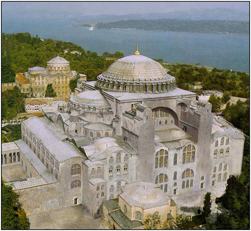
    The Seljuks were indeed great patrons of the Church of the East, and helped build monasteries as caravanserais in almost regular intervals along the entirety of the length of the Silk Road in their territory. The travellers would often use the inns as their most commonly used function, but the hospitals, the schools and the libraries were beneficial mostly to those living in their close proximity. It was actually this network of monasteries that resulted in the conversion to Christianity in the area.

    Persian Christians were thus offered the lower posts in the administration and bureaucracy, but without them the entire state could barely work. These people were the ones, who reintroduced the old Persian model of governance and the satrapies. However, implementing it into a country divided amongst the clans of the conquerors (3). And bringing back the Kurds, the Lurs and the Dailamites under control would be another.

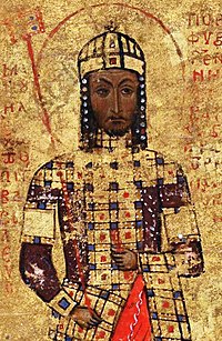
    Thus in the mid-twelth century, Shahanshah Petrus II. (4) decreed an administrative reform, subject to which was to be almost the entire country, save “Chartered Lands Under Exclusive Authority of Tribal Clans”. In other words, the land left to unruly tribes for it was not worth fighting them.
    upload_2019-11-25_9-49-9.png

    Administration in Persia
    Implementing said reform was easiest in Sawat and Khuzestan and along the Silk Road, as well as in the royal demesne around Ispahan. More difficult, but not impossible was Kerman and Pars; Khorasan and Adarbaigan would have to wait.

    Khorasan, whose language was already under heavy Turkic influence was one of the first parts of the empire to set itself free from the authority of the Shahanshah. The area had been previously mostly Manichean, now again converted to Nestorianism.
    upload_2019-11-25_9-43-9.png

    Let us see the Turkic enclaves in the Iranian Sea
    And then we have Sogdia. The Mesopotamia of Central Asia. The area used to be a multireligious and multicultural melting pot, a crossroad of civilizations, where Iranian, Indian and Chinese influences met. By the twelfth century, the Nestorians have come to dominate the cultural landscape, increasing their proportion to 60%. The second most numerous group were the declining Manicheans, making around a fifth of the population. The Buddhists number a mere tenth of the population, and the rest being a mix of Zoroastrians, Jacobites and Jews.

    While Manicheism used to flourish in the lands of Central Asia, where it was home and headquarters to the Denawar Church based in Samarqand, it has been in decline, and especially since the Seljuks began actively promoting Nestorianism, which was already gaining numerical superiority in the region by the eleventh century. Religious strife began to be an issue in the previously tolerant region, mostly Denawar against Nestorians, with occasional clashes and attacks. This results in more Buddhist emigration from Sogdia into the staunchly Buddhist- dominated Tukharistan; meanwhile a steady number of Manicheans move to the relatively safe region of Khwarezm.

    The Denawar Manicheans took up a more militant version of the faith, as a response to being threatened. Manichean scholars and thinkers, writing in Sogdian and even more commonly in Kwarezmian-influenced Sogdian justify the need of self-defence and defence of one´s community in accordance with Manichean doctrine (6).

    Many Persian were also prepared to use violence in bringing down the Seljuk Empire and reinstating a true Persian Persia. They would assemble in secret societies, and their bases of operation could have been found in the inaccessibility of the Elborz Mountains, but also anywhere where they could blend in with the locals. Their methods of warfare could not be described as guerrilla warfare either, although skirmish tactics were often used to attack patrols in the proximity of their hidden castles. But the most standard attacks were carried out as discrete murders (7) of important Seljuk official.
    upload_2019-11-25_9-44-21.png

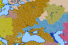
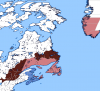
    And finally a political map in the end
    (1) Without Arabic influence, the change from “p” to “f” in Persian does not occur

    (2) Yes, it reminds me of the Yuan dynasty of China.

    (3) Or warlords, put it simply

    (4) This a Muhammad II analogue

    (5) I´ve inspired myself the Scorpion´s Bite, by @fi11222

    (6) So maybe we have a sort of Central Asian islam after all. Or don´t we? Well, they are limited by now mostly to Uzbekistan, so not that much they can do anyway.

    (7) The Assassins, anyone?
     
    Chapter 76: Mess in Mesopotamia
  • The realm of Mazoun has thus faced a severe crisis and appears not to have fully recovered. While a major slave rebellion has indeed been supressed, the realm has been weakened also by the rise of powerful competitors, and the Mazouni Republic has degraded into nothing more than a mere oligarchy during the course of the 12th century, and the real power was vested not in the hands of the Rais, nor the Council of Elders, not even the Sacred Council, but in the hands of the Dapir[1]. This was the most influential position, with the real executive power.
    upload_2019-12-6_11-27-27.png

    A political map of the Gulf Region
    However, Mazoun lost most of its position in the trading system to the island-city of Ormus. This new rival took advantage of the weakening of Mazoun and due to a more favourable position took control of practically all trade entering and leaving the Gulf. Fighting a series of wars against Mazoun, Ormus manages to confirm its new position, and the Emirate of Magan[2] accepts Ormusian suzerainty, paying a yearly tribute. Mazoun remains a more pragmatically-oriented city-state, careful to have good relations with the powers that be in Persia (allowing free concessions for any Seljuk merchants and practically no tolls), as the local plutocrats know that risking war is certainly not a good idea.

    Mazoun, having lost its position in the trade network and generally weakened now after the rise of Ormus sees itself become a monarchy by the 1160s in possibly all but name, as the office of the Dapir becomes hereditary and the remaining republican institutions merely formal. As the landowners gain more and more influence, while the traders gradually lose it, the society becomes generally more conservative, meaning more aristocratic and clerical power, with more conservative ideas and mores.
    upload_2019-12-6_11-30-24.png

    Linguistic make-up of the Gulf. Notice that Aramaic has expanded into parts of northern Mazoun
    As for Beth Qatriye, the region has once again swapped to a sort of feudal rule, as the area experienced a population decline due to climate change, and a general collapse of some social structure, with the military commanders overthrowing the “greedy” merchants. Staying true to the tenets of the Christian faith, they outlawed any form of slavery, be it open or in disguise, as it is unjust and sinful.

    Beth Qatriye has listened to the words of Youhanan of Gebail[3], heavily criticising the corruption of the Church and its mingling with Manicheism in most of Asia, as well as the temporal power of the Catholicos. His followers began to be known as sharirlimadh (meaning true disciples); the name has been corrupted in English into the form of Sarlimian. This new movement spread along the Qatriyan coast, and upon hearing that the Church of the East is not willing to take a rough stance against the Persianate Marriages they denounced the legitimacy of the Church of the East as an institution, claiming that it lost the original message of Jesus and was tainted and acculturated too much into the earlier Persian and Manichean traditions.
    upload_2019-12-6_11-26-31.png

    The Sarlimians shown in purple
    Ironically, an unbiased observer could actually witness more Manichean and Gnostic elements in the Sarlimian theology than in Nestorianism. The Sarlimians judged everything and gave a moral quality (plus or minus) on any action, and put again more emphasis on the spiritual rather than the material world, claiming that only those who seek the transcendent are eligible to enter the Kingdom of God.

    For this matter, many Qatriyans would retreat to the desert for a couple of weeks to meditate and seek to enter the Heavenly Kingdom, taking example from Jesus himself as well as Paul the Apostle in Arabia. In fact, this period of meditation began to be seen as another sacrament, marking the spiritual adulthood of the Sarlimian faithful.

    As mentioned much of the region of Sawat remains under the rule of the Seljuks. This area, corresponding to what historians called Lower Mesopotamia was more or less synonymous with ancient Sumer or perhaps Lower Babylonia. The area remains a heavily populated and urbanized region, and therefore the Seljuks do not give it to a random clan as a trophy of war, but put it into the hands of their most trusted administrators.

    As for the population, the gross and overwhelming majority are again Nestorian Christians, with Gnostic Mandeans retaining some presence in the marshy regions on the borderlands of Khuzestan and in the Mesopotamian marshes. Linguistically, the dialects to the south of Qtēspōn show some variations from the speech elsewhere in Mesopotamia, mainly by incorporating more borrowings from Persian and Turkish as well as Arabic (which was the case in the whole of Mesopotamia). However, more often, it was actually Arabic taking up Aramaic loanwords and cognates, for the lands of the Fertile Crescent were more civilized than the desert interior of the Arab Peninsula. In many cases, such as the semi-desert borderlands of southern Mesopotamia, you get just a variety which can best be described as Aramaic spoken and mispronounced by Arabs.

    The population of Lower Mesopotamia was labelled as Sawadis or Chladeans by other Aramaic-speaking peoples, but of such “national identity” did not exist, rather they were seen as those Aramaic-speaking Nestorian Christians, who are subjects of the Seljuk Shahanshah. Nevertheless some cultural differences began to emerge as this area had more contact with Persia than the rest of Mesopotamia.[4]

    The central regions of Mesopotamia include the city of Qtēspōn, as well as the region of Babil[5] were included in the “Donation of Tughril” and formed the Patriarchal State, a theocratic regime under the direct administration of the Patriarch of the East. Or at least theoretically, this metropolitan area was the demesne of the Nestorian Patriarch or Catholicos [6]. This region was heavily urbanized and there were practically no religious minorities (save a handful of Jewish merchants), yet the area was rather cosmopolitan, as it was basically the headquarters of the Nestorian church, so you could meet there people from India, from Socotra, from Sogdia or even Mongolia.

    Regarding cultural developments, one can say that indeed Mesopotamia was rather advanced in culture and education; as previously stated, Assyrians were one of the best scholars in the medieval world. Great universities could have been found in Gundeshapur, in Niniveh, in Qtespon, a new one in Kashkar and in Nisibis. Mesopotamia continues in its ancient tradition of astronomy and astrology (although you hear occasionally some priests and monks complain about it being idolatry).

    The prosperity in the area, as well as historic tradition [7] had it that prostitution was relatively widespread in the area of Mesopotamia. Even despite the fact, that the area was literally outside the doors of the Nestorian Patriarch, perhaps because the ark is the darkest just below the lamp. The region of Sawat was fast in adopting the Persianate marriages from beyond the Zagros, although sometimes these formalities would not even happen.

    The very relaxed mode of these urban societies would be something that the Church did try to tackle, but had real difficulty in doing so, especially in Sawat.

    To the west of Qtespon, we have the Jewish city of Nehardea, which remains one of the greatest centers of Jewish culture worldwide. Nehardea is one of the few areas in the world actually ruled by the Jews in the form of a city-republic, while being practically dependent on the Patriarchal State for in most practical affairs. Actually, the sole reason for which it continues to exist as an independent entity in the first place is the lack of further territorial ambitions in Qtespon.
    upload_2019-12-6_11-29-1.png

    Government in the Persian Gulf
    Further upstream the Euphrates, there is the small, yet still independent County of Anbar, which thanks its independence to Nehardea. Not much is to be said about this place, except that it remains in a rather backwaterish state.

    In Upper Mesopotamia, the Malikdom of Assyria experiences, yes, you expected, religious tensions yet again. The Seljuks seek practically disestablish the Maphrianate of the East and open persecution of the Syriac Jacobites begins, as all of it is declared to be merged into the Church of the East. In the lowland regions around the Euphrates river and in Tagrit, this results in converting (at last nominally) the majority of the population. After all, the liturgical language is practically the same, and the only differences remain in the question whether Jesus was a man or God. But the Schism is long gone, and people and priests actually have forgotten the real reasons for the schism but have continued viewing each other in enmity ever since.

    The regions of the Khabour (Gozarto) and Tur Abdin remain the bastions of the Syriac Jacobite Church[8], which is thus geographically divided into two, with these northern areas separated by Nestorian and Orthodox from the Jacobite areas further southwards in the proximity of Damascus.


    [1] Original Persian word for the „scribe“ or secretary of the Sassanian kings, from whom the Abbasid office of the Vizier was derived

    [2] Corresponding more or less to the UAE

    [3] Qatriyan Aramaic variation of Jubail, Eastern Province, Saudi Arabia

    [4] For some reason, I come to view the development of the Nestorian wolrd in Asia as an nalogue of Europe. Qtespon being Rome, the whole of Mesopotamia being analogous to Italy. South Italy being like Assyria, squabling between Orthodox and Catholic/Nestorian; lower Mesoptoamia being like northern Italy, the Zagros being the Alps and Persia being the Frankish realms. We can continue to view Qatar as Spain etc.

    [5] For some reason, early Christians identified Babylon with Rome. With Qtespon being the Rome of Asia, very near the ruins of ancient Babylon, we can see it there again.

    [6] An analogy to the Papal States, yes.

    [7] Also New Testamental scriptural references to the Whore of Babylon

    [8] Very much like in OTL, where these mountain refuges remained the last areas where the Jacobites actually retained their majority
     
    Chapter 77: Wars of the Holy Sepulchre
  • What was the main conflict going on in the Middle East during the twelfth century? As you may have guessed, religion continues to play an important, perhaps even decisive role in this region, and particularly sensitive is the issue of the ownership of the Holy Land, containing biblical locations such as Jerusalem, Nazareth and Bethlehem.

    While northern Syria was reconquered from the Seljuks by Rhomaic troops, southern Syria as well as the Holy Land were under the control of Tutush, one of the successors of the Seljuks. The realm of Tutush had been relatively weak since the very beginning, as the majority of the population in Damascus and the inland regions were belonging to the Syriac Jacobite Church, that is Miaphysites, strongly opposed to Nestorianism [1]. The coastal areas were, however, mostly Chalcedonian, with the Tutushid realm surrounded by an ever more ambitious Egypt and Rhomania.

    The Seljuk policies, especially regarding the Holy Land, where they put all of the important Christian monuments under the control of Assyrian monks, and demanded high fees from pilgrims of other denominations, resulted in the so-called Wars of the Holy Sepulchre[2].
    upload_2019-12-17_16-13-8.jpeg

    Church of the Holy Sepulchre. Who controls it?


    After the death of Tutush, his heir Duqaq got into a quarrel with his nephew Tutush II., who was rather sympathetic of the Syriac Jacobites. Tutush fled to Egypt, where Yaraklas welcomed him and, having already a candidate to enthrone in –Damascus, marched upon Jerusalem. The Egyptian campaign was also aided by an unexpected ally – the Arab tribes in Midian. Ultimately, in the First War of the Holy Sepulchre, the Nestorians lose and Tutush II is proclaimed King of Syria and Damascus in 1104.

    Unfortunately for him, this considered an insult to the Great Seljuks in Qtespon, that these places are left under the rule of such blasphemous heretics, and the Second War of the Holy Sepulchre begins in 1115, with Turkic cavalry manifesting its superiority in many battles, taking control of Damascus after a swift siege, but resulting in a bloodbath. Subsequently, the Duchy of Aram is set up, while the Holy Land, once conquered by the Seljuks, is organized in a theocratic manner, and indeed is proclaimed as the Holy State of the City of Jerusalem, directly administered by the Nestorian Archbishop of Jerusalem and the Holy Order of Mar Addai.

    Unfortunately for the Nestorians, this new state was not of long duration either. This was caused by a similar way of thinking among Italian merchants and Frankish knights, who jointly sought to regain control of the region for the Chalcedonian faith[3] (and, also very importantly, to take control of the Neguev Desert and the Gulf of Aqaba, allowing access to the trade with India.

    Therefore, the Latins waged war against the Turks in the Third War of the Holy Sepulchre in 1154. Unsurprisingly, the Maronites managed to reassume independence as a separate kingdom in Lebanon, while the city of Damascus was captured by the Rhomaics in a brief campaign. By in 1157, the area between the Mediterranean and the Dead See, extending to the Jordan River, and ultimately beyond, is under the control of the Chalcedonians, declare the holy Land to be under the direct rule of the Patriarch of Jerusalem, who is restored to his office. In practical terms, the most important office was that of the Defender of Jerusalem, who was actually in charge of the temporal matters in the Patriarchate. The Defender was usually the man who was to be seen dealing with practical matters; however the real executive power was vested in the six grand offices: the constable, the marshal, the seneschal, the chamberlain, the butler, the chancellor and the bailiff. The last one grew to ever-more more prominence, as he was literally the regent, and generally the office of the Defender and the Bailiff would come to be combined.
    upload_2019-12-17_16-13-48.png

    Map of the Southern Levant
    As for the demographics, one can observe a significant decline of population in the area, caused by continuous warfare. Separate demographic patterns could have been observed in urban and rural areas: the urban centres saw major demographic disturbances, caused by continued warfare; while the rural areas did not witness as much disruption.

    The rural population of the Patriarchate could be estimated to be somewhere at around 200 000 people. Most of the villagers were indeed Chalcedonian Christians, speaking mainly Aramaic, to a lesser extent also Arabic (in the south). These could number to some perhaps 130 000[4]. The second most numerous were Samaritans, living, well in northern Samaria, numbering some 30 000 people, followed by Nestorian Christians (some perhaps 25 000 people) and the remaining 15 000 being mostly Syriacs, Jews and Copts. Ultimately, another 40 000 Frankish (mainly Occitan and Provensal) farmers arrived in the area, who were separated from their neighbours mainly by their language. The Latin-speaking farmers have settled mostly on the coastal plains and in the proximity of castles; the Syriac Jacobites actually spoke mainly Arabic and lived in the Negev, while some others spoke Aramaic and could be found in the Galilee. Nestorians have settled mainly in the proximity of key Biblical locations, with Galilee and the Golan being the areas with their highest concentrations.
    upload_2019-12-17_16-14-24.png
    upload_2019-12-17_16-14-37.png

    Demography of Jerusalem
    Regarding the urban population, the numbers have risen again from a drop to a mere 75 000 back to 200 000; with major urban centres being found on the coasts: Acre, Ceasarea, Jaffa, Tyre, Gaza and Ascalon; with Jerusalem and Nazareth being major exceptions, while Tiberias sort of fits into the rule by being on the coast of the Sea of Galilee. The coastal cities have soon come to be dominated by Italian, to a lesser extent also Occitan townsfolk, who could number as much as 100 000.Significant remained also local Greek Orthodox (Aramaic-speaking, also partially Hellenophone) townsfolk, making 30 000 as well; numerously similar were Maronites (20 000) and Armenians at 15 000 (an Armenian Quarter could have been found in every major city). Furthermore, you could meet some Nestorians (15 000), newly installed Greeks (10 000), Syriac Jacobites (5 000). Ultimately, there were also Jewish and Samaritan townsfolk (5 000 together).

    Thus, all in all, the realm had some 400 000 people, with the Latins actually being the most numerous at 140 000 (32%), followed by Palestinian Greek Orthodox 115 000 (26%) and Maronites 60 000 (14%). Important minorities also include 40 000 Assyrians (9%), 30 000 Samaritans (7%) and 15 000 Armenians and Greeks each (4%). The rest being Syriacs, Jews and Copts.

    As the victors of the Third War of the Holy Sepulchre were mainly from Western Europe, they took with them most of the advantages; handing out landed titles and taking control of the trade in the area. Very favourable to the new arrangement were especially the Maronites, living in the north of the realm; the Palestinian Orthodox may have preferred to be united under the Rhomaic Empire, should the Emperor at least care a little for the region. The new regime is not however seen very positively by the Armenians or the Assyrians[5] . The Samaritans are mostly left alone without major concern.

    Further northwards, we can see the Duchy of Lebanon, a Maronite state, which reclaimed its independence during the Wars of the Holy Sepulchre. Lebanon has very close ties with Jerusalem, and has opened its ports to Italian (and Greek) merchants, seeking not to give the Rhomaic Empire any casus belli.

    Ultimately, the Duchy of Aram continues to exist as a rump state on the fringes of the Syrian Desert.

    upload_2019-12-17_16-15-33.png

    Forms of government in the southern Levant
    [1] Yes, the Nestorian-Miaphysite divide is going to play the role of the Sunni-Shia divide

    [2] Yes, an analogy to the Crusades. But you fight for the True Faith, against blasphemous heretics.

    [3] After all, Jerusalem was also the home of one of the Patriarchates of the ancient Pentarchy, which was however in enemy hands.

    [4] Of these, some 40 000 could be Maronites

    [5] However, quie a few of the believers of the Church of the East used to be Syriac Orthodox or Chalcedonian previously, and were converted by the previous regime.
     

    Attachments

    • upload_2019-12-17_16-13-40.png
      upload_2019-12-17_16-13-40.png
      1.1 KB · Views: 176
    Chapter 78: Komnenian Rhomania
  • Hello there, we are returning again to the hegemon of the Eastern Mediterranean, to the Rhomaic Empire. The realm to thirds of the Haemos[1] Peninsula, as well as Anatolia. Imperial possessions include also large parts of northwestern Syria; Cyrenaica and the southernmost tips of Italy, as well as parts of the Taurican [2] coastline.

    With the Rhomaic Empire being Rhomaic Empire, unsurprisingly, new problems with heretics arise. These are the result of an earlier resettlement of Paulicians in Thrace. The Paulicians are a Gnostic denomination, originally from the regions of Roman Armenia and have caused quite a lot of trouble. Significant numbers of them have been deported to the Rhodope Mountains; however, dissatisfied Slavic inhabitants of Karvuna[3] or Paristrion rapidly adopting this new faith (also as a means of reasserting their own identity vis-à-vis the imperial Rhoman one.
    upload_2019-12-20_14-47-25.png

    Beige is Paulicianism
    Paulician ideas continue to spread from here into Bosnia, where they become known as the Patarenes. Paulicians (Pavličani) were openly persecuted, and the Komnenian emperors had them burnt at the stake, as they considered them to be Manicheans.

    The reign of John II. Komnenos was a relatively long one (1118-1143), and was distinguished by his lack of cruelty. He was nicknamed as John the Good, or the Second Marcus Aurelius. The northern frontiers, threatened by the Pechenegs, were fortified again.

    During the reign of John II. Komnenos, the Rhomaics conquered the Beqaa Valley around the city of Zahle, as well as Damascus. Fruther fortifications were built on the Danube frontiers, while in the west, the Rhomaics conquered the Duchy of Salerno, thus consolidating their south Italian holdings.

    Under the rule of the following Emperor, Manuel Komnenos, the Rhomaic Empire conquers Serbia and Croatia, as well as Bosnia. The northern limits of the Empire are thus found on the Kupa-Sava-Danube line; with Slavonia remaining as a Hungarian march.
    upload_2019-12-20_14-48-43.png

    A political map of the Empire
    With a powerful and capable navy, Manuel launched an invasion on Sicily, seeking to restore Rhomaic rule on the island. The Tafircans, allied to Kemet, sought to halt any further Rhomaic expansion on the African soil. To counter the Copts, Manuel allied with the Patriarchate of Jerusalem. While Rhomaic forces suffered defeat under the Libyan sun, the naval battle of Lampedusa proved the superiority of the Rhomaic navy, and opened up the path for a Rhomaic conquest of the island, which then offered little to no resistance.

    Twelfth century Rhomania sees a period of prosperity and population growth, with new villages being founded in the rural regions of Anatolia. Furthermore, many cities, such as Thessaloniki and Antioch experience growth, multiplying their size two or even threefold.
    200px-Manuel_I_Comnenus.jpg

    Emperor Manuel Komnenos
    Peoples of the Empire
    The Rhomaic Empire remains a multi-ethnic state; however the Greeks form over a half of the population of the Empire. The Greeks live in the heartland of the Empire: in Thrace, peninsular Greece and Anatolia, as well as Cyrenaica and parts of southern Italy and Sicily. With Greek being the language of state administration, of the army and liturgy, it has made significant advances, surpassing other languages in favour of Greek. Apart from standard Greek, divergent Hellenic languages include Pontic Greek (to be found along the north Anatolian Coast, as well as on the Black Sea coast of Taurica), Cappadocian Greek (at the northern foothills of the Taurus Mountains in Anatolia) and Italiot Greek (in Calabria, Apulia and western Sicily). Furthermore, there is also Cypriot, which developed independently from the rest of the Empire, and then Cyrenaic Greek on the North African coast and Antiochian Greek in Syria. The mountainous Peloponnesus has also resulted in isolated Hellenophone populations of Maniots (in the southern tip of the peninsula) and Tsakonians (in the eastern coast). These two languages are thought to be the descendant of the ancient Doric language of Sparta.
    upload_2019-12-20_14-48-5.png

    Languages of the Empire
    The Slavs form a considerable minority in the northern provinces. Primarily the Karvunians in the Diocese of Paristrion[4], who have faced severe persecution after adopting the Paulician heresy, and then the Croats and Serbs in the newly acquired regions of former Roman Dalmatia. By this time, any further Slavic presence in Anatolia or further southwards was assimilated into Greek, or Vlach, or perhaps living as isolated pockets in an otherwise Greek environment.

    The Romance peoples living within the borders of the empire are usually classified as either “Latins” (to relate to southern Italians, Sicilians and Dalmatians) or Vlachs (the bluk of Peninsular East Romance speakers), who are sometimes divided into Moesian Vlachs, Dacian Vlachs and Macedonian Vlachs. While it is acknowledged that also the Vlachs speak a dialect of Latin, generally the Latins are considered to be civilized, but the Vlachs are viewed as tough shepherds, who are suited excellently for warfare in mountainous terrain.

    Armenians living within the borders of the Empire have, for the gross part, come under the jurisdiction of the Rhomaic Church; and many, apart from those in the close proximity of the eastern borders, also assimilated into Rhomaic culture, with their names being sometimes the only memory of their Armenian heritage.

    The Syriacs are still a considerable minority in the Empire; apart from the newly acquired city of Damascus, the gross majority of Syriac-speaking subjects of the Empire are now under the Melkite Patriarch of Antioch, rather than the Syriac Jacobite Church. The area has been considerably depopulated during the wars of the Seljuk invasion and then again during the Rhomaic reconquest.

    The Arnautes[5] continue to inhabit the northern parts of Epirus; with a lifestyle very similar to the Vlachs. Other groups which do appear in demographic surveys are “Iberians”, that is Kartvelian-speaking Lazes, living to the east of Trebizond; and occasionally there are mentions of peculiar transhumance shepherds and nomads in Anatolia, who speak a peculiar tongue, thought once to have been around in the area. In general, these tribes are on the margin of extinction. Their differing religious identity (Paulicianism), means that they are likely to resist assimilation for quite some time. But will they escape eprsecution from the Patriarch of Constantinople?

    The Jews are no longer regarded as an ethnic group, but are rather viewed as a religious group; and usually, four different Jewish peoples are described. Firstly, the Rhomaniote Jews, who have integrated into Rhomaic (Greek) society, speak a variant of the Greek language and can be found in the core areas of the Empire. Then, secondly, we have the Syrian Jews (mainly in Aleppo and Damascus), speaking a form of Aramaic. Thirdly, there are Italiot Jews from southern Italy, and finally Moesian Jews living Paristrion, who have adopted the Vlach language for everyday communication.

    Rhomaic Military
    The Empire has managed to greatly reorganize its army. The elite units of the army include the Varangian Guard (originally recruited from Vikings and Russians, now perhaps considered to be the successor of the Praetorian Guard in imperial Rome), the Immortals heavy cavalry, and the Archontoupouli (consisting of the sons of dead officers). Also famous are Kataphraktoi heavy cavalry, recruited mainly from Macedonia, Thrace, Thessaly and the Marmarian provinces in Anatolia, then the Trebizond Archers and Vardariotes (horse archers from among the Steppe peoples stationed in Macedonia, but also from Paristrion). Another cavalry type were the koursores, roughly corresponding to central European Hussars.
    upload_2019-12-20_14-49-51.jpeg

    Rhomaic cataphracts
    Standard infantry units would include hoplites (heavy infantry), peltasts (javelin throwers), and the psiloi (unarmoured light infantry).

    The top commander bore the title of Megas Domestikos, next inline was the Protostrator. Individual field armies were led by the strategos. The smallest tactical unit was the allagion, perhaps some 400 men strong, led by an allagator (not an alligator).


    [1] Balkan

    [2] Crimea

    [3] Bulgarians living in the Paristrion region (Lower Moesia)

    [4] The rump of the Bulgarian nation

    [5] Albanians
     

    Attachments

    • upload_2019-12-20_14-46-35.png
      upload_2019-12-20_14-46-35.png
      15.6 KB · Views: 183
    Chapter 79: Pope, Patriarchs, Pentarchy... and Schism
  • Until the mid-twelfth century, Chalcedonian Christianity remains as a unified Christian denomination, covering most of the Mediterranean world, at least most of the Greco-Roman world. While the ancient ideal of the Pentarchy was still considered valid, this ideal state had in fact many flaws and therefore could be considered to have been rather divergent of the de facto situation.

    In theory, the institution of the Pentarchy meant, that the entire Christian world was to be governed by the Bishops of the most important Apostolic Sees, those being:
    6006197a08792d0b73c21687c6d5b5c5.png

    The original notion of the Pentarchy. Later, Macedonian and Dacia was tranferred under the jurisdiction of Constantinople
    1. Rome, the former capital of the Empire, heartland of the Latin-speaking West to cover the lands of the borders between Dalmatia and Upper Moesia[1], as well as the northern parts of the Libyan continent to Sirte. The Patriarchate of Rome claimed to be the most senior Patriarchate, claiming its origins from Apostle Peter. In reality, the authority of the Pope had been challenged by Carthage, which was the See of the rather rigorous and strict sect of Donatists[2]; by the rival Patriarchate of Aquilea at the mouth of the Adriatic and by a rather independent Celtic Rite Christianity in the British Isles[3]. The authority of the Roman Patriarchate has spread throughout much of Europe under the conquests of Charlemagne in Germany, and further into the former Roman Pannonia (Hungary) and Dalmatia (Croatia), into Poland and Scandinavia, as well as to the Canary Islands and Madeira. The Roman Pontiff has acquired much moral authority, and has become to be regarded as the ultimate arbiter in the disputes between the various kings and lords within his sphere.

    2. Constantinople, or the Second Rome, has been, by the virtue of becoming the new capital, been elevated to the second highest position. Being placed on the Bosphorus Strait, enabling contact between the Pontic and Aegean Basin, it has become the capital of the Greek world. Its formal jurisdiction borders were defined to include most of the Balkan Peninsula as well as Anatolia up until the Taurus Mountains; the ultimate jurisdiction of the Constantinoplian Patriarch have expanded to include also Wallachia, formerly known as Dacia, then Taurica[4] and the surrounding Steppe, Alania and the various principalities of the Rus´. In praxis however, the Rhomaic possessions in Southern Italy and Sicily, while de jure belonging to the Patriarchate of Rome, have been placed by the Emperor under the authority of the Patriarch of Constantinople, with the instalment of Greek bishops and Greek Rite even in Latin-dominated places such as western Sicily or the newly conquered Duchy of Salerno. A similar process happened also in Dalmatia. Unlike in the West, the Patriarch of Constantinople is not a fully independent and supreme canonical hierarch; rather the Patriarch looks to the Emperor as the sovereign authority[5].

    3. Alexandria, in Egypt, by tradition founded by Mark the Apostle, was to encompass Egypt, Cyrenaica and the entire Nile Valley. However, the Melkite Patriarch of Alexandria[6] is the religious head of only a fraction of the populace – mainly of the Alexandrian Greeks, the Cyrenaican Greeks and perhaps a few merchant sin the coastal towns. Full stop. This is because the gross majority of the Christians in Egypt, the Copts and also some Arabs adopted the Miaphysite theology, and have formed their own church, the Coptic Church, led by the Coptic Pope[7]. Therefore, this ancient see has lost a large part of its importance. Recently, the issue was to be tackled by the Komnenian Emperors, who detached the island of Crete from Constantinople and put it under the jurisdiction of Alexandria.

    4. Antioch, formerly the most populous city in the Roman East was to cover the central and northern Levant up to the Taurus. While Antioch was a Hellenophone city, most of Syria consisted of Aramaic-speaking hinterland; differences between the two communities[8] resulted in the formation of a separate Syriac Jacobite Church, in communion with the Coptic one. By the twelfth century, the Syriac Church was in decline and much of western Syria (under active support of the emperors) now belongs to the Greek Patriarchate. Autonomous are churches in Cyprus, Lebanon[9] and Georgia.

    5. Jerusalem is the smallest Patriarchate, consisting only of the Holy Land and Arabia (including the Sinai). Chalcedonian Chrisitianity has not expanded much beyond the borders of the former Roman Empire.

    Outside this theoretical Pentarchic arrangement were already extant centres of Christendom in Mesopotamia (Qtespon), Armenia (Etchmiadzin), Aghbania or Ethiopia (Axum), as these were outside the borders of the Roman world.

    By the mid-twelfth century Constantinople and Antioch were to be found within the borders of the Rhomaic Empire; the Church in Alexandria was also dependent on Constantinople. The different political situation (with the Emperor seen as the ultimate arbiter, with the right of calling ecumenical councils in the East, while the Pope´s image as the ultimate arbiter in the West) caused the two to grow more and more apart; of course a form of the language barrier may have also helped to channel up further misunderstandings, as Italian or Latin was the language of the Pope in Rome, while the remaining Patriarchs (except Jerusalem) all spoke Greek.
    upload_2019-12-21_17-34-29.png

    A geographical representation of the schism. Yellow is now Catholicsim, under Rome, and Orange is Orthodoxy. the Nestorians and Maronites claim communion with both.
    Theological disputes, mainly with the Rhomaic Emperor´s tricks in solving Christological problems, with the Latin position (if ought to be defined) was very close to that of the Nestorian one (however, as long as one does not call it that way), have also contributed to further misunderstandings, as well as the filioque issue.

    The most direct cause was however the Rhomaic rearrangement of canonical borders, simply attaching all previously Roman-administered territory in Sicily, Croatia and Salerno, under the authority of Constantinople, and totally replacing the Latin Rite with the Greek Rite in those areas.

    The result was the Great Schism. “And so it was that due to the arrogance of the Rhomaic Emperor, as he expelled bishops from Palermo, Salerno, Spalato and dozens of other places, as if they were commanders of his army, that he bestowed upon himself the wrath of Rome” wrote an Italian chronicler from Florence. The wrath of Rome materialized in its guarantee of all Italian states to its south, especially Benevento, but more importantly, by sending envoys to Constantinople, politely, but boldly asking the Emperor to und his policies in Croatia and Italy.

    This, could, however not accepted by the Emperor, as he was regarded as the universal authority, and the notion of a Church structure legitimately challenging legitimate imperial authority was completely alien to the mentality in Constantinople at the time. Subsequently, at the residence of Patriarch of Constantinople, the debate resulted in opening all kinds of disputes, with the end result being the breaking of the Communion between the two Churches. Alexandria chose[10] the Constantinoplian side, while Antioch was more moderate, but ultimately chose that side as well. The Patriarchate of Jerusalem declared to remain in communion with both parties, claiming that the whole issue has no real theological basis.


    [1] Roughly on the Drina River separating Bosnia from Serbia.

    [2] Who were however confined to the Berberophone regions of the Sahara and then established this variant of the faith in Sub-Saharan west Africa

    [3] These should however not be viewed as schismatics. Rather, they continued to develop independently, since the links with Rome were lost.

    [4] Crimea

    [5] Or perhaps said in American terms, imagine the Rhomaic Emperor as the President, and then the Patriarch of Constantinople as his Secretary of Religious Affairs.

    [6] Or the Greek Patriarch of Alexandria, or Chalcedonian, as you wish to call him

    [7] The Coptic Pope claims to be Patriarch of Alexandria, but resides in Kashromi (Cairo).He is the primus inter pares of the Miaphysite communion, or the so-called Oriental Orthodox.

    [8] And the Indo-European and Afro-Asiatic mentality and structure of languages, I suppose

    [9] As a compromise with the Maronites

    [10] Given the Melkite Patriarch´s dependence on Imperial support, it appears he didn’t have much of a choice , however.
     
    Chapter 80: A Brief Description of the Empire, by Heracleus Staurakios
  • Wait, you did not believe that we would finish the Rhomaic Empire in one update, did you? Well now. We will now take a look at the way the country is governed by the mid-twelfth century. The division of the country into dioceses still exists; although some of them have changed especially as the boundaries changed, and as the borders shrank and expanded again, some of them were re-established and some were not.

    I shall describe the different administrative areas and insert quotes by Heracleus Staurakius[1].
    upload_2019-12-23_12-6-59.png

    Administrative map of Rhomania
    Magistrate of Constantinople

    “The City of Constantinople, also called the City of the World´s Desire, Tzaregrades by the Serbs and Karvonians and by a handful of other names was founded anew by the Emperor Constantine on the place of the ancient Hellene colony of Visantion. It has been described to be the most marvellous city on earth, dominated by the Imperial Palace and the Hagia Sophia.

    The city is situated on the easternmost extremity of Thrace, by the bay of the Golden Horn where it enters the Bosporus strait connecting the Marble Sea with the Black Sea” Heracleus Staurakius then goes on to describe the various dominants of the city, its history as well as the Theodosian Walls, which, as he notes, are considered to be the outer borders of the jurisdiction of the city. “The Walls of Theodosius, an impressive project built by the emperors to protect the city from barbaric raids now mark the border between the Magistrate of Constantinople and the Diocese of Thrace”.

    Constantinople is a multicultural city, overwhelmingly Greek, but populated by people from all over the Empire; especially visible communities include Romaniote Jews, Latin[2] merchants, Varangians[3], but also Vlachs and Armenians.
    image297.jpg

    Hagia Sophia
    Diocese of Thrace

    Thrace is the name of the diocese beyond the walls of Theodosius. The name Thrace is from that of the ancient tribe of Thracians, who were related to Dacians further north; and they had their kingdom under Odrysus. Now, there are no more Thracians, as either they adopted the customs of the Romans and became scattered into the mountains when the Bulgars came, thus becoming one tribe with the Vlachs, or they learnt Greek.”

    The chief town of Thrace is labelled as Adrianopolis[4] on the Evros River[5], also Philippopolis is labelled as being an important town, as well as Heraclea on the coast of the Marmara Sea. The northern border of Thrace is said to be the Haemus, and again Staurakius describes the people as being mainly Greek, with a few Vlachs here and there. Quite a long passage deals with the original wars against the Bulgars, and Staurakius also notes that there is a distinct people living in the mountains:

    “In the mountains called Rhodope, there dwells a secretive folk, who are not Thracians. They were settled here from the border regions of Armenia, as they were heretics called Paulikians. They now adopted Rhomaic language, but in secrecy continue to practise the God as their grandfathers did”.

    Macedonia

    “Macedonia is known to be the birthplace of Alexander the Great, Lord of Asia and the nemesis of Persians; many claim that is so because it lies beneath the shadow of the Olympus. Be it as it is, the metropolis of Macedonia is Thessaloniki, and Macedonia covers the entire valley of Axios, called also Vardarios by many, as well as the Thessalian plain” Much of the description speaks about Thessaloniki, and then of particular notice is taken Mount Athos. The population are said to be mainly Greeks, with considerable Vlach presence in the northwest, but the “uppermost reaches of the Axios are populated by the Arnautes, a secretive Hillman people perhaps descended from the Illyrians of old”. Furthermore, Staurakios speaks of nomads, who were resettled to Upper Macedonia where they train to serve as light cavalry skirmishers, and are said to be “Turks from a great multitude of tribes”.

    Bithynia

    “Opposite Constantinople is the land of Bithynia, which encompasses also Paphlagonia and Galatia”. The geographer then speaks of the great cities of Chalcedon and Nicaea, which held great ecumenical councils, but also about Ancyra. The population is said to be almost entirely Greek, although “a small shepherd-folk persist in a few easternmost villages of Galatia, speaking a peculiar tongue”.

    Asiana

    At the west of Anatolia is the diocese of Asiana, with its great cities as Ephesus, Smyrna, Pergamon, Sardes and ancient Troy; home to many river valleys”. Ephesus is identified as the former metropolis of the region, but now many have moved to Smyrna. Staurakios also speaks of the city of Miletus and its history during the Greco-Persian wars, as well as Apostle Paul´s ministry in the region. Pergamun is also mentioned as the place where the tradition of writing on o skins began. As general observation, he states that “the towns in Asiana are larger and more numerous than in other lands of the empire”. Of recent history, he has mentioned some resettlements of Slavs into the regions of Mysia[6].

    Anatolikon

    “Under the name Anatolikon we ought to understand the central and interior parts of the Anatolian Peninsula around the city of Iconium, what was called Lycaonia and Cappadocia in the days of old. The land is an arid plain, but has many lakes, which are however salty”. While majoritarily Greek, Staurakios noticed that the tongue spoken in the area different from Constantinople “but when listening to the villagers, I hardly understand them, for their way of speaking is different from the learnt tongue of Constantinople, and occasionally they put in words that one cannot understand”. He is clearly pointing out to the fact that Cappadocian Greek has diverged significantly from Koiné, as this area was the last refuge of the Anatolian languages.

    Also Staurakios mentions a peculiar language, of which sounded not like any other he ever heard, and has been identified as Isaurian. “And they write it with Armenian letters to hide it from their neighbours, for they do not follow the True Church, but in the custom of the Armenians”[7].

    Pontus

    “The last diocese in Anatolia is that of Pontus, named after the Pontic[8] Sea it faces to its north”. The historical descriptions in this chapter speak of the founding of the colonies along the Pontic coast in the Antiquity, of the wars against Mithridates na dthen of the Lazic wars. The coastal regions are described as being lush with greenery. However, Staurakios also warns any traveller before entering Pontus “but be careful to listen, for the people of Pontus speak in a different way and you may not understand what they say; that being if they speak Greek, for there are many great Armenians in the region of Sebastea and many Iberians called Lazes in the mountains” Apparently, he noticed and felt the language barrier in the area. Pontic Greek is thus a distinguishable language already by this time, and he encountered problems as the Armenians and Lazes did not speak proper Greek.

    Pontus is home to many Armenians; and while many in other parts of Anatolia have adopted Rhomaic style and customs, and embraced the True Faith, those in Sebastea and other parts of Pontus are stubborn in their Armenian tongue and Monophysite heresy”, meaning that the area did keep its distinctive Armenian character, despite being under Rhomaic rule for quite some time.

    Morea

    The land of Morea, called Peloponnesus in ancient times and Achaea to the Latins” is described as having the shape of a hand with stretched fingers. Noted is the ancient history of the region, especially noted is the tale of the warrior-kingdom of Sparta. Further history speaks of the settlement of the area by Slavic tribes from the north; and ultimately says “In some parts of Morea the people speak the tongue of the ancient Spartans, especially in parts of ancient Laconia and Kynouria”[9]. Attached to this area is also the region of Attica, Boiotia and surrounding regions; noted is the history of ancient Athens.

    Epirus

    The land of Epirus lies on the western coast of Rhomania, west of the Pindic Mountains which separate it from Macedonia”. Epirus in this time is mostly rural, with Nicopolis and Dyrrhacium being the major cities; Epirus proper is said to be mostly Greek, its highlands populated by Vlachs, while the highland regions in the north are said to be populated by Arnautian tribes “whom we think are the remnant of Illyrians of old”

    Dacia

    The name Dacia refers to the lands around the Gorge of the Danube to its south; and from there westwards into the valley of the Margos[10] towards the city of Naissus , towards its estuary into the Danube. Rhoman Dacia ought not to be confused with the Dacia of Traian, which existed in the wild lands beyond the Danube, but rather can be equated with Upper Moesia. This is so, because when the barbarians ravaged Trajan´s Dacia, the people fled t the safe side of the Danube”. Virtually all of the people of Dacia are described to be Vlachs “who speak the tongue of the Latins in the most peculiar way; and found refuge in the mountains´, when their cities were burnt by barbarians, and they are tough Hillman folk, from amongst whom perhaps the best soldiers of the Empire are recruited”.

    Paristrion

    The land of Paristrion lies on the lower Danube, in Greek the word literally means “by the Danube”. This region is largely synonymous with ancient Roman Lower Moesia, but more often than not it is described also as Karvuna.

    In the historical chapter about this province, much is spoken of the Bulgarians, and it is stated, that “finally this people was destroyed and scattered, and their remnants are called Karvunans and speak a Slavic tongue; then there are the Turks of many tribes whom our Emperors settled to guard the borders on the Istros, and then the Vlachs living at the foothills of the Haemus” Finally, there were also Greeks living at the ports near the Pontic coast, and many Jews living in the towns as well.

    Here again, Staurakios speaks of Paulikianism and how it spread among the Karvunians “These sturdy people have thus listened to this nonsense and embraced the Pavlikian heresy, and while their kingdom was crushed, their hatred for the empire was not.”

    Taurica

    “The peninsula of Taurica lies on the far side of the Pontic Sea, and on its southern shore, there were Greek towns since time immemorial; sometimes this land is called Perateia, as the far shore. Protected from cold winds and fierce tribes by the Tauric Alps, this land is good to grow wine, and were it not for the barbarous Turks in the neighbourhood, the land could be settled greatly by many peasants, for the crops grow well here”. It is thus hinted that this land could be a place of future expansion, but before, something ought to be done and pacify the neighbouring tribes.

    “And the Greeks of Taurica speak the same way as in Pontus, and there are Goths in Theodoro, and Circassians and Armenians and Jews and Turks from a multitude of tribes”

    Cilicia

    Very little is said about Cilicia, mainly that it is the birthplace of Paul the Apostle and that it lies to the south of the Taurus
    Cyprus

    Not much is said about Cyprus, especially noted is its rural character.

    Antioch
    Antioch-on-the-Orontes-River-in-the-1st-2nd-century-AD-Looking-South-West-3685.jpg

    “The greatest city in the Orient is Antioch, founded by Antiochos the successor of Alexander in Syria; it was the place where Christians were first called Christians as such”. And then more is said that the city is Greek in character and see to the Patriarch, of whom the entire list is given.

    Syria

    “The hinterlands of Antioch are labelled as Syria, and include many cities of which most important are Damascus and Berroia, and then there are Emesa and Laodikia and many others”

    The rivalry between Damascus and Berroia[11] is well noted, and it is said that many speak Aramaic, “which is believed to be the tongue of our Messiah”, but along the coast also many speak Greek. “Those in Syria are called Antiochian Greeks, and have sided with Constantinople, while those far from the sea have held their grudges against us”. Also described are the conquests and reconquests of Syria and the kingdom of the Ghassanids.

    Crete and Cyrenaica

    “Cyrenaica remains the last foothold of Rhomaic power in the Lybian Continent, as Egypt proved to be far too unruly. It was combined with the southernmost island of Crete. The towns in Cyrenaaica are Greek, but the countryside saw many Lybes settle, and many adopted Greek customs, but many did not”
    4-a612fe71b1fb856d57f7e60bc22852e09008f4b0.jpg

    Etna Volcano
    Sicily

    The island of Sicily is the greatest in the Inner Sea, and is the most recent addition to the empire. Its major city is Syracuse, Greek in tongue since times immemorial”. Other cities of influence are Messina and Palermo; Sicily is noted for being the place of Punic wars, then he volcano of Etna is described in detail. “On the eastern shore, people speak Greek, in the western parts, you hear villagers speaking a dialect of Latin”[12].

    Also noted are the various smaller islands around Sicily, where Malta is said to speak a tongue “similar to that of the Jews, perhaps that of Hannibal”

    Calabria

    Not much is said about Calabria other than details about the towns; only that almost everyone speaks Greek

    Longobardia

    “The eastern promontory of Italy is called Longobardia, for much of Italy was settled by Lombards. We should however not mistake this region around Tarent with Greater Lombardy around Mediolanum further north” Tarent is thus the chief city of this region, others mentioned are Brindisi, Otranto and Bari. It is also said that while many speak Greek, also Latin can be heard further north.

    Salerno

    “Salerno is also one of the most recent additions to the empire, found in southern Campania. The city was a Duchy ruled by Lombards as was neighbouring Benevento for a long time”. Described are the Dukes of Salerno and then the attempts to Hellenize the church, which resulted in the schism

    Serbia

    “The Diocese of Serbia is found in a mountainous region, to the north and west of Lake Skadar. The Serbs are a Slavic tribe, and used to have kings of their own; traditionally their lands are divided into coastal Zeta and mountainous Rascia”

    Dalmatia

    Dalmatia is the last Diocese mentioned by Staurakios. It includes: “The coast of Dalmatia, still speaking Latin, but also the inland regions of Croatia and Bosna, which are Slavic”. The northern border of Dalmatia is described to be on the Sava River. In its history chapter, described are the kingdoms of the Croats, and most recently, that many “Hillman adopted the Paulician heresy”


    [1] This fictional 12th century geographer is known for writing A Brief Description of the Oecumene, or a short geographic handbook describing the known world.

    [2] The word „Latin“ in Rhomaic sources usually refers to Italians, and may be extended also to South Romance speakers and Dalmatians, as well as Occitans. Most likely, they were either Venetians or Genoans and Pisans

    [3] Varangians refer to mercenaries, mainly from Scandinavia, Russia and the British Isles; i tis however possible that some Merya or Mordvins were among them as well.

    [4] Edirne

    [5] Marica

    [6] Hudavedingar

    [7] Luckily for them, Staurakios did not write that they are Paulicians, but assumed they are Armenian Apostolics.

    [8] Black

    [9] Referring mostly to Maniot peninsula and Tsakonia in the east

    [10] Morava River in Serbia

    [11] Aleppo

    [12] Reference to the Sicilian language, belonging to the Southern Romance branch
     
    Chapter 81: The Rise of Armenia and Novgorod
  • Now we will take a look at Eastern Europe and the Caucasus. The new hegemon of this region is again Armenia[1]. The kings of Armenia have once more managed to unify almost the entirety of the Highlands, except the region of Kharpert.

    The Duchy of Kharpert remains a separate independent polity, where Paulicianism actually becomes the official religion; this borderland region on the borders of Rhomaic and Armenian territory has come to develop its separate identity, calling themselves Tzopkeanner[2].
    upload_2019-12-23_17-21-4.png

    Kharpert is a bastion of Paulicianism. Also notice the advances of Orthodoxy along the Daugava (Bishopric of Jersika)
    Armenia itself thus unified most of the Highlands, including Syunik, Vaspurakan, and further northwards, they also subjugated Kartlia[3], where the Kartli language takes in a considerable number of loanwords from Armenian. This time also sees the change of the ethnic identity in the region of Tao-Klarjeti (Tayk) from Georgian to Armenian again.

    On the other hand, the western Kartvelian kingdom of Lazica or Colchis, facing the Pontic Sea remains independent, and the Mingrelian tongue rises to prominence.

    The lands of Aghbania remain under Seljuk rule, although most probably this will not last very long. The middle Kura valley still speak Utyk, the ancient language of Aghbania.

    Further northwards, the Alans have become the major power in the area. The Kingdom of Alania has expanded westwards to subjugate the various Circassian tribes, and extending to the Kuban and the Terek Rivers. While Circassian has taken quite a lot of loanwords, especially those regarding Christianity from (Pontic) Greek, other words, regarding to structures of power were taken from Alan[4].

    The northeastern parts of the Caucasus remained home to a great variety of tribes: but Khundzia region came to be subjugated by the Kartlian vassals of the Armenians (the region already became Christian). [5]

    The coastal regions of the Khazar Sea [6] are becoming again more urbanized, and gradually the people adopt the Khazar language as the tongue to communicate amongst themselves, although in the villages they speak their own languages. The majority religion in this region has in fact become Judaism, and thus this region is one of the few where the majority and the ruling elites are actually Jewish.

    We have discussed the realm of the Cumans already, so let us take a look at Eastern Europe now.

    The realm of Bolgharia[7] remains one of the few staunchly Manichean realms in the world. Manichean beliefs slowly spread up the Kama River to the Udmurts and also downstream to the nearest Cuman clans.The Bolghars are faithful to the Denawar branch of Manicheism, and Manichean scripture is being translated into the Bolghar language (which is being written using the Manichean alphabet).

    The Merya Kingdom is a prosperous realm on its offensive; controlling practically the entire middle Volga basin. Many new bishoprics have been founded, and the Bible was translated to the Merya language (with many Slavonic influences, however). The existence of the separate Metropolitanate at Obran Osh means that even Constantinople recognizes this Finno-Ugric kingdom as realm culturally distinct from the neighbouring East Slavic peoples. The Merya have incorporated the Duchy of Muromia-Ryazania, incorporating the gross majority of the Mordvin into their realm. True, many Mordvin have until no remained pagan.
    800px-Novgorod_torg.JPG

    Marketplace in Novgorod
    In the north of the East Slavic lands, arose the Republic of Novgorod. Referred to its citizens as Gosudar Gospodin Velikiy Novgorod [8], this republican city-state situated on Lake Ilmen has come to dominate much of the surrounding region, expanding to the shore of the White Sea and commanding the trade in the region. Trade consisted mainly of furs, sea fauna, salt and other resources, collected by neighbouring Uralic tribes who paid tribute to Novgorod.
    upload_2019-12-23_17-18-27.png

    Languages of Eastern Europe. Notice that the Volga Finnic group remains strong
    Thus, while a highly divergent form of the East Slavic language (Novgorodian) is spoken by the townspeople, influences of Scandinavian (North Germanic) and Uralic languages are present in the speech. Novgorodian rule actually did not seek to displace the native tribes, rather for the Novgorodians the native Uralic tribes were important, in fact crucial for their trade, for they knew best where to gather and collect the trade commodities, which were to be exported on the European market.[9]

    Nevertheless, some coastal areas of the White Sea were settled by Novgorodian settlers (these people became to be known as Pomors [10]

    Politically the head of state was the Posadnik, while the head of the army was called the Tisyatsky; and the city had a parliament called Veche.

    Apart from the city itself, the land controlled by Novgorod was divided into pyatinas (fifths), which encompassed the core regions of Novgorodian land, and then volosts, which could be compared to hardly-settled territories, inhabited by tributary tribes.

    Further southwards, we have other squabbling Russian principalities, such as Smolensk, Chernigov, Pereyaslavl, Kiev and Galicia-Volhynia. Out of these, Kiev still appears to be the senior one, yet challenged by Galicia and Chernigov. This is helped also by the fact that Kiev remains the seat of the Metropolitan, and has been considered as the principal Russian city; and the Russians have expanded a little southwards, ploughing some of the land that was formerly the Steppe and used to belong to the Cumans

    The Duchy of Polotsk was, however, conquered by Lithuanians, a Baltic tribe, while its Latgalian vassals at Jersike have broken themselves free. This Latgalian duchy appears to have unified much of the region around the Daugava River, to include also Semigallia and Selonia, as well as parts of Livonia.

    Similarly, the Curonians have unified the western coast, from the Gulf of Riga to the Nemunas estuary; they were feared pirates, and the Scandinavians have sent numerous expeditions against them.

    Ultimately, there were the consolidating duchies of Lithuania, Sudovia and Prussia. Apart from Latgallia, the rest of these tribal chiefdoms were pagan; although Lithuanians have conquered quite a large number of Russian subjects in the Duchy of Polotsk.

    As for now, Lithuania and Lattgalia appear to be close into entering the eastern cultural sphere, while Curonia and Prussia might enter the western world. Sudovia remains a big unknown, however. Anyway, things may change, but this is the state of the Baltics as they are right now.

    upload_2019-12-23_17-19-44.png

    in the end, a political map of Eastern Europe.
    [1] In OTL, Georgia has come to be the hegemon of the region. Here, Armenia, because it was not hit as badly by the Seljuks, nor suffered under the Arabs, rises to prominence.

    [2] Derived from the name Tzopk (Sophene, a historical region roughly in the smae area)

    [3] Eastern Georgia, mainly in the Kura valley

    [4] Ossetian language

    [5] Really, one must not forget that Georgian did in fact have real contacts with peoples beyond the Caucasus, and by the twelfth century, a large majority of them were baptized by priests from Georgia (or Alania).

    [6] We are speaking of the Dagestani Coast

    [7] Kingdom of Volga Bulgaria, centred on the confluence of the Volga and Kama rivers, roughly around Kazan

    [8] His majest, Lord Novgorod the Great

    [9] I envision Novogorod like the Hudson Bay company, relying on pioneers trading with the native Americans...

    [10] Who
    upload_2019-12-23_17-23-16.png

    Who expects a republic so far north?
     

    Attachments

    • upload_2019-12-23_17-20-49.png
      upload_2019-12-23_17-20-49.png
      27 KB · Views: 367
    Chapter 82: Of the Baltic Sea, Scandinavia and the Realms Beyond the Sea
  • Continuing further in our tour across Europe, we arrive in Scandinavia.

    The kingdom of Gaetia[1] begins a slow northward colonization of the Sami lands, and Gaetian colonization of the Finnish coast, at first by Aland Islands, and then also into the regions of Finalnd Proper, Satakunta and Ostrobothnia. By this time, any remaining Asatru (Norse pagan) regions in the area are Christianized. A little further eastwards, in the regions of Uusimaa[2], Tavastia and Savonia, the Finnish tribes gradually establish their own powerful chiefdoms, trying to establish their own realms. The Duchy of Savonia of Tavastia, encompassing much of central Finland (Tavastia plus Uusimaa) has become a polity powerful enough to be reckoned with.[3]
    upload_2019-12-25_12-24-38.png

    Religion in northern Europe
    The Tavastians a little further eastwards have joined the Karelians into another important tribal chiefdom; the two tribes appear to be engaged in trade with Novgorod.

    The real powerbase in the region is however located in Denmark. The Danes have been plundering the British Isles for quite some time; now again their focus switched and they decided to focus on the Amber Sea. While commanding the Jutlandic Peninsula and the island of Sjaellen, as well as Scania and Bornholm, the Danes have subjugated also Pomerania to their south. Of course, the earlier Pomeranian dynasties remain in place as the dukes and counts; most notable is however the spread of Danish as the principal language in Stettin and Lybaek[4].

    It was in fact Danish settlement and Danish communities, which hastened state formation in Prussia and Curonia. There were in fact Latin mentions of a “dux Pruthenorum” and a “dux Curoniae”; it can be assumed that the capital of Prussia was located either at Truso [5] or Elbings [6]. Liepaja, located on the western coast of Curonia, has become its natural capital. The consolidation of Prussians results also in their expansion slightly southwards, which results also in a slight southward expansion of the Sudovians.
    upload_2019-12-25_12-25-52.png

    Danish expansion in Pomerania
    As for Estonia, the strongest of the tribes was that living around the fortress called Varbola in the county of Varju. Estonia appears to be still inhabited too sparsely to allow for a unification of the country.

    Unsurprisingly, Norway expands further northwards, to encompass the coastline to the eastern end of Finnmark[7]. Needless to say, real Norwegian colocnization only occurred in the coastal areas; the Finnmark wilderness was left mostly untouched by Norwegians and settled by nomadic Sami tribes. Norwegian seamen have discovered the naval road around Sápmi, and could have been found in the White Sea, trading with Pomors.

    But I believe what we are all most interested in, is what was happening in the North Atlantic.

    Not much happened in Iceland, except that the climate was generally getting colder; while not felt directly, it meant that the island would not support much population growth; and Icelanders would either seek their fortune in the British Isles, or go to Greenland and from there to Vinland.

    Greenland has achieved its own bishop seated at Garðar; and a gradual cooling of the climate in the area resulted in more Greenlanders settling in Vinland, which becomes a land of opportunity. Recent arrivals of Icelander and Greenlanders boost the population to some fifteen thousand people by the mid-twelfth century. By the year 1200, the overall population of Vinland reaches some 70 000 people. Evidence from mDNA[8] suggests that the Vinlanders intermarried with not only Celtic, but also Skraelinga women. However, very few Skraelinga men can be found in the paternal line.

    Being so distant, Vinland is declared to be a separate church province, with the new archbishop´s residence at Erikshófn. The diocese of Garðar in Greenland is transferred as a suffragan to Erikshófn
    upload_2019-12-25_12-28-37.png

    Ecclasiastical provinces map
    The Vinlanders have established trading relations mainly with the neighbouring peoples of the Mikmaqi and the Stadaconi[9]. While at first, all of them are just dumped as Skraelingas, later it appears that closer contact was established with the Mikmaq[10]. The greatest of Vinland´s exports: fish, the Great Banks have come to dominate the European market.

    It appears that the original Mikmaq population has dramatically declined at first, upon contact with the Norse, their population fell from some 15 000 to a mere four thousand; and the epidemic spreads throughout the eastern woodlands and reaches the Great Lakes region by the end of the century; however, by this time the Mikmaq have not only fully recovered, but their population rose to as much as 26 000, and not only that, but seem to have adopted iron-smithing and seafaring. As a price, however, they had to give up the areas of Pigtogeoag and Onamag[11].

    The Mikmaqi Kingdom is thus the first one which comes into contact with Europeans, and has adopted European customs and religion (there are reports of the Mikmaq being converted by some Papar monks). The land is divided into numerous counties: Gespegeoag, Sigenigteoag, Epegoitnag, Esgigeoag, Segepenegatig and Gespogoitnag. The Mikmaqi receive soon a bishop of their own, which is also suffragan to the Archbishop of Erikshófn.

    The new capital of the Mikmaq is the fortress of Kaqoukowek on the Mikmaq Isthmus separating the peninsular part from the mainland of the kingdom.
    upload_2019-12-25_12-25-7.png
    upload_2019-12-25_12-26-30.png
    upload_2019-12-25_12-27-17.png

    Chrisitianity in North America; Realm of North America
    Adjacent to the Papar on the Anticosti is the land called Nitassinan by its Innu inhabitants. The Innu lived as nomadic hunter-gatherers, mainly hunting for deer, caribou, and moose.
    1024px-EtangCastor.jpg

    Boreal forest in the Subarctic
    The Papar society on the Anticosti consists mainly of monks and former Vinlander thralls; however the island offered little to no natural sources as it lies already in the Subarctic[12]. Therefore, they sought to establish a new settlement on the mainland, which is named Cuán[13]. This small town becomes their first foothold on the North American mainland. Its inhabitants enter the woodland regions in search for furs and wood, living off by hunting, and intermarrying with the local Innu women. The people develop a new identity and are generally called Lúmaná[14]. Their language consist of the core of Irish vocabulary, with a layer of Norse terminology, especially regarding structures of power, and ultimately, many words from the native Innu language. This new Lúmanár language is thus a fully creolized language, taking also native pattern .The land they settle, in the southern part of the Labrador Peninsula becomes known as Nithásinn[15].
    upload_2019-12-25_12-30-51.png

    Languages of North America
    Meanwhile other groups venture into the more pleasant valley of the Great River which they call Cánúaca River [16]. Here, some of them settle amongst the peoples of Stadacona and Hochelaga, while others make a living of trading between them and Vinland as middlemen.


    [1] Corresponding to a more inward-looking Sweden

    [2] Around Helsinki

    [3] Comparing the Gaetian conquest of Finland to the Swedish one in OTL, I would consider this ATL process to be more gradual, not only because the Swedes were the coastla peoples and the Gaet core of the country is more inland, but also as the Catholicism here is not so much Crusader-driven as in OTL.

    [4] The German city of Luebeck (Liubice) in Schleswig-Holstein

    [5] Koenigsberg

    [6] Elblang, Poland

    [7] Practically to its borders with Russia

    [8] Mitochondrial DNA contains information which is passed from mother to daughter, and thus the female lines of the populations can be found out.

    [9] The St.Lawrence Iroquoians, who spoke a supposedly „Laurentian language“ as it says on wikipedia, living in the Quebec heartland.

    [10] The Mikmaq inhabited the region of New Brunswick, Nova Scotia and Prince Edward Island.

    [11] Prince Edward Island and Cape Breton Island, respectively.

    [12] Although the climate could have been a little warmer by then

    [13] Meaning „bay“, which is of the same meaning as the Innu word Uashau for the town in the location of Sept-Isles, Quebec.

    [14] From Lomanai, meaning Lumberjacks, adapted to Norse and then Innu phonology

    [15] The original Innu word, Nitassinan, adapted to Irish

    [16] From Kahawakye, the native name of the St. Lawrence River
     

    Attachments

    • upload_2019-12-25_12-27-12.png
      upload_2019-12-25_12-27-12.png
      23.6 KB · Views: 282
    Chapter 83: West Slavs,Pannonia and Poland
  • As for Central Europe, we can witness a period of fragmentation. This is because the defensive is on the advantage to the offensive, and somehow, this region lacks powerful historical figures, or conquerors, who are able to hold pretenders and powerful nobles at bay.

    In Poland, after the death of Boleslaw the Bold, the country was eventually divided, with successor realms beings established in Greater Poland, Lesser Poland, Mazovia and Silesia. The fragmentation of Poland greatly benefits its neighbours, in the north (Kashubia and Prussia), but also in the east (Galicia), who manage to develop their own identities and statehood.

    These new states develop their own centres of power, which serve as capitals for their duchies: Gniezno in Greater Poland, Krakow in Lesser Poland, Warsaw in Masovia, Wroclaw in Silesia and Gduńsk[1] in Kashubia. Apart from Masovia being often ravaged by Sudovian and Prussian raiders, not much happens in Poland. By the end of the 12th century, one can observe a unification of Lesser and Greater Poland, initiated by the former, resulting in Krakow becoming the capital of the new state.

    The Duchy of Silesia proceeded to create a personal union with Sorbia, unifying the two realms in the valley of the river Oder. Sorbia however saw considerable settlement by Saxons, who arrived into the western reaches of the area, as population grew much faster in Saxony, than in the Slavic realms. By the end of the 12th century, the Saxons (and to a smaller extent also the Thuringians, have colonized almost all lands to the west of the Elbe River; and the language borders were established especially a few miles to the east of its flow[2].

    Similar developments occur further south. After the Arpád dynasty dies out, the Hungarian kingdom crumbles and successor realms[3] emerge in Moravia, Nitra, Zemplin [4], Pannonia, Temes[5] and Bihar[6].

    The Duchy of Moravia could have been found between the Danube and the source of the Oder River, with its seat in Olomouc. This duchy maintains its Slovak cultural identity; although its southern districts, between the Thaya and the Danube were settled by Bavarians.

    The Duchy of Nitra is located between the Carpathians, the Danube and the Transcarpathian Mountains. It includes also parts of Upper Pannonia, with the seat of the Archbishopric at Ostrihom. What can be seen is the assimilation of Magyars in parts of the Lesser Hungarian plain, as they pick up Slovak as their daily language. This duchy is ruled by the House of Divinský. The Duchy of Nitra is home to many towns, which have also a strong German element.

    The House of Laborecký rules the upper reaches of the Tisa Valley. Especially the region of Spiš becomes home to German townsfolk, who build the cities of Käsemarkt, Leutschau and others. The principality of Laborecký, based in the Zemplín region, acknowledges the authority of the Divinsky dynasty and merges with the Duchy of Nitra.

    The Duchy of Bihar ultimately fails and is conquered by Ardeal, which extends its borders until the river Tisa. Ardeal is thus a regional power, commanding Transylvania, Crisana and Maramures. As mentioned, the population consists of Vlachs and Biharians[7].

    The Principality of Temes has been overrun by Pechenegs, who escaped after their crushing defeat by the Rhomaic army westwards. Their former realm is now seized by Vlachs from Oltenia from the west, Russians from the north and Karvunians from the south. Yes, many Paulician Karvunians from the Rhomaic diocese of Paristrion now pour into this steppe region, seeking refuge from Rhomaic inquisition.

    The region between the Danube and the Tisa was seized by the Duchy of Pannonia, roughly corresponding to ancient Roman Pannonia Valeria, based in Sopiane[8]. The Dukes invited many Italian settlers, mainly from the Veneto region, to help cultivate the lands. These arrive, mixing with the native Pannonians, hence some north Italian influences in the Pannonia language. The Magyar language is now on the retreat, as it was closely associated with the steppe nomadic culture

    Ultimately, we have Croatia, which was now reduced to the Slavonian Mesopotamia, threatened by the Rhomaic Empire from the south. The capital of this Slavonia is at Sisak[9]. Slavonian language is essentially of the Kajkavian dialect[10]; and with Sisak being established as its own metropolitan province, this dialect gets spread eastwards into the region of Syrmia as well.

    upload_2019-12-26_21-28-36.png
    upload_2019-12-26_21-29-7.png
    upload_2019-12-26_21-31-23.png

    Political map of the area, linguistic map and canonical map.
    [1] The Kashubian name of Danzig

    [2] So here we have it, the German Ostsiedlung. Ostsiedlung does not happen so dratically and is slowed down in territorial extent, as the area concerned is not under German rule.

    [3] Or warlord states

    [4] Eastern Slovakia

    [5] Banate

    [6] Bihar is the name for the Romanian-Hungarian borderlands

    [7] The Slavic population of Transylvania ethnically identifies with Bulgaria. Somecan be found in the Bihor/Crisana regions ; others have settled from the hills and slopes of the Eastern Carpathians. These peoples however are classified as Eastern, rather thaqn Southern Slavic; and have settled the rather sparsely populated parts of the the northeastern Alfold

    [8] From Sopianae, the Latin name for the city of Pécs, in Pannonia

    [9] Ancient Siscia.

    [10] The dialect spoken at Zagreb, very close to Slovene
     
    Chapter 84: Germania and Italia
  • upload_2019-12-28_19-56-46.png

    A political map of the area
    Okay so I have taken a look into it again and came up with this: Poland is not going to fragment. Poland remains as a stable country, also including Silesia and Mazovia. And support from Poland is the factor behind Nitra unifying Slovakia. This Poland also made its way to the Baltic Sea by subjugating Kashubia[1].

    The main reason why I decided to rewrite history is development in Saxony and Germany. Saxony is no longer the same country as in the times of Charlemagne. The large forests have disappeared mostly, apart from the mountainous regions. The population increased dramatically, and cities such as Hamburg and Bremen flourish. The Saxons have expanded their control to include the Sorbian lands east of the Elbe and to the middle Oder valley. The new available land enables the surplus population of Saxony to move eastwards into former Lutician lands[2].

    Saxons have also integrated Thuringia, and jealously look at the Danish Pomerania, which they view as rightfully theirs. Saxony is a heavily feudal society, where practically all of the land is held by the nobility; exceptions include the lands of the Archbishop of Magdeburg and the royal free cities of Bremen and Hamburg.

    The typical Saxon warriors are light infantrymen equipped with axes, others with swords and gradually also heavy infantrymen and knights.

    As for Germany, we can observe a gradual weakening of royal authority. That remains to some extent in the Rhine Valley and Swabia; and after a dynastic union with Italy, the German kings sought to actually enforce their rule in the country. However, they epically failed, as they met the Lombard League, a confederation of Italian cities, led by Milan, which also included places like Verona, Brescia, Mantua, Padova and Genoa. More to be said later.

    The Duchies of Bavaria and Carinthia (to the southeast of the Eastern Alps) became independent; and thus Germany proper was confined to Swabia, Franconia and Lotharingia. These areas were subject to the so-called Landsfrieden, meaning that vassals were not allowed to wage war upon each other.

    Bavaria, located between the Bavarian Forest[3], the Lech and eastern Alps, remains a unified kingdom, and Bavarians have settled the Alpine valleys[4] and the former Ostmark, around Linz and Vienna.

    The Alpine pass of Brenner remains one of the most important in Europe, and the cities of Verona and Augsburg, on either side of the pass greatly profit from transcontinental trade.

    As mentioned northern Italy saw the rise of a new socio-political formation. The rise of city-states (as this area, heavily populated had its population concentrated in the cities) was a phenomenom which was not restricted merely to the most famous coastal states of Genoa, Pisa and Venica, the latter ruling over much of Istria as well. In fact, the medieval commune was spread throughout the entire Po Valley, and included also inland cities such as Milan, Torino, Verona or Bergamo. These cities were held together by confederation called the Lombard League. The only exception was the Patriarchate of Aquilea, an independent theocracy.
    upload_2019-12-28_19-58-2.png

    The republican form of government has increasingly become common in northern Italy
    While the interests of maritime merchants in Pisa, Genoa and Venice are rather doomed to change over time, as they compete for markets and trade zones, this confederation of city-states is united at this time against foes from beyond the Alps or from the Rhomaic Empire.

    The Po Valley of Italia Annotaria has maintained a memory of the Roman culture and tradition in its cities, as Italy always had remained a much more urbanized society compared to, let us say Gaul or Spain. While the Langobard or Ostrogoth kings themselves did divide their realm into duchies and counties, their residences remained the cities, rather than castles or fortresses. The feudal model imported from Francia beyond the Alps may have been briefly implemented, but in the densely- populated Po Valley, this was not to last for very long.

    Rather, the townspeople established communes or signorias themselves, and the most influential families in every city shared power over the city as a whole. Gradually, some of the cities might evolve into de-facto monarchies, as one of the families might become dominant, yet still they would be challenged by the others. Feuds between families within a city were not uncommon, and therefore one can witness defensive towers within the city. More often, however, the city-states resulted in cooperation, rather than bloody warfare.
    220px-San_Gimignano_%281%29.jpg

    Further southwards, we can see independent city state of Pisa (controlling Corsica), Lucca, Florence, and Ancona. These form a strip of land, between the Papal State and the Lombard League. Florence and Ancona have been previously part of Lombardy; Pisa is however the dominant naval power in the Tyrrhenian Sea

    In southern Italy, we have the Duchies of Spoleto and Benevento, which are the remnants of the Lombard invasion of the Appenine Peninsula. Still, in their capitals, Spoleto and Benevento, one is much more likely to encounter people with blonde hair or blue eyes as in the rest of the peninsula. After witnessing the conquest of Salerno, the other smaller states in Campania (such as Gaeta or Capua), accept the authority of the Duke of Benevento, who in turn recognizes their liberties. This new agreement is also sponsored by the Pope, who has no interest whatsoever of bordering the Rhomaic Empire.

    As for Sardinia, the island is divided into three. The northeastern part is held by Pisa; Tátari[5] itself is an independent city-state, while the south is held by Tafirka.

    Regarding linguistic development, as you may be concerned, we can see a separate development of the Saxon[6] language, which is differentiated from the High German of the rest of the country. Bavarian remains rather distinct, but other than that, we can see no real differences, except the Sorbia and the Carantanian[7] being more geographically spread.
    upload_2019-12-28_19-59-4.png

    A language map of Germany and Italy
    As for the language borders in the Alps, we have a couple of good news for the Rhaetian speakers, as their language stays much more vibrant in the Rhaetian region, as well as in Tyrol. The Patriarchate of Aquilea is locate in Friuli, and the Furlan language, itself a form of the Rhaeto-Romance, is the language of this theocratic realm.

    With the rise of independent city-states in much of Italy, we can see that the emergence of a great dialectal variety is very likely to happen. This is already the case of Ligurian (Genoa), Lombard (Milan and westwards), Venetian (Venice and March of Verona), Romagnan (Ancona and region), Tuscan, and dialects for Latium, Umbria and Samnium. Sicilian language is going to be again influenced by the imposition of Greek, as is the southern dialect of Campania.

    The language of Corsica on the other hand, is under heavy influence of the Tuscan dialect of Pisa; as is the northeastern corner of Sardinia.


    [1] Remember however, that the majority of Kashubians are pagan, however Gduńsk is the seat of bishopric and the town is already Christian.

    [2] Sorbian population remains in the marshy Spreewald, as well as in the district of Frankfurt and der Oder of Brandenburg.

    [3] Šumava, on the borders with Czechs

    [4] Of Steiermark

    [5] Sassari

    [6] Low German

    [7] Slovene
     
    Chapter 85: The Angevin Dynasty, and Heresy in Guyany and Burgundy
  • We will now take a look at Western Europe, beginning with the British Isles.

    What we do see at the north of Great Britain, we can see Alba consolidating not only the Central Belt, but also the Highlands, where they manage to incorporate also the clans in the Moray and Inverness region, as well as the Dukes of Galloway. The southern border of Alba runs to the north of the Hadrian Wall along the Cheviot Hills[1].


    The country remains thoroughly Gaelic, one can even say Highlander in culture. Why? Well, had England been conquered by Neustrians, a Latinate populace, opposition to such occupation would have been strongest in the most Germanic north, and such dissidents would be the ones who flee to the closest neighbouring realm, in our case, Alba. Here however, England is conquered by the Vikings, and North Germanic people, thus opposition to such conquest would be strongest in Wessex and Mercia, where the Romano-British and Brythonic elements were strongest, and these revolts would seek aid from Wales and Neustria.

    1578219405599.png

    Alba still has a reputation of being a rather barbaric country at this point in time

    Anyhow, Gaelic remains the dominant language in Alba, penetrating also into West Lothian, while the eastern parts of Lothian continue to speak Anglish.

    The only other language surviving within the borders of Alba is Cumbric, spoken in Galloway and Anandale, located in the southwest corner of the realm.


    While the feudal model was imposed on Alba, and the kingdom was divided into comitates, the society, especially in the Highlands remains barely touched by feudal institutions. Furthermore, the burgs, or market towns remain small, and grow only near river estuaries
    [2]. Alba remains seen as a barbarous country, at the very fringe of European culture. Gaelic poetry works however remain popular throughout the country, played at hill-forts and early castles, and the bards remain connected very close to the culture of Alba


    Mann was name of the realm composed of various islands, including Mann proper, the Hebrides, Orkney, Shetland, Faroes, as well as Sutherland. While Gaelic is spoken in the Hebrides, Norn and Faroese have come to be spoken on the islands and in Sutherland, both being of North Germanic branch.

    Then across a strait, we have the island of Ireland. Unsurprisingly, Ireland remains fragmented, with the formation of a new political entity; that being the Lordship of Ireland. What started out as a confederation of a few Norse towns (Dublin, Cork, Wexford, Waterford and Limerick) has grown larger, mainly due to support from the now Viking England. New Viking lords took up their own lordships in the now newly seized country. This Norse Lordship extended to cover much of southeastern Ireland, while leaving enough space for Connaught to act as the main unifying force of the Gaelic part of the island.

    East of the Irish Sea, Norse England is again experiencing unrest, predominantly in its southwestern part.
    1578219081345.png

    A political representation of western Europe. Pink are the Angevin lands, light green in Guyany
    Cambria, or Wales has become the new counterbalance of Jórvik, offering assistance to the Saxon bandits and guerrillas fighting the Vikings. Cambria arose as a unified realm after the petty king of Gwynedd also became the ruler of Powys, gradually other rulers acknowledged his suzerainty, as a means of defence and better coordination. Cambria has undergone a process of urbanization, as new towns are being founded, especially in the south, and many Saxons, who escaped the Viking rule found refuge in Wales[3], settling beneath castle walls as craftsmen, but also as men-at-arms.


    The continuing armed resistance against Norse rule in England has its base in the southwestern parts of England, as mentioned. But wait… England at this time is not a unified ethnic reality. In the eastern coast, from Essex, through Lincoln and into Yorkshire and Northumbria, we have a people calling themselves the Angles. The Angles have acknowledged Danish rule and are pretty much accustomed to Danish rule by now. The Scandinavian settlers themselves are perhaps just a minority, but have made themselves a home in Northumbria, and Jórvik is very much their capital. If precision needs it, Jórvikish can be classified as a North Germanic tongue, while Anglish, spoken by the rest of the Angles is still sort of… West Germanic, I think?


    The Saxons are the people found in the southwest, that being Kent, Sussex, Wessex and parts of Mercia. The Saxons seem not to be happy about being ruled by the Northmen and the forest are home to many bandits fighting the Northmen
    [4]. These rebels are supported by Cambria and Brittany, throughout the first half of the 12th century. However, the Norse rule does not last forever, and as it happens, the crown of England is inherited by the Angevins, a Neustrian dynasty from the Lower Loire Valley. The Angevin lands, in the Neustrian provinces of Anjou, Mains and Tourraine are some of the most fertile and pleasant in the world, and these people brought with them a distinct noble style, replacing the rather barbaric Norse customs. In fact, Britain in those days had an influx of many Neustrian younger sons, and it was particularly this influx of Neustrians. It was in fact the arrival of the Neustrians, which saved the now assimilating Brídaney (British Latin) tongue spoken in the lower Severn Valley, as well as bringing in many Neustrian and Latin-descended words into the Anglo-Saxon language.


    The Angevin lands have also included the region of Normandy in the Seine estuary region; thus the Angevin continental possessions were comparable to the rest of Neustria put together. In practical terms, the Neustrian laws were effectively never put in place within the Angevin realm, which thus stops being a true part of Neustria for all practical purposes; efforts of Neustrian kings to bring them under control would result in war.

    Further eastwards, we have Flanders, which is now a flourishing region, due to trade with wool and textile production. The counties of Flanders and Brabant thus prosper, mainly from trade, and industry, and the cities grow independent of their feudal lords; practically a similar process occurs as in north Italy.

    Perhaps I have not mentioned it, but the Rhine has become one of the major axis in 12th century Europe, home to many thriving towns and cities; and being one of the major arteries of Europe. These have become home to one of the world´s largest Jewish communities, while adopting a version of the local dialect and transforming it to their own language, called Yiddish.

    1578219150177.png

    We can see a gradual rise of republics along the Mediterranean coast and in Flanders

    The basin of the Rhône River is encompassed within the Kingdom of Two Burgundies. Perhaps this shape of the realm may be considered unnatural, but the realm is bound by the Rhône on the west and the Alps in the east, including also Provence. While Lower Burgundy, that is Provence, speaks Provensal, being a dialect of the Oc linguistic continuum[5], while the Upper Burgundy speaks a dialect more closely related to those of Neustria[6].


    Developments in Burgundy are also interesting in another manner. Given intensive trade across the Western Mediterranean
    [7], the coastal cities prosper, and are granted city charters, just as well those guarding the Alpine passes.


    The city of Lyon was the home of Peter Waldo, originally a wealthy merchant, who by the late 12th century sold his property and taught apostolic poverty. They are known to encourage voluntary poverty and not to believe in the idea of the purgatory. The movement quickly spreads, as it had the Gospel translated into the popular –Arpitan- language, throughout much of Upper Burgundy, especially Savoy and Delphinat
    [8].
    1578219333523.png

    Heresy! Heresy! Heresy everywhere.

    As for Guyany
    [9], the realm could be found between the Loire, the Rhône, the Pyrenees and the Mediterranean. Guyany benefits from the pleasant climate of the Garonne River. Guyany is a predominantly Guyanish[10] realm, with power centres in Bordeú and Tolosa. The country is divided into numerous fiefs, such as Beárn, Périgord or Lémosin.[11] The Guyanish language is known as the language of troubadours and poets, and literature. In fact, Guiana has become one of the culturally most advanced parts of Europe, although this did not prevent heresy from spreading.


    Guyany contrasts with Neustria, having written law and Guyanish retains many more Latin words, which Neustrian abandoned for Germanic, mainly Frankish expressions. Guyanish at this time also includes the dialects of Poetou
    [12], Berric and Borbonés[13]. Guyany has made significant improvements not only in military architecture, but also in military weaponry but mainly armour.

    1578219515404.png

    In Guyany, the Cathars have built castles in remote locations
    Guyany has become also the home of a new heresy in Christianity, called Catharism. This religious sect is claimed to have been influenced by Gnosticism, such as Paulicianism and even Marcionism. Cathars believed in Dualism, with a good New Testament God and a bad Old Testament God. The material world is thus created evil. The Cathars have rejected all sacraments together and abstained from reproduction and meat-eating if it could be avoided.


    Observers may note, that this practical aspect, as well as the organization of the faith
    [14](perfecti and credentes) is very similar to Manichean practises and doctrine. In fact, it appears, that the Cathars are just another Manichean denomination.

    1578219256564.png

    Arvern is still surviving in the Massif Central

    The Arvern language is being gradually pushed into the higher and higher parts of the Loire valley.

    Lastly, we have Armorica, the large peninsula on the westernmost tip of Neustria. Considering probability, it will not be far-fetched, if this Brythonic-speaking peninsula becomes part of the Angevin domains, while maintaining its institutions, customs and culture. Thus, the Armoricans maintain their own autonomy, while benefitting from the protection of a larger realm.


    [1] At first, I thought I could just have it stick at Hadrians Wall, but then I realized the Viking England is centred on the city of York which is on the east coast and in the north. So yes, the border between England and Scotland is at the same place as OTL, although this is not on purpose.


    [2] The urbanization of Scotland in ATL is slower than in OTL.


    [3] Perhaps here, Wales and Scotland switch places. Scottish identity in this timeline is going to be very much connected to Gaelic language, while Welsh be more non-ethnic, allowing for Saxons, Welshmen and Latin speakers all to call themselves Welsh.


    [4] Yes, I´ve seen Ivanhoe.


    [5] Guyanish


    [6] Arpitan


    [7] In contrast to OTL


    [8] Dauphiné


    [9] Guiana is the word in the native Guyanish language which is descended from ancient roman Aquitania.


    [10] Guyanish is the demonym from Guiana, and denotes Occitan.


    [11] These were actually second level subdivisions in OTL


    [12] Poitou


    [13] Berry and Bourbonaise


    [14] A network of bishoprics to include Albi, Tolosa, Carcassona and Agen


    Chapter 86: The King and the Captain
  • The king of Lusitania, Henri, was praying, when his Chancellor disturbed him. „Your Majesty, we there is a man, a merchant, Luís, who wishes to speak with you.“

    The King finished his prayer and moved to his office. The Chancellor presented this merchant Luís to the King.

    Luís was from Lisbon, and has come up with an idea, perhaps one no one ever thought of before. „Your Majesty, my King. I have come to present you an idea, an enterprise that could greatly enrich our coffers and the prestige of our country“ King Henri listenned with interest. Yes, this sounded good. More money means more mercenaries affordable, which means more possible manpower to use against those petty city-states in Bética... rich city-states in Bética.

    My cousin´s friend has been in Malaga last month, and there he heard of tales about a country rich in gold, called Agadula[1]. This kingdom is also known in Seftu and Carthage.“ The merchant rolled out his pergamen scroll and there was a mariner´s map, with more detail in the Mediterranean and along the western coasts of Europe, but rather vague in the rest of the world.

    "According to our estimates, this kingdom is found beyond the vast Libyan desert. We believe that the distance from the Mediterranean is comparable to the distance between Carthage and Alexandria. This means, it must be somewhere here”, he pointed with his finger on the map at the mountain west of the letter “L” in the Libia Interior label.
    1578228349765.png

    The Mawrs and the desert tribes travel through the Libian Desert, loading their camels with goods under the scorching sun. But what if… if there was a sea passage to these lands?” Luís proposed.
    1578228401838.png

    What if the King of Lusitania was to trump Venice and Rhome and find a sea road to the richest country under the sun?” This idea looked ambitious. But it offered great opportunities. The Lusitans already controlled of the island of eternal spring, called Madeira, and knew of the Canarian archipelago. This way, Lusitania would gain an advantage over Maurtain and Bétican city-states.

    This seems an interesting idea and brilliant endeavour. So you plan to sail along the occidental coast of Libya, along the coast of the Bargawata to the Canary Islands. How long do you think will the journey take from the last of the Canaries?

    I believe, as we spot the first of the Canary Islands, we will be half way there. When we shall depart the islands, we will venture into the unknown, and seek to find a great river, such as the Tagus or Duoro and find a path into the kingdom. We hope to find the kingdom of Tacuria, which is said to be behind all the sand of the desert

    This was not far-fetched, and Luís hoped to bring on-board as much water and wine on the Canaries as possible, because sailing along the coast of Sahara is not going to be an easy enterprise. Moreover, he had no idea, who lives in those regions, and had hoped that his Guanche and Berber interpreters will be of use.

    "And what do we actually know of the kingdom? "
    "Agadula is an empire, perhaps large as Guyany, where the people have skin not the colour as we, but have black skin, as if baked by the sun. The king is Christian, at least this is what he says, but not of the True Faith, but Berber heresy.

    The King appeared to sympathize with plan, yet needed his councillors to agree. While some were doubtful and claimed it would be a waste of resources, badly needed for fighting yet another war in Bética, other, wiser were in favour of the adventure. "


    [1] Corruption of the word Wagadou
     
    Chapter 87: The rise of Lusitania and Navarra
  • As hinted by the previous chapter, we are going to finish Europe by taking a look at the Iberian Peninsula.

    Beginning in the northwest, we have the kingdom of Asturia[1], controlling most of the lands between the Cantabric Sea, also known as the Bay of Biscay and the Duoro River. The realm has enriched thanks to a lot of Catholic pilgrims visiting Galicia, as it is supposed to be the location of the tomb of St. James. The town of Santiago del Compostela has built itself a magnificent cathedral. For many, especially in the more culturally sophisticated south of the Peninsula, Asturians are seen as hot-headed rustic highlanders, easily provoked to duel and rather explosive in nature. Of course, this may be a mere stereotype, but still, it may have to do to its unsubdued nature and Celtic heritage.[2]

    1578332185255.png

    Unlike other parts of the Peninsula, Galicia is lush in greenery
    From the linguistic point of view, we can already speak of the dialects of the Ibero-Romance in the region to become divergent languages of Galician[3] and Asturian [4].


    The upper and central parts
    [5] of the Ebro Basin were dominated by the kingdom of Navarra. This realm has expanded southwards to include the petty-state of Barracín and the city-state of Valencia. Subsequently, royal marriages with the Dukes of the Empuriu have given them also the north-eastern parts of the Ebro Basin[6].


    Navarra proper has been a mostly Basque realm; throughout the 12th century it has more than doubled its area to include mostly Romance-speaking area along the Mediterranean coast. There are now three distinct Romance dialects within the Kingdom of Navarra. Edetan in the region of Valencia, Aragonese, heavily influenced by Basque, spoken at the southern foot of the central Pyrennees, and Tarragonés, spoken in the north-eastern parts of the kingdom
    [7]. Tarragonés was more related to the languages of Guyany on the other side of the mountains, and truly enough, ideas would often travel back and forth…such as the ideas of Catharism were quick to spread along the coast.[8]
    1578331932203.png

    Catharism has spread into the northeast of the Peninsula

    Unfortunately for Edetan, it fails to become the standard official language of the kingdom, as it has not been standardized (for Valencia was not the centre of an archbishopric). Due to confusion between Aragonés and Tarragonés (which are seen as misspellings of one another), it became that the standard language of Çaragoça was declared to be Tarragonés
    [9], resulting in more confusion.

    1578332268706.png

    A typical landscape in the vicinity of Toletu. The region is rather arid
    The vast inland plateau, called the Meseta was dominated by the kingdom of Toletu, centred on the city of Toletu. Toletu was a predominantly feudal state, with few towns save Toletu itself, and the land divided into baronies and counties. The landowners themselves created large plantations, and sometimes you could travel for hours without encountering any form of settlement. Villages were large and far apart, surrounded by vast agricultural area. The drier regions were used for herding sheep and horses – the Carpetan horsemen were renown.


    The dialect of Toletu, known also as Carpetán or Toletano, was significantly influenced by Visigothic
    [10]. Toletan is the language of various heroic poetry, which was used as an example, as an inspiration to develop the Toletan knightly culture.


    Toletu has engaged in multiple wars, seeking to dominate the peninsula. While controlling its central regions
    [11], Toletu had no coastline and fought a series of wars against other realms in the southern part of Hispanian to gain sea access.

    1578332024767.png

    Toletan cavalry
    The Republic of Contestáňa, based around Cartagena has experienced a few defeats in the wars against Toletu. Contestáňa is a maritime-driven country, in close alliance with Maouretaňa to the south, from where it gets a large number of Berber mercenaries, used to fight of any Toletan cavalry attacks.

    The dialect of Cartagena did not diverge much from Latin, and it contains a few early sound shifts that also happened in Afirka (based upon the Punic substratum); it can be seen as a mid-way between Toletan and Bétican.


    The previously rich region of Bética
    [12] has been experiencing a period of destructive wars, as Lusitania[13], Toletu and Maourtanya all compete for power and influence within the rich and populous region. The local cities themselves all shift alliances often, and endemic warfare continues for much of the century. Eventually, Toletans conquer Xaén and Corduva in the north, while another key city, Ispál[14] along with Gades has subjugated itself to Lusitan overlords. The Lusitans wished to seize the lower Bétican regions, which were already engaged in the exploration of the Macaronesian archipelago.


    The only Bétican city-state which has remained independent also at the end of the
    1578331857096.png

    Feudal structures have come to dominate again most of the peninsula
    12th century was Granada, protected by the mountains, although Granada has also dropped the republican form of government. Rather, the republican institutions were overthrown by a nobleman, who happened to be also a capable military genius, and has rendered himself prestige in a victorious battle.

    Thus we may consider the golden of the Bétican city-states to be over, although this was only at first-glance. A more detailed analysis shows us that in fact, the consolidation of the region has in fact helped the economy. Bétican city-states provide now an industrial and scientific base for the militarily more capable kingdoms of Toletu and Lusitania.

    Lusitania appears to be the big winner of the whole geopolitic gamble in the region. Given strong and capable military, plus revenues from trade with wine, they were able to make considerable profit.


    Lusitan
    [15] mariners have become one of the most experienced in western Europe, and as wih the conquest of Ispal Lusitania got also the western parts of the Canary Islands, they have gotten a further base for marine exploration of the West African coast.
    1578331792921.png

    Lusitan exploration in Macaronesia

    The island of Arguim off the west coast of Africa
    [16] was established as a base and supply station. The expedition of Luís , who wished to reached Wagadou, has indeed arrived in the realm of Takrur, where they learnt, that there is, in fact, a realm further eastwards.


    Further expeditions, which were misdirected by storms, discover the archipelagos of Capverds and Azore Islands. At first, small ports and villages were established as resupplying stations, populated at first by fisherman and impoverished villagers, but also criminals, who have repented and pardoned. The western African coast was not yet explored, but trading stations were established with Takrur at the estuary of the Senegal River.


    Summing
    up the entire Peninsula, we can see a rather balanced Lusitan realm in the west, with a capable military, a few towns, and cities but also important production in the west; a highly feudal Toletu with a knightly culture, a highly fortified Granada , a Contestaniadevouted to trade, Navarra shifting its attention to the Ebro Valley and seeing the more urbanized valleys and plains gain more influence compared to the original Navarran core and finally an sturias with a highly provincial or rugged feel

    1578331774110.png


    [1] The kingdom of Asturia thus controls the land , which in OTL corresponds to Galicia, Asturia, Cantabria, much of León and Old Castille.


    [2] The cultural traditions of the kingdom of Asturias are thus more likely to be very similar with OTL, just skipping the religious fervour thing.


    [3] The Galician language for our reader can be considered something very similar to OTL Galician, without Castillan influences


    [4] The Asturian language should be what we understand as Astur-Leonese; and is spoken also in much of Cantabria and Old Castille as well.


    [5] For our reader: Basque Country, La Rioja, Navarra proper and much of Aragón


    [6] Catalonia


    [7] Catalonia


    [8] The spread of Catharism into Catalonia is more than likely. Firstly, given that heresies tended to arise among minority populations who were ruled by overlords of different culture. Secondly, given Catharism´s egalitarian nature and the left-wing leaning of Catalan nationalism,this makes sense. Furthermore, having said that Tarragonés is very closely related to Guyanés, it makes sense for Catharism to spread, as the preachers would be speaking basically in the same tongue.


    [9] Thus, we can say that this form of medieval Aragonese or Navarro-Aragonese would be spread across the kingdom, while Catalan be considered either a dialect thereof or a form of Guyanish (Occitan).


    [10] For practical purposes, I propose we use a middle way between Old Castillan (without Basque influences) and Mozarabic (without Spanish influences), plus more Gothic influences, to represent this language.


    [11] Castilla-La Mancha and the Community of Madrid


    [12] Andalusia


    [13] Local form: Lustánha?


    [14] Sevilla


    [15] The Lusitan language ought to be something between Extramaduran and the southern dialects of Portuguese, minus the Arab influence. Or perhpas we could make Fala become the language of Lusitania in this timeline


    [16] Near the border of OTL Mauritania and Western Sahara


    Chapter 88: Mawritanya, Afirka and the Donatist Strongholds
  • The region of Tamasga[1] is going to be our next focus. Notice, that my conlangs for Maourtanya and Tafirka Afirka, are still in the process of development, so the place names may change.

    1578497327112.png

    Maourtanya is weakened by the civil war and division. Afirka remains dominant.
    Maourtanya dominates the maritime regions north of the Atlas Mountains. In the previous century, it has grown to become the regional hegemon, and Maourtanyans have converted most of the Berbers to Catholicism within their realm. The conversion to Catholicism meant close contact with the rest of the Mediterranean world, but has also fuelled resistance among the highland clans of the Berbers.


    The cultural divide between the Highlands and Lowlands in Maourtanya is very strong and feels as if the two were totally different realms. In a way, they were.
    [2] The Lowlands were fully Romanized by this time, with the people speaking a Latin-derived language, being Catholic, and preserving as much from Roman culture as happened possible; living in cities and the countryside being dominated by originally large plantations turned villages. Feudal bonds have developed in this region in a similar way as they did in most of the former Western Roman Empire.


    The people in the highlands have a radically different lifestyle. Living in the hilly terrain, they rely on herding livestock, and are, or at least were, led by native chiefs, living in clan structures.
    1578497913218.png

    A mountain scenery in the Atlas Mountains
    These differences resulted in tensions, which were not settled by political means. Rather, they resulted in a bloodbath, when the king Frimyanu[3] was murdered along with most of his nobles in Voluviđ[4]. They were encircled by Hillman warriors, who were summoned by conspiring Berber chiefs. The chiefs were led a certain Baga, from the Izayen tribe in the Middle Atlas. Baga declared himself king, and had the lordships of the murdered nobles seized and confiscated. This feat put the remaining Mawritan nobles on high alert, and the result was of course civil war.


    The chaos generated by the civil war meant that the areas to the east of the Middle Atlas ridge reasserted its independence, becoming known as the kingdom of Késaryensi (as it corresponded geographically very much to the Province of Mauretania Caesarensis), the capital of which shifted Atlava
    [5] to Fótu Diviňi [6]. The shift of the capital to the coast means that this realm is more open to the Mediterranean world, and influences; resulting in the Catholicization of the remaining Donatist clans in the region.


    Relations of the Késaryensi across the sea are very close with Constestania, which employs many Berber mercenaries.

    Meanwhile, further westwards, the revolt of the Latinate nobles is successful to a degree that the Izayen clan warriors cannot siege their castles and domains, while neither can they defeat the Izayen in the mountainous terrain. Essentially, the war reaches a stalemate and while the Izayen dynasty remains on the throne, ancient rights of the cities and nobles remain untouched.


    Further southeast we reach the independent regions on the southern foothills of the Atlas Mountains and plateaus, reaching further into the Teneré
    [7] Desert. Given the trend of disintegration throughout Europe, why not continue in this area as well? Well, this half-desert region is likely to be divided into two, the western region has become the Holy State of Aghlan[8]. [9] Aghlan has thus become a theocratic state, located at the very edge of the greatest hot desert in the world, and has become a centre of education and science within the berber world, focusing on predominantly astronomy and mathematics.
    1578498034089.png

    Tuggurt at the edge of the desert

    The second country further east is the Duchy of Tuggurt, also located in the semi-desert region. These semi-desert regions were the last vestiges of Donatism, a Christian denomination, that used to encompass much of the Tamazghan region; by this time, its last believers have been reduced to a rump community at the very edge of the Teneré desert. True, there were vibrant and flourishing communities to the south of the desert, such Songhay and Wagadou.

    1578497606757.png

    By this time, Donatism is restricted from the coastal regions
    The currents currently present within the Donatist thought, building on the tradition of the infamous Kirkumkellions[10], who used to harass travellors on the road and actually sought to get killed. In modern eyes, we can see them as the first suicide-terrorists. This tradition was of course rationalized, and given the harsh climate and scarcity of resources, as well as the Berber clan structure, what has happened is that we can witness a new phenomenon : warrior monks. These warrior monks are trained to excel in all forms of combat possible in this forbidding climate: to be brilliant riders on camels and on horse, to be perfect archers and dagger holder. Throughout Tuggurt and Aghlan, and into Fasania, they have built a network of monasteries. The sole duty of these men is to fight, and with nothing to lose, they fight with fanatical zeal. An important teaching that developed in the school of Aghlan is that no one is permitted to decide and choose his day of martyrdom.

    1578497730724.png

    A map of the Donatist diocese in the 12th century
    The Donatists saw themselves as fully righteous, and were looking down on Carthage, as the place of decandence and consummery.


    Further northwest, we arrive into Afirka, the coastal regions around Carthage, but also extending westwards, to incorporate also historical Numigia. Afirka has developed is seen a continuation of Italy further southwards, and Afirkans are greatly engaged in Mediterranean trade. Especially prosperous were the cities of Carthage and Adurmetum
    [11], which were free cities without any form of feudal overlordship. The wish for profit drove also Afirkans to reconquer lost Tirfwitanya[12] from the Berbers, as this is the end station of the Trans-Tenerean trade network. This resulted in an invasion of the area and the conquest of the coastal regions, to gain control of the trade routes. The areas further inland were pretty much left alone, and rather were used as a nice buffer zone.
    1578497242648.png

    While feudalism was prevalent in most of the region, you could also find free cities and a theocracy

    Religion is not a primary issue for the Afirkans. More important than how you pray, is whether you can make profit. This has become a cornerstone in Afirkan policies when dealing with their neighbours and subjects. Therefore, Donatist bishops and priests are allowed to operate within Afirkan territory, given that they follow the law and do not cause public trouble. This was of primary concern, as it had to do with the evolution of Donatist thought in the broader region.

    Afirkans also control the Balearic Islands and southern Sardinia. Unfortunately for them, they have lost the island of Sicily to the Rhomaic Empire. Nevertheless, Afirkans have also conquered the small border town of Syrte, on the border with Cyrenaica. Its continued independence would present a problem due to possible smuggling, and therefore had to be brought under control.

    1578497386488.png

    You can see the Romance-speaking coast and the Berberophone interior
    Syrte is possibly the last place where Punic language is spoken. While the place was garrisoned with Afirkan troops, life in the city continues as before, yet the town becomes more and more a backwater.


    [1] Tamazgha, the Berber word for Maghreb


    [2] You can think of the who Highland-Lowland divide in a similar manner as in Scotland


    [3] One of the Latin names (Primianus?) for which I do have reocrded sound changes.


    [4] Volubilis, according to our sound changes.


    [5] Altava


    [6] Portus Divini, at the location of present-day Oran.


    [7] Teneré is the Berber name of the desert. Given the region is not populated by Aras, the name Sahara is not going to be used as its name.


    [8] Mozabite name for the M´zab Oasis


    [9] Given that Mzab is a theocracy in EU4, why not it become such in ATL?


    [10] The Circumcellions were devout Donatists who were looking forward to martyrdom, seeing it as the most important feat one can do.


    [11] Hadrumetum, modern Sousse


    [12] Previously spellt Tibwitanya. This appears to be a more realistic outcome of sound changes. Actually, the soudn changes ought to result in Tirfowitanya, but ommitting the „o“ between the „f“ a „w“ is more than likely


    Attachments

    • 1578497303862.png
      1578497303862.png
      10.3 KB · Views: 292
    Chapter 89: Collapse of Wagadou
  • On the southern edge of the Atlas Mountains, there is still the city of Sijilmassa. However, it fails to dominate the western trade route (the trade routes across the Teneré are however shifting again eastwards to the Great Bend of the Niger River. Losing profit from trade, the oasis of Sijilmassa is taken over by a dynasty of warlords, overthrowing the merchants from rule over the oasis. The individual oasis further southwards, were no more under control of Sijilmassa, but rather came under control of local tribes

    Continuing further, we enter the regions to the south of the Great Desert of Teneré. At the western end, near the estuary of the Senegal River, is the realm of Takrur. This realm has already been superficially Christianized, however, Takrur was now coming into maritime contact with the Catholic kingdoms in Hispania, such as Lusitania but also Maurtain. This contact resulted in the establishment of Catholicism along the coast. Catholicism was spread by Latinate-speaking merchants from the sea, while contact with Donatist centres was largely lost by this time.
    1578665983944.png

    Catholicism has spread along the coast of Takrur. Traditional beliefs still predominate in much of the region
    The realm of Wagadou by this time has crumbled into numerous successor states, each ruled by their own petty kingdoms. The successor states in the north have retained much of the ofrmer Wagadou institututions, such as the duchies of Sosso (in the east) and Djenné (on the Niger River). In the west, the Diafanu Duchy has returned to the old pagan ways, as has the Duchy of Niani[1]. This realm has found itself living in perhaps the metalurgically richst region in the world, where there was great abundance of gold; this enabled them to hire more mercenaries, and eventually become the unifier of the region, although not just yet.

    1578665865996.png

    A political map of the region
    Further downstream, we have the realm of Songhay, based around the river of Niger on its middle course, around the city of Gao. Songhay was still in contact with the Tamashek[2] living in the desert; who brought ideas from across the desert.


    While the Songhay were in contact with the ideological developments of the Donatists further northwards, the Mandinke peoples of the upper Niger River were heavily syncretizing the version of Christianity that reached them into a probably unrecognizable form.


    Anyhow, contact with the Mediterranean is rather limited
    [3] as the West Mediterranean remains a unified cultural region, where the northern and southern shores ae culturally very interconnected, which results in the coastal realms of North Africa more carefully taking alook at the coast, with the desert regions cut off resources and access to the Mediterranean are the ones more southward-looking.
    1578665915811.png

    Most of the grasslands region is ruled in a feudal-like manner
    For the realms found in the grasslands, the natural border of their oecumene are the Dunes of the Desert in the north, and the lush jungle forests in the south. The key axis of communication and travel is of course the Niger River, the source of which lies in the Guinean Highlands and then follows a path to the northeast, where it makes the Great Ben and again makes its path southeastwards and southwards, perhaps entering the Gulf of Guinea
    [4]. Of course, contact across the vast desert was existent, and caravan traders brought news from the Mediterranean Basin and from Egypt and Holy Land; however it was rather unusual for the inhabitants of the Sahel to cross the vast Teneré desert themselves[5]. (Some exceptions would include monks and devout kings go on pilgrimage to Jerusalem)Rather, the desert tribes acted as the key middlemen, taking part as caravan traders and guards.

    1578666329217.png

    The entrance of a Donatist Church
    The architecture featured major cities built from adobe, that is unburnt bricks, practically mud. This would be dried on the sun and used to build major fortresses, and cities. The development of architecture, fortress architecture has also allowed the regional lords to fortify their castles more efficiently, giving the defenders advantage over the attackers, which allowed the crumbling of the Wagadou realm. One may also seek the reasons behind the decline of the Wagadou realm in waves of drought, as they hit the former cores areas of the realm in Koumbi Saleh, and the regions around the valley of the Niger River, such as Djenné grew more in influence


    When speaking of the region, we must not forget that the region did have a written tradition at this time. There were two written languages in the region: Classical Songhaic and Classical Soninke. These two languages are unintelligible and unrelated, belonging to two different language families. Classical Songhaic was the language of Gao, spoken by the peoples living on the Great Bend of the Niger River, and belongs to the Songhaic branch of the Nilo-Tenerean languages
    [6], spoken also around Lake Tchad and Nubia. Soninke however belongs to the large Mandé grouping found in the Upper Niger Basin[7], which itself belongs to the large Niger-Congo branch. Therefore, Classical Soninke is likely to spread as a written language throughout much of the region (as it did in Takrur for example).
    1578666087892.png

    A linguistic map of the region

    The writing was, however reserved for a small community of priests and scribes, but spread also to merchants and poets. However few noblemen or warriors were able to read and write.

    As a matter of fact, the form of Christianity found in the region was highly divergent from what the people of Europe understood under Christianity. While the people of the region nominally belonged to Donatism, it took a highly syncretic form in the region, intertwining with previous regional beliefs. In fact the Pater Noster in Songhaic prayed not only “give us our daily bread” but also to provide rain. Many previously animistic spirits and forces were re-interpreed as angels or saints and remained an object of worship.

    The further south we have the forest zone of West Africa, where there are emergent realms such as the realms of Kong, Bonoman or Mossi. These states are of course hit by some structural changes in the north, but are protected from meridional expansion due to differing climates and environments. These realms grew slower and smaller, as it was more difficult to keep control of a large realm without pack animals such as horse or camel.


    [1] The endonym for the future empire of Mali


    [2] Tuareg people


    [3] In contrast to OTL


    [4] The Niger Delta was not known to the Songhai and Mandinke peoples at this point in time.


    [5] Without the duty of the hajj, one could observe much less dark-skinned people frm the Sahel in North Africa and the Middle East than in OTL. People in North Africa and Hispany, possibly in Italy and Guyany have heard of the fact that there are some dark-skinned Christians living in kingdoms beyond the desert, but in general, contact relied on Tamashek (Tuareg) merchants actingn as middlemen.


    [6] Nilo-Saharan


    [7] Much of southern and western Mali , as well as the eastern half of Guinea


    Chapter 90: Waaqefanna, the Cushitic Monotheism
  • Kemet, or as it became known to outsiders, Egypt, was ruled by the descendants of Yaraklas throughout the twelfth century. Yaraklas of Kemet has made the country into a true African power, subduing the Blemmyes and conquering Nobatia, the northernmost of the Nubian realms. The arrangement with the Alexandrian city-state worked, and it became a splendid source of income, as the city was prospering in trade with the Mediterranean. Of course, the status quo could only be maintained with a power-balance between Rhomania and Kemet; any weakening of one or the other is likely to result in attempts to conquer the city itself.

    Kemet now seeks to dominate the trade in the Red Sea Basin-parts of it are already under control, specifically the Beja coast. Kemet has however experienced a defeat when being repulsed during the wars of the Holy Sepulchre, resulting in them having to recover their strength and forces. Therefore, they restrict themselves in establishing a direct foothold in Gedda and accepting Hegaz (by now unified into one merchant-confederation) as a ˛tributary state. This allows them to take indirect control over Mecca and Yathrib, while Midian remains an independent tribal realm.

    By now, Kemet has practically assimilated almost all Arabic speakers within Egypt proper however the Mishric dialect, which developed in the Eastern Delta is a very distinct one, due to the high number of Arabic influences and borrowings. In the south, linguistic border with Nobatia moves a little further upstream, presumably somewhere to the Second Cataract, to include also the town of Pharas, previously the capital of Nobatia.

    The Nubian realms of Makuria and Alodia face a rather deep crisis. The Makurian realm feels threatened by the rise of Kemet, but also faces serious problems concerning desertification and drought. Alodia further upstream had to deal with invading peoples from the south, particularly the Shilluk. They were a Nilotic peoples, who established themselves in the region of the lower White Nile, lured by the development and wealth of Alodia.

    As has been hinted in one of the previous updates, the Nubian realms, mainly Makuria, have been in contact with the Daju kingdom in what some of our readers know as the Darfur region. The Daju were semi-nomadic, with two major cities, Tajuwa and Samna. Similar to other emergent kingdoms in the region, the Daju as well adopted a form of government under divine kings, very similar to the Kemetic hierocratic administration. Unsurprisingly, given the cultural attraction and gravity of Kemet and Makuria, some of the nobles and merchants have accepted Christianity; however even such conversions were largely superficial[1].
    1578757708512.png

    These marshes were an effective end to all practical communication in Shilluk

    The Shilluk, who have established their realm near Fashoda, were located at the fringe of the civilized world. Further south, there were the endless marshes of Sudd, which were an effective border of any further travel southwards, as they limited transport either on land or on boat. However, they were populated by a great number of tribes and peoples.

    Further southwards, the Ethiopian Highland is home to half a dozen of emergent statelets. They are: Gojjam, Damot among the more civilized, Kaffa, Enneara, Welayta, Hadiya and Daroro being the more barbaric. All of these have emerged within the Ethiopian sphere of influence.


    1578757610255.png

    Ethiopian Highlands

    As for Hadhramawt, throughout the century it remained under the control of the merchant-city of Salalah, now seeking to rival Mazoun, from which they have set themselves free. They have also taken control over the northern Cushitic coast regions, to secure their sources of frankincense, which was highly demanded in the Mediterranean Basin, as well as searching for supplies of water.

    The island of Socotra continues to command only a small part its colonies on the tip of the Horn of Africa; further southwards, the city of Serapion, as well as the other colonies appear to have been conquered by the inland Cushitic clans. Indeed, the clans of the Ogaden have united into a tribal confederation and have conquered the city of Serapion, now renamed Šerafein, to accommodate with Somali phonology, which they made their new capital. The kingdom of Ogaden is a pagan tribal Cushitic kingdom commanding much of the Shabele river basin. Or is it pagan? The kingdom of Ogaden follows a religious system called Waaqefana, which is a monotheistic religion of native origin.

    With their land dotted by merchant posts, it has been really a matter of time, as of when with the Cushitic-speaking peoples of the Horn of African unite to create their own native kingdom. Also the waves of drought have prompted the people from the more arid environments to move to the coastal regions, where they have overrun the small settlements and got to know the intricacies of civilization.
    1578757404858.png


    The Dabqaad as used in Waaqefanna religion, burning frankincense
    The region has been in contact with more advanced forms of civilization for two centuries already, although this has happened only on the coast. Therefore, it appears to be quite plausible to assume that some strong chieftain will be able to unify the various clans in the region and become Supreme Lord of the Clans.

    Thus we can witness the formation of a large Cushitic- speaking kingdom in Somalia, with its unique monotheistic religious system as well. This religion focuses heavily on the connection of the Sky God (called Waaq) with rain, and its followers often prayed for seasonal rains. Within the Waaqefana religious system, there are spirits (perhaps similar to angles in Abrahamic cosmology) called ayaana.

    Further southwards, the city-states Zania along the tropical coast continue to expand southwards, and another trade league around the city of Sofala is formed.


    1578757023681.png
    1578757052251.png
    1578757080666.png
    1578757107126.png


    [1] Although common cultural background, as well as the adaption of Christianity to the early Nubian culture could have significantly eased the whole issue. Remember, that Nubian language is already a written liturgical tongue, plus the Nubian church had a cult of dead kings and local saints (which may point out to residual parts of ancient Egyptian mentality still present in Nubia).


    Overview: A Political Map of the Known World in 1200AD
  • So here I present you the map of the known world by 1200 AD. It may not be complete and may lack a few details here and there, but here it is:
    1578779052534.png

    In terms of geographical extent, perhaps the largest realms are:
    • The Rhomaic Empire
    • Cumania
    • Jurchen (Jin) Dynasty of Northern China
    • Dynasty of Song
    • Mandeshi Dynasty of India
     
    Overview: Forms of Societal Organization in 1200 AD
  • 1579016731053.png

    By the end of the twelfth century, there remained numerous ways of organizing a society:
    1. Tribal (brown)- tribal realms ruled by mighty chiefs can be found throughout much of Africa and Siberia, as well as more remote parts of Asi.
    2. Nomadic (golden) - much of the Steppe and the Teneré (Sahara)
    3. Feudal (blue) - the feudal system is inherently tied to western Christendom, but can also be foundin parts of Arabia, Subsaharan Africa and elsewhere. Relies on the power of the military caste, who own most of the land
    4. Republic (pink)- republican societies can be found mainly in places where the wealthy merchants have taken control, in place such as Aden, Alexandria, Novgorod, but mainyl northern Italy, Iceland and parts of Spain
    5. Despotic monarchy (indigo) -can be found in various emergent states mainly outside the reach of Christendom
    6. Caste (purple) - native to India
    7. Mandala (carrot) - native to Southeast Asia
    8. Hierocratic (beige) -developped in Egypt and was adopted by African states in its proximity
    9. Theocracy (white)
    10. Meritocracy (green) - The Chinese meritocratic system was indeed adoptepted by the Karakhitai in Central Asia
    11. Imperial (purple) - Rhomania
    12. Satrapy (golden-orange) - Iran
    13. Plutocracy (cream) - Philippines, Swahili Coast Hausa
    14. Monastic Feudal (brown) - Tibet
     
    Overview: Religions and Denominations in AD 1200
  • 1579443887783.png

    On the above mapy you may see the various religious systems. In terms of geographic expanse, the most widespread is Christianity, featuring four major branches: Catholicism in the west, Orthodoxy in the middle and north, Miaphysitism in the south and Nestorianism in the east. The second most widespread faith in Buddhism, with Mahayana in India, Tarim Basin and Manchuria, Theravada in Sri Lanka and Burma and Vajrayana in Tibet.
    The Iranian religions continue to be represented by Manichaeism, split into its Denawar (Central Asian) and Mazdakik (Indian Ocean) sects; Toxoxian Manichaeism appears to have merged into Buddhism in the Tarim Basin.
     
    Top