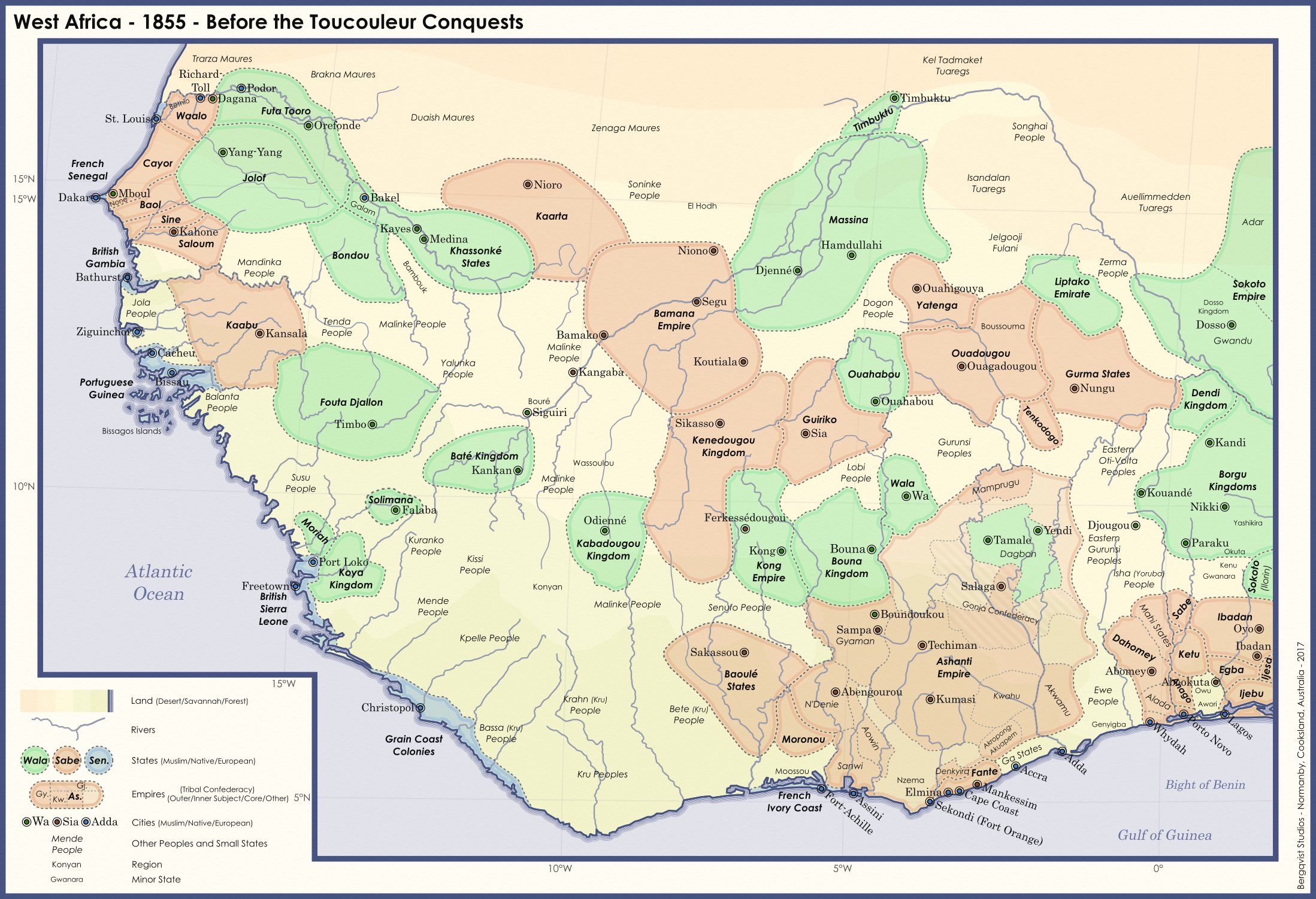
The finished product of a WIP posted months ago!
My original intention was to make a map showing the expansion of the ATL state that rises after the collapse of the Toucouleurs - however, the entire thing got out of hand, and the project evolved into a series of maps showing West Africa changing through the 19th-20th centuries. This is the first map - though given how long I tinkered with and stressed over this map, I'm not sure what form the next maps will take. (Hopefully I'll finish the follow-up quicker than I finished this...)
Full disclosure: this map is mostly OTL (as the butterflies from my 1796 PoD haven't significantly affected uncolonised Africa) - so I apologise to anyone who knows more about the region than I do. It's near impossible to find good sources or maps for many of these lost states - I've taken artistic liberties when it comes to the exact borders of states (Kenedugu is practically complete guesswork), which states are 'Muslim' and which are 'Native' (most places aren't uniformly either), and which entities to include on the map.
The significant changes from OTL are basically Liberia ('sold' to Britain), the lack of a French presence at Medina, and the slightly later beginning of alt-Umar Tall's Toucouleur conquests.
I had to downsize the map for the forum, so here's the link to the full sized version on deviantart (though it's not that much bigger tbh)
Last edited: