Hey i know its been a while, but is there any more progress with this?View attachment 724024
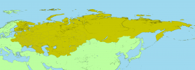
Russian Empire guberniyas and uyzeds so far
You are using an out of date browser. It may not display this or other websites correctly.
You should upgrade or use an alternative browser.
You should upgrade or use an alternative browser.
The XK-BAM map series
- Thread starter Klime
- Start date
View attachment 890034
Quebec, Ontario and Newfoundland and Labrador in 1000 AD
Same map with labels.
Was there actually any norse settlement of anykind? I thought that they only raided the area on occasion.View attachment 890035
Same map with labels.
Final_RSL.csv
 drive.google.com
Etopo_Monde_uplift.tif
drive.google.com
In Raster Calculator (GIS): rasterElevation - (rasterIsostatic/1000 * [numbers of years from now]) - sea level[date]
This is the approximation of sea level in the world to 25Ka to 0ka. The accurate sea level is not possible due to 25 thousand years of sedimentation.
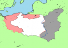
Does anyone has Bakker-Schut (plan C), Curzon Line (B), Northern Epirus, Serbo-hungarian republic of Baranja-Baya and Srpska Krajina correct borders?
Just made one of the Curzon line a bit ago, so i threw this together in the style of an image I found onlineDoes anyone has Bakker-Schut (plan C), Curzon Line (B), Northern Epirus, Serbo-hungarian republic of Baranja-Baya and Srpska Krajina correct borders?
Attachments
I had one of Bakker-Schut plan A, but I dont know what I did with it. you can make something close with modern subdivisions as they havent changed that much
Reworked Republican China. Updated and improved the border in Mongolia with better reference material. Red and green lines show differences between Chinese (green) and Japanese (red) land surveys of the area.
AddendumView attachment 891458
Reworked Republican China. Updated and improved the border in Mongolia with better reference material. Red and green lines show differences between Chinese (green) and Japanese (red) land surveys of the area.
Mongolia border shown in Japanese maps from the 1930s-40s
Mongolia border shown in contemporary Nationalist Chinese maps from the 1940s, and succeeding publications in Taiwan since then.
Last edited:
Manchukuo and Mengjiang rework, using contemporary Japanese maps
Last edited:
Wow, I didn't know it was that different even 1000 years ago. Well maybe not significantly different but it's notable. I'm curious, are there any models predicting what Canada or the Baltic could look like in the future, say 1000 or 2000 years from now?View attachment 888945
The differences between Contemporary Canada (2024 AD) to 1000 AD Canada
WIP map of the ROC's administrative superintendent districts (行政督察區) in 1948
Finally completed the 行政督察區 (blue lines). Started doing some of the counties (縣)
Blank 8K-BAM map in the year 1000 AD (1Ka before 2000 AD)
Edit: corrected minor errors.
Last edited:
Hi! Good work but, (as advice) please don't use my sea ice (all oceanic ice except the lightest one) patches. They are simply inaccurate and underdetailed for the scope of 8K-BAM.Blank 8K-BAM map in the year 1000 AD (1Ka before 2000 AD)
Evolution of Hudson Bay and Europe in the last 4000 years (2000 BC to 1950 AD)
Is there an 8K-BAM map with territorial water boundaries of countries?
It would be nice if someone could share it
It would be nice if someone could share it
I have been working on a 2K-BAM version of this, but it is still extremely WIP, and very likely outdated.Is there an 8K-BAM map with territorial water boundaries of countries?
It would be nice if someone could share it
Share: