People do talk of Restless spirits...Right, the poor Restless. Will the spirit of the Restless be haunting that stretch of water?
You are using an out of date browser. It may not display this or other websites correctly.
You should upgrade or use an alternative browser.
You should upgrade or use an alternative browser.
The Rainbow. A World War One on Canada's West Coast Timeline
- Thread starter YYJ
- Start date
Threadmarks
View all 257 threadmarks
Reader mode
Reader mode
Recent threadmarks
Appendix 5: Diving the Wrecks of Barclay Sound Appendix 6: Introduction Appendix 6 Part 1: The Warships Appendix 6 part 2: The Liners Appendix 6 Part 3: The freighters Appendix 6 part 5: Conclusions Appendix 7: CBC Radio Program Morningside Interview Book Club Questions.Driftless
Donor
Right, the poor Restless. Will the spirit of the Restless be haunting that stretch of water?
Local legend will have it that way to be sure.
Driftless
Donor
One thought leading to another.... Retelling some of the rustic quirks of this tale might have been right up Robert Service's alley, but he would have been living in Paris by this point.
"The Tale of the Restless", "The Ballad of the Brave Boys" or "The Bamfield Station" come to mind for subject matter
Borrowing a bit from "The Shooting of Dan McGrew"
"The Tale of the Restless", "The Ballad of the Brave Boys" or "The Bamfield Station" come to mind for subject matter
Borrowing a bit from "The Shooting of Dan McGrew"
Were you ever out in the Great Alone, when the moon was awful clear,
And the icy mountains hemmed you in with a silence you most could hear;
With only the howl of a timber wolf, and you camped there in the cold,
A half-dead thing in a stark, dead world, clean mad for the muck called gold;
While high overhead, green, yellow and red, the North Lights swept in bars?—
..........
I have a question for you naval construction experts. Much of this TL has dealt with captured vessels and then arming those captured ships with guns. Can you just bolt a 75mm or 90mm gun to a deck and shoot it? I would think warships would be designed with reinforced bracing that accounts for the recoil shock of the guns designed for that particular ship. Wouldn't bolting a gun on a ship not designed for it cause structural damage? (Particularly if it was a civilian designed ship) This just occurred to me and I wondered how you would know where and how to mount a gun so it doesn't wreck the ship it's attached too. I mean even a 50 caliber machine gun would create stress on the frame it's mounted on.
I have a question for you naval construction experts. Much of this TL has dealt with captured vessels and then arming those captured ships with guns. Can you just bolt a 75mm or 90mm gun to a deck and shoot it? I would think warships would be designed with reinforced bracing that accounts for the recoil shock of the guns designed for that particular ship. Wouldn't bolting a gun on a ship not designed for it cause structural damage? (Particularly if it was a civilian designed ship) This just occurred to me and I wondered how you would know where and how to mount a gun so it doesn't wreck the ship it's attached too. I mean even a 50 caliber machine gun would create stress on the frame it's mounted on.
It depends completely on the ship and gun itself. A lot of large liners were built specifically with hardened points for weapon mountings for use as armed merchant cruisers, so obviously those are perfectly fine. The Canadian Fisheries Vessels like Galiano, Malaspina, etc were all also built with reinforced sections to take on small guns for constabulary duties, although these weapons are 37mm or 57mm at most. For the most part, I believe the cutoff for guns becoming too much with improvised mountings is around the 76mm mark. At and around that, you are going to be putting a lot of weight and stress on the decking and hull of the ship in question. I believe the author has done a fairly good job so far given how from memory, only 3.7cm Pom Poms and 5.2cm anti-torpedo boat guns have been mounted to captured enemy ships, which are generally fine.
Notice how previously when speaking about the 4”/40 guns the Canadians mounted ashore, they bolted them down with metal plates and they were still blown clear by enemy fires.
Not a naval construction expert myself. In this timeline so far the armed civilian vessel have been,I have a question for you naval construction experts. Much of this TL has dealt with captured vessels and then arming those captured ships with guns. Can you just bolt a 75mm or 90mm gun to a deck and shoot it? I would think warships would be designed with reinforced bracing that accounts for the recoil shock of the guns designed for that particular ship. Wouldn't bolting a gun on a ship not designed for it cause structural damage? (Particularly if it was a civilian designed ship) This just occurred to me and I wondered how you would know where and how to mount a gun so it doesn't wreck the ship it's attached too. I mean even a 50 caliber machine gun would create stress on the frame it's mounted on.
On the German side:
SMS Price Rupert, with 2 x 5.2 cm naval guns, 2 x 3.7 m pom-poms, and several Spandau (Maxim) guns.
SMS Princess Charlotte, with 3 x 5.2 cm naval guns, 2 x 3.7 m pom-poms, and several Spandau (Maxim) guns.
SMS Princess Sophia, with a Spandau gun. (2 x 4 inch guns on her foredeck are strapped down as cargo and not operational).
SMS Galiano was designed to carry a 6 pounder (57mm) naval gun.
On the Canadian side:
CGS Estevan, a 1161 ton lighthouse tender, 1 x 6 pounder (57mm) naval gun
CGS Restless, a 76 ton tug, 1x 6 pounder (57mm) naval gun
CGS Newington, a 193 ton trawler, 1 x 3 pounder (47mm) naval gun
CGS Alcedo, a steam tug of unknown tonnage, 1 x 3 pounder (47mm) naval gun
CGS Malaspina was designed to carry a 6 pounder (57mm) naval gun.
Nav Weapons lists the weight of the Hotchkiss 3 pounder on its mount at 0.7 tons (0.8 mt), although it does not specify the high angle or low angle mount
Nav Weapons lists the weight of the Hotchkiss 6 pounder as 849 pounds and the mount weight as 896 pounds, if I read correctly that gives an overall weight of 1745 pounds, or 0.78 long tons. Again, there were various mounts through the ages.
Nav Weapons lists the weight of the 5.2 cm naval gun as 3.86 tons (3.9 mt) including BM, whatever BM is. That is much heavier than the British guns, so I wonder if that weight includes a gun shield. However, picture and blueprints of german cruisers from the era show the 5.2 cm secondary guns as having no gun shield.
These weights by themselves do not seem like they would stress the decks of a ship . The upper decks of the CP and GTP steamers carried the weight of lifeboats, and it was common to lash deck cargo wherever it would fit.
I would think recoil would be a worse stressor than the dead weight of the guns and mounts. The blueprints of the German cruisers and Galiano class patrol ships show the mount base continuing through the deck where the gun is mounted and connecting to the deck below.
The 3.7cm pom-pom is really a big maxim gun. I would think it could just be through bolted to a deck plate and be fine.
Nav Weapons shows the 3 pounder gun mounted in the back of a truck. The truck suspension would absorb some of the recoil, but that tells me the overall recoil was not so much. The 3 pounder was also sometimes historically dismounted and fired from a ships boat.
The Hotchkiss 6 pounder and German 5.2 cm guns look to be similar to each other in having no hydraulic recoil mechanisms. They just use the mass of the mount to absorb the recoil. I would think these guns would need the deck to be reinforced somewhat to stop the deck plates from deforming over time, even though these are still light guns. I have read, and cannot produce a source at the moment, that timbers run on the underside of the deck and braced vertically to the deck below were the most common expedient method to reinforce a merchant ship's deck to accommodate a naval gun. Timbers were commonly carried aboard ships to shore up bulkheads in the event of storm damage or grounding.
I have also read, and again I can't find the source, that when up-gunning some US Coast Guard cutters to patrol ships in the wars, that guns could be mounted near the edges of the deck, but not on center line, presumably because the sides of the hull provided rigidity to the deck, but the center of the deck on these ships was weaker, and they could only take larger guns on center line after more reinforcement work had been done.
Germany 5.2 cm/55 (2.05") SK L/55 - NavWeaps
Britain 1-pdr (0.45 kg) [1.46" (37 mm)] Mark 1 - NavWeaps
Thank you, both RelativeGalaxy7 and YYJ. Your posts were very informative and I really appreciate what you laid out as it made perfect sense in my logical mind.
YYJ, again I really am enjoying this TL as well as learning quite a lot about a great many subjects connected with your story. That fact I am learning while enjoying is a mark of a great writer/teacher.
YYJ, again I really am enjoying this TL as well as learning quite a lot about a great many subjects connected with your story. That fact I am learning while enjoying is a mark of a great writer/teacher.
marathag
Banned
You can look and find the muzzle energy of most cannons. That gives a good idea of recoil, following Newton. What recoil systems do is spread the energy over time, as well as the added weight is a bonus for reducing momentum.Can you just bolt a 75mm or 90mm gun to a deck and shoot it? I
Note the famous example of PT-109, a plywood deck, with a 37mm AT gun strapped to it with timber and rope
Isn't there also an element of "don't give a damn" about how the structure is impacted - long term - when the need is temporary? As long as the gun doesn't fly over the rail upon firing, it's all good?
Bear in mind though that firing the gun might work seams open (Deck and hull) if the deck isn't built for it, depending on caliber, leading to unplanned baths for the engine crews. This annoys them.
This was what I was thinking when I asked my original question. It wasn't the fact that the deck couldn't support the weight of the gun as much as what repeated firing vibrations/shock did to the ship as a whole.Bear in mind though that firing the gun might work seams open (Deck and hull) if the deck isn't built for it, depending on caliber, leading to unplanned baths for the engine crews. This annoys them.
Based on replies I think that many ships were over engineered with arming being a consideration when designed. Don't think that would be the case with a ship built today!
I am not sure this was the case Pre-WW1 but I do know that ships during the inter-war years were designed and built to be easily convert into armed merchant ships. Especially, is the government was involved in anyway with their construction.
It seems that in British parlance, a liner “built to Admiralty Specifications” means that it was built with hard points to receive guns. Perhaps even with the deck ready to bolt the mountings down. There are other features on this list, like good compartmentalization. So ships built to Admiralty spec were considered safer. I have yet to find the list of what the specs were, but you sometimes see this term in the description of a ship’s construction. Other countries would have had a similar arrangement.I am not sure this was the case Pre-WW1 but I do know that ships during the inter-war years were designed and built to be easily convert into armed merchant ships. Especially, is the government was involved in anyway with their construction.
Based on replies I think that many ships were over engineered with arming being a consideration when designed. Don't think that would be the case with a ship built today!
It seems that in British parlance, a liner “built to Admiralty Specifications” means that it was built with hard points to receive guns. Perhaps even with the deck ready to bolt the mountings down. There are other features on this list, like good compartmentalization. So ships built to Admiralty spec were considered safer. I have yet to find the list of what the specs were, but you sometimes see this term in the description of a ship’s construction. Other countries would have had a similar arrangement.
This is correct. What would happen is that the RN would partially finance a ship in exchange for it being built to certain specifications, which included hardpoints for weapon emplacements. There would also be the understanding that in time of war, the ship could be called up to serve as an auxiliary. There was usually a required minimum speed, reinforced areas for weapon emplacements, certain compartmentalization and other features dependent on period. It was the next best thing to the Age of Sail where you could buy a fast ship, slap some cannons on it and call it a sloop of war.
This was what I was thinking when I asked my original question. It wasn't the fact that the deck couldn't support the weight of the gun as much as what repeated firing vibrations/shock did to the ship as a whole.
Right, if you don't have the weapon properly bolted down, it can tear out of it's mounting when fired. If it is properly mounted down, and the ship wasn't built to take it, then it can work open seams. Ships that were build to take it had reinforced area specially built with weapons in mind. They had a maximum safe caliber that they could take.
Driftless
Donor
Right, if you don't have the weapon properly bolted down, it can tear out of it's mounting when fired. If it is properly mounted down, and the ship wasn't built to take it, then it can work open seams. Ships that were build to take it had reinforced area specially built with weapons in mind. They had a maximum safe caliber that they could take.
In this situation, I'd guess the Germans aren't very concerned with damaging the structure of a prize ship(so long as the gun doesn't completely fly off the deck when fired). The prize ship is even more of a disposable asset than a light cruiser half the world away from home. If they can use a coastal steamer long enough to have a gun shoot off 20-40 rounds, it's all good. The Kaiser is only out the cost of the ammo, the gun, and of course the fate of the gun crews (the only non-disposable asset in the calculation).
Last edited:
In this situation, I'd guess the Germans aren't very concerned with damaging the structure of a prize ship(so long as the gun doesn't completely fly off the deck when fired). The prize ship is even more of a disposable asset than a light cruiser half the world away from home. If they can use a coastal steamer long enough to have a gun shoot off 20-40 rounds, it's all good. The Kaiser is only out the cost of the ammo, the gun, and of course the fate of the gun crews (the only non-disposable asset in the calculation).
Exactly so. Chances are, that if they manage to escape after all this, they'd strip the ship of anything useful, and scuttle it somewhere. These coastal steamers don't have the range to be useful.
Exactly so. Chances are, that if they manage to escape after all this, they'd strip the ship of anything useful, and scuttle it somewhere. These coastal steamers don't have the range to be useful.
In this ATL, the book and movie title "They Were Expendable" may apply to a popular history of this naval campaign.
What are good names for this naval campaign?
Almost as famous
Aug 21, 1000 hours, SMS Leipzig, Strait of Georgia.
Leipzig had been chasing the CPR steamer Princess Patricia northward for almost an hour, without gaining, as the sun rose higher over the Georgia Strait. To the east was the green mass of Lasqueti Island, and behind it, larger Texada Island. Trade Commissioner Meyer had reported how rich Texada Island was with minerals. Huan could see through his binoculars, several iron mines on the west coast of the island, and the equipment of a limestone quarry, but he was more interested in the rich gold and copper mine on the east shore at Van Anda. For now, that would have to wait for its turn.
At 0850 the Canadian excursion liner had turned several points to the east, steering to pass on the Strait of Georgia side of Hornby Island. Haun kept Leipzig to her course, which would take the cruiser to the west through the one kilometer wide Baynes Sound between Denman Island and the main body of Vancouver Island. Leipzig passed a lighthouse on Yellow Rock, just off the south tip of Denman Island. The lighthouse keeper looked back at Haun through his own binoculars. Haun had no doubt that his position was being constantly reported.
Leipzig entered Baynes Sound, and rounded the spit protecting the small fishing port of Deep Bay. The masts of fishing boats jutted up above the sand bar. As soon as Haun adjusted Leipzig’s course north west to run down the center of the Sound, the coal loading pier at Union Bay became visible, 7 nautical miles distant. It would take 20 minutes to cover that distance at 21 knots. To the east the farms of Denman Island rolled by. Haun noticed a jetty of bright white on the shore to the west.
“What is that?” he asked the younger Mueller, pointing.
“Oyster shells,” replied the pilot. “Great mounds of oyster shells. They serve them on the CP transpacific liners and hotels, among other places. Fanny Bay oysters are almost as famous as the ones from Japan.”
Haun could see groups of people lining the shore, watching Leipzig race past. Directly ahead, the details of the Union Bay coal loading facility were becoming more clear as the distance closed. The timber wharf must have been half a kilometer long, extending out into the deep water where a freight liner, easily 6000 tons, was moored on the outboard side. Haun read Kumeric – Glasgow on the liner’s stern. The now familiar shapes of a pair of former sailing ships cut down to coal scows were moored on the inboard side of the wharf. A row of coal rail cars sat atop. Just inland, smoke poured from a line of coke ovens. Industrial buildings, smokestacks, and waste piles of coal slack were scattered about the landscape.
As he watched, events rolled out much the same as they had in Departure Bay in Nanaimo, two hours before. Men in militia uniforms were busying themselves denying the coal to the marauding Germans. The scows alongside the dock began to settle as the militia and dock workers scuttled them. A steam tug shunted the Kumeric out into Baynes Sound, with the first hints of the liner’s attempt to get steam up issuing from her funnel. Soldiers on top of the massive timber structure began lighting fires. Leipzig was still tree miles away. Smoke rising from the burning wharf bended with the smoke from the usual industrial activities. Haun could see train crews who seemed to be arguing with the soldiers on the wharf. Whatever the outcome of the argument, a locomotive and tender remained on top of the wharf as the fires took hold and by the time Liepzig drew parallel with the burning structure, the weakened roadbed was sagging under the weight of the big locomotive.
Black smoke obscured Haun’s sightline to the Kumeric, until Liepzig passed by the blazing wharf at 0935 hours. The bridge crew could feel the heat from the fires on their faces 100 meters away.
ABANDON SHIP YOU WILL BE SUNK BY GUNFIRE, signaled Leipzig.
Kumeric was slow to respond, and Leipzig turned a full circle in the channel waiting for her boats to be launched. By 0950 hours, the boats were safely away, and Liepzig fired a broadside at Kumeric’s waterline from 200 meters away. The drifting freight liner received 3 more broadsides in quick succession, until it was clearly sinking.
“Helm, take us east,” ordered Haun. The northern end of Denman Island trailed off into a series of spits and sand bars.
“We have to keep heading north for a ways,” instructed Mueller, “to keep out of the shallows. As it is, we are lucky to be here at high tide, otherwise we draw too much water to pass around the north end of the island.”
The helmsman kept to a northward course, following Mueller’s expert instruction. To stern, the listing Kumeric drifted up against the burning wharf at Union Bay before partially capsizing. Ahead, another great timber wharf dominated the entrance to Comox harbour.
Mueller pointed. “That is the log sorting and loading wharf at Royston,” he said. “It was originally going to be used as the coal loading port for the mines at Cumberland, but the bay is too shallow for ocean going ships.” Several acres of logs were bobbing off the end of the wharf. A line of train cars atop the wharf was loaded with cut trees, their trunks of unbelievable diameter. Two small steam tugs were being tied up and their crews were scampering ashore, mindful of the approaching German cruiser.
“We will not be expending ammunition on a floating logs this day,” pronounced Haun.
“Helm, take us east,” instructed Mueller. “Line up on that marker. The clear channel is quite narrow.”
“Hmm,” mused Haun. “The Canadians could have made some fine mischief for us, if they had thought to move channel markers.”
“I would have noticed,” replied Mueller. “Especially on such a fine day as this.”
“Sir!” called a runner from the wireless cabin. “We are receiving very strong wireless signals, in clear. To all stations. Warning of our presence.”
“That would be the Cape Lazo Dominion Wireless Station,” said Mueller. “You will be able to see the masts in a few minutes.”
Sure enough, Liepzig’s north east heading took her past the Comox Peninsula, and soon a pair of wooden masts could be seen over the scrub trees on the east side of sandy Cape Lazo.
“Range, 2000 meters,” said the gunnery officer.
“Fire a ranging shot,” ordered Haun. “Then give them five minutes to run.”
The number one gun on the foredeck fired a round, and a dust cloud rose on the point.
“Wireless station reports they are under fire,” reported the wireless runner. “Continuing to announce our presence.” Five minutes passed.
“Fire another ranging shot,” ordered Haun.
The sightline to the wireless station was improving as Leipzig moved to the east. Another dust cloud rose, near the base of one of the wireless masts.
“That blast knocked the operators finger off the key,” said the wireless runner, “But he continues to transmit.”
“Wireless,” ordered Huan. “Transmit that we are commencing bombardment of wireless station. In clear.”
Haun focused his binoculars on the wireless station operations building, a small, peaked roof house. The door flew open and a man ran down the steps and away, inland. Haun waited two minutes, then said, “Fire.”
Leipzig fired four broadsides. On the second, the operations building was smashed into kindling. On the fourth, the northern mast fell over.
“Cease fire,” ordered Haun.
“That wireless is now silent,” reported the wireless cabin.
Cape Lazo drew astern, Huan could see, now 20,000 meters to the north west, the smoke and silhouette of the Princess Patricia disappearing at full speed. To the north east he could now see smoke from a different source, the pulp mill at Powell River. Leipzig crossed the Georgia Strait at 22 knots, her bow pointed directly at the smoke pall of the mill.
 search-bcarchives.royalbcmuseum.bc.ca

 www.google.com
Leipzig had been chasing the CPR steamer Princess Patricia northward for almost an hour, without gaining, as the sun rose higher over the Georgia Strait. To the east was the green mass of Lasqueti Island, and behind it, larger Texada Island. Trade Commissioner Meyer had reported how rich Texada Island was with minerals. Huan could see through his binoculars, several iron mines on the west coast of the island, and the equipment of a limestone quarry, but he was more interested in the rich gold and copper mine on the east shore at Van Anda. For now, that would have to wait for its turn.
At 0850 the Canadian excursion liner had turned several points to the east, steering to pass on the Strait of Georgia side of Hornby Island. Haun kept Leipzig to her course, which would take the cruiser to the west through the one kilometer wide Baynes Sound between Denman Island and the main body of Vancouver Island. Leipzig passed a lighthouse on Yellow Rock, just off the south tip of Denman Island. The lighthouse keeper looked back at Haun through his own binoculars. Haun had no doubt that his position was being constantly reported.
Leipzig entered Baynes Sound, and rounded the spit protecting the small fishing port of Deep Bay. The masts of fishing boats jutted up above the sand bar. As soon as Haun adjusted Leipzig’s course north west to run down the center of the Sound, the coal loading pier at Union Bay became visible, 7 nautical miles distant. It would take 20 minutes to cover that distance at 21 knots. To the east the farms of Denman Island rolled by. Haun noticed a jetty of bright white on the shore to the west.
“What is that?” he asked the younger Mueller, pointing.
“Oyster shells,” replied the pilot. “Great mounds of oyster shells. They serve them on the CP transpacific liners and hotels, among other places. Fanny Bay oysters are almost as famous as the ones from Japan.”
Haun could see groups of people lining the shore, watching Leipzig race past. Directly ahead, the details of the Union Bay coal loading facility were becoming more clear as the distance closed. The timber wharf must have been half a kilometer long, extending out into the deep water where a freight liner, easily 6000 tons, was moored on the outboard side. Haun read Kumeric – Glasgow on the liner’s stern. The now familiar shapes of a pair of former sailing ships cut down to coal scows were moored on the inboard side of the wharf. A row of coal rail cars sat atop. Just inland, smoke poured from a line of coke ovens. Industrial buildings, smokestacks, and waste piles of coal slack were scattered about the landscape.
As he watched, events rolled out much the same as they had in Departure Bay in Nanaimo, two hours before. Men in militia uniforms were busying themselves denying the coal to the marauding Germans. The scows alongside the dock began to settle as the militia and dock workers scuttled them. A steam tug shunted the Kumeric out into Baynes Sound, with the first hints of the liner’s attempt to get steam up issuing from her funnel. Soldiers on top of the massive timber structure began lighting fires. Leipzig was still tree miles away. Smoke rising from the burning wharf bended with the smoke from the usual industrial activities. Haun could see train crews who seemed to be arguing with the soldiers on the wharf. Whatever the outcome of the argument, a locomotive and tender remained on top of the wharf as the fires took hold and by the time Liepzig drew parallel with the burning structure, the weakened roadbed was sagging under the weight of the big locomotive.
Black smoke obscured Haun’s sightline to the Kumeric, until Liepzig passed by the blazing wharf at 0935 hours. The bridge crew could feel the heat from the fires on their faces 100 meters away.
ABANDON SHIP YOU WILL BE SUNK BY GUNFIRE, signaled Leipzig.
Kumeric was slow to respond, and Leipzig turned a full circle in the channel waiting for her boats to be launched. By 0950 hours, the boats were safely away, and Liepzig fired a broadside at Kumeric’s waterline from 200 meters away. The drifting freight liner received 3 more broadsides in quick succession, until it was clearly sinking.
“Helm, take us east,” ordered Haun. The northern end of Denman Island trailed off into a series of spits and sand bars.
“We have to keep heading north for a ways,” instructed Mueller, “to keep out of the shallows. As it is, we are lucky to be here at high tide, otherwise we draw too much water to pass around the north end of the island.”
The helmsman kept to a northward course, following Mueller’s expert instruction. To stern, the listing Kumeric drifted up against the burning wharf at Union Bay before partially capsizing. Ahead, another great timber wharf dominated the entrance to Comox harbour.
Mueller pointed. “That is the log sorting and loading wharf at Royston,” he said. “It was originally going to be used as the coal loading port for the mines at Cumberland, but the bay is too shallow for ocean going ships.” Several acres of logs were bobbing off the end of the wharf. A line of train cars atop the wharf was loaded with cut trees, their trunks of unbelievable diameter. Two small steam tugs were being tied up and their crews were scampering ashore, mindful of the approaching German cruiser.
“We will not be expending ammunition on a floating logs this day,” pronounced Haun.
“Helm, take us east,” instructed Mueller. “Line up on that marker. The clear channel is quite narrow.”
“Hmm,” mused Haun. “The Canadians could have made some fine mischief for us, if they had thought to move channel markers.”
“I would have noticed,” replied Mueller. “Especially on such a fine day as this.”
“Sir!” called a runner from the wireless cabin. “We are receiving very strong wireless signals, in clear. To all stations. Warning of our presence.”
“That would be the Cape Lazo Dominion Wireless Station,” said Mueller. “You will be able to see the masts in a few minutes.”
Sure enough, Liepzig’s north east heading took her past the Comox Peninsula, and soon a pair of wooden masts could be seen over the scrub trees on the east side of sandy Cape Lazo.
“Range, 2000 meters,” said the gunnery officer.
“Fire a ranging shot,” ordered Haun. “Then give them five minutes to run.”
The number one gun on the foredeck fired a round, and a dust cloud rose on the point.
“Wireless station reports they are under fire,” reported the wireless runner. “Continuing to announce our presence.” Five minutes passed.
“Fire another ranging shot,” ordered Haun.
The sightline to the wireless station was improving as Leipzig moved to the east. Another dust cloud rose, near the base of one of the wireless masts.
“That blast knocked the operators finger off the key,” said the wireless runner, “But he continues to transmit.”
“Wireless,” ordered Huan. “Transmit that we are commencing bombardment of wireless station. In clear.”
Haun focused his binoculars on the wireless station operations building, a small, peaked roof house. The door flew open and a man ran down the steps and away, inland. Haun waited two minutes, then said, “Fire.”
Leipzig fired four broadsides. On the second, the operations building was smashed into kindling. On the fourth, the northern mast fell over.
“Cease fire,” ordered Haun.
“That wireless is now silent,” reported the wireless cabin.
Cape Lazo drew astern, Huan could see, now 20,000 meters to the north west, the smoke and silhouette of the Princess Patricia disappearing at full speed. To the north east he could now see smoke from a different source, the pulp mill at Powell River. Leipzig crossed the Georgia Strait at 22 knots, her bow pointed directly at the smoke pall of the mill.
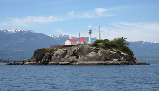
Chrome Island Lighthouse
Photographs, history, travel instructions, and GPS coordinates for Chrome Island Lighthouse.
www.lighthousefriends.com
Screw Steamer KUMERIC built by Russell & Co in 1906 for The Bank Line Ltd - mng A Weir & Co, Glasgow, Cargo
Screw Steamer KUMERIC built by Russell & Co in 1906 for The Bank Line Ltd - mng A Weir & Co, Glasgow, Cargo Q1/1932 broken up in Italy.
www.clydeships.co.uk
Coal docks at Union Bay - RBCM Archives
Sailing ships in bay; coal cars on rails.
Google Maps
Find local businesses, view maps and get driving directions in Google Maps.
www.google.com
Last edited:
Threadmarks
View all 257 threadmarks
Reader mode
Reader mode
Recent threadmarks
Appendix 5: Diving the Wrecks of Barclay Sound Appendix 6: Introduction Appendix 6 Part 1: The Warships Appendix 6 part 2: The Liners Appendix 6 Part 3: The freighters Appendix 6 part 5: Conclusions Appendix 7: CBC Radio Program Morningside Interview Book Club Questions.
Share: