I've been looking more into it,
the official comission (led by Jēkabs Peterss) that was supposed to review the Tajik claims (separately, Bukhara, Samarkhand and Surxondaryo) gave negative suggesition for the first two (mainly on economic basis, but also because it would meet to much opposition from the Uzbeks), but actually supported the Tajik ckaim for the latter
However it was refused, that same book suggests a few reasons why
1) It would prevent Uzbekistan from having a foreign border, becoming the only SSR to be landlocked within the USSR
2) It didn't have a clear majority between tajiks and uzbeks, no matter which census they used (the uzbek favouring 1926 ones, the 1917 preliminary ones or the russian imperial ones), or which study they used, chagatai people (about 20% of the region) also didn't fit into either group
3) The collectivisation in the Khujand region, which was recently removed from Uzbek ssr to Tajik SSR, was... not going well, and they didn't want to put more burden on it at the time
Worth noting this region had a large "Chagatai" (Turkified rural Tajiks) population, one of the many groups that didn't make the cut in Soviet Ethnography
----
About the aforementioned region (Khojant/Sughd) at the heart of the current Kyrgyz-Tajik conflict some notes I found on a book about why the soviets put it with tajikistan "But there is strong evidence that economic considera- tions were the main factor behind the reconsideration of the borders; it was right around this time that state planners from the reorganized Goskolonit proposed turning Khojent—a part of the Uzbek SSR with a large Tajik- identified population—into a model cotton-production region. The planners suggested that the regime resettle Tajiks from the mountainous regions of the Tajik ASSR onto new cotton-oriented collective farms in this region. The expansion of the Tajik ASSR to include Khojent provided a national-political rationale (Tajik nation-building) for this resettlement operation.121"
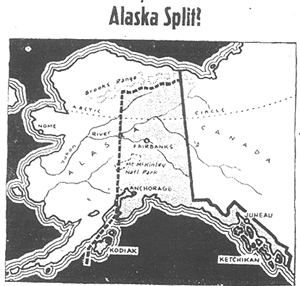
View attachment 775496
Also interesting fact, Tajikistan was supposed to be merely an Autonomous Oblast until the last minute of its creation where it was elevated to ASSR, had it been it may have somewhat delayed its accession into the USSR, enough maybe to make border changes more conservative.
Other points
Osh and Jalalabat were claimed by Uzbekistan and original given to them, but quickly transfered to Kyrgyzstan despite their Uzbek majority, on the basis that the Kyrgyz regions of the Fergana valley lacked a urban center, saying that "Cities' fate was to be "nationalized" by the surrounding countryside", through rural exodus and forced sedentarisation... These regions of Kyrgyzstan have had regular ethnic violence since independence...
Similarly, during the division of Khorezm, Dasoguz was initially supposed to go to Uzbekistan but then given to Turkmenistan
Finally, the The Kazakh Autorities in the RSFSR, during the division of the Turkestan SSR, wanted the Entirety of the Semirechie and Syr Darya oblasts, this was a point of contention with the Uzbek since the later had Tashkent, the largest and most modern russian city in Central asia. Eventually all of the former and most of the later was given to the Kazakh/Kirgiz ASSR, but Tashkent stayed Uzbek
View attachment 775519
Here's a rough representation of what the borders would look like today if Kazakhstan was awarded all of the Syr Darya oblasts
We can also imagine what a "minimal Uzbek SSR" would look like given all the above:
View attachment 775521
This smaller Uzbek SSR would still have 16-19 millions inhabitants, depending on how much of the steppes area are later integrated to it, Tajikistan, Kazazkhstan and Uzbekistan would have roughly similar populations
Also about that particular Tajik claim, Francine Hirsch in "Empire of Nations" has a different interpretation of it
A contiguous bridge to Bukhara, but less of the rural and desert regions, it makes sense to me, although worth reminding that Farsi was spoken quite a bit in the rural areas around Samarkhand, not just in the city itself
Interestingly the division of Surkhan-Dar'ia depends on source, some talk about it going to the Tajik SSR entirely, other talk about a east-west compromise (like above) or a north-south compromise.
Also interesting note in Adeeb Khalid, Central Asia, A new history (2021)
"There is some irony in the case of Kazakh- stan, because Khrushchev had wanted to move the capital of the [Kazakh] republic to the same city (As Astana/Aqmola)—then called Tselinograd (Virgin Land Town)—but Kazakh elites had dragged their feet and defeated the proposal. Aqmola, as the town was renamed upon independence, was a small provincial town (its population was 281,252 at the time of the 1989 census) with an extreme continental climate: its temperatures range from -35°C to 35°C over the seasons, and it experiences savage winds from the steppe
funny, since nowadays many Russian Kazakhs consider the capital change as Internal Ethnic Kazakh colonialism
Beside Dasoguz (btw reading about it, it seems Khorezm revolutionaries were against handing it to Turkmen ssr, while Bukharan and Tashkent one didn’t care)
Farap and its district was also contested between Uzbek and Turkmen SSR
"Concerning Farab, there was no proposition that the inclusion of the village was necessary for the administrative, political or economic future of the respective republics. It was simply a question of the nationality of the population in the disputed area. Both subcommittees argued that their group represented the majority in the Farab district."
eventually the decision was put to a vote between deciding based on a 1923 survey (which had a Turkmen majority ) or waiting for additional data, the former won and the city was given to the Turkmen, considering the active uzbekisation efforts at the time, a delay may have changed the outcome
continuing in the Fergana valley, the book lists the contested cities (again under the same principle of a city to "fixate" a rural population) "
All the appeals regarded the urban areas of Osh, Margilan, Andijan and Jalal-Abad." the author says that Andijan was the principal point of contention, and that the Kyrgyz were insistant in claiming it, much more so than Osh or Jalal-Abad, which did end up inside Kyrgyzstan.
Going toward Tashkent (96,000 Uzbek for 174 Kazakh in 1923):
-Shymkent was also a Uzbek majority city, but was not claimed by the Uzbeks since they agreed on the Kazakh need for a city, this agreement stood only as long as they kept Tashkent of course
-Around Tashkent proper the Uezd of Tashkent and Mirzachul were hotly contested. The Establishment of National Republics in Soviet Central Asia by Arne Haugen describes it in depth from page 201
-The résolution favoured Uzbek
- This région had a large Kurama population (another group not formalised by the Soviets, considered at the the time as settled Kazakhs), both Uzbek and Kazakh claimed them as their brethrens and then got assimilated as Uzbek.
EDIT: I've been trying to find detailled late tsarist maps of the *Volost* of
Syr-Darya Oblast, where the border disputes happened, to no avail,
I found those of the neighbouring Semirechensk oblast!... good luck if you try to follow the various claims that are listed in Arne Haugen's book, it's not made any easier by multiple cities name change (tsarist->leninist->stalinist->post-stalinist->independent) and various reforms of the Russian, Uzbek and Kazakh language! Honestly, I can't even find Mirzachul Uezd, I only find some vague reference to it on russian wikipedia... Current Mirzachul is shown in red below
Nevertheless here's a rough comparison of the extent of the Tashkent Uezd with modern borders (using
this dataset)
Perhaps the one interesting bit is that Moscow overrode some of the Territorial comittee, notably
1) the comittee decided to give Irjar (a location where a battle happened, just east of the red dot on the map above) to Kazakhstan along with four Volost, while Moscow decided to give the four volost in Uzbekistan (Dzhizaksii had 20 volost, so I guess around 20-30% of the area), this little panhandle south of the Shardara reservoir may have been quite larger had they not done it. As it is, the current border within Mirzachul is the maximum extent claimed by the Uzbeks, as they did not lay claim to irjar
2) The comittee gave Chinaz to Kazakh, but Moscow decided to keep it inside Uzbekistan
Otherwise in most of Tashkent Uezd Moscow followed the comitee, which mostly did a compromise, with some exception, Chirtchik was also notably claimed by the Kazakh but was refused in the first round by the territorial comitee,
Here's a map of the mentionned cities:
Finally the author suggests the decision to elevate Tajikistan as SSR was probably influenced by the afghan civil war

americanaejournal.hu