You are using an out of date browser. It may not display this or other websites correctly.
You should upgrade or use an alternative browser.
You should upgrade or use an alternative browser.
Map Thread XX
- Thread starter Balkanized U.S.A
- Start date
- Status
- Not open for further replies.
Crazymachines
Banned
trade competition leads to oneupmanship, oneupmanship leads to asinine naming conventionsI like the adjectives the city states have.
The Second Coming of Hannibal - What if Ibrahim II of Ifriqiya succeeded in his final campaign?

The main reason why this map exists:
This is an unrealistic scenario. Ibrahim II was essentially a Tunisian Ivan the Terrible, who allegedly greatly mistreated his subjects and even his government. The Abbasid Caliph was pretty angry at this, so he commanded Ibrahim to abdicate his Emirate and go to Baghdad. So Ibrahim raised a massive army and set out for Baghdad.
He planned to take the scenic route.
Ibrahim wanted to prove to the Caliph that he was indispensable, so he planned to push the Byzantines out of Sicily, ravage Italy and enter the Balkans, then charge toward Constantinople, besiege it, end the Byzantine Empire and valiantly march to Baghdad.
In our world, he died of dysentery in Sicily.
So in this timeline, he succeeds in his ABSURD plan, and manages to hold onto his empire for a little longer, although it inevitably collapses within a few years, but it does completely change world history.
soviet_killer
Banned
Emperee European
Here's a map based on my oldest idea for the Angevine Empire: the alien ship crashed in the Bavarian mountains/forests, and Bavaria became the seat of power for the Angevines. I ended up trashing it because well, its easier to invade Mocambique than it is to invade Germany, a NATO and EU member nation.
Anyway, idea here is that they took over Germany, Austria, Poland and bits of other countries. Bavaria and the French-speaking areas were easier-ish to integrate, so by 2045 they were a strong pool of people which to then settle in the German lands. The Zone Germanique is, in idea, a colony of sorts. Sure, in some areas there are no Germans, yet. Mostly because they get resettled from the Western provinces. Meanwhile the Poles can remain there, or go back to Gouvernment Polone, a Slav-Polish area.
Meanwhile, in the outside world, France is relunctantly co-operating with the European Empire, Yugoslavia is a frankenstein created by the Empire as their version of peace in the Balkans, Ukraine and Belarus got eaten by Russia, Romania grabbed Moldova, and Belgian Lives Mattern't. Oh yeah, Slovakia is Hungarian now. For no reason tbh, if anything I think this Hungary would be less nationalistic. That or, they invaded Slovakia. Most likely the latter. Either way, F for Slovakia. Denmark is now Sweden the horror, and the Baltics are unified. Name would be United Baltic Defense Council, but taht doesn't really fit in that space.
The names are in Auld French, basically I took French, bashed it against the wall and purified it of its Germanic influences. Oh yeah, Elysee is, think of TNO Burgundy, but actually French.
Would anyone have a map which allows for a space based map game-primarily focusing on star systems (o really all yu need to add is Pin pricks of colour representing stars), but which takes account of the 3 dimensional nature of space, which could be applied to a substantial portion of the Galaxy. I picture the map as a 3D representation of a square, perhaps with a grid allowing people to gauge where to put stars above, along side or below other stars.
Would anyone have a map which allows for a space based map game-primarily focusing on star systems (o really all yu need to add is Pin pricks of colour representing stars), but which takes account of the 3 dimensional nature of space, which could be applied to a substantial portion of the Galaxy. I picture the map as a 3D representation of a square, perhaps with a grid allowing people to gauge where to put stars above, along side or below other stars.
Not sure about "substantial portion of the Galaxy" and not sure about the editability either but there should be some decent maps of the local stars (or local galaxies) while considering the 3D nature of space.
An Atlas of The Universe
Contains maps of the universe zooming out from the nearest stars to the entire visible universe.
I suppose all i really need is some form of cube with a cross section of cubes within it, or method of making said cubes within a cube,which in map terms would represent sectors 20 light years acrossNot sure about "substantial portion of the Galaxy" and not sure about the editability either but there should be some decent maps of the local stars (or local galaxies) while considering the 3D nature of space.
An Atlas of The Universe
Contains maps of the universe zooming out from the nearest stars to the entire visible universe.www.atlasoftheuniverse.com
I've been toying around with a Dieselpunk setting for a short story I might write. It's a bit more ASB than I would like, but this is more of a rough draft concept.

The world is divided into 5 blocks
The Imperial Commonwealths (Commonwealths impériaux/Keiserlike Gemenebes/Commonwealths imperiales/Wspólnoty cesarskie/英聯邦/الكومنولث الإمبراطوري) is led by a joint Anglo-French Alliance. Originally formed in the late 1890s as the Anglo-Japanese Alliance, France joined with the start of the Great War and it was first renamed the Entente before becoming the Imperial Commonwealths. In 1932, the Anglo-Japanese Split occurred and it led Japan to form...
The Greater East Asia Co-Prosperity Sphere (大東亜共栄圏/大东亚共荣圈/အရှေ့အာရှအာရှပူးပေါင်းဆောင်ရွက်မှုနယ်ပယ်) is a regional alliance formed when more Nationalist elements took over the Empire of Japan and their puppets. While they were offered to join the Anti-Communist Pact, they turned it as it loudly threatened to invade Poland and other non-communist nations. Member states include the Empire of Japan, the pro-Japanese Empire of China, the Republic of Honduras, the Union of Burma, Tibet and the State of Manchuria.
The Anti-Communist Pact (Antikommunistischer Pakt/Patto anticomunista/Pacto anticomunista/پیمان ضد کمونیست/Pactul anticomunist/ميثاق مناهضة الشيوعية) is a German led alliance that claims to be against any communistic powers. In another timeline they may have been called Fascists, but in this timeline they are usually just called Ultranationalists. Member States include the German Empire, the Kingdom of Italy, the Imperial State of Iran, the Austrian Reich, the Kingdom of Romania, the Argentine Republic, the Republic of Peru, the Sultanate of Nejd, and the United States of Venezuela.
The Third Communist International (Tercera Internacional Comunista/Гурав дахь коммунист олон улсын/第三共產國際/Dritte Kommunistische Internationale) is the Communist bloc. The International! The World Revolution has come! ... Kinda. The most powerful nation is the Union of Soviet Socialist Republics, led by Lev Kamenev, which supports the Asian People's Republics, made from the Mongolian People's Republic, the Tuvan People's Republic, and the Xinjiang People's Republic. There is also the Communist states of the Bavarian Socialist Republic, led by Kurt Eisner, the People's Republic of Paraguay, and the Ecuadoran Socialist Republic, and the Republic of Spain. The Comintern contains multiple ideologies within it. Democratic Socialists rule in Bavarian while hardline Leninists rule in the Soviet Union.
Neutral Nations are the various nations not aligned with any of the large multi-national alliances. While some have slightly aligned with them, they don't join. This includes the United States, who leans towards the Imperial Commonwealth or Greater East Asia Co-Prosperity Sphere depending on the president, Brazil and Portugal, who both lean towards the Imperial Commonwealth, and the Turkish Republic, who leans towards the Third Communist International.
This is a really interesting premise. A quick question though, what is a shuranate? I did a brief search and it didn't come up with anything.-snip-
Also is modern-day Greece Muslim or Christian?
Last edited:
This is a really interesting premise. A quick question though, what is a shuranate? I did a brief search and it didn't come up with anything.
Also is modern-day Greece Muslim or Christian?
A "Shuranate" is probably a Muslim form of Republican government.
Shura - Wikipedia
Not sure about "substantial portion of the Galaxy" and not sure about the editability either but there should be some decent maps of the local stars (or local galaxies) while considering the 3D nature of space.
An Atlas of The Universe
Contains maps of the universe zooming out from the nearest stars to the entire visible universe.
Having looked into it, all i really need is a transparent rectangle designed in a grid pattern-like the following but rectangular. (apparently a rectangle makes it easier to note down X, Y and Z coordinates than a cube)
You'd think such a think is easy to find on google, apparently not!

The World of the Kayser-I Rum

Map of the Empire of Rum (Ottoman Dynasty) and Her Neighbours c. 1600Religious Map of the Empire of Rum c. 1600
The Loyalty of Skanderbeg to the Ottoman Empire was untouched and unquestionable. His conquest of Venetian sea ports in the Adriatic in the name of the Ottomans in 1443-47 was a fabulous victory, and ensured that he would serve alongside Mehmed II the Conqueror during the Siege of Constantinople in 1451, wherein the infamous city fell to the Ottomans. During the Siege, Skanderbeg continued to shine, and was raised to become a full general and was made a Bey. In 1455, the Empire of Trebizond was subjugated, though on more tolerant terms than the main Byzantine Empire (the Komnenos of Trebizond retained a noble title as Hereditary Governor of Trabzun), Mehmed II turned his eyes towards the west. A learned man, a man enthralled with the Roman Empire, he had taken the title as Kayser-I Rum when he conquered Constantinople. Caesar of Rome. But he wanted this title to be more than just a simple title. He wanted it to be reality. In 1456, the largest shipbuilding scheme in Ottoman history began as the Empire prepped up for the invasion of Italy.
In 1460, Rhodes and the Genoan holdings in Anatolia fell to the Ottomans in an experimental amphibious assault. In 1464, the Ottomans launched an attack on Cyprus and conquered it. The Mamluks were next to fall to the combined might of Mehmed II and Skanderbeg. The former excelled in conventional warfare, and the latter excelled in assymetric warfare. This duo conquered their way into Egypt and the Mamluks fell. Taking the title as Caliph, Mehmed II, getting old and needing to administrate his new vast empire, decided to return back to Konstanniye, and Skandeberg, retired from military life, having had a fruitful career, and became the Grand Vizier of the Ottoman Sultan. In 1475, the Ottomans launched an invasion of Malta, with a three pronged amphibious assault. Malta held out for one year bravely, but in the end, it fell. The stage was set.
In 1480, the Ottomans landed a large force in Otranto, and began to invade the region. In the Battle of Naples, the Ottomans were defeated, but virtually all of Italy south of Naples became Ottoman territory. In 1484, coming close but not realizing his ideals of a reunified Roman Empire, Mehmed II died. Cem I succeeded him, and inherited the dream of a reunified Roman Empire. He failed to invade Mesopotamia and take it from the Qara Qoyunlu, a bad omen, however in 1490, he restarted the conquest of Italy. In 1495, the great city of Rome Fell alongside the rest of the Papal States.
In 1497, Pope Alexander VI crowned Cem I as the Emperor of Rome, on the condition of religious tolerance of Christians in the new empire, and the autonomy of the Papacy within the Empire. Cem I known to us today as Cem I 'The Restorer' restored Rome. Thus began the story of the Empire of Rum.
The Second Coming of Hannibal - What if Ibrahim II of Ifriqiya succeeded in his final campaign?
View attachment 662207
The main reason why this map exists:
This is an unrealistic scenario. Ibrahim II was essentially a Tunisian Ivan the Terrible, who allegedly greatly mistreated his subjects and even his government. The Abbasid Caliph was pretty angry at this, so he commanded Ibrahim to abdicate his Emirate and go to Baghdad. So Ibrahim raised a massive army and set out for Baghdad.
He planned to take the scenic route.
Ibrahim wanted to prove to the Caliph that he was indispensable, so he planned to push the Byzantines out of Sicily, ravage Italy and enter the Balkans, then charge toward Constantinople, besiege it, end the Byzantine Empire and valiantly march to Baghdad.
In our world, he died of dysentery in Sicily.
So in this timeline, he succeeds in his ABSURD plan, and manages to hold onto his empire for a little longer, although it inevitably collapses within a few years, but it does completely change world history.
I love Jack Rackham videos so I love this.
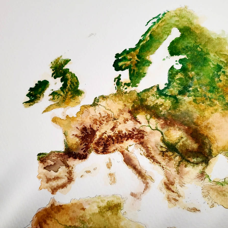
How Muslim is Italy?
How does both Islam and Christianity looks like now?
How does Greece, Italy and Lombardia look like?
Here are the next two maps in my timezone ISOT series. As it's now been quite a while since the last one, and about a year since I started the series, I've uploaded all the previous maps to my DA for anyone who missed the previous ones. I'll also try to get round to adding descriptions over there for the UTC±00:00 and UTC+01:00 maps which were originally posted without one.

UTC+09:00
Regions transported: Russia (Amur Oblast, Zabaykalsky Krai, Sakha Republic (Yakutia)), Japan, North Korea, South Korea, Palau, Indonesia (Maluku, North Maluku, Papua, West Papua), East Timor
For Russia, the period following the Event was one marked by squabbling and disagreement between the three provincial governments of the Amur Oblast, Zabaykalsky Krai and the Sakha Republic, primary over their respective reactions policies to their new situation, but also over where and how Russia's federal institutions should be re-established. Eventually an interim agreement was reached whereby meetings between representatives from each of the provinces would be held alternatively in Chita, Blagoveshchensk and Yakutsk. This arrangement however failed to bring the unity initially hoped for as each government continued to pursue its own policies, so that as the years progressed the meetings became less frequent, eventually being reformulated into a rotating annual meeting between what were now recognised as the three sovereign governments of Amuria, Zabaikalia and Yakutia. While Amuria had developed a more cosmopolitan and Asian culture thanks to its existing and new Korean, Chinese and Japanese communities and trade across the Sea of Japan, Zabaikalia remained more Russian in character with the Mongol Buryats as the only significant minority, although many had moved south and established a separate republic of South Buryatia. Yakutia retrained its status as north Asia's resource hub, happily supplying Chita, Blagoveshchensk and beyond.
In Pyongyang, the sudden flash and disappearance of the Chinese and Russians from their borders was taken as a sign that now was the opportune moment to retake the capitalist south and hence, just a few days later, thousands of PKA troops crossed the DMZ, coming within 10km of the outskirts of Seoul before the South could meet them and mount a defence of their capital. While the North had hoped that both fate and the element of surprise who deliver them a swift victory and the South expected to be able overwhelm the North with their technological superiority, the war soon became entrenched as the PKA continuously threw more conscripts at the South's guns and Seoul found itself struggling to maintain its army without the imports it had come to rely on. The stalemate was finally broken when the Japanese entered to support the South Koreans. Both Seoul and Tokyo had been reluctant to take action which would see Japanese soldiers in action on the Korean peninsular again, but the situation necessitated it and a couple of months later Pyongyang was on the defensive with many areas in the north falling to Seoul's control for the first time since the 1950s. As ROKA troops entered Pyongyang thoughts turned to reconstruction. Due to the scale of the task it was decided to install a temporary administration known as the Republic of Choson which would undertake the "de-Kimification" of the country, with areas which had escaped the worst of the fighting being ceded directed to the Korean republic.
The Second Korean War had generated a mass exodus of refugees and emigrants as those that could escaped north and west into Amuria and across the Yellow Sea to avoid the fighting, leading to a large Korean presence across the region, but one with hardly any central co-ordination. Establishing law and order in these new regions fell to Seoul with assistance from the Japanese and Amurians. Meanwhile, in the eastern reaches of the Gobi desert reports had emerged of new settlements appearing with the DPRK flag flying over them. Dubbed the magical "Unicorn Kingdom" by the Russians, information on the re-emerged Kim regime remains severely limited.
While Korea was working to recover from the ravages of war, the Japanese were free to bring large tracts of land on the southern Chinese coast and along the Yangtze, or Choko, river, helped by land clearance, agricultural and construction robotics and AI technology.
South of the equator, what remained of the Indonesian government was faced with a series of secession crises with both Papua and South Maluku declaring their independence, as well as several smaller religious and ethnic minority groups. Thus the much reduced Indonesia's efforts in the first few decades were taken up with efforts to reintegrate, as well as expand their territory. While it looks like South Maluku may well be on course to re-join Indonesia, New Guinea's independence is well established with only the most ardent of Indonesian politicians believing reincorporation of West Papua and Papua is still achievable. With the increasing Japanese presence in the region, in fact attention has been increasingly focused towards a wider regional pact incorporating Timor and Palau to "protect against protentional Japanese aggression". Indonesia remains by far the most enthusiastic supporter of the pact though.

UTC+09:30
Regions transported: Australia (South Australia, Northern Territory)
It didn't take too long for Australia's north/south division to become more than just a line in the sand as the government in Adelaide prioritised bringing the lands of the Murray-Darling valley back under cultivation to feed itself and provide an outlet for those South Australians who found themselves with itchy feet. The new states of New South Australia and East Australia where thus quickly established while Territorians felt increasingly ignored. Adelaide's response was to grant enhanced self-rule for the Aboriginal lands and encourage non-Aboriginal northerners to either migrate south or set up mining communities in the Kimberly region. While the self-ruled areas were later expanded, the Kimberley mines largely failed thanks to high start up costs and Australia's small domestic market. As New South Australia and East Australia matured, West Australia was set on the road to statehood and new territories in Carpentaria, Central Australia and the Coral Coast were established by disaffected northerners and southerners seeking a more natural lifestyle.
UTC+09:00
Regions transported: Russia (Amur Oblast, Zabaykalsky Krai, Sakha Republic (Yakutia)), Japan, North Korea, South Korea, Palau, Indonesia (Maluku, North Maluku, Papua, West Papua), East Timor
For Russia, the period following the Event was one marked by squabbling and disagreement between the three provincial governments of the Amur Oblast, Zabaykalsky Krai and the Sakha Republic, primary over their respective reactions policies to their new situation, but also over where and how Russia's federal institutions should be re-established. Eventually an interim agreement was reached whereby meetings between representatives from each of the provinces would be held alternatively in Chita, Blagoveshchensk and Yakutsk. This arrangement however failed to bring the unity initially hoped for as each government continued to pursue its own policies, so that as the years progressed the meetings became less frequent, eventually being reformulated into a rotating annual meeting between what were now recognised as the three sovereign governments of Amuria, Zabaikalia and Yakutia. While Amuria had developed a more cosmopolitan and Asian culture thanks to its existing and new Korean, Chinese and Japanese communities and trade across the Sea of Japan, Zabaikalia remained more Russian in character with the Mongol Buryats as the only significant minority, although many had moved south and established a separate republic of South Buryatia. Yakutia retrained its status as north Asia's resource hub, happily supplying Chita, Blagoveshchensk and beyond.
In Pyongyang, the sudden flash and disappearance of the Chinese and Russians from their borders was taken as a sign that now was the opportune moment to retake the capitalist south and hence, just a few days later, thousands of PKA troops crossed the DMZ, coming within 10km of the outskirts of Seoul before the South could meet them and mount a defence of their capital. While the North had hoped that both fate and the element of surprise who deliver them a swift victory and the South expected to be able overwhelm the North with their technological superiority, the war soon became entrenched as the PKA continuously threw more conscripts at the South's guns and Seoul found itself struggling to maintain its army without the imports it had come to rely on. The stalemate was finally broken when the Japanese entered to support the South Koreans. Both Seoul and Tokyo had been reluctant to take action which would see Japanese soldiers in action on the Korean peninsular again, but the situation necessitated it and a couple of months later Pyongyang was on the defensive with many areas in the north falling to Seoul's control for the first time since the 1950s. As ROKA troops entered Pyongyang thoughts turned to reconstruction. Due to the scale of the task it was decided to install a temporary administration known as the Republic of Choson which would undertake the "de-Kimification" of the country, with areas which had escaped the worst of the fighting being ceded directed to the Korean republic.
The Second Korean War had generated a mass exodus of refugees and emigrants as those that could escaped north and west into Amuria and across the Yellow Sea to avoid the fighting, leading to a large Korean presence across the region, but one with hardly any central co-ordination. Establishing law and order in these new regions fell to Seoul with assistance from the Japanese and Amurians. Meanwhile, in the eastern reaches of the Gobi desert reports had emerged of new settlements appearing with the DPRK flag flying over them. Dubbed the magical "Unicorn Kingdom" by the Russians, information on the re-emerged Kim regime remains severely limited.
While Korea was working to recover from the ravages of war, the Japanese were free to bring large tracts of land on the southern Chinese coast and along the Yangtze, or Choko, river, helped by land clearance, agricultural and construction robotics and AI technology.
South of the equator, what remained of the Indonesian government was faced with a series of secession crises with both Papua and South Maluku declaring their independence, as well as several smaller religious and ethnic minority groups. Thus the much reduced Indonesia's efforts in the first few decades were taken up with efforts to reintegrate, as well as expand their territory. While it looks like South Maluku may well be on course to re-join Indonesia, New Guinea's independence is well established with only the most ardent of Indonesian politicians believing reincorporation of West Papua and Papua is still achievable. With the increasing Japanese presence in the region, in fact attention has been increasingly focused towards a wider regional pact incorporating Timor and Palau to "protect against protentional Japanese aggression". Indonesia remains by far the most enthusiastic supporter of the pact though.
UTC+09:30
Regions transported: Australia (South Australia, Northern Territory)
It didn't take too long for Australia's north/south division to become more than just a line in the sand as the government in Adelaide prioritised bringing the lands of the Murray-Darling valley back under cultivation to feed itself and provide an outlet for those South Australians who found themselves with itchy feet. The new states of New South Australia and East Australia where thus quickly established while Territorians felt increasingly ignored. Adelaide's response was to grant enhanced self-rule for the Aboriginal lands and encourage non-Aboriginal northerners to either migrate south or set up mining communities in the Kimberly region. While the self-ruled areas were later expanded, the Kimberley mines largely failed thanks to high start up costs and Australia's small domestic market. As New South Australia and East Australia matured, West Australia was set on the road to statehood and new territories in Carpentaria, Central Australia and the Coral Coast were established by disaffected northerners and southerners seeking a more natural lifestyle.
Welcome back, and excellent work as always. What happened to the North's nuclear arsenal, though? I'd imagine that the Kims would sooner bathe both South Korea and Japan with nuclear fire than accept total defeat. Did the SK-Japan alliance successfully found and destroyed all of them, or did the Kims decided to abscond with them to their "Unicorn Kingdom", in order to guarantee their rump state's long-term survival?In Pyongyang, the sudden flash and disappearance of the Chinese and Russians from their borders was taken as a sign that now was the opportune moment to retake the capitalist south and hence, just a few days later, thousands of PKA troops crossed the DMZ, coming within 10km of the outskirts of Seoul before the South could meet them and mount a defence of their capital. While the North had hoped that both fate and the element of surprise who deliver them a swift victory and the South expected to be able overwhelm the North with their technological superiority, the war soon became entrenched as the PKA continuously threw more conscripts at the South's guns and Seoul found itself struggling to maintain its army without the imports it had come to rely on. The stalemate was finally broken when the Japanese entered to support the South Koreans. Both Seoul and Tokyo had been reluctant to take action which would see Japanese soldiers in action on the Korean peninsular again, but the situation necessitated it and a couple of months later Pyongyang was on the defensive with many areas in the north falling to Seoul's control for the first time since the 1950s. As ROKA troops entered Pyongyang thoughts turned to reconstruction. Due to the scale of the task it was decided to install a temporary administration known as the Republic of Choson which would undertake the "de-Kimification" of the country, with areas which had escaped the worst of the fighting being ceded directed to the Korean republic.
I don't know yet.@Zurirach Adankar interesting
Who rules Westphalia?
Westphalia exists because Bavaria would have gotten too strong for the other European powers if it would have annexed the entirety of former Prussian territory.
So I guess:
- either a German house - maybe the House of Urach a branch of the royal family of Württemberg,
- or a cadet branch of a European royal house to improve diplomatic relations - for example a Habsburg (maybe Westphalia is more stable than Mexico and Maximilian might survive), or a Bonaparte (due to history and getting Napoleon III. on their side - might be unpopular with German nationalists)
Thank you! The Kims would definitely have taken some of their missiles with them as a deterrent, however no foreign government has been able to determine their location out in the desert. I didn't mention it, but Amuria was also drawn into the war against North Korea and took a very evasive position regarding whether they had inherited any of Russia's nuclear weapons which could have given Kim pause for thought. Some of the North's facilities were destroyed while others were discovered during the invasion.Welcome back, and excellent work as always. What happened to the North's nuclear arsenal, though? I'd imagine that the Kims would sooner bathe both South Korea and Japan with nuclear fire than accept total defeat. Did the SK-Japan alliance successfully found and destroyed all of them, or did the Kims decided to abscond with them to their "Unicorn Kingdom", in order to guarantee their rump state's long-term survival?

Here's a map depicting Plymouth if it survived as a separate colony from Massachusetts Bay and became a US state. The flag is also an original creation. In this timeline Plymouth Colony is granted a charter after the dissolution of the Dominion of New England instead of being absorbed by its northern neighbor. Plymouth's development diverges somewhat from the OTL region: it is more populous (being a separate state there are more economic projects dedicated to the region), less liberal politically (being a light blue swing state), and some people speak with a Plymouth accent that is distinct from non-rhotic accents in Boston and Rhode Island. Most of the towns have different borders than they do IOTL. Plymouth gets more favorable rulings against Rhode Island during the states’ border disputes ITTL, and all land east of the Seekonk River and Aquidneck Island is owned by Plymouth. With manufacturing and whaling long-moribund, the state relies heavily on tourism as a source of revenue. There is a notable financial sector in Plymouth, as the state used lower tax rates than neighboring Massachusetts to poach companies who do business in the Boston area. While its 2.5% sales tax rate is not as lucrative as New Hampshire's famous 0% rate, it is enough to draw in shoppers from Massachusetts and Rhode Island looking to save some money, and as a result Plymouth's border towns have many stores and malls. As the state capital, Plymouth is a city rather than a town as it is IOTL, and developed in a more northerly direction so that it could be geographically closer to Boston and Providence. It has a population of approximately 90,000, which is much larger than the OTL number of just under 60,000, but it is a very large city land area-wise so it retains a small town feel. Despite all these differences, the Mayflower State doesn't look significantly different from the region IOTL. Sleepy commuter towns constitute the northern reaches of the state, Cape Cod and the islands are tourist hubs, the cities of Bristol County have a Rust Belt vibe to them, and the rural center of the state is a major center of cranberry production.
Last edited:

- Status
- Not open for further replies.
Share: