Map Thread XX

Status
Not open for further replies.
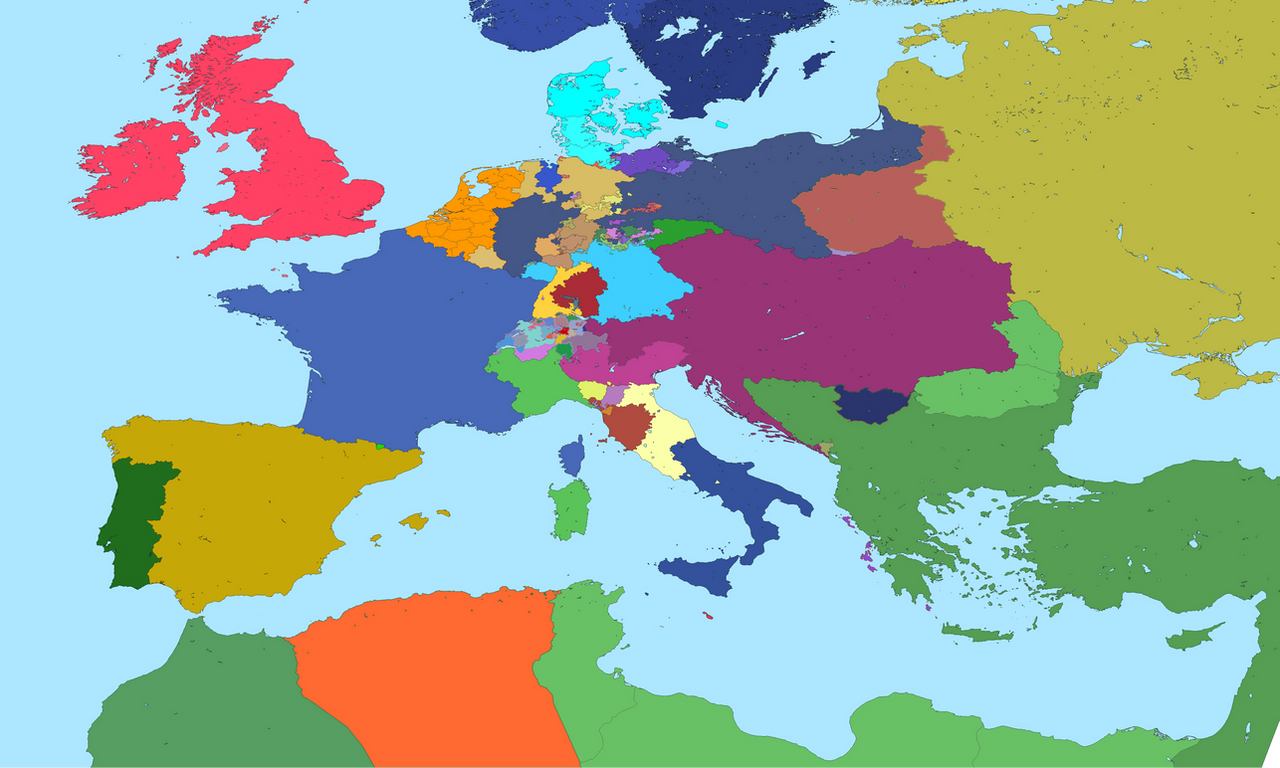
Sweet wank, although I think Napoleon probably would be butterflied.

Minor quibble: darker borders on the Russian puppet states would emphasize their fragmented status. Right now it looks more like PL is somehow dominating a federal Russia as big as it is rather than a bunch of small states.
Noted.

Though i'm frankly curious about the Napoleon being butterflied part. Can you tell me more about that?
 
Last edited:
Youre not wrong, but read the room
"Blacks" isn't an offensive term.

A lot of countries get their names from colors. Sudan and Ethiopia both mean Land of Blacks, and Albania (Land of the Whites more or less), Belarus (White Russia), and Lebanon and Kenya also have white as influential in their etymologies.
 
Last edited:
Noted.

Though i'm frankly curious about the Napoleon being butterflied part. Can you tell me more about that?

Poland breaking up Muscovy over a hundred years before Napoleon's birth is a big enough divergence in European history that multiple generations of Napoleonic ancestors managing to have exactly the same marriages and exactly the same children over that period seems a touch unlikely. I mean, I can see an alt-French revolution with an alt-Napoleon type, but not the same person.
 

Screen Shot 2021-05-10 at 11.33.33 AM.png

This map (Fig. 1A) was found in a Sons of Liberty safe-house in the Mission Hill neighborhood of Boston, Plymouth, following a raid by police authorities on 12 March, 1974. The flag of Plymouth has been defaced with the Nine-Stripe Flag, the symbol of the Sons of Liberty. The vandalization of this map shows that the SoL consider the so-called "People's Republic of Hudsonia" - a hardline communist dictatorship - to be "allies of the revolution" (See Chapter XVII: The Sons of Liberty and Communism).
Within the same universe: https://www.alternatehistory.com/fo...al-figures-here.491184/page-201#post-21915803
 
"Blacks" isn't an offensive term.

A lot of countries get their names from colors. Sudan and Ethiopia both mean Land of Blacks, and Albania (Land of the Whites more or less), Belarus (White Russia), and Lebanon and Kenya also have white as influential in their etymologies.
Both Kenya and Lebanon refer to the whiteness of snow-topped mountains, not people in any way.
 

This map (Fig. 1A) was found in a Sons of Liberty safe-house in the Mission Hill neighborhood of Boston, Plymouth, following a raid by police authorities on 12 March, 1974. The flag of Plymouth has been defaced with the Nine-Stripe Flag, the symbol of the Sons of Liberty. The vandalization of this map shows that the SoL consider the so-called "People's Republic of Hudsonia" - a hardline communist dictatorship - to be "allies of the revolution" (See Chapter XVII: The Sons of Liberty and Communism).
Within the same universe: https://www.alternatehistory.com/fo...al-figures-here.491184/page-201#post-21915803
Fun!
 

This map (Fig. 1A) was found in a Sons of Liberty safe-house in the Mission Hill neighborhood of Boston, Plymouth, following a raid by police authorities on 12 March, 1974. The flag of Plymouth has been defaced with the Nine-Stripe Flag, the symbol of the Sons of Liberty. The vandalization of this map shows that the SoL consider the so-called "People's Republic of Hudsonia" - a hardline communist dictatorship - to be "allies of the revolution" (See Chapter XVII: The Sons of Liberty and Communism).
Within the same universe: https://www.alternatehistory.com/fo...al-figures-here.491184/page-201#post-21915803
Very nice. I always like when people post maps that have been defaced. It’s an interesting and effective way to show conflict.
 
The Korean Peninsula as of 1970

In this timeline's Korean war, the Chinese intervention into Korea is not as devastating to the UN Command forces, resulting in more modest gains for Chinese-led forces. By the time a ceasefire is signed in 1953, South Korea has gained considerable territory from the North roughly outlined by the Nampo-Chonnae Line. As this print shows, the South is left considerably larger and, as such, is seen as the stronger and more relevant of the two Korea's, even in 1970. As this print was printed for American consumption, it is biased in favor of South Korea and the United States.
I'm pretty sure I've seen this map on the site before...
 
20210510_192003_by_spazzreflex_dejew85-pre.jpg


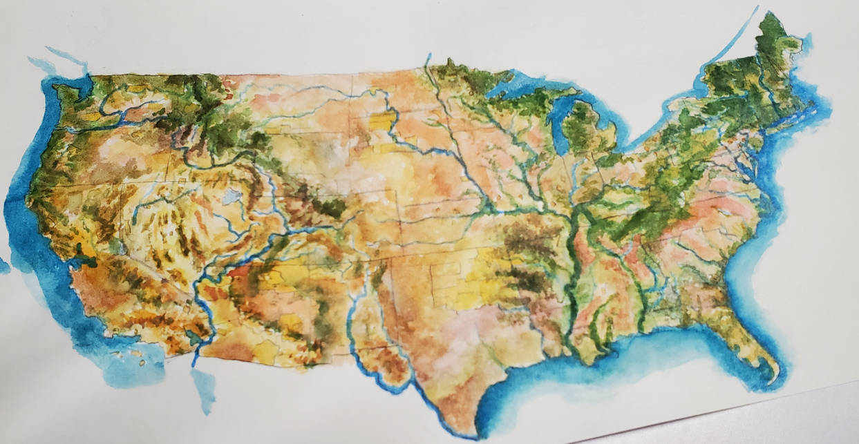
Hey, its been a while since we've had a handmade map: Former US in LTBL 2076

Great American Desert takes its place as the master of the continent, and much of the land has returned to an unsupervised state, giving some plant and animal species the breathing room to make the migrations north following new forests and grasslands. Humans tend to be clustered in mountain valleys and rock outcrops on higher altitudes. Ailanthus trees have quietly taken a spot in the Northeastern forests, and mosquito born illnesses have returned to the Appalachians.
 
As usual, crossposting from the MotF thread, with questions, comments, anything really being welcomed, while I hope you all like the map, since I really loved the whole idea

Anderida, a pocket of Celts just to the south of London

vrRdlwM.jpg

Since the lore is included in the map (I just found my lore too fun not to include in the overall work), I'll just comment quickly how much fun I had working on this idea. It was like my third plan, which I stumbled unto after thinking of doing a more-generally Celtic Britain, a project I eventually abandoned in favour of this more controlled piece, but one that nevertheless seems more interesting, if only for its oddness.

And yes, the moment I thought of this idea, I imagined Tolkien would have to be involved. It was far from an afterthought. Having Robin Hood, the Lollards and the Diggers involved were just extra pleasures that I indulged in.

Anyway, I hope you like it, because it was an idea that enchanted me from the moment I thought it up.
 
Top
Status
Not open for further replies.
Top