Map Thread XVII

Status
Not open for further replies.
welcome to Not-Inversia(TM)

i decided to try a method for making maps look more relief-y

upload_2018-2-23_21-12-15.png
 
It's not really a case of agreeing to disagree; the map thread has always been for all maps that people have created themselves. There've been tons of OTL maps posted over the years. The tags are effectively meaningless, but if you want to pick at them, the tags 'alternate history' and 'maps' are separate, ergo the presence or lack of an 'OTL' tag doesn't actually make a difference.
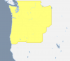
You say this, and then I look at the tags and realizes there is no tag up there about how we must build a canal.
 
I've had a small, but niggling annoyance at the HoI4 map. Swaziland and Basutoland should be British, not South African.
Oh and there's the fact that Burma is part of British Raj and the Chinese warlords are all wrong.

I actually did like twenty extended timeline maps for HoI4, although there's no mod containing them yet.
 
Socialist States of America (small WIP lol)

Ever since the U.S.A. surrendered to the C.S.A. due to Britain's help, America has always felt anger towards the Brits. In 1902, after years of poverty and starvation, the country had a military coup led by Nelson A. Miles. After two years, he was assassinated and succeeded by William Rufus Shafter. Shafter poorly led the country into World War I, where the Americans were defeated and embarrassed by the C.S.A. once again.


After this ordeal, the American people had enough of Shafter's regime and began to revolt. After a week, the states of California, Nevada, Wisconsin, Michigan, Illinois, Indiana, and Ohio had left the 'Union,' officially plunging America into the Second American Civil War. After the failure for the U.S.A. at the Battle of Glasgow, even more of the American states left the Union. These included Cascadia, Dakota, Minnesota, Iowa, Kentucky, Pennsylvania, Delaware, New Jersey, New York, and Maine.


Shafter put the U.S.A. in martial law, causing even more anger and confusion to the situation. After a few weeks, the S.S.A. captured the four U.S. states of New Hampshire, Vermont,

Massachusetts, Connecticut, and Rhode Island. After a brutal five months of war, the S.S.A. was able to capture and secure Washington, D.C. and many border cities on the western front.


In California, the revolution was made difficult due to the Rocky Mountains and more. To the ease of the West, Utah had seceded and became the "Mormon State of Utah." Rumors also have begun to be made that the governor of Texas, James E. Ferguson, will make Texas independent again.

upload_2018-2-23_20-16-9.png

This was just made for fun. I will probably not continue it.
 

Attachments

  • upload_2018-2-23_20-9-41.png
    upload_2018-2-23_20-9-41.png
    50.4 KB · Views: 310
A WIP in progress, a commission for krinsbez. Some inspiration taken from Alex Richard's awesome WorldRaj.View attachment 372369
My first thought upon seeing this? "Oooh, someone is doing something based on La Morte de Arthur!" Turns out one of the most famous versions of the King Arthur mythology had the Knights be from everywhere and they fight the Senator of Rome and his vassals the kings of India, Africa, Turkey, etc. I do have to wonder how much of a Britain or England wank your map is (or Krinsbenz, I don't know how much leeway you have in commissions). The Danes/Jutes certainly have a lot of the English coast, even if a lot of it used to be underwater, and I am intrigued at what the yellow dot in southern Wales is. I would suggest using a shade of grey around it, as the black outlining distorts the nearby coastline. Ahh, and in Finland... aren't some of those principalities going to be almost complete underwater? And what is th situatoin with Canterbury? The Archbishop got a lot of autonomy? And what is the state with Rome? I know, probably best to wait for you to Munroify the map, but I can't help myself when something this intriguing is dangled before us.
 
Hi all,

I spent some time going back through a lot of old files I had from various places and came across the Alkebu-Lan map of Africa uncolonized by Europe due to some unspecified event.
9c37083c6e91300577ec46214da2a577.jpg


It got me thinking; How could this come about?

I did some digging and there seems to be a consensus online that this would be due to some sort of super Plague.

Notably, the author does not claim this and, if you look at the original map [not the later ones], the Ottoman Empire is shown. To me, this says that, if Plague had hit, it would probably have had a similar effect on the Middle East and North Africa. As the map implies their survival there had to be another reason.

Later I came across some data I had about the Tocharians [ a fair skinned, red haired Indo-European people and their land on the Silk Road in the Tarim Basin]. They are extinct now but they also got me thinking.


What if the Indo-European language groups had migrated East instead of West. Obviously the Tocharians had but so too did the Indo-Aryan peoples of the Near-East and India. [NB Linguistically Iran = Aryan]

If the Southern arm could succeed surely, with more people, so could a theoretical Northern arm.

With just a few tribes going West Europe could be a sparsely occupied land barely known to the more civilized South and East. What would be the effect on the emerging civilizations of OTL?

This is what I came up with.

For those interested this is the link to the Alkebu-Lan map.https://decolonialatlas.wordpress.com/2014/11/15/alkebu-lan-1260-ah/
 
Last edited:
Top
Status
Not open for further replies.
Top