I don't mean to sound impatient, but it's been a week since you said you'd do the text on the flag.I’ll do it!
You are using an out of date browser. It may not display this or other websites correctly.
You should upgrade or use an alternative browser.
You should upgrade or use an alternative browser.
Request Maps/Flags Here
- Thread starter Tom Thumb
- Start date
- Status
- Not open for further replies.
I have a flag request, and ethnically Spanish, religiously Jewish(with heavy focus on Kabbalah) state in North Africa.
View attachment 494525
I have trouble merging these two maps together in GIMP. Whenever I do so, I get this:
I can only merge these two maps together by doing this:
But this reduces the opacity of the top image by 50 percent. How do I merge both maps so I can view both images in full opacity with all their content? Can anyone show me the steps?
(BTW, I posted it in the HELP forum)
superimposed the 2 images but instead of cutting strait across, used the eraser to delete only part of the top layer, preferably having the parts that overlap being the water so the border don't show.
Hello!
Can someone make me a flag of a Scandinavian Union, which is an economic and defense supranational union that exists in a world without a single, continent-spanning EU?
I was thinking of using the Norwegian flag as a base: the Norwegian red should be replaced with the red used by the Danish flag, the internal blue cross should be replaced with the yellow on the Swedish flag, and the border between the two should be replaced by the blue used in the Norwegian flag; the idea is to synthesize the banners of the three founding members.
There is already (at least) 2 flags for a Scandinavian Union, the Kalmar Union's Flag, and the Nordic Council, but I'll make you that flag if you don't like either oneHello!
Can someone make me a flag of a Scandinavian Union, which is an economic and defense supranational union that exists in a world without a single, continent-spanning EU?
I was thinking of using the Norwegian flag as a base: the Norwegian red should be replaced with the red used by the Danish flag, the internal blue cross should be replaced with the yellow on the Swedish flag, and the border between the two should be replaced by the blue used in the Norwegian flag; the idea is to synthesize the banners of the three founding members.
My issue with the Kalmar Flag is that it's tied to a specific dynasty, and thus has a connotation of domination as opposed to a consenting union of equals, whilst the current Nordic Council flag seems to be...more focused on appearing modern rather than actually resonating with Nordic aesthetic vexillological tradition.There is already (at least) 2 flags for a Scandinavian Union, the Kalmar Union's Flag, and the Nordic Council, but I'll make you that flag if you don't like either one
i would like to have a post-republican china map/flag for my timeline
what do you mean by "post-republican china" ?
Hey, can someone make me flags for communist Irish, Scottish, Welsh, British and then one for them united.
Is it supposed to be a similar arrangement than the various republics within the USSR ? If so, you could have the various component use a modified version of the Union's flag. Example:
Mollweide is difficult, if you can find the map in Aitoff, Hammer, Robinson, or Winkel Tripel I should be able to convert into your desired projection. If you tell me exactly what the map is of i might have a look for it myself.The original one is a Mollweide, and I need it changed to an equirectangular map.
seems I'm a bit late but sounds fun. If you dont mind me having a go, tell me what time period the flag exists in and what type of communism(classic M-L/Non-Marxist/other?) and I'll upload something.Hey, can someone make me flags for communist Irish, Scottish, Welsh, British and then one for them united.
zesamofdepast
Banned
Here it is:Mollweide is difficult, if you can find the map in Aitoff, Hammer, Robinson, or Winkel Tripel I should be able to convert into your desired projection. If you tell me exactly what the map is of i might have a look for it myself.

ah sorry, this is still in the Mollweide projection. I need it in any of: Aitoff, Hammer, Robinson, or Winkel Tripel projections if you want me to turn it into equirectangular. is this where you got it from: http://deeptimemaps.com/global-paleogeography-and-tectonics-in-deep-time-series/ ?Here it is:
so here is a very rough draft, so what i have done is try and warp the Mollweide projection into the Hammer projection, then convert that to Equirectangular.Here it is:
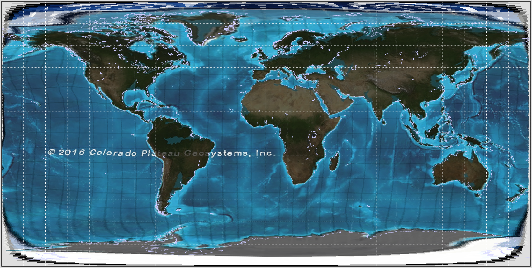
you can see distortions from my warping near the poles where the difference between the projections are hard to see, and in the pacific where there are not many features. you can see in the light purple outline the current day continents and compare it to the shaded in parts of the original map to see the effects pf my waring..
seems I'm a bit late but sounds fun. If you dont mind me having a go, tell me what time period the flag exists in and what type of communism(classic M-L/Non-Marxist/other?) and I'll upload something.
Never hesitate to have a go at a fun idea even if someone already fulfilled the request. If anything, its always fun to see variations based on the same concept and even if the OP doesn't go for it, it might inspire another creator.
zesamofdepast
Banned
O
That’s good. thanks!so here is a very rough draft, so what i have done is try and warp the Mollweide projection into the Hammer projection, then convert that to Equirectangular.
you can see distortions from my warping near the poles where the difference between the projections are hard to see, and in the pacific where there are not many features. you can see in the light purple outline the current day continents and compare it to the shaded in parts of the original map to see the effects pf my waring..
- Status
- Not open for further replies.
Share: