Not that I know of, but the green and yellow in that map don't really pop out so it might be a bit toughAnyone?
You are using an out of date browser. It may not display this or other websites correctly.
You should upgrade or use an alternative browser.
You should upgrade or use an alternative browser.
Proposals and War Aims That Didn't Happen Map Thread
- Thread starter Beedok
- Start date
I came across this today while working on the world map for my Untied States project:
Early proposals of a Sikh nation of ‘Sikhistan’ led by Maharaja of Patiala were published by Dr VS Bhatti in 1940 for a “Khalistan led by the Maharaja of Patiala with the aid of a cabinet consisting of representative federating units”.[2][3][4][5] These would consist of the central districts of Punjab province then directly administered by the British, including Ludhiana, Jalandhar, Ambala, Ferozpur, Amritsar and Lahore; the 'princely states' of the Cis-Sutlej, including Patiala, Nabha, Faridkot and Malerkolta; and the 'Shimla Group' of states. After partition of India in 1947, The Liberator, a Sikh publication advocated for Khalistan which would include East Punjab merged with PEPSU led by Maharaja of Patiala as its monarch.[6]
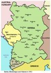
I found this image on Wikipedia. Apparently this was Serbia’s original plan in the First Balkan War. This is probably easier to QBAM, if someone hasn’t done it already.Not that I know of, but the green and yellow in that map don't really pop out so it might be a bit tough
Attachments
Has anyone made a map of this?I came across this today while working on the world map for my Untied States project:
https://tile.loc.gov/image-services...701:g3701e:ct008649/full/pct:25/0/default.jpg
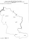
Here's a map called Indian Land Areas Judicially Recognized. Published on September 30, 1978, all of these are lands that various Native American tribes, either in the U.S. Indian Claims Commission or U.S. Court of Claims, were able to prove original tribal occupancy. In other words, these are lands that, according to all those treaties that were signed and later ignored, should've remained under native control, or least guaranteed their territorial autonomy.
Here's a map called Indian Land Areas Judicially Recognized. Published on September 30, 1978, all of these are lands that various Native American tribes, either in the U.S. Indian Claims Commission or U.S. Court of Claims, were able to prove original tribal occupancy. In other words, these are lands that, according to all those treaties that were signed and later ignored, should've remained under native control, or least guaranteed their territorial autonomy.
Wow this is extremely detailed good find!https://tile.loc.gov/image-services...701:g3701e:ct008649/full/pct:25/0/default.jpg
Here's a map called Indian Land Areas Judicially Recognized. Published on September 30, 1978, all of these are lands that various Native American tribes, either in the U.S. Indian Claims Commission or U.S. Court of Claims, were able to prove original tribal occupancy. In other words, these are lands that, according to all those treaties that were signed and later ignored, should've remained under native control, or least guaranteed their territorial autonomy.
Does anyone have a fixed QBAM of the San Stefano Treaty? Crazy Boris made this one, which is magnificent, except for the Russian-Ottoman border, which follows the implemented Treaty of Berlin. I also found this picture on the Wikipedia page for the treaty which outlines the change. It would be really cool if someone could help me out.
Attachments
No one?Does anyone have a fixed QBAM of the San Stefano Treaty? Crazy Boris made this one, which is magnificent, except for the Russian-Ottoman border, which follows the implemented Treaty of Berlin. I also found this picture on the Wikipedia page for the treaty which outlines the change. It would be really cool if someone could help me out.
You could patch in the Ottoman/Russian border from another map if you're capable of doing it.No one?
That’s the problem I think. I haven’t been able to find the exact border, unfortunately.You could patch in the Ottoman/Russian border from another map if you're capable of doing it.
If you go to my DeviantART account I am pretty sure that I have maps where I didn't change the border between the Ottomans and Russia and Kars is still Ottoman.That’s the problem I think. I haven’t been able to find the exact border, unfortunately.
Who are you on DeviantART?If you go to my DeviantART account I am pretty sure that I have maps where I didn't change the border between the Ottomans and Russia and Kars is still Ottoman.
Look at the link in my signature. I haven't been actively uploading things there for awhile though.Who are you on DeviantART?
Here's the same map with the borders highlighted (and the corresponding areas and the key numbered - red are the proposed borders and black are the 1913 borders - only the borders on land are highlighted and where it wasn't obvious from the colour difference etc.Not that I know of, but the green and yellow in that map don't really pop out so it might be a bit tough
Attachments
honestly i barely know what a qbam is but this guy did a map back in juneAnyone?
heres the map itself on the library of congress page, higher quality and readableHere's the same map with the borders highlighted (and the corresponding areas and the key numbered - red are the proposed borders and black are the 1913 borders - only the borders on land are highlighted and where it wasn't obvious from the colour difference etc.
also ended up finding this article on the LOC's website discussing the context and giving much more informationhonestly i barely know what a qbam is but this guy did a map back in june
heres the map itself on the library of congress page, higher quality and readable
The comments are pure gold on there.also ended up finding this article on the LOC's website discussing the context and giving much more information
Based on a recent post of Mobiyuz on DeviantArt, plus a very old video that i've remember from youtube (long gone deleted), did the allies ever planned to give Czechoslovakia an overseas colony?
Plan? No. The Czech did lobby for Togoland in particular, arguing that the port concessions in the German port cities of Stettin and Hamburg (Moldauhafen, which still exists FYI) would allow the Czech navy to reach its new colony.Based on a recent post of Mobiyuz on DeviantArt, plus a very old video that i've remember from youtube (long gone deleted), did the allies ever planned to give Czechoslovakia an overseas colony?
There's apparently a Czech book from WW1, České kolonie zámořské by Jan Havlasa, that goes into further details and features more suggestions, but there doesn't seem to be a non-Czech version available.
EDIT: I found an article covering the book, "Imperial Ambition: The Campaign for Czechoslovak Colonies on the Eve of the Paris Peace Conference" by Michael W. Dean, released last year. Here are three highlight quotes.
According to that article, Havlasa and other Czechoslovak colonial advocates argued that 1) colonies were necessary for Czechoslovakia to have the raw materials to build up a strong, sovereign economy, 2) that having colonies with the opportunity for settlers would allow Czechoslovakia to lose excess population without alienating that population from the Czechoslovak state, 3) that either through the Danube or the Elbe Czechoslovakia would easily be able to project maritime power across the world, and finally 4) that New Guinea & Togoland & West Africa (idk if that's supposed to be Kamerun or South West Africa) & Kamchatka (yes, the peninsula in the Russian Far East) should be Czechoslovak colonies.
The article also includes the vision of a Greater Czechoslovakia as advocated by Josef Hüldner consisting out of "a protectorate over the Sorbs in Lusatia, the annexation of Lower Silesia, guardianship over Slovaks and the Ruthenians of Carpathia, Slavic ports on the Baltic and Adriatic seas, and a land corridor connecting the Czechs to the southern Slavs" in addition to Bohemia, Moravia, and Austrian Silesia.
Last edited:
Potential enlargement of NATO according to the Wikipedia page.
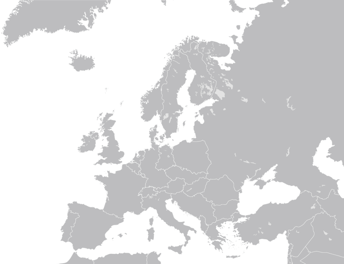
Enlargement of NATO - Wikipedia
Share: