Map Thread XIX

Status
Not open for further replies.
Is there a link? Sounds very useful.
I also require the link

https://forums.getpaint.net/topic/1...r-pdn-v41-and-beyond-updated-december-1-2018/

Boltbait's plugin pack, under the Outline Selection tool, pick a width of 1, Anti aliasing on, you may have to remove the anti aliased pixel (or not) using the recolouring tool depending on if you want outlines with only directly adjacent pixels or not.

Also includes a few useful tools for gradients, shadows and pattern repeating.
 
China, 22 November 1925

upload_2019-12-20_22-8-19.png
 
Start Time is 3:26:00

EDIT:
End time 4:21:30, just under 1 hour. Most of that was cleaning up provincial borders, which unfortunately still have to be done manually.
EDIT 2:
Disregard that, just noticed I messed up Argentina. Counting that, end time is 4:28:40, just over 1 hour.

worlda_outline_2017-png.510149

This is going to be massively useful, for pretty much any map that displays client/puppet states with modern borders. Thank you.
 
Here is a couple of transparent Q-BAM maps for my TL, showcasing both the flags & subdivisions of the Soviet Union & Mongolia. Pretty normal by all means, but it's my first time doing a transparent map, & I figured I'd share.


-Flags-
Q-BAM (Mongolia - Soviet Union) (Flags).png


-Subdivisions-
Q-BAM (Mongolia - Soviet Union) (Subdivisions).png
 
Here is a couple of transparent Q-BAM maps for my TL, showcasing both the flags & subdivisions of the Soviet Union & Mongolia. Pretty normal by all means, but it's my first time doing a transparent map, & I figured I'd share.
Not bad, but the Soviets didn't annex Tuva until the tide turned during WWII. If it is shown as annexed here, need to get the Baltic states and the areas the Soviets gained to the south of that.
 
Not bad, but the Soviets didn't annex Tuva until the tide turned during WWII. If it is shown as annexed here, need to get the Baltic states and the areas the Soviets gained to the south of that.
I probably should've mentioned that this is an alternate USSR centered on the present day. WW2 doesn't happen, but a war with Japan does. A minor detail with the USSR is the Volga German ASSR & Moldavian ASSR still existing. Of course there are also modern borders for the SSRs & ASSRs, sort of being unrealistic, I know.
 

Bytor

Monthly Donor
That Was the rule in the old UCS, yes. But with so Many schemes in use now, I’m not sure it’s still that way

I thought the fill was what it would be if it were not a puppet state, and a different border indicated the master to the puppet. For example, Vichy France would be blue bordered in dark grey. At least that's what makes most sense to me as a border is to me conceptually an overlay, like like a puppet master would be.
 
Ahikto North, 1400 [The Turn of the 15th Century]
This is a map that shows Ahikto in 1400, with the Piklandic Civil war Kicking off in 1399 and with a crumbling Ujuakti, the next Century seems a bit too far long.

Time Stamps
Febuary 3rd, 1399 - Start of Piklandic Civil war
August 8th, 1400 - Gliserine Annexes Chutawa
October 19th, 1400 - Kussel IV, king of Midgaurd dies and is replaced by Clendric II
December 29th, 1400 - Ghusiv II of Kynto Dies and is replaced by Cayi V
(+)________________________________________________________________________________________________________(+)
1400_LRG.jpg

____________________________________________________________________________________________________________

January 1st, 1400
________________________________________________________________________________________


Created by Kento Kei Hayama

December 21st, 2019

________________________________________________________________________________________
 
Sometimes you just feel like finishing you left as a project long ago. In fact, 5 months ago. I posted a series of maps detailing a general Timeline, with some shaky PoD's causing the American Civil War to flow reverse, causing the northern states to secede instead of the southern ones. But you'd better check that yourself, as I made three different maps depicting the progress of the TL.

Northern War of Independence

The World in 1896

The World in 1929


And finally, here's a modern map of the world in that TL. Questions would be appreciated to force me to build extra lore.

northern secession Final map.png
 
Sometimes you just feel like finishing you left as a project long ago. In fact, 5 months ago. I posted a series of maps detailing a general Timeline, with some shaky PoD's causing the American Civil War to flow reverse, causing the northern states to secede instead of the southern ones. But you'd better check that yourself, as I made three different maps depicting the progress of the TL.

Northern War of Independence

The World in 1896

The World in 1929


And finally, here's a modern map of the world in that TL. Questions would be appreciated to force me to build extra lore.

View attachment 510546
Why’d the FSA take the Maritimes?
 
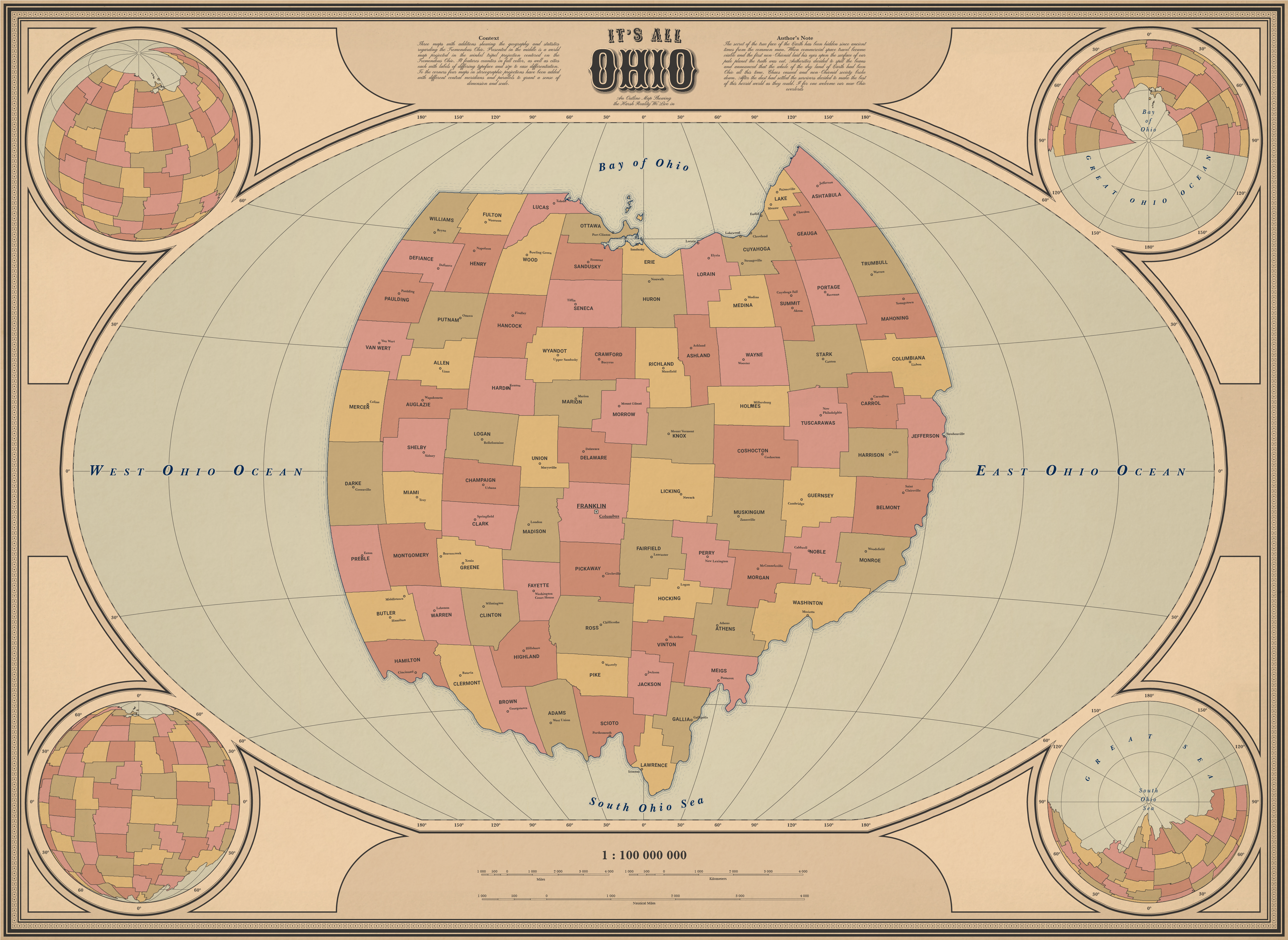
Its all Ohio-01 - Copy.png


drumroll, please!

Ladies and Gentlemen, I present to you:

The Tremendous State of Ohio in the 34th consecutive term of the Grand-Governor Logan Paul!


This site still doesnt seem to allow me to embed images so here's the biggest rendition you'll get unless you visit the DeviantArt link
Full res on DeviantArt
 
Last edited:
ddmse03-1b118d3b-c1fa-4aab-96dc-82384cb6d5cf.png


drumroll, please!

Ladies and Gentlemen, I present to you:

The Tremendous State of Ohio in the 34th consecutive term of the Grand-Governor Logan Paul!

df62fc9-1.jpg

Oh god so flat earther were wrong, it wasn’t flat earth but ohio earth

This explains why so many astronauts come from Ohio, they wanted to keep it secret
 
Last edited:
Top
Status
Not open for further replies.
Top