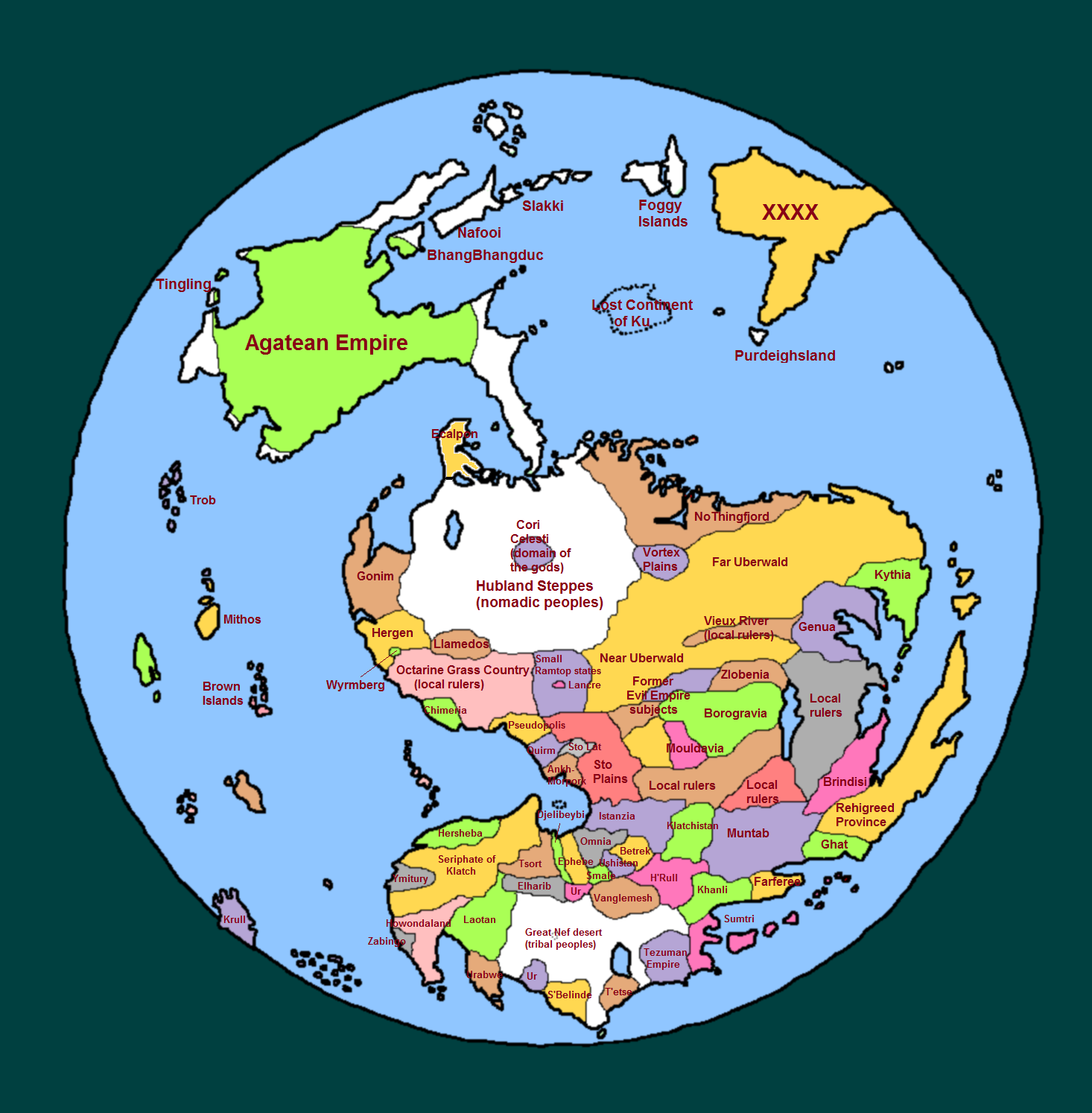
EDIT: Why are there two places called "Ur"? Is Klatchistan a region or a country? I've never really been clear on that one.
I don't know why there are two Urs, but it's on the Discworld Mapp, and considering how daft some things are on Roundworld...
A lot of the countries in Klatch the continent are sometimes treated as part of Klatch the country - my interpretation was that they are sometimes vassals of Klatch proper and part of the empire but are still considered distinct regions - like for example Egypt vis-a-vis the Ottoman Empire.
And

on the size of Uberwald. I thought that it was about half that size...
In "The Fifth Elephant" Vimes reads that Uberwald is 'five or six times the size of the whole of the Sto Plains' (i.e. Ankh-Morpork, Quirm, Pseudopolis, Sto Lat, and the region I've labelled as (other) Sto Plains (city-states)). If anything I underestimated Uberwald's size...but then Ankh-Morporkians would probably consider places like Borogravia, Zlobenia and Mouldavia to be part of Uberwald as they were formerly part of the Evil Empire, in the same way that a lot of modern Britons confuse Russia with the Soviet Union.
EDIT again: And you have Ghat and Farferee the wrong way round...
Bugger, you're right.