You are using an out of date browser. It may not display this or other websites correctly.
You should upgrade or use an alternative browser.
You should upgrade or use an alternative browser.
Another Collaborative Worldbuilding Thread
- Thread starter LNSS
- Start date
Romanos_the_Fourth
Banned
View attachment 395140
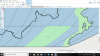
and my contribution
Thanks for improving those thick black outlines. I use Microsoft paint, so my artwork can be a little shabby.
We see them on our maps, so yes i thinkCan we leave the Deltas? Those things don’t grow on trees, you know.
Here is some work I did in the southern continent. The colors may not exactly match up, however. What are the hex codes we are working with?

")
Deleted member 108228
any raster editing software (MS Paint, Paint.NET, etc...)
For Paint.NET how do you do the fill without the blur and the border color change?ATTACH=full]395180[/ATTACH]
Attachments
You can disable anti-aliasing by clicking on the button depicting a curve along the top (to the right of the "sampling" option and the left of the Erlenmeyer flask for blend mode).For Paint.NET how do you do the fill without the blur and the border color change?ATTACH=full]395180[/ATTACH]
Added to the North-western area and to the Southern continent
Not sure where the dark pixels on the southern river on the main continent came from. I didn't touch that area.
Who ever goes next could you remove it?

Not sure where the dark pixels on the southern river on the main continent came from. I didn't touch that area.
Who ever goes next could you remove it?
Added some lakes to the Rental Continent. That continent's interior is going to be DRY, as in a large desert like does of the Steppes. The mountain effect along with the tendency for deserts to form at the 35 degrees N and S latitude will make the interior one big desert, hence the lakes, oasis, and partially forming rift valley.
Share: