resources:us_state_election_maps
Table of Contents
US State Election Maps
Maps depicting elections for state legislatures and so on in U.S. states (covering the last election before November 2014, so usually either 2012 or 2010). Need to split these based on year.
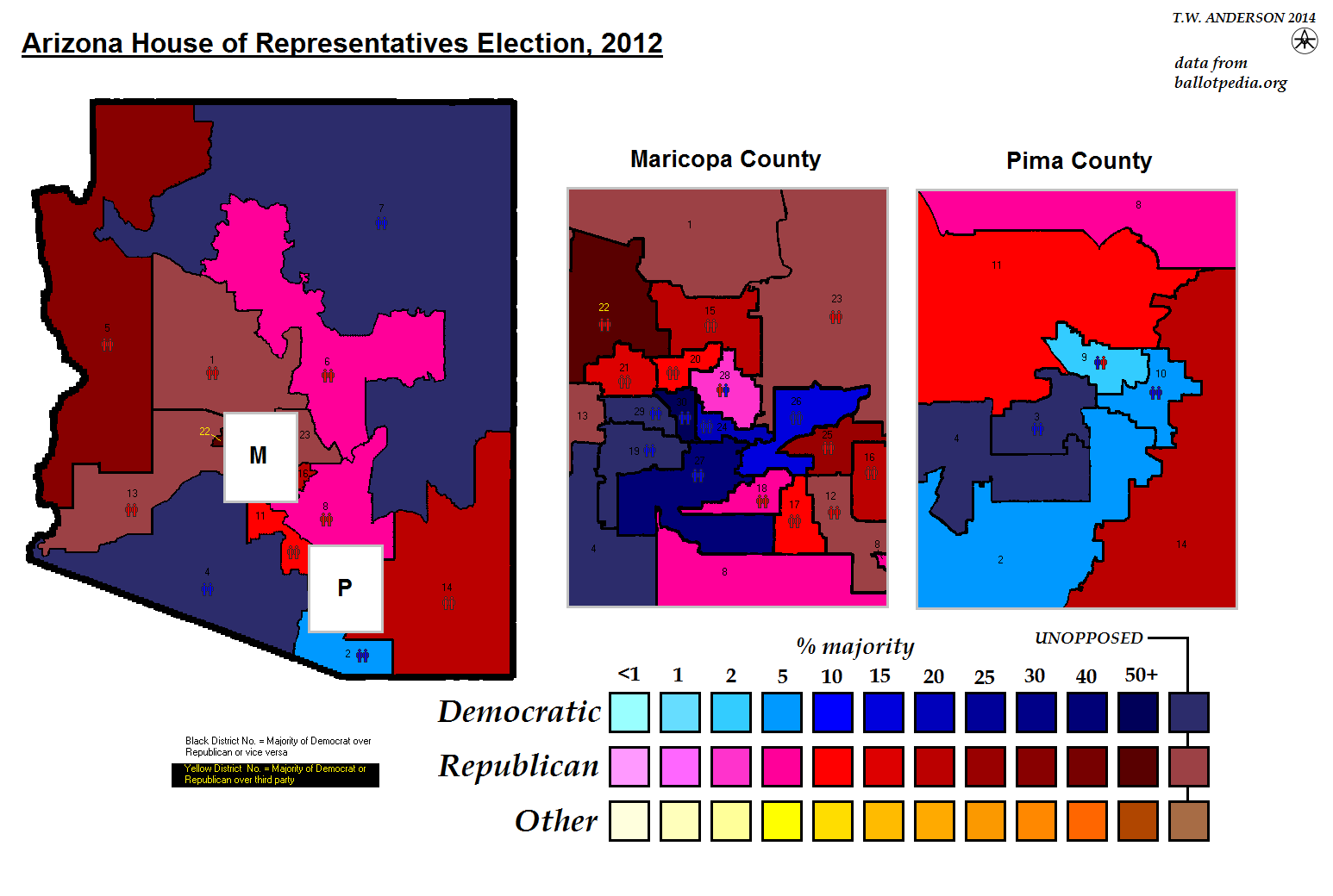
Arizona House of Representatives Election, 2012
Arizona State Senate Election, 2012
Arkansas House of Representatives Election, 2012
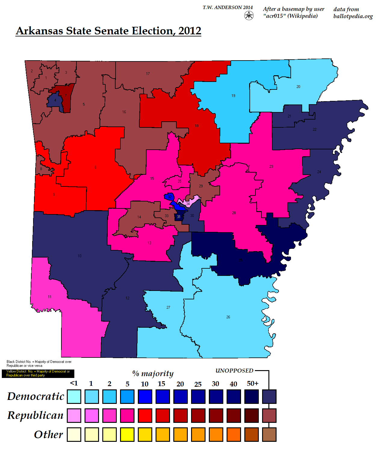
Arkansas State Senate, 2012
Colorado House of Representatives Election, 2012
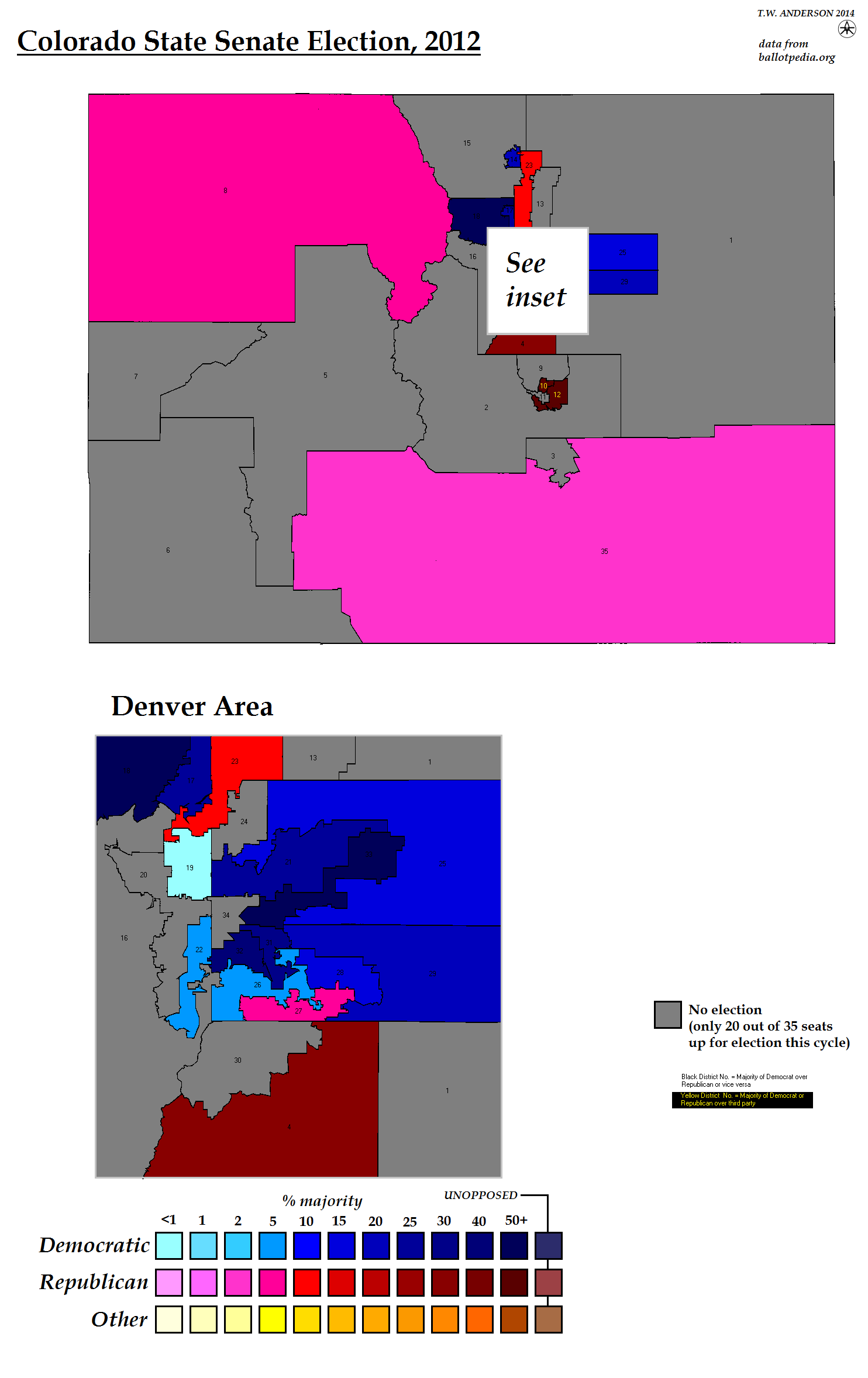
Colorado State Senate Election, 2012
Delaware House of Representatives Election, 2012
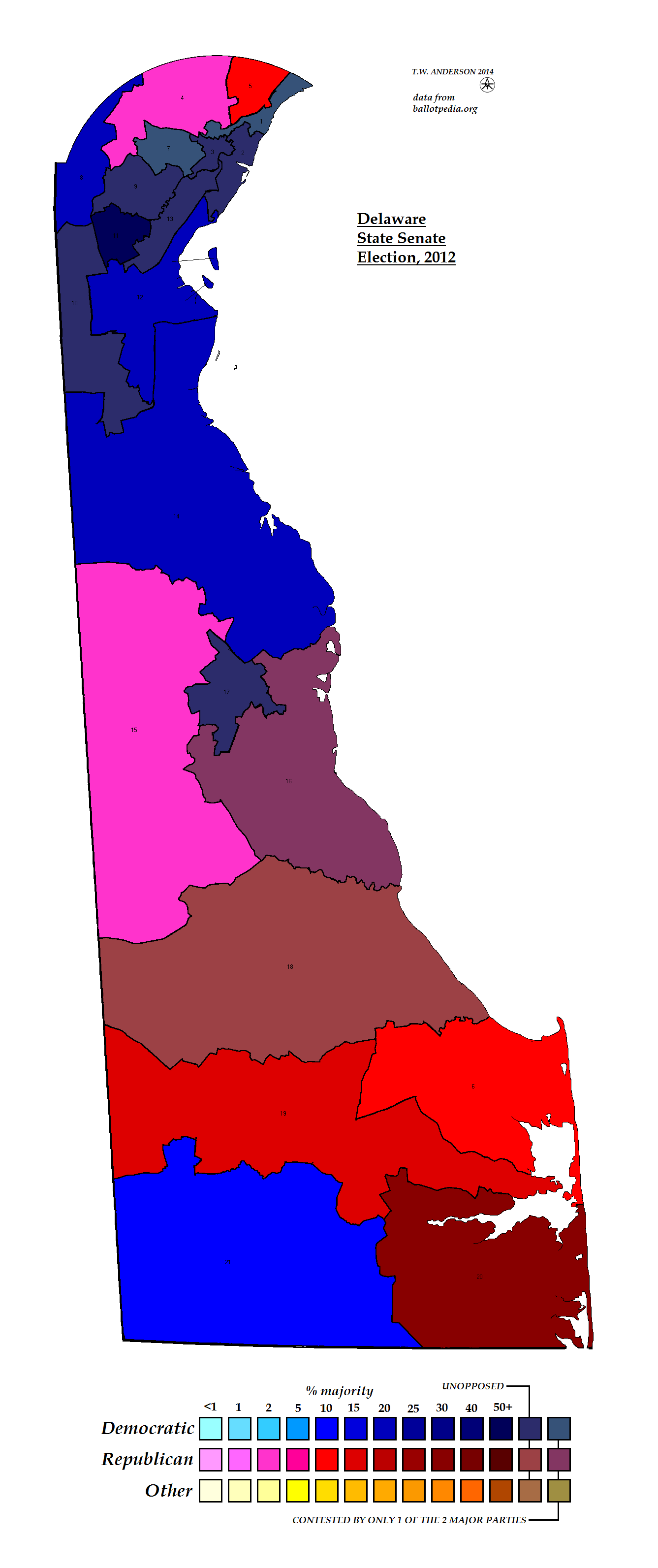
Delaware State Senate Election, 2012
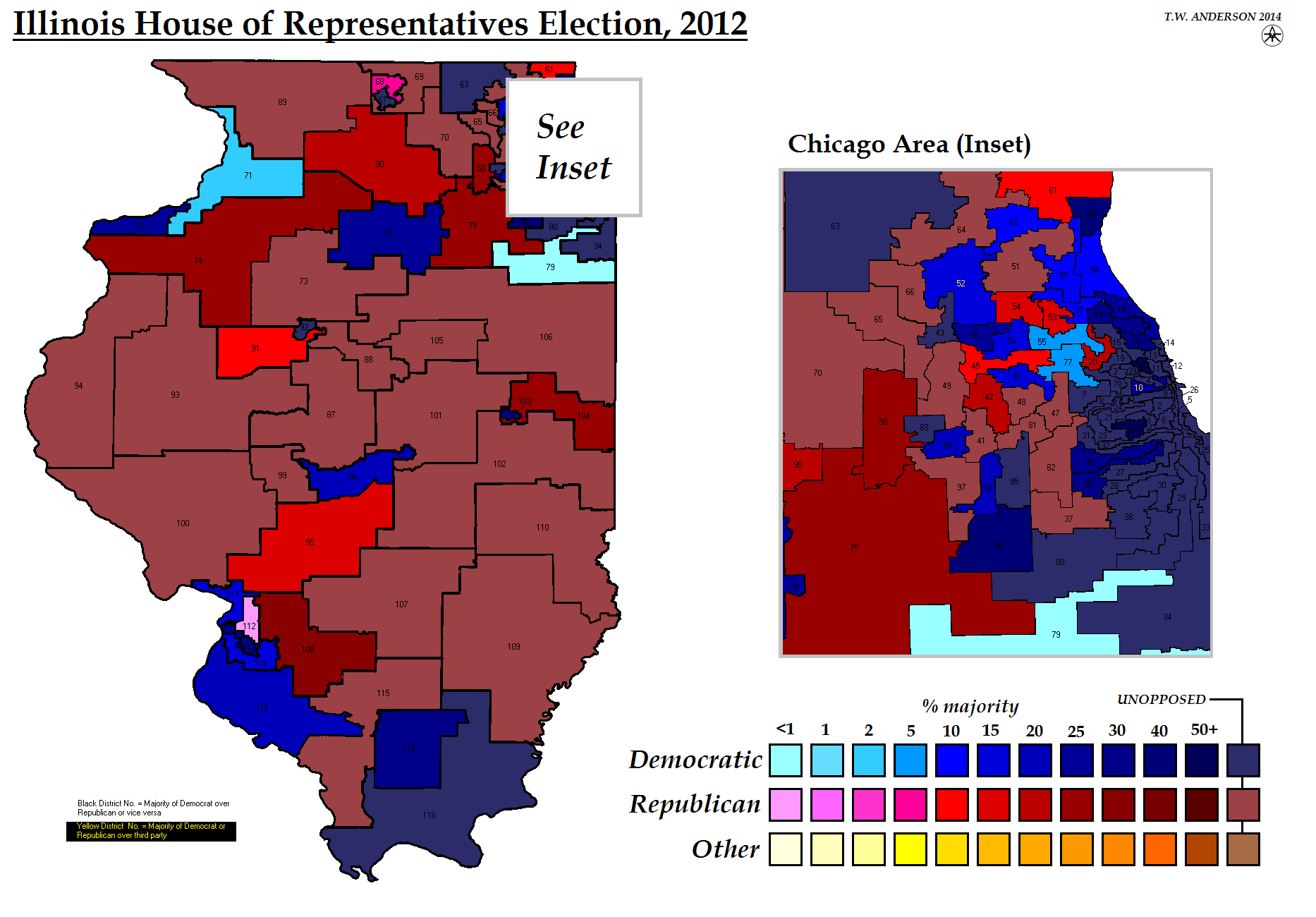
Illinois House of Representatives Election, 2012
Illinois State Senate Election, 2012
Iowa House of Representatives Election, 2012
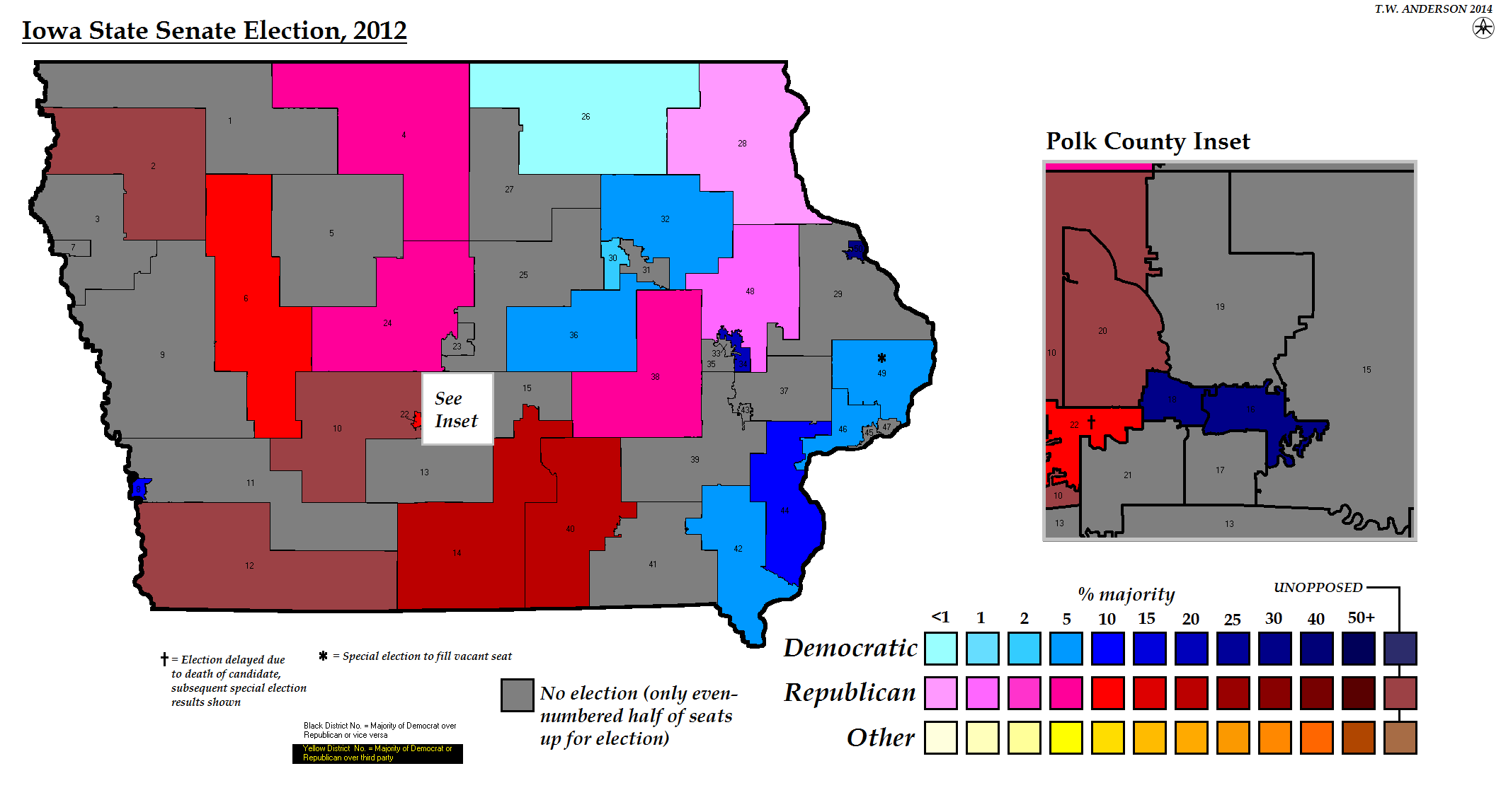
Iowa State Senate Election, 2012
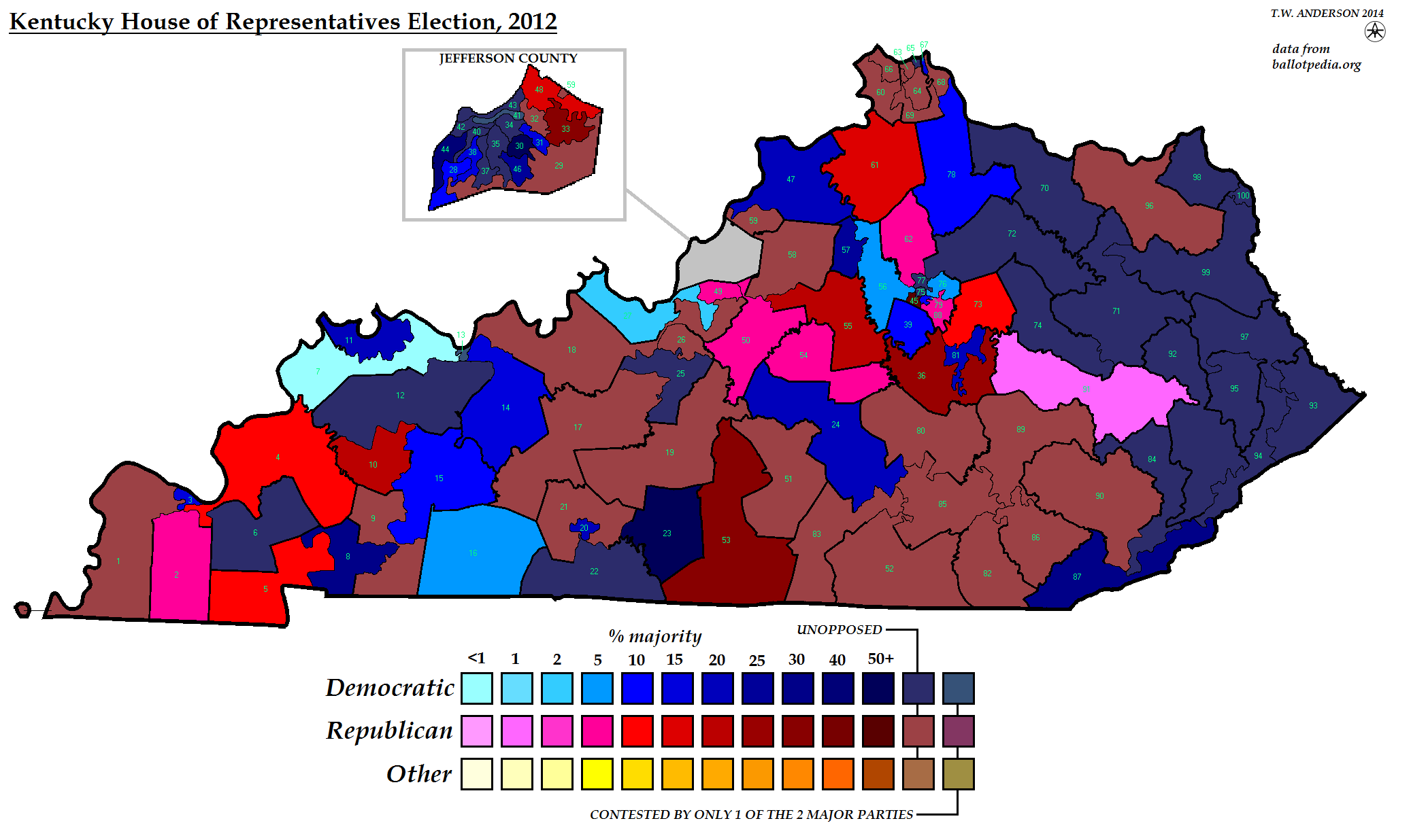
Kentucky House of Representatives Election, 2012
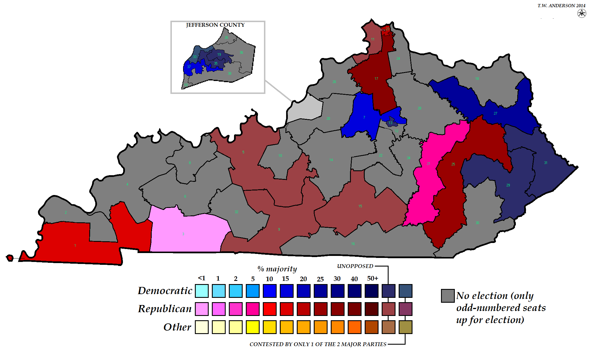
Kentucky State Senate Election, 2012
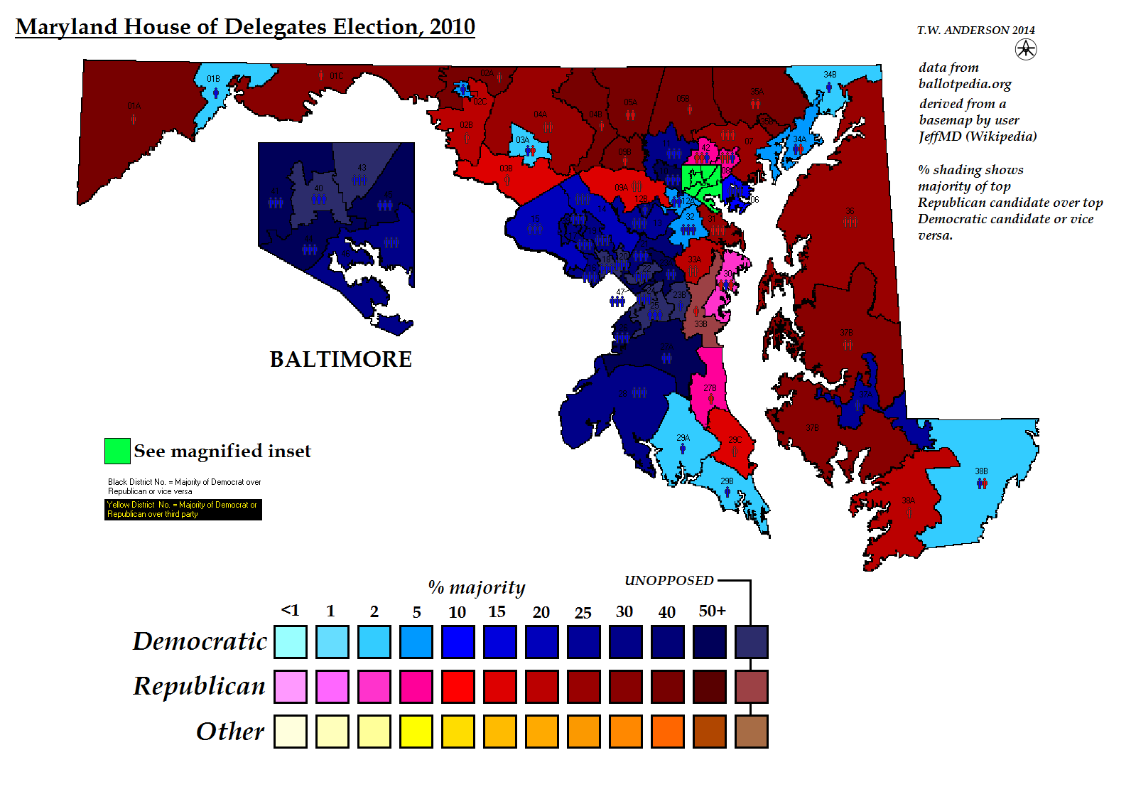
Maryland House of Delegates Election, 2010
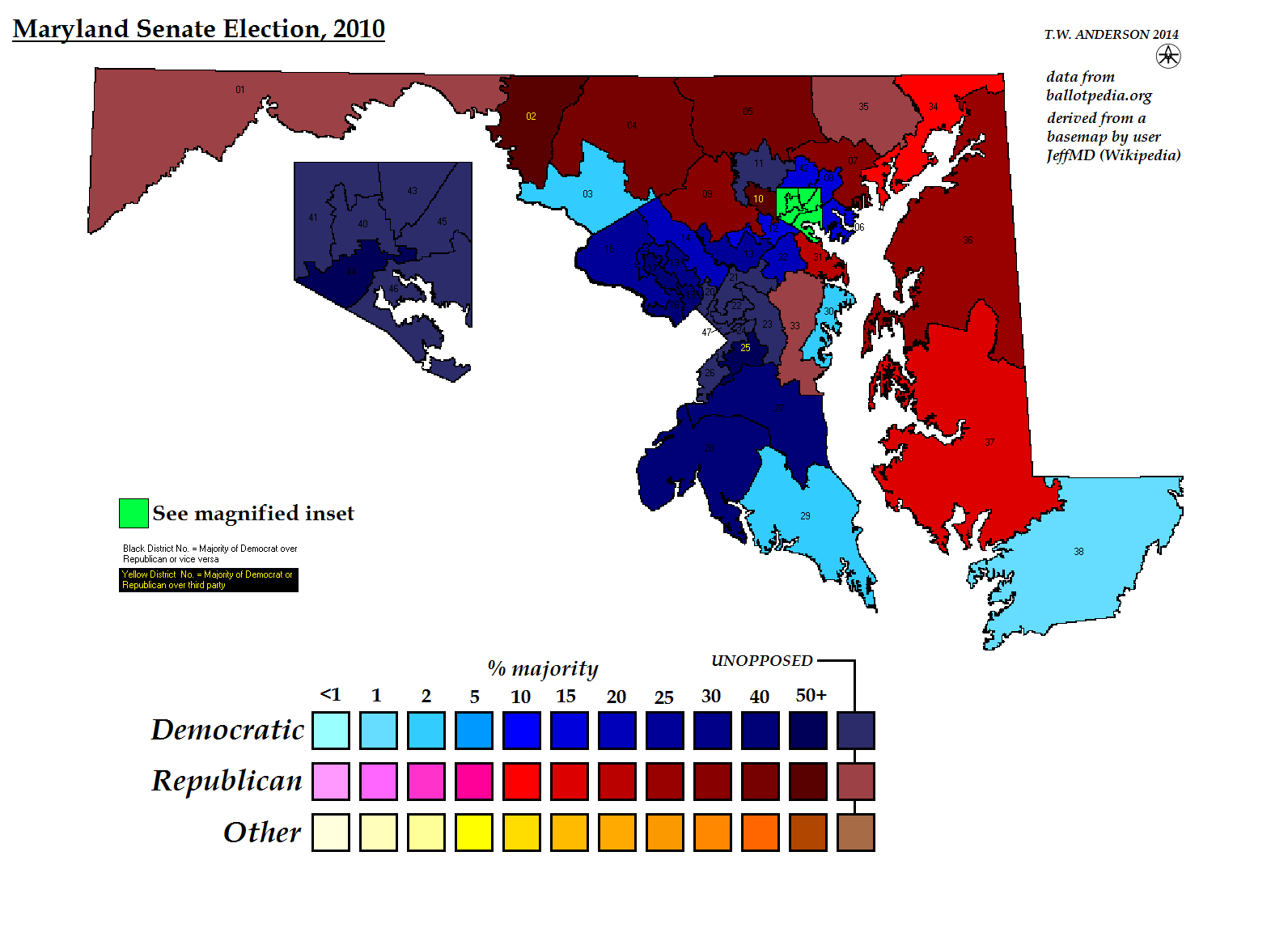
Maryland State Senate Election, 2010
Massachusetts House of Representatives Election, 2012
Massachusetts State Senate Election, 2012
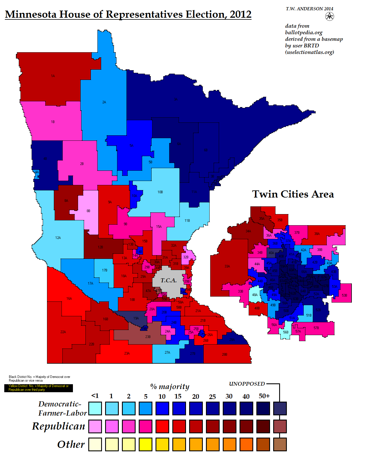
Minnesota House of Representatives Election, 2012
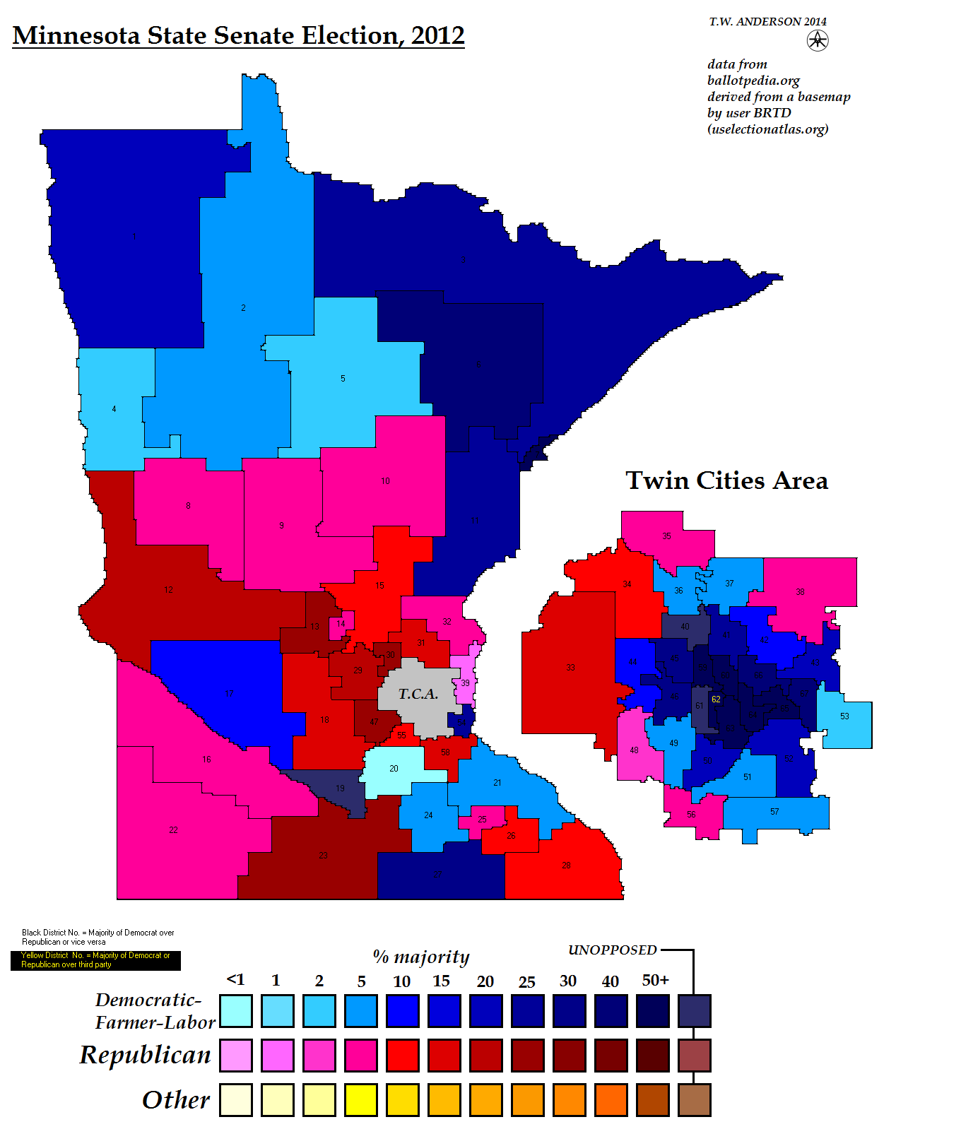
Minnesota State Senate Election, 2012
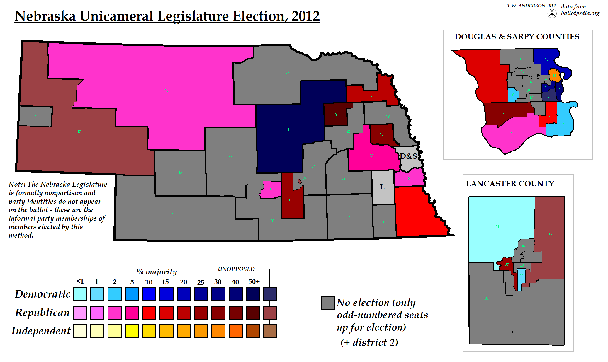
Nebraska Unicameral Legislature Election, 2012
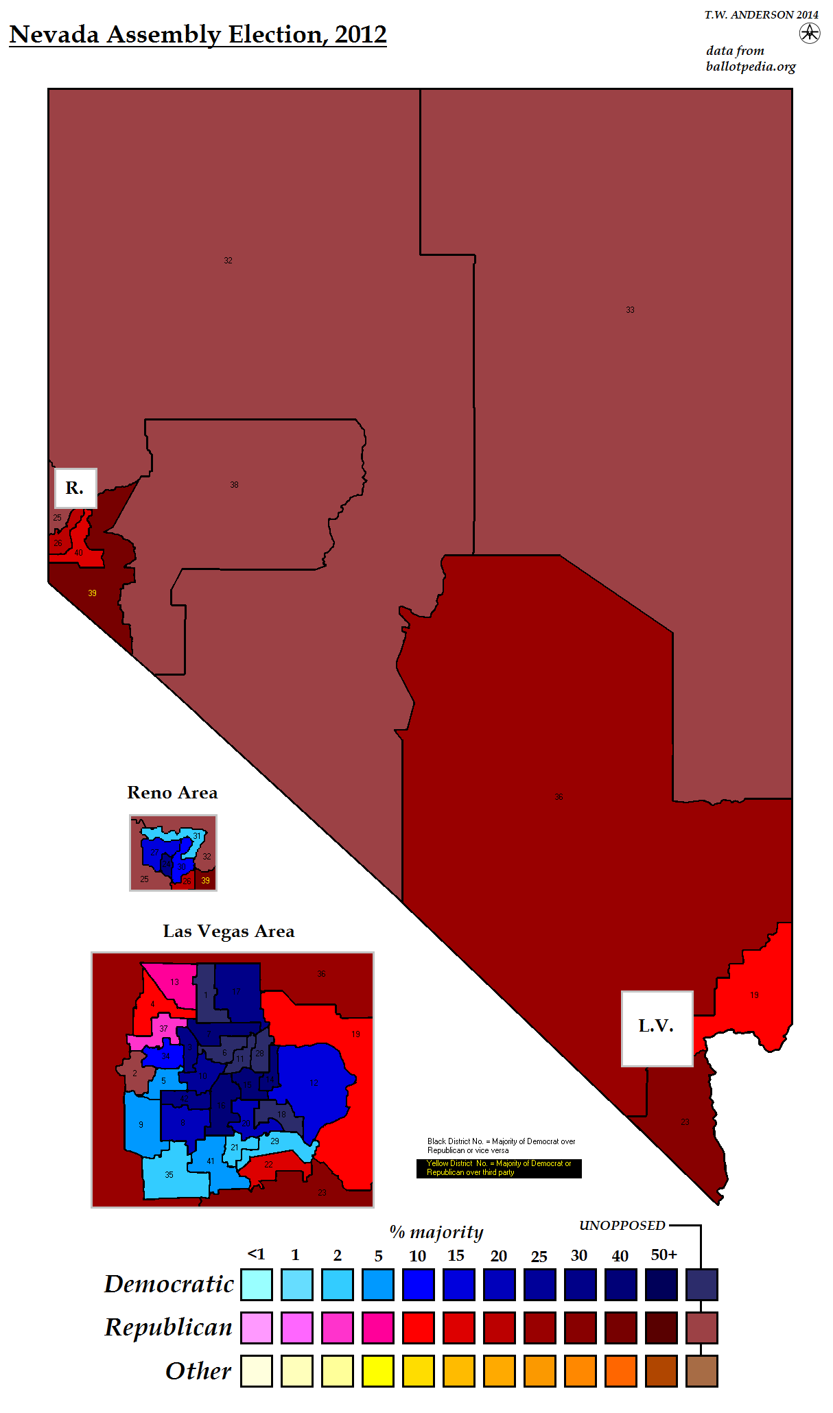
Nevada Assembly Election, 2012
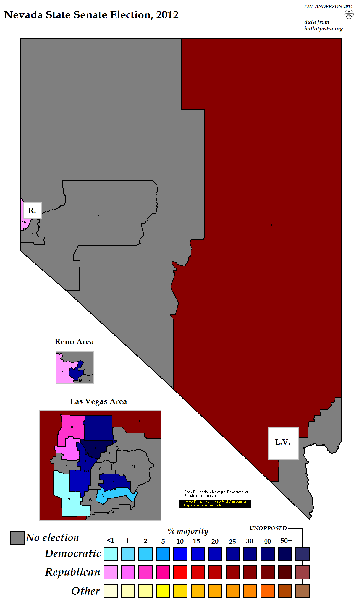
Nevada State Senate Election, 2012
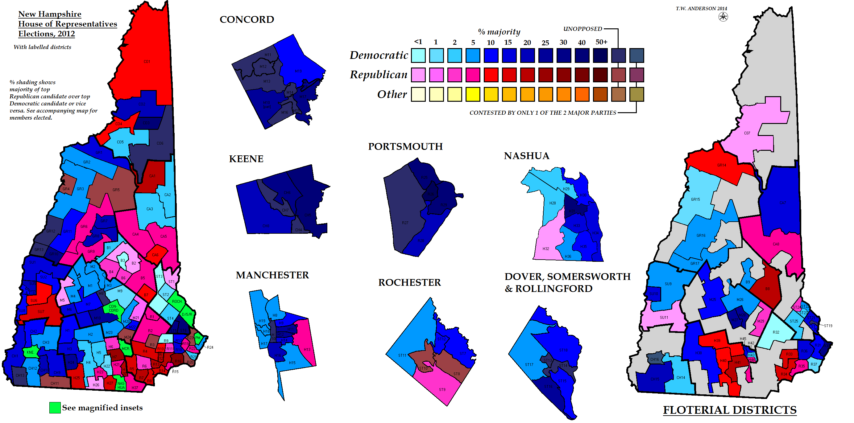
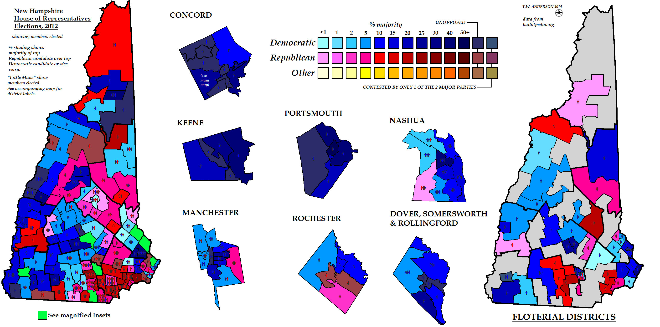
New Hampshire House of Representatives Election, 2012
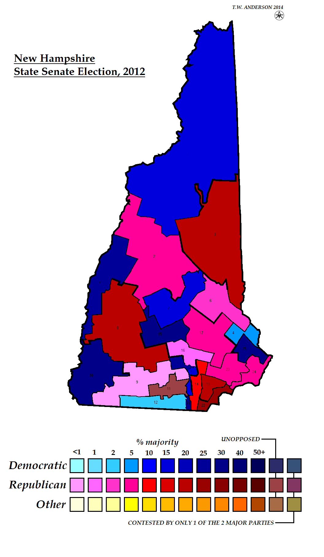
New Hampshire State Senate Election, 2012
New Hampshire Executive Council Election, 2012
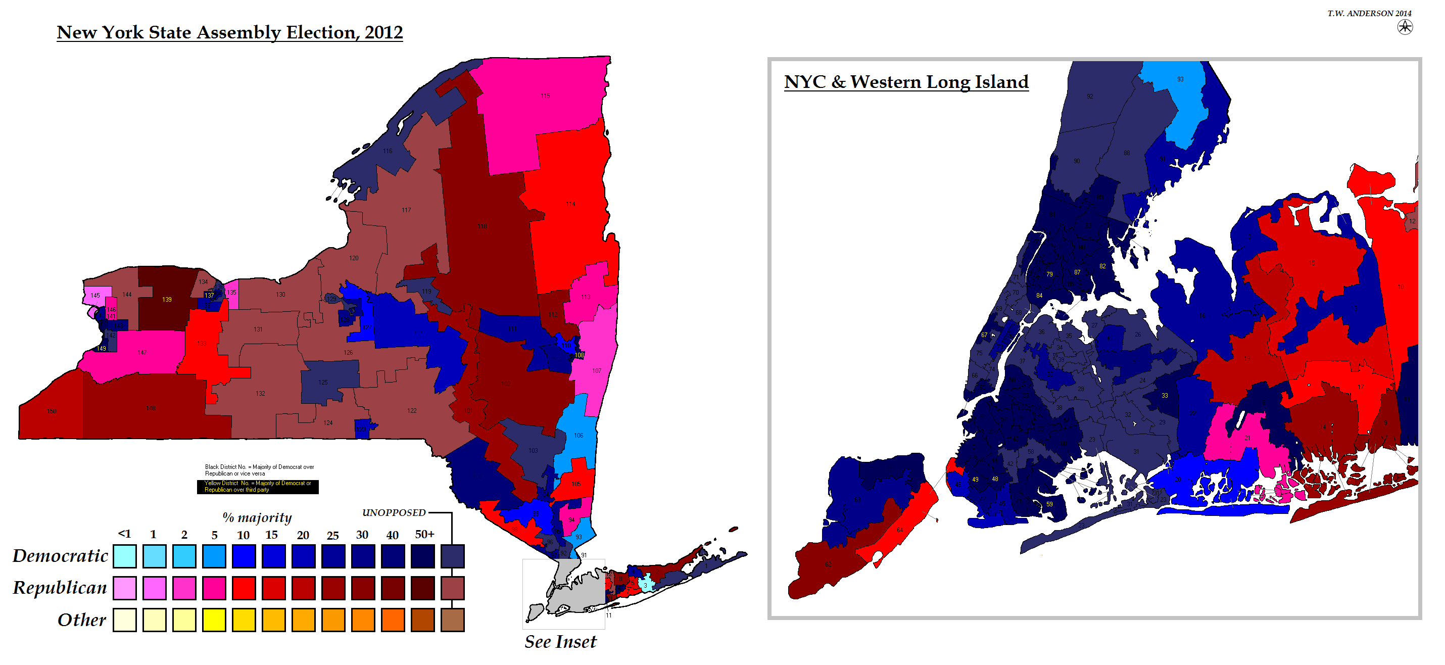
New York State Assembly Election, 2012
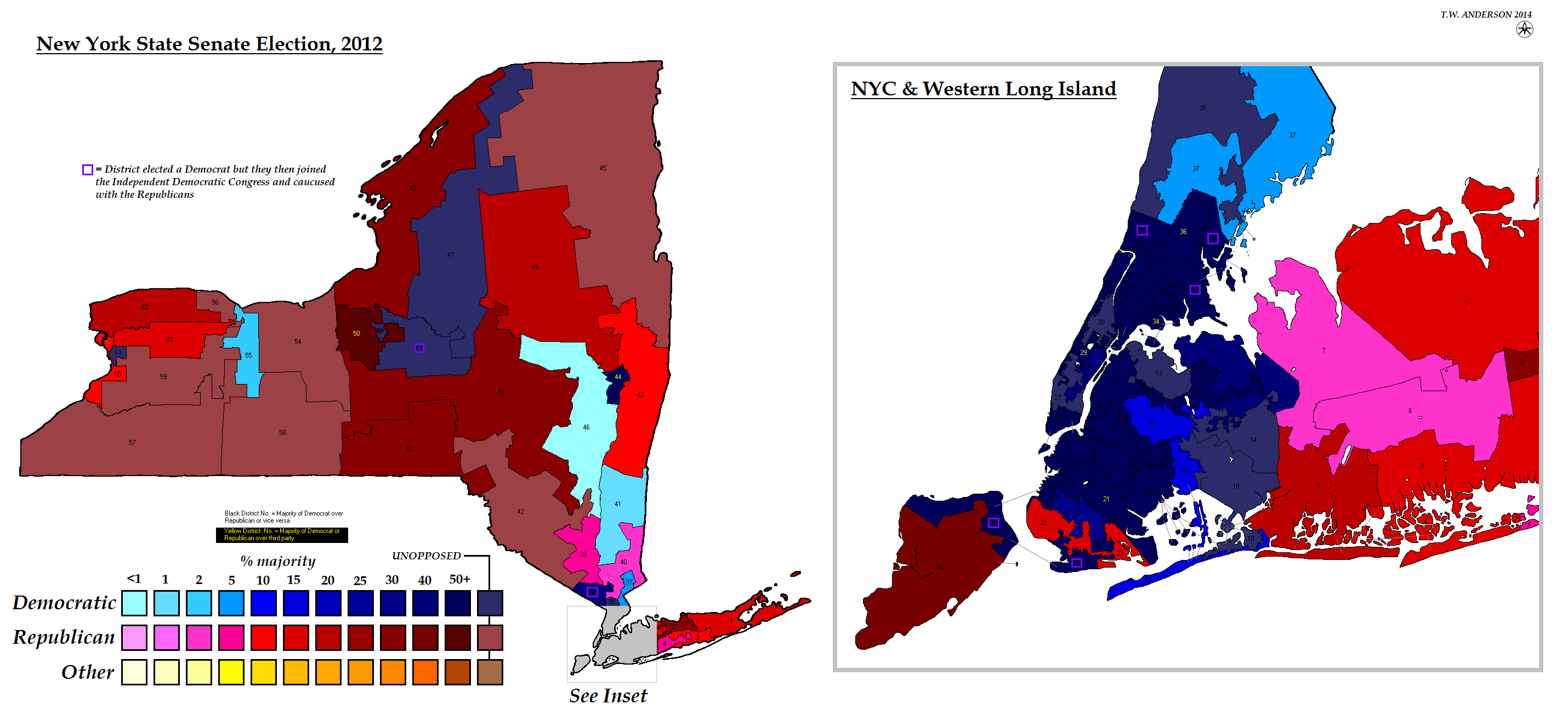
New York State Senate Election, 2012
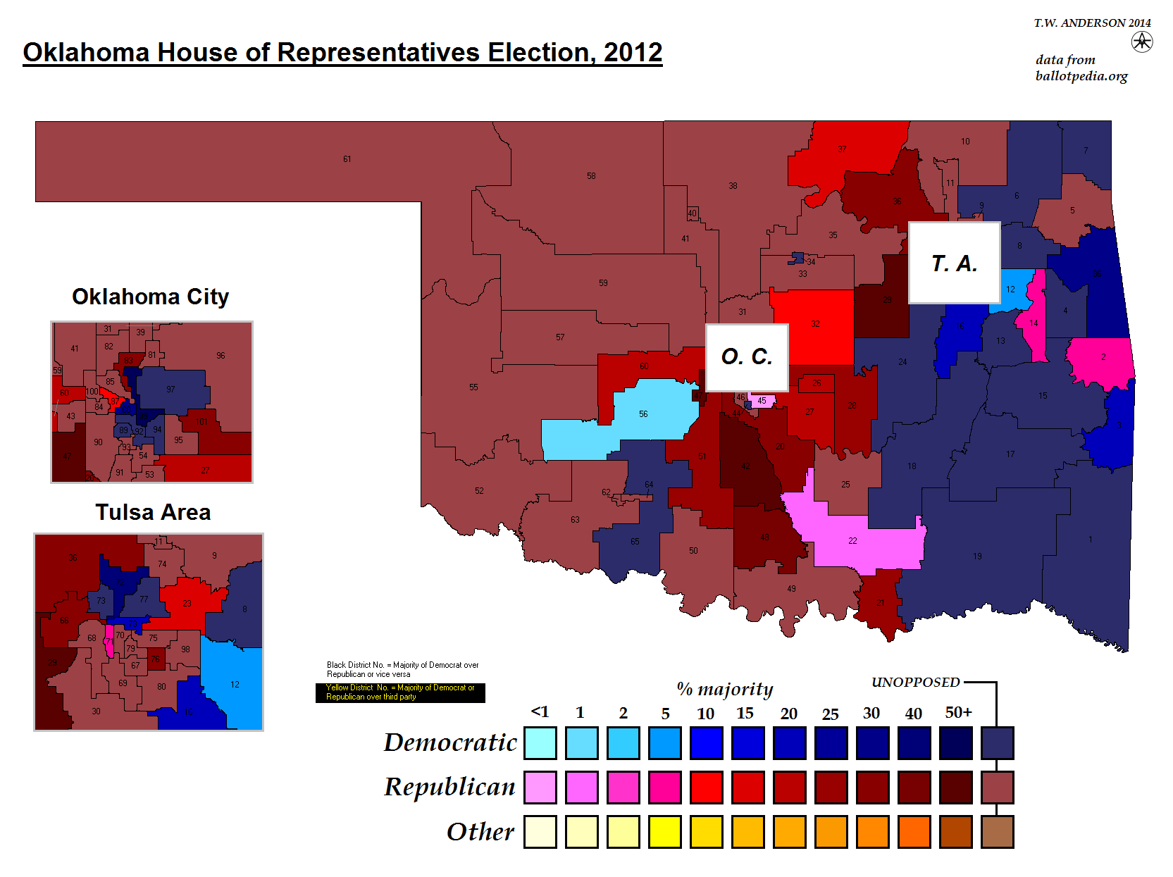
Oklahoma House of Representatives Election, 2012
Oklahoma State Senate Election, 2012
Utah House of Representatives Election, 2012
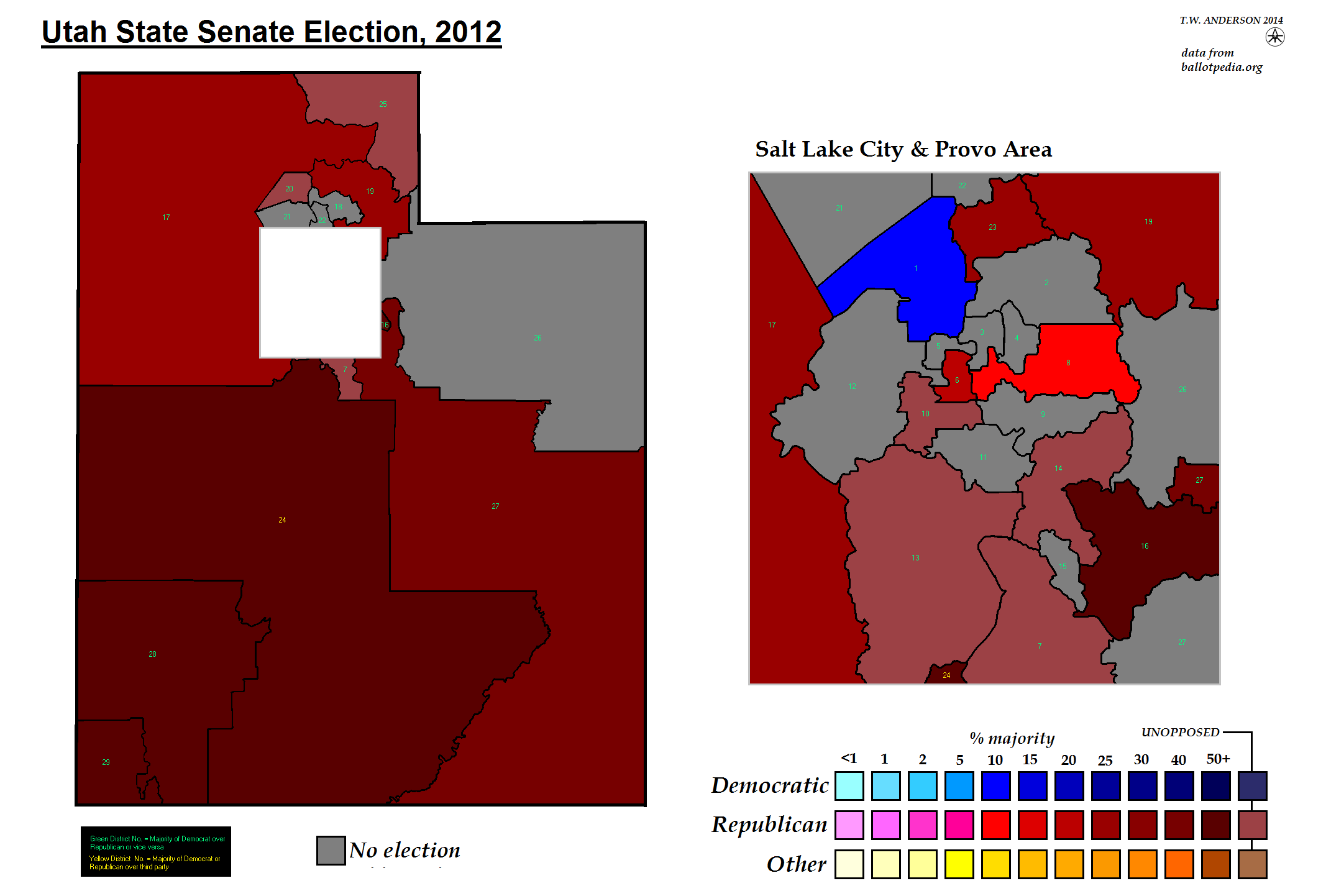
Utah State Senate Election, 2012
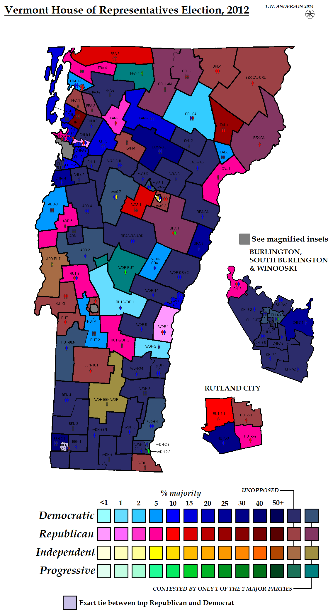
Vermont House of Representatives Election, 2012
Vermont State Senate Election, 2012
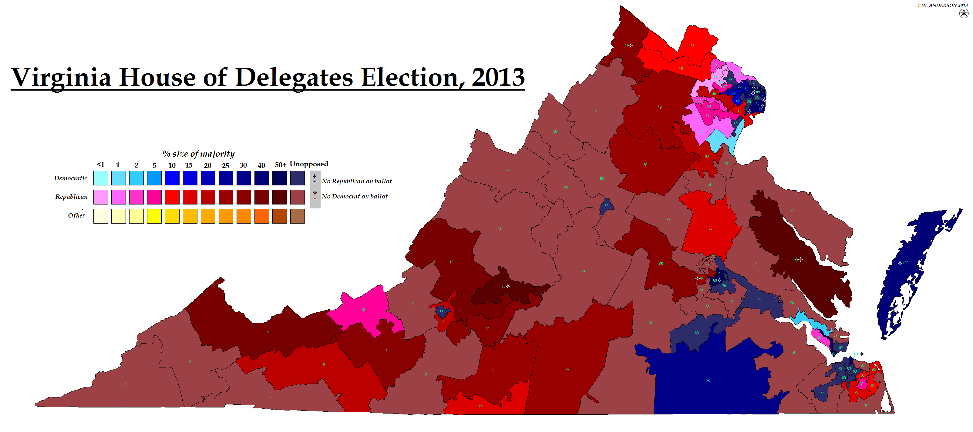
Virginia House of Delegates Election, 2013
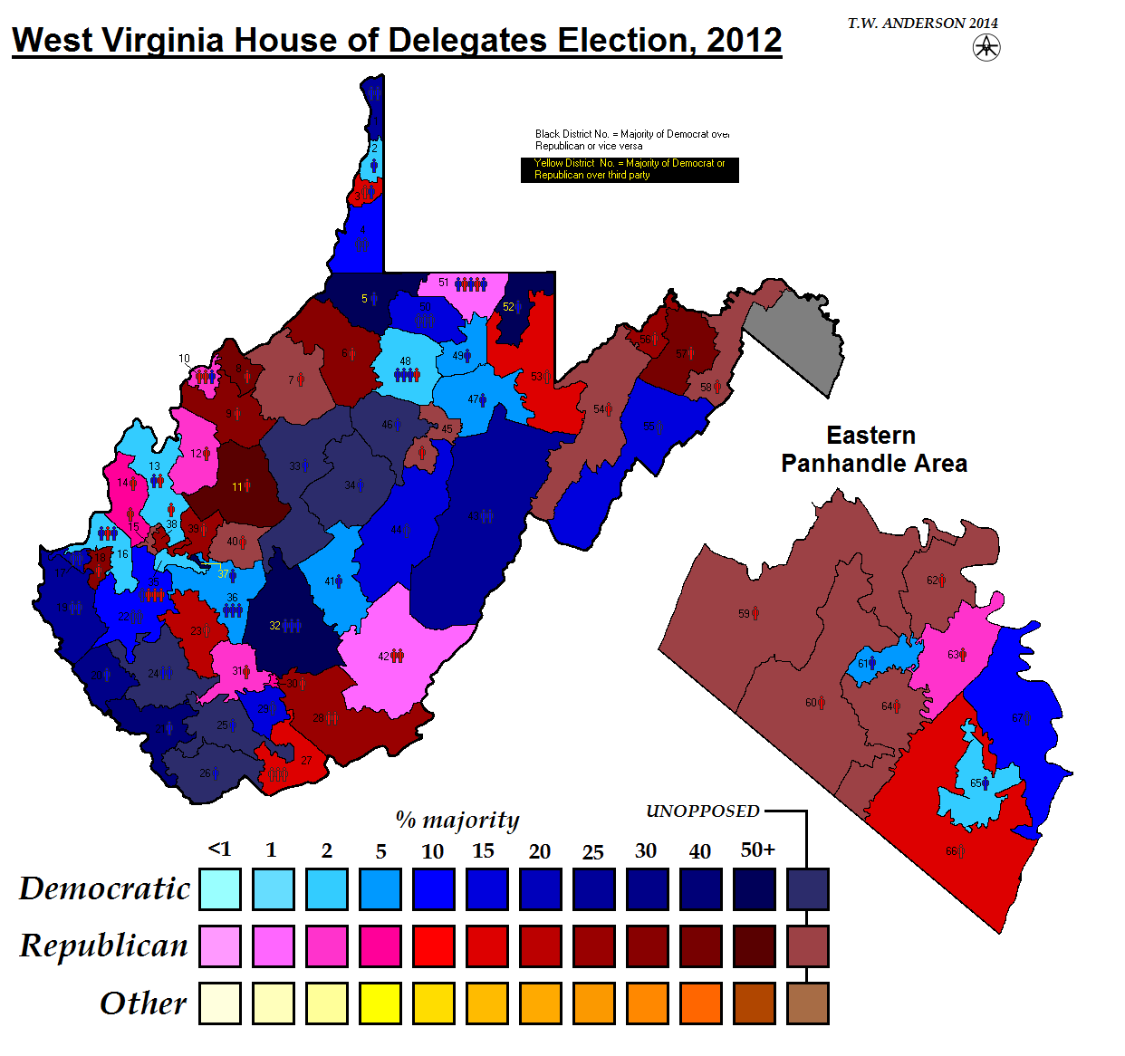
West Virginia House of Delegates Election, 2012
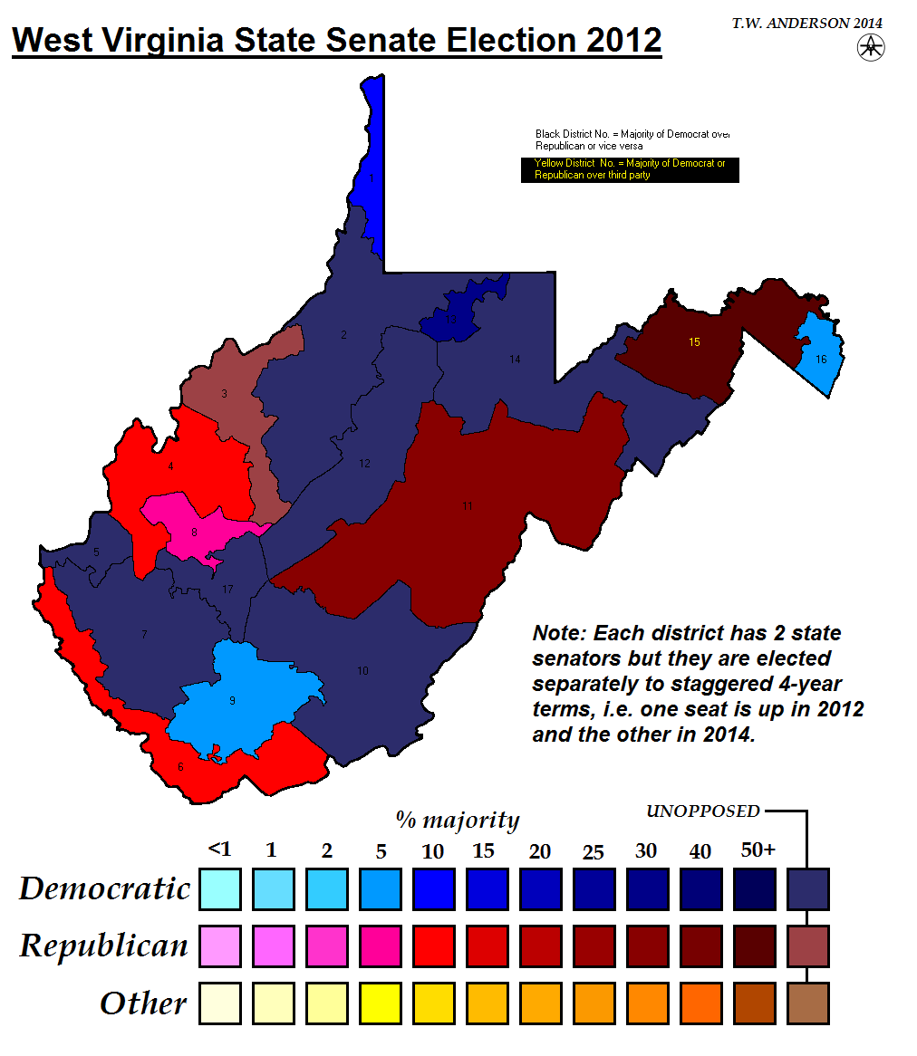
West Virginia State Senate Election, 2012
resources/us_state_election_maps.txt · Last modified: 2019/03/29 15:13 by 127.0.0.1

