You are using an out of date browser. It may not display this or other websites correctly.
You should upgrade or use an alternative browser.
You should upgrade or use an alternative browser.
The XK-BAM map series
- Thread starter Klime
- Start date
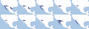
This is actually promising! Finally i wont have to use those maps from the tibet server.Progress on 1836
View attachment 682142
Thank you!This is actually promising! Finally i wont have to use those maps from the tibet server.
Full 1836 map progress so far (added Hungarian counties)
To highlight my process for the Hungarian counties as an example, I used maps from ~1780 and ~1880, and then researched the changes between those maps.
View attachment 1634822381180.png
A "patch" (well, maybe not actually a patch) of all OTL 2021 French territories (except for French Antarctica). Slots nicely over the 8K-BAM map (if it doesn't for some reason, the blob in the middle is mainland France and Corsica.
Spots where the solid line breaks off into dots (as in multiple dots) are major landmasses like the Americas or the Indonesian Archipelago.
Started the Russian Empire governorates (1836), made Taurida and Bessarabia governorates.
Russia controlled Danube Delta according to 1829 Adrianople Treaty.Started the Russian Empire governorates (1836), made Taurida and Bessarabia governorates.
Thank youRussia controlled Danube Delta according to 1829 Adrianople Treaty.
Why does the 8K has complete administrative divisions to all European countries except Romania and North Macedonia?Found a good image to use as a reference for Romania's officially missing LAU 1 level of administative divisions. It doesn't line up perfectly with municipality borders, but it's workable.
View attachment 609529
I don't know about North Macedonia, considering most of its internal borders are simply miscolored, but for Romania I can say for certain it's representation on the map is too small to look like anything but a grey blotch, if its smallest administrative units were to be drawn. Consider that the country goes straight from counties to communes, 2686 in total, without passing through municipalities as far as its internal structure is concerned.Why does the 8K has complete administrative divisions to all European countries except Romania and North Macedonia?
There was, but as of the time of writing this (5 Nov 2021), it's not complete, and only North America and Europe are complete (the rest of the world only has the most major rivers).Is there a 8k-bam map with only rivers?
Hello, im new here. Has enyone made ww2 borders for this map? I think its made in QGIS and there are shapefiles for them. Theres a thread for them here: https://www.alternatehistory.com/forum/threads/historical-gis-resources-thread.516971/
Thanks
Thanks
Share: