Of course, there is also the Website-That-Which-Must-Not-Be-Named, a mine for opinionated, blatantly shoddy bordered, anachronic carthographies. It's kind of sad because, obviously, the author did searched a lot to find cultural and polities not usually depicted (and to be fair, I do use these maps to search for these as well), but...it's simply too poorly executed.
You are using an out of date browser. It may not display this or other websites correctly.
You should upgrade or use an alternative browser.
You should upgrade or use an alternative browser.
Return of Horrible Educational Maps
- Thread starter Westphalian
- Start date
Nikan State is the most superior alternativeI don't know why, but it makes me irrationally angry when people call the Qing Dynasty "the Manchu Dynasty/Empire".

You get an empire, YOU get an empire, YOU get an empire! Except you, Japan. You're just a shogunate.
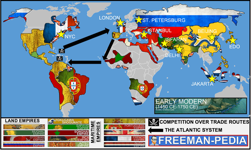
Also what kind of moron says 'Manchu Empire'?
French Guiana doesn't exist.Jakarta was called Batavia before its independence and it wasn't even founded when the Songhai were around. Russia colonized Alaska after the Incas fell. The Mughal empire started to look like that after the American revolution. I don't know who made this but I'm sure he got a lot more wrong.
Bonus points for warship picture stolen from Age of Empires 3.You get an empire, YOU get an empire, YOU get an empire! Except you, Japan. You're just a shogunate.
Also what kind of moron says 'Manchu Empire'?
D. Trump?
Has this been posted yet? Can someone tell me who thought this was a good idea?
Barry Bull
Donor
Don't forget occupation of india through the Himalayans.
Plus, the China all the way to the Aral Sea
Well, the light orange part can roughly be translated as "area of unstable Chinese Sphere of Influence" and the purple part is the Tibetan Empire, so it is not that bad. . and Whether the Tang internal administration borders are period appropriate or not is beyond my knowledge. Interestingly, the small map at the lower left corner does not show any occupation of India and Tibetan Empire.
@LSCatilina
Up to Aral Sea, the question is less about Chinese influence being stable or not, but actually existing.Well, the light orange part can roughly be translated as "area of unstable Chinese Sphere of Influence"
At the height of T'Ang control over Central Asia, safe the Tarim basin and Ferghana, you didn't have much regions of entities that can be considered part of the Chinese Sphere, unstable or not, especially regions we know having been rather under Sassanian influence, and more or less important Arabo-Islamic control.
It's a Tibetan Empire that shrinked after being washed? Because even assuming this is an anachronical map displaying all regions that T'Ang controlled, influenced, wished they had, told everyone that their Canadian girlfriend was going to carry with them when she'll come just you see...and the purple part is the Tibetan Empire, so it is not that bad...
At the very last, the southern Tarim basin and southern highlands should be depicted the same way as the eastern highlands of the Tibetan Empire were, a relatively temporary conquest.
Interestingly, the small map at the lower left corner does not show any occupation of India and Tibetan Empire./QUOTE]
Are we going to give a medal for that, tough? It looks like someone decided to depict every regions that was more or less (sometime not even this) related with T'Ang Empire as part of it or its "sphere of influence".
I don't think depicting Harsha's Empire not as part of the glorious stronk T'Ang Empire is that of an achievement, to be honest.
These issues makes me quite suspicious about the overall quality of the map, at least for what matters outer borders : maybe it's more accurate for what matter Corea, for instance, but would it be only the overblown Tarim basin...
Behold this pudgy nightmare.
What's next, Bandiaterra and/or Papers, Please?
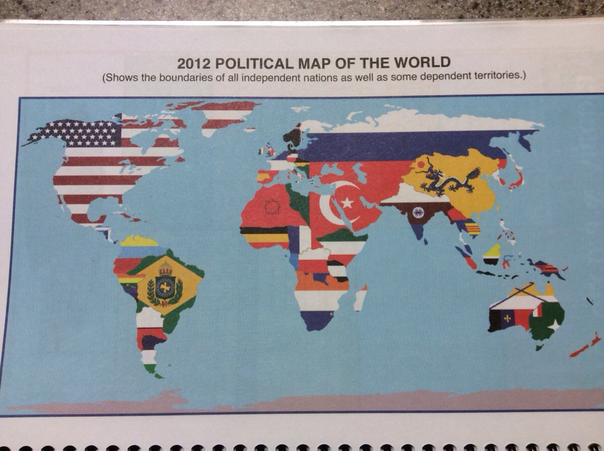
OMG TANZANIA IS PRUSSIA!!
also, TEENY TINY CRIMEA
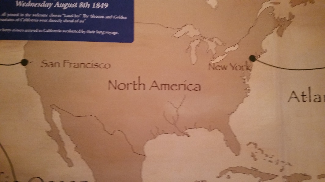
Depiction of the California gold rush features a slightly wanked America. Found in the Smithsonian Museum of American History. Really the best you can do?
View attachment 337528
Depiction of the California gold rush features a slightly wanked America. Found in the Smithsonian Museum of American History. Really the best you can do?
Seems legit.
Depiction of the California gold rush features a slightly wanked America. Found in the Smithsonian Museum of American History. Really the best you can do?
Not many rivers here, apparently.
And the Maritimes look really weird for some reason.Not many rivers here, apparently.
The border's missing.And the Maritimes look really weird for some reason.
What's next, Bandiaterra and/or Papers, Please?
OMG TANZANIA IS PRUSSIA!!
also, TEENY TINY CRIMEA
Crimea actually looks normal for its size. The Falklands, on the other hand...

Just because Sacramento is misspelled and Boise is too far west...Shamelessly stolen from Imgur.
Yes, those are the only things wrong with this map...Just because Sacramento is misspelled and Boise is too far west...
Share: