You are using an out of date browser. It may not display this or other websites correctly.
You should upgrade or use an alternative browser.
You should upgrade or use an alternative browser.
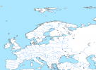
You have a version that shows the administrative divisions in Austria-Hungary?9View attachment 564073
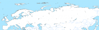
I had time to kill so I made a 5K Map of Europe in 1914
I don'tYou have a version that shows the administrative divisions in Austria-Hungary?9
Republic of China provinces, 1924.
Decided to do a major remaster now that I have new material from mastering QGIS.
ROC provinces in 1948

qazse
Gone Fishin'
View attachment 663398
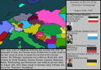
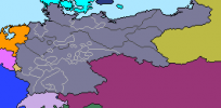
Europe in Kaiserreich, 1936
- Ireland should be independent.
- Don-Kuban and Persia should not be part of Russia.
- Montenegro should be part of Illyria.
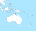
Why is the Guanabara State of Brazil represented? It was made extinct in 1975, also for some reason Guanabara Bay isn't represented despite being large enough to see at this scaleView attachment 474740
update on the administrative map, an effort by various people has led to the USA counties being almost complete. Green areas have been claimed by a fella, but the white areas are open to claiming for second level administrative borders.

In Spain, Cantabria and Basque Country seem to be fusedfirst level subdivisions 100% done now ok, thanks vatican city
2 year old post but for the record this isn't entirely correct. The Anhui-Jiangsu border is wrong, Xikang shouldn't include Ningyuan and Ya'an in 1924 (and it's wrong for post-1939 too), Shandong-Zhili border is wrong, Yunnan northern border is wrong, and in 1924 Gansu should include Xining. I might make a map with fixes.View attachment 663356
Republic of China provinces, 1924.
Decided to do a major remaster now that I have new material from mastering QGIS.
View attachment 663357
ROC provinces in 1948
Hey original author of the thread here, I just thought that id clarify (in case it wasn't entirely obvious lmfao) that I've fully dropped this project and probably won't come back to it either, as I prefer the 8k and 16k bams to this. Feel free to update this on your own time if you want, and I also might add some threadmarks to map/historical patches if enough get made, but beyond that, I don't really want to bother with this anymore.
It's not canceled, I'm just probably not going to be working on it ever again. Anyone else can feel free to make patches or maps with it if they wantHE CAME BACK
Also aw man (no 5K-BAM?)
Share: