Map Thread XX

Status
Not open for further replies.
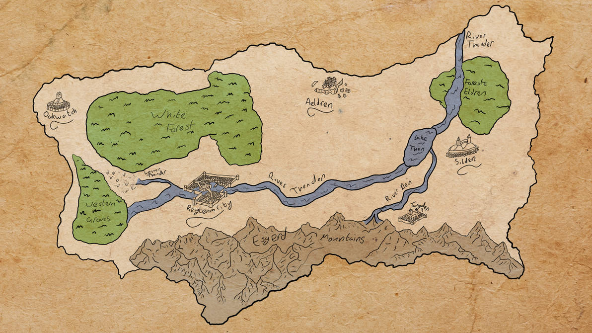
To celebrate the soon to be closed XX thread, the first I properly interacted with, I present the first map I drew on a computer. It's about 7 or so years old and looks absolutely awful so to end this thread for me I thought I'd show where I started so the XXI can show where I am currently.

map_of_celdair_by_kinglarthur_dewop6o-pre.jpg
 
I meant Lunigiana. Often maps don’t bother showing all the small things as, unlike with San Marino and Benedetto, there was so many other small states early that there wouldn’t be room for have of them to get a single pixel, if we went with most of the maps on here. Mapwise it is al,ost like Thuringia, though in this case I don’t think it is because of families dividing their territory among their kids. Lucca had no real land in the part of Lunigiana you gave them, but it might work to an extent if they are given overlordship in exchange for the Luccans giving up their own enclaves so the Habsburgs got unimpeded access to the coast for Modena. Though it doesn’t look like they have it there... Well, the satellites innthe area are all the same color anyways. Possible the revolutions sweep aside Lucca and Genoa anyways, though if they survived this long they might have strong enough local identity to not want to be swallowed up by the other Italians.

The term applies to a wider area https://en.wikipedia.org/wiki/Lunigiana , although I suppose it might be used for a more specific area, as this map of Italy from 1499 https://upload.wikimedia.org/wikipedia/commons/4/4a/Italy_in_1499.png and, yes, Lucca is not shown as owning that particular version of "Lunigiana". In my defense it was shown in these , and, as I said, I only have so much time to research these maps, especially when verifying fine historical detail on the internet is like stumbling blindfolded through the Turd Museum with your arms out, in hopes of putting your hands on a diamond . Let's just call it another ministate. I will admit I should have given Massa to Habsburg Parma to give it some coastline.

(I'm fine with suggestions on how to improve my maps, but I find your responses a little hectoring, a little "why did you miss this obvious thing." Perhaps I'm oversensitive - I have been on some new medication lately, and it affects my mood.)
 
Last edited:
To celebrate the soon to be closed XX thread, the first I properly interacted with, I present the first map I drew on a computer.
On the same principle, though it's not quite the first...

I took someone's map of TL191 and tried to modify it for the CSA collapsing in WW1. The Germans then let the French keep some more territory, because they were alarmed by the blatant US expansionism. This probably does weird things to alliances post war. (Also the Yanks reconnected Baja to the rest of Mexico here.)

I was using Paint 3D at the time. That was a rougher experience for sure, which helps explain the minimal changes.

TL-191 1920 Total Collapse on the Southern Front .png
 
A lovely map. I was going to comment about the naming for New Granada and Colombia, but looking it up it seems the name of the area marked with 3 went back and forth a lot back then. I don’t see the expansion of Venezuela into Colombia to be practical (straight lines in the jungle or expansion on the coast around mountains) but I understand these are the sort of stuff needed to make a map interesting. I have to wonder if these changes came before or after the revolution. Was this revolt mentioned something that kept the whole thing from just being a Venezuelan empire? Did Ecuador breakaway here early on or simply never join? I also find it amusing to see Costa Rica has expanded territorially here, though I doubt it would be called a wank by even the slightest stretch of the imagination given it is going to be in the crosshairs of the Colombians and Americans- Wait. Mexico or just the Yucatán is American? Seems it has to be American, as the maps showing the revolts in Central America and Brazil means there would be no need to mention it otherwise. And... Ahhh, I just wonder what is happening with Peru. Is this map one in a series? I would like to give the others a look over, if so.
Wow! Thank you for the questions and feedback! To answer them quickly:

1. These changes happened before the revolution. I am pretty sure they are based on something in OTL but I cant seem to find it.
2. The Revolts in the Yucatan are because of a Cold War-like scenario in the Americas, unless you are talking about something else.
3. Ecuador broke away early ITTL.
4. Costa Rica is part of something somewhat like a "Great Game", but over Central America
5. Yep! American Yucatan, maybe a little too cliche, but definitely fun.
6. Peru is undergoing a civil war, but to bee honest I didn't put that much thought into it.
7. This map is one in a series! I will be posting a new map soon (more in the style of the original series) and it will be including everything I've made so far. (as well as 2 or 3 nations more!)
 
Which parts of the world would you recommend for me for my Mosaic Earth, and when?

1944, IS 'mature' DRM, all the tropes are there, from global exhaustion to the birth of fascism. I advise you to consider an area without elves, like France+Germany or recolonised Eastern Europe, that would be an interesting culture clash.

The issue with brining along just a chunk of the front line is that the humans would be likely massacred quite quickly, everybody is too dependent on global, mutual support and even by 1944, things are pretty damn knife edge. The elves don't really need supply lines, so any massive disruption like an ISOT would be massively in their favour.

Your best bet would be the Iberian peninsula, its small and the Spanish forces are resilient but broadly isolated from the global supply chain, though that only means they would last a few months or maybe years before the Iberian Fey overwhelm them.
 
The term applies to a wider area https://en.wikipedia.org/wiki/Lunigiana , although I suppose it might be used for a more specific area, as this map of Italy from 1499 https://upload.wikimedia.org/wikipedia/commons/4/4a/Italy_in_1499.png and, yes, Lucca is not shown as owning that particular version of "Lunigiana". In my defense it was shown in these , and, as I said, I only have so much time to research these maps, especially when verifying fine historical detail on the internet is like stumbling blindfolded through the Turd Museum with your arms out, in hopes of putting your hands on a diamond . Let's just call it another ministate. I will admit I should have given Massa to Habsburg Parma to give it some coastline.

(I'm fine with suggestions on how to improve my maps, but I find your responses a little hectoring, a little "why did you miss this obvious thing." Perhaps I'm oversensitive - I have been on some new medication lately, and it affects my mood.)
My apologies if it came across that way. Part of why I look out for these little areas is because of all the exciting tidbits that tend to come with them. I only went into such great detail because I thought you thought I misspelled Lucca and figured I should clarify.
 
My apologies if it came across that way. Part of why I look out for these little areas is because of all the exciting tidbits that tend to come with them. I only went into such great detail because I thought you thought I misspelled Lucca and figured I should clarify.
Man, I'm almost as uncomfortable with people assuming that I have an elaborate explanation for everything as with people nitpicking on difficult details. It assumes too much from me. If the completion of a map is a fairly long time after I start it, I might not even know why some details are the way they are. When I said that was part of Lucca, I was making an assumption: I no longer recall whether I originally intended that to be Luccan territory or maybe just a rando independent mini-state because San Marino. :coldsweat:
 
To celebrate the soon to be closed XX thread, the first I properly interacted with, I present the first map I drew on a computer. It's about 7 or so years old and looks absolutely awful so to end this thread for me I thought I'd show where I started so the XXI can show where I am currently.
I love the style, great work!
 
Top
Status
Not open for further replies.
Top