Here is a blank ethnic map of the entire world, with political, linguistic and cultural factors also considered. I saw there weren't really any other maps like this around that I could find, so I decided someone would probably have some use for it.
You are using an out of date browser. It may not display this or other websites correctly.
You should upgrade or use an alternative browser.
You should upgrade or use an alternative browser.
A Blank Map Thread
- Thread starter Matt
- Start date


JJohnson
Banned
And there is 1926... View attachment 307669
That's the map style I've been looking for! Do you know of a version for 1914, 1938/39, one with Turkey and France's subdivisions, one with 'German Austria,' and one with the United States of Greater Austria on it? That would be very helpful for a timeline I'm writing up.
JJohnson
Banned
Super Euro-Bam with historical borders WORK IN PROGRESS

I started in Poland, drawing the eastern border of Germany of 1937. As you see, I am not done yet.
But I wanted to share my WiP with you. Enjoy.
Great map! Do you happen to have a version with German Austria's requested borders and 1871 Germany's borders? And perhaps the requested United States of German Austria?
Wait, how did you make this?After a few hours of fiddling on Gprojector and outlining on MS Paint, I have successfully transferred this Green Antarctica map onto worlda. Now you can add the Tslal to any timeline! Make them fight the Draka or something.
View attachment 309904
I have only 1939 and 1914 but without "the United States of Greater Austria"That's the map style I've been looking for! Do you know of a version for 1914, 1938/39, one with Turkey and France's subdivisions, one with 'German Austria,' and one with the United States of Greater Austria on it? That would be very helpful for a timeline I'm writing up.
Attachments
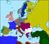
I have only 1939 and 1914 but without "the United States of Greater Austria"
This map is so cool because it forms France's flag in Sweden, Finland and Russia 's colors >.>
JJohnson
Banned
I have only 1939 and 1914 but without "the United States of Greater Austria"View attachment 321204
Those are great, thanks!! That's very helpful.
I'm going to try to edit those a little more together for a variant Europe with an East/West Poland, Basque Country, Roussillon back to Spain, Artois and Hainaut in a united Netherlands, Kurdistan and Greater Armenia, Greater Luxemburg (Belgian and Grand Duchy), a form of greater Greece; and then make a few edits thereafter.
I appreciate you posting that.
Sorry if this has been asked before, but I need a blank unterraformed Mars for a school project. Thank you!
Sorry if this has been asked before, but I need a blank unterraformed Mars for a school project. Thank you!
https://www.google.co.uk/search?q=n...fvuzTAhUmDcAKHYPiC3wQsAQIKw&biw=1600&bih=1057
(By alt-hist standard, a blank unterraformed mars map would be featureless land)
I would love to see one of these showing the Belgian and Luxembourgish occupation zones after the World Wars. Though it was a rather small window of time. Though a bit odd with Tangier. Did the French occupy it at this point in time to prevent the Germans form taking it during WWI? Though looking it up, it seems that it wasn't an international zone until several years after the war. Hmmm... Really do wonder what was going on there.And there is 1926... View attachment 307669
ISOT Questions
1] Our World
A] Why is it always our world that gets transferred to a "Virgin World"? What if an advanced state gets moved to our Earth?
B] What replaces the moved areas on our Earth? water? parts of Virgin Earth?
2] Virgin World
A] Why is the Virgin Earth the same as ours, what if its flooded?
B] Why is the alignment of Earth always the same as ours, the magnetic polarity of the planet is known to change, what if the Earth flipped so the South Pole is North?
C] What if one Virgin Earth is more susceptible to "receiving"?
D] Does it have to be Earth that receives? [Poland on Barsoom maybe]
3] States
A] Why do only states from one time move? What about states from various eras; Imperial Rome, Habsburg Lands from 1648, Spain 1492, Songhai etc etc.
B] Why do states always appear where they were on our Earth? The British Isles, for example, could appear in Africa or Siberia.
C] How about moving only certain sections of the populace;
a] Anyone with a certain ancestry-all Viking descendants for example [Rus, Normans, English, South Italians].
b] Anyone with black hair.
c] Believers in the Rapture move to Virgin Earth
d] etc etc
4] Other forms of ISOT
A] What about moving in time? WW1 Germany in the Modern World? Imperial Russia in 1240 vs the Mongols? etc etc.
B] What about moving in space only; the area of North America, West of the Great Divide, becomes an island in the Pacific or Atlantic or Iberia switches with South East Asia. etc etc.
C] Near Humans ISOTed to Earth?
Just a few questions to get the "Little grey cells" working and also to introduce these "Virgin World" maps.
If anyone wants to pursue them or use the maps please feel free.
Does anyone have a map of the world with the states of America, territories of Canada and the states of Mexico?
Well, it is the Q-BAM, but actually I don't have the download, sorry :[Does anyone have a map of the world with the states of America, territories of Canada and the states of Mexico?
No problem. I forgot to check those.Well, it is the Q-BAM, but actually I don't have the download, sorry :[
Does anyone have a map of africa like that but covering Eritrea too? I know there is the Q-BAM but i don't like it much.
(If anyone is going to make the map, I just need Ethiopia, Eritrea and Djibouti)
(The map isn't mine, it's from a guy of this forum but I don't remember his name)

(If anyone is going to make the map, I just need Ethiopia, Eritrea and Djibouti)
(The map isn't mine, it's from a guy of this forum but I don't remember his name)
Hi guys,
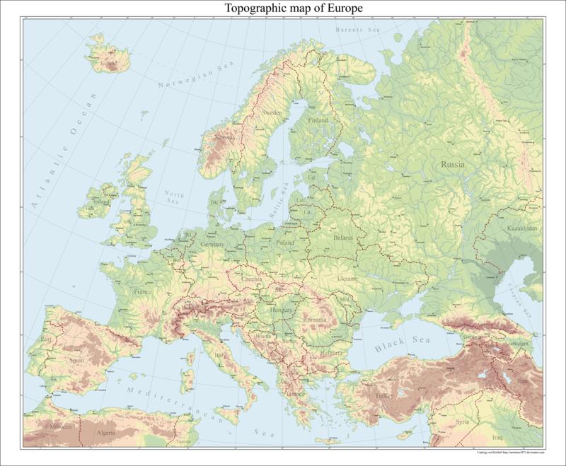
I worked over 1 week on a topographic basemap of Europe, I hope you like it:
http://www.deviantart.com/art/Europe-topographical-map-682407330
I worked over 1 week on a topographic basemap of Europe, I hope you like it:
http://www.deviantart.com/art/Europe-topographical-map-682407330
Last edited:
I can make it any size, it is a vector map. I create them with Illustrator lately^^Is there a bigger version?
I hope I don´t sound greedy, but this map was really a hell of work and I decided to not give it out for free in a higher resolution. sorry mate :/
Share: