EDIT: By the way, the irony is is that your username sounds rather like it could be a continent on this planet, as I named them (years ago) as things like Tzardin and Czaarlin

Cool, perhaps then I'm one of your continents come to life and am just a manifestation of it on the internet.
And thanks for the well wishes too Glen!
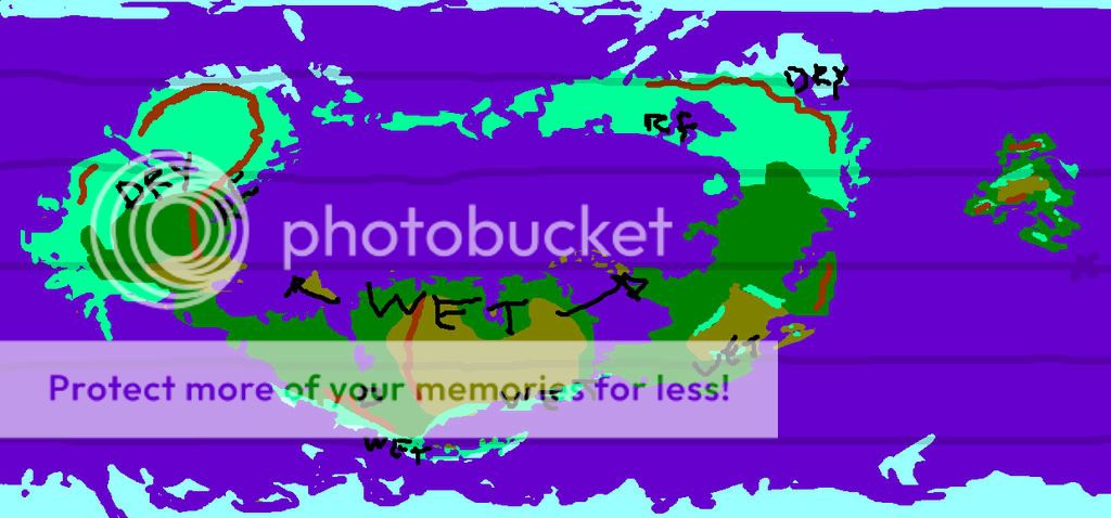
Now, for a bit on my planet. Scrolling up reveals my thoughts on the patterns in the winter, but winter sucks cause its cold. Lets go where its balmy and perhaps there are tropical girls with alcoholic beverages.
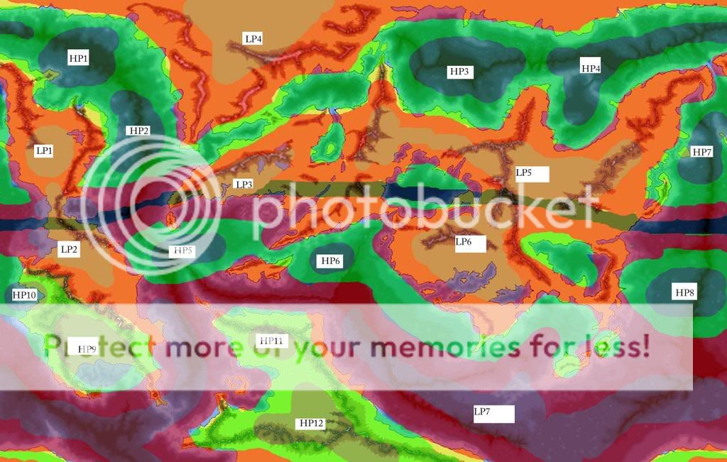
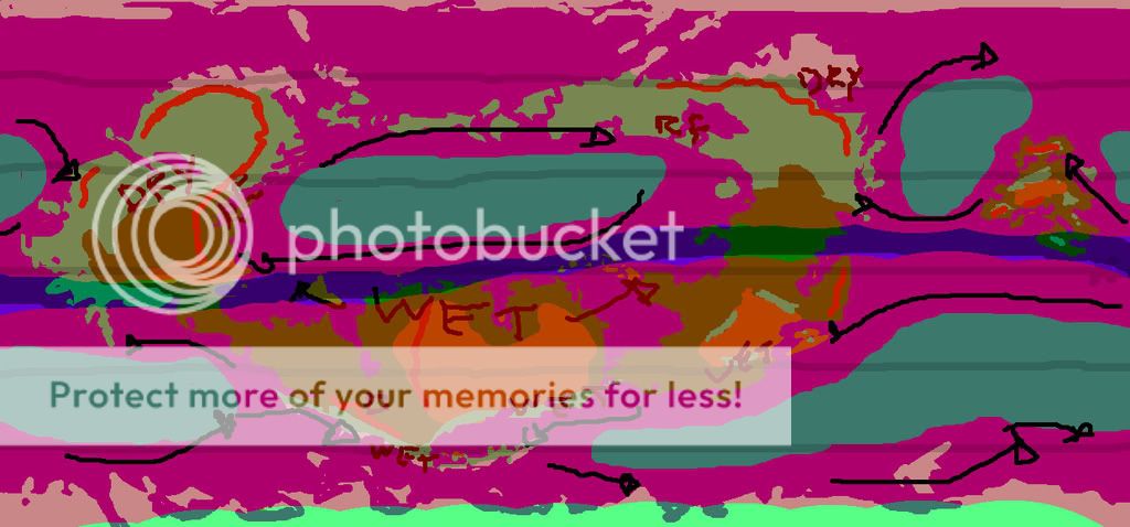
Note: This is Map One, of the two I posted, I fubared it, remember? Dont' get confused.
So, HP1-4 form out over the ocean because that is again cooler than the land about it. They form a band of high pressure cells at the same general lattidude across the map. And due to the Coriolis forces, the outward motion of the winds (High to low) is forced to the east. If you're brave, you could follow the northern coast of the ocean all the way from HP3 past HP4 and down to HP2 and then up again along the opposite shore.
I would assume in some cases a standard square rig sail wouldn't be advantageous, because of the presence of other LP systems siphoning off energy. But thats not so much climate as much as exploration, so I digress.
LP1, LP4, and LP5 are all positioned during these months to suck as much moisture and air off the ocean as possible. If you start with the wind flows I mentioned before and take into account terrain, it looks to me like the continental LP systems are going to bring a good bit of water in through the valleys (mainly the northern continent in this case). I don't think those valleys are going to be pretty to live in during these months. They pretty much act as funnels, forcing the air together and down. This is going to increase the pressure some at low altitudes as well as the wind speed. Once the wind is out of the valleys, I'd imagine that it would possibly explode with water. With the sudden drop in pressure the interior of the northern continent would be ideal for rainstorms, and probably thunderstorms as well.
LP5 does a similar thing, but noticing the terrain is different the pull of wind is a bit more normal. Wind flows off the ocean into the interior dropping it as it cools. In the case of LP5, most of the water is going to be dropped by the time it hits the mountain.
LP1 is a mix of the two. From the eastern coast it sucks water through the mountain valleys (there is one 'major' valley and probably lots of small ones). Due to the mountains, a good bit of the water is lost. But that means the eastern coast should be decently watered in summer. The interior is primarily going to be sucking water in from the west (HP7) as well a perhaps a small bit from the north.
HP7, which dampens LP1, also provides northerly trade winds along the coast, which would then take you out to the west and across the ocean. This also acts to water the coast of the larger continent to HP7's west. The rain shadow of these winds is on the western slopes of the mountain, but due to the other HP systems, it looks like at worst it would be plains and not desert.
Now to the equatorial LP zones. LP2, LP3, and LP 6. If you compare the two maps, you'll notice where LP2 is there is a low pressure system almost year round. That sucks for people who like the sun. Its liable to be hella rainy (Amazonian, in fact). LP3 creates the forest nestled against the mountains, and that forest would theoretically sprawl from one end of the mountains across the continent, but due to humans being humans, alas, a good portion would be slowly conquered and cut.
At the same time HP5, which feeds the forest to the north, would bring you eastwards along the coast and then south and out towards the continents to the west.
LP6 is fed by HP6, as well as the small (unnamed) HP system in the sea to its north, and the band of high pressure following its southern shore. This tells me that due to the topography and wind patterns there are going to be quite a bit of rain forests on the planet.
HP8-10 contribute another set of trade winds, small bit of rainforest potential, and mega desertification. Look at HP9, sitting on top of that desert and preventing any significant amount of water to reach the interior. Sucks balls to be out there without a couple (dozen) canteens.
LP7 is a huge band of low pressure following the southern ocean. Much like the Antarctic band of LP on earth (though this is distorted due to the land). This means that all of the high pressure systems around it are sending it winds and moisture, and creating a nice current around the planet.
Nice as in convenient...not as in nice. Since it is low pressure, that means storms. And since it is a large ocean (laterally) that gives storms quite a bit of time to build up power before either breaking on the coasts of the southern continent or arcing up northwards into the equatorial waters (which would suck major balls). And where HP11 and HP12 rest on top of the southern continent, we have another out board motor contributing to the great world current with a good number of different wind patters converging and interfering with each other (not all of which is going to be destructive interference
)
So STAY OUT OF THE SOUTHERN OCEAN. Its dangerous.
And heres hoping for some comments/requests/etc. while I meander over to the gym.