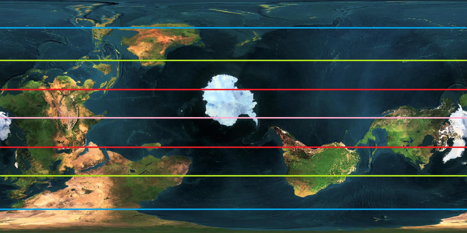
Here's "North Pole in Paris" map, shown in Robinson projection, made by GProjector. Sorry for being a bit late, and hope it would help.
NOTE: This map doesn't show the exact altitude. Europe and NZ would be depressed by glacier, and places like Greenland, Canada, Antarctica would rise higher.
edit: Also, depending on the size of the european ice dome, the overall sea level would get higher or lower.(I think it would get a bit higher; europe is smaller than antarctica anyway.)
I don't have image software on this computer, so a text update about the polar regions -
The European Cap extends from Paris as far south as Scotland, Morocco, Sicily, Crete, Turkey, Romania, Ukraine, Belarus, Finland, and Scandinavia; with ice freezing to the sea floor in the Bay of Biscay, the north Mediterranean, the Adriatic Sea, the Aegean Sea, the Baltic Sea, and part of the North Sea; and an ice-shelf extending for most of the year across the rest of the Mediterranean, the Black Sea, and much of the north Atlantic.
The connection between the Spanish ice and the Moroccan ice is so extensive that water doesn't flow there, but I think there will be a glacial flow out into the Atlantic. I think the same will be true between Greece and Turkey, but there the Black Sea is not frigid, and is fed by water from all of European Russia, so sometimes water could flow over there, into the Mediterranean. The Dead Sea is now renamed the Glass Sea, because it's deep and clear and often covered in ice. Water flows in through the Jezreel, and out by Aqaba.
In the Sahara, Arabia, and Russia we have tundra, forests, and steppe, not sure where the borders of each goes yet. By the time we get to the southern coast of West Africa, and possibly southern Arabia, Yemen and Oman, it's a pleasant warm temperate verging on subtropical.
Then there was Chad. What will happen to it here? With melt-water from the European cap, and rains from the Atlantic, I think it's as large as it ever was in OTL, where it flows out into the Congo river basin, which would not itself form a lake. The Senegal river will also be strengthened, some rivers will flow through the Sahara to reach it. West Africa might be our 'water superpower' like North America in our world, but with actual ice-cap water flowing into it.
What happens with New Zealand? I'd say that it looks like Antarctica. Then the free floating ice-cap is also there. It might be isolated most years, it might link up with the New Zealand ice, they might scrape against each other, they might do all kinds of things. I still can't get my head around how such a feature would look in real life. Europe having Antarctica-like conditions transitioning to Siberia-like conditions makes much more sense.