Return of Horrible Educational Maps

I recon that lately there has not been enough screaming and eye-gouging in this thread. Time to rectify this:

View attachment 895179

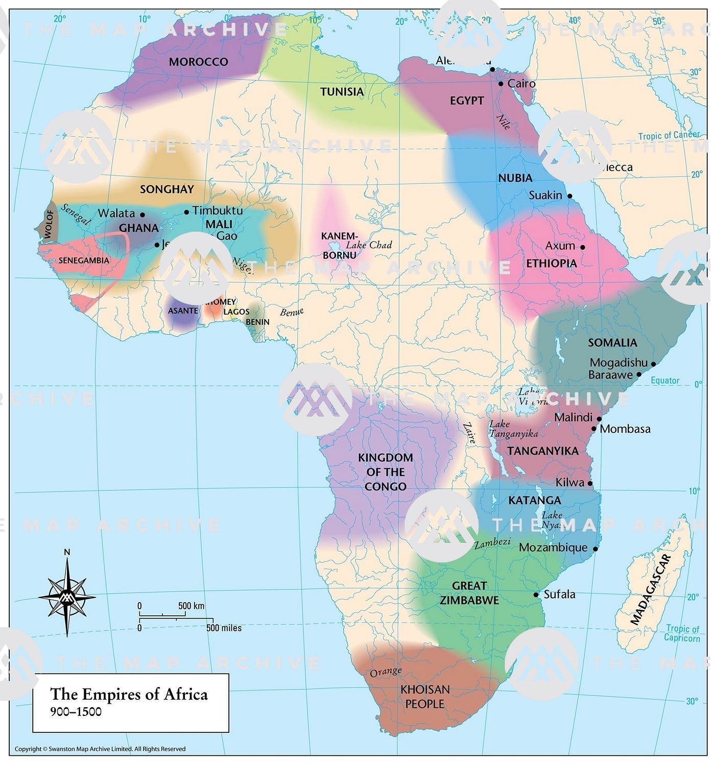
This time with the source link (where the map is even bigger)

lol the meow in Russia.

Philippines and Guinea seem to be the only fully coloured countries, thought Mexico has a bunch of colours as well. It is very funny how someone put a pin on where Sweden would be despite Sweden being covered by the Baltic in the map. A pin in the Pacific, perhaps meant to be Guam? North Korea kinda seems to have a pin or colour but I am not sure.

Also very diverse group (class, I am assuming). (Edit: college dorm, according to the Reddit link)
 
Last edited:
Behold! The empires of Africa!
1*WP9Vhe_m343Q9PW14EC-hw.jpeg
 
What’s wrong? Itallyria, Polauswitzhia, Baltarus, Arabia, Blackseagaria, Moroccotania, Turcaspian, and Germalowcountries are all real countries. Ireland being united is the only error.
 
Ah, yes. Arabia, Persia, Otherabia, India, and Southeast Asia. What’s the prob… oh, I see, Europe looks a bit odd. And there’s no Anatolia.
 
On a more lighter note a screenshot from the Totally Spies cartoon:

badtotallysp.jpg


Of course rather atrocious but maybe that cartoon does play on an alternate earth where that map would be correct, who knows...
 
On a more lighter note a screenshot from the Totally Spies cartoon:

Of course rather atrocious but maybe that cartoon does play on an alternate earth where that map would be correct, who knows...
You do wonder what the characters have been getting up to that led to the creation of the Gulf of Tibet...
 
Top