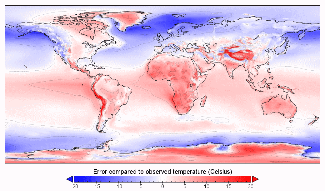
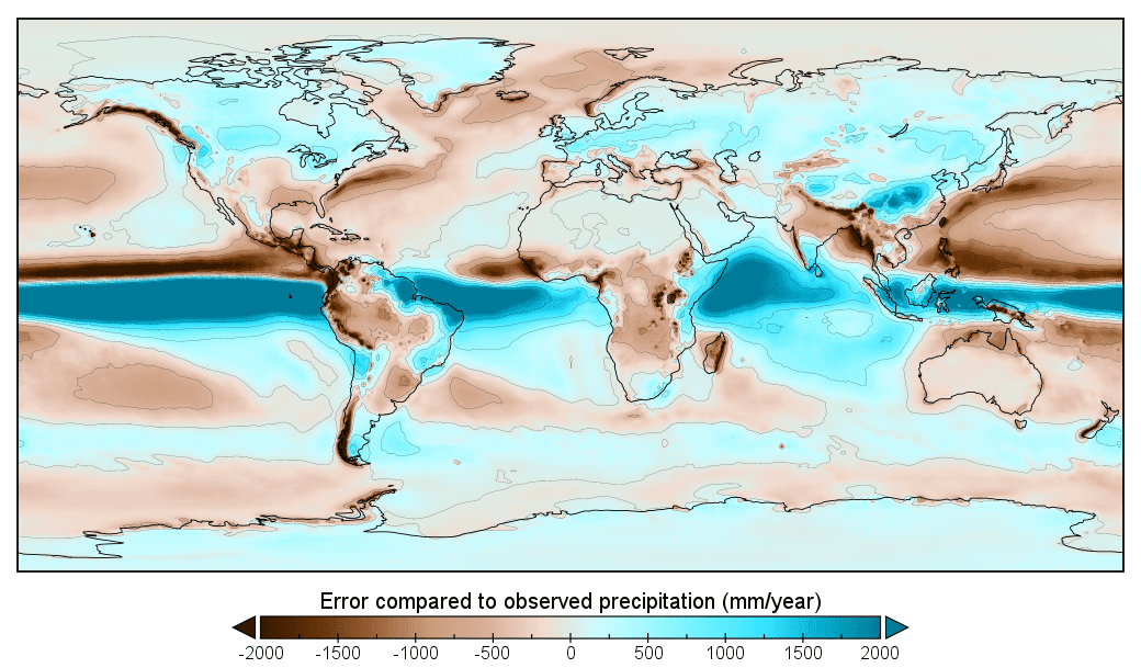
So, I tried to Simulate Brazil but with way less erosion, like 7.6 times erosion throughout the building of the Andes to try and simulated less erosion under desert conditions and I knew there was a chance for an introgression but I didn't think it'll pass both the high that separated the Pebas from Venezuela and Venezuela from the Old world.
I calculated the less sedimentation and the used a dynamic topography mask that should roughly simulate the shape of the bedrock beneath sediment, over modern topography at a transpiracy that got me the lowest point I calculated. If this method is faulty and you know a better one, gib advice.
It is slightly below the Jaredia sea level we're using but I checked another way and it'll have to be like, Last Glacial Maximum levels for this not to be this not to be under water. I guess given that if conditions were like this, the desert wouldn't be a thing in the first place I have lee way to edit it until it is mostly back to dry land.
But yeah, Desert Brazil turns into an Inland Sea is the summary.
Edit
Oh, I see what the problem was. The Orinoco is Sealevel and by the very nature of its erosion, deposition and sedimentation, it'll always be sealevel. Now, I don't know what to do about it, simply importing a Sea level and slightly above layer would look weird. Uh....


 )
)