What's wrong?
Rather converngent borders you have there, old chap.
What's wrong?
ah nvm...figured it wout with the claimed territories ^^Pretty please?
Here is my terrible attempt at what you wanted. I couldnt find the Venturas River on any maps.Pretty please?
....In any case, In this map the American Revolution took the whole of North America with it....
ok are the texas eastern borders the same as otl, or the same as it was back then?Pretty please?
Thankee sir, that's basically what I'm looking for. The only thing off is the Texas/California border, which should be a bit more west. The Green River (a tributary of the Colorado) down to where it meets the Colorado, and then a Meridian down to the Mexican border.Here is my terrible attempt at what you wanted. I couldnt find the Venturas River on any maps.
did you want ruperts land seperate from canada...cos they werent a part of canada til 1870Pretty please?
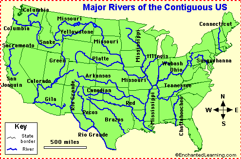
I ant get any decent maps with the Green River...Thankee sir, that's basically what I'm looking for. The only thing off is the Texas/California border, which should be a bit more west. The Green River (a tributary of the Colorado) down to where it meets the Colorado, and then a Meridian down to the Mexican border.
Thankee sir, that's basically what I'm looking for. The only thing off is the Texas/California border, which should be a bit more west. The Green River (a tributary of the Colorado) down to where it meets the Colorado, and then a Meridian down to the Mexican border.
Can I have the map please? Do it have the Green River?ive got a good map of america aqnd the lower part of canada but couldnt find one of the top half of canada and alaska...its bloody hard trying to find one of all that has the rivers for borders x.x
This map should have better borders.
IMO, The premise of the map doesn't matter, but the quality does.
Mmm...Well a little request : an Aquitain wank.
Yes, please. The date is around 1850 in ah with a POD only a few years prior.did you want ruperts land seperate from canada...cos they werent a part of canada til 1870
Here you are.I ant get any decent maps with the Green River...
I need a worlda one so I can copy-paste.Yes, please. The date is around 1850 in ah with a POD only a few years prior.
Here you are
I need a worlda one so I can copy-paste.
Ok, here is my attempt.It seems quite easy to hand draw it. The standard Worlda does have the Colorado on it, and the Green River straddles the Utah-Colorado border, making it easy to compare as far as size goes.