resources:west_midlands_election_maps
This is an old revision of the document!
Table of Contents
West Midlands Election maps
Herefordshire
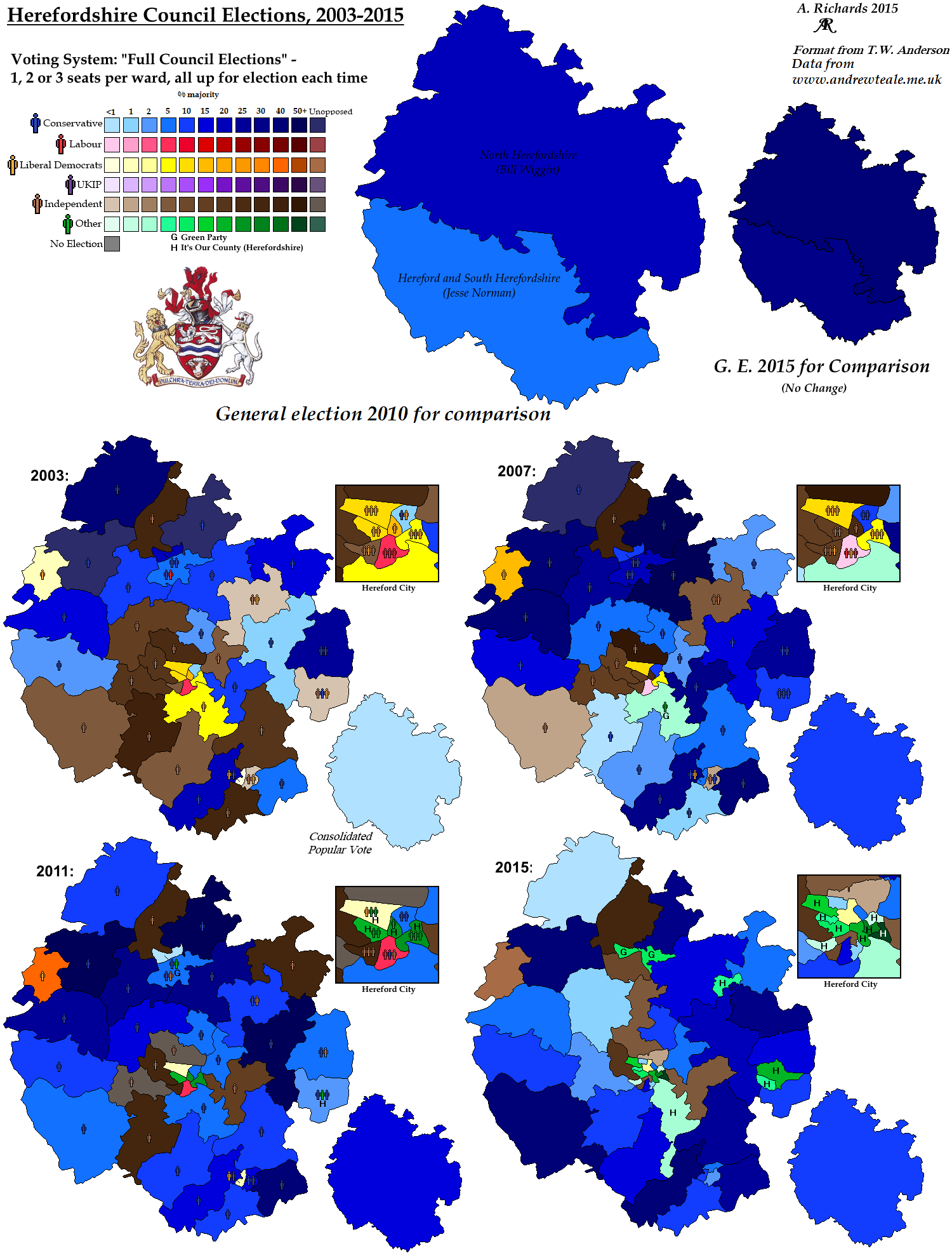
Council Elections in Herefordshire, 2003-2015
Shropshire
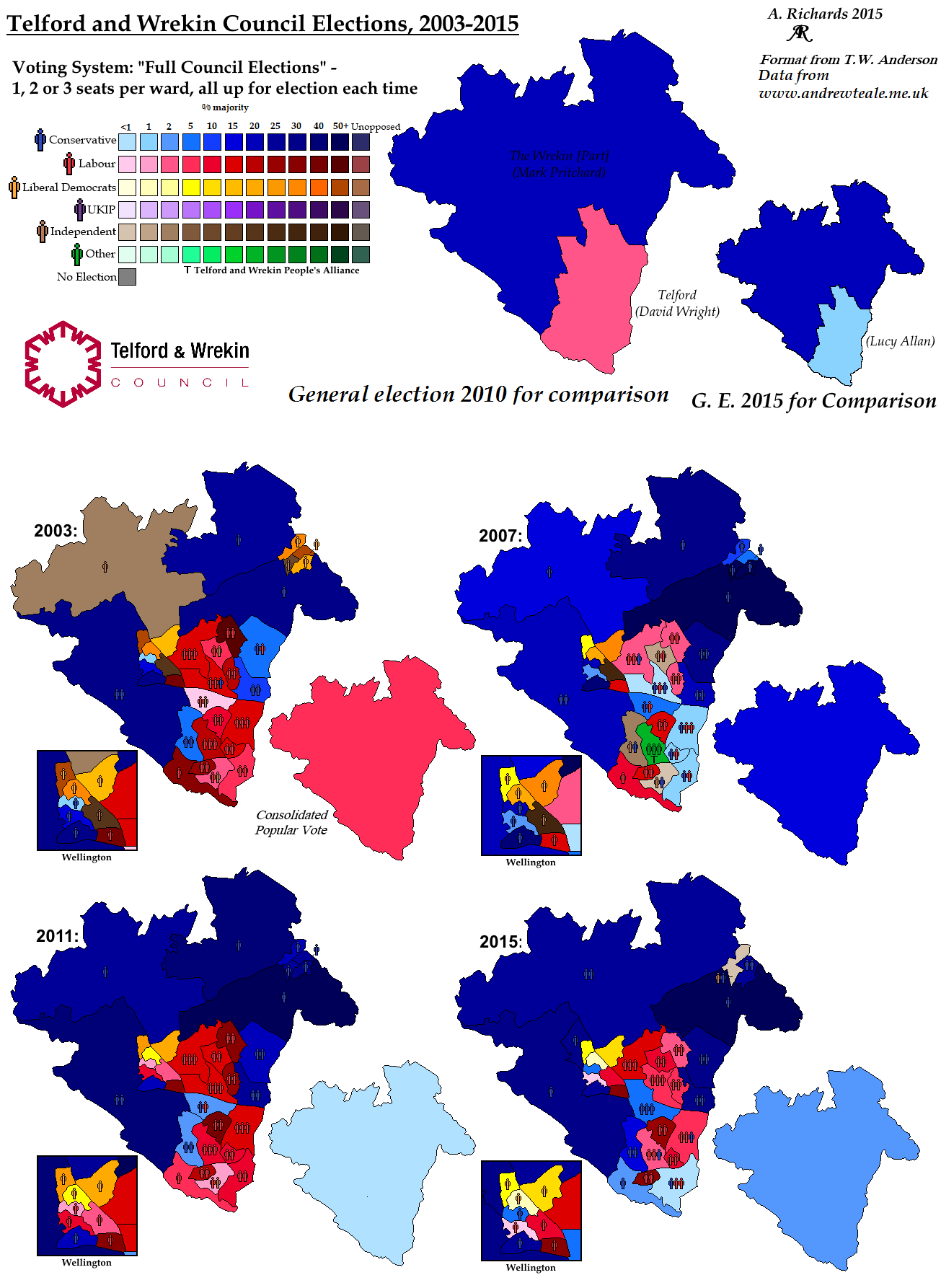
Council Elections in Telford and Wrekin, 2003-2015
Staffordshire
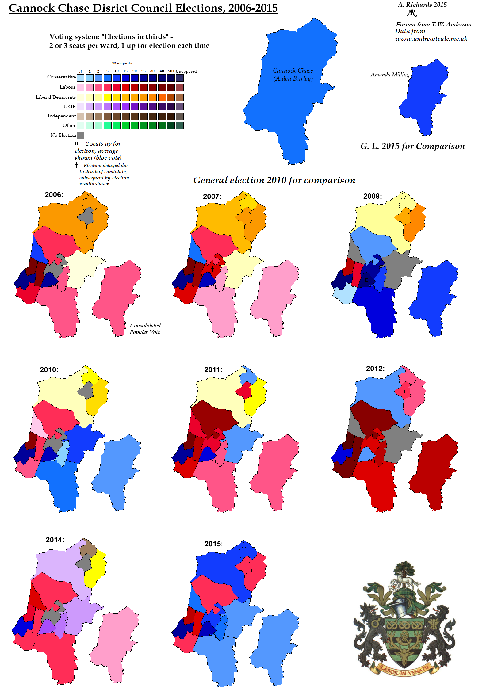
Council Elections in Cannock Chase, 2006-2014
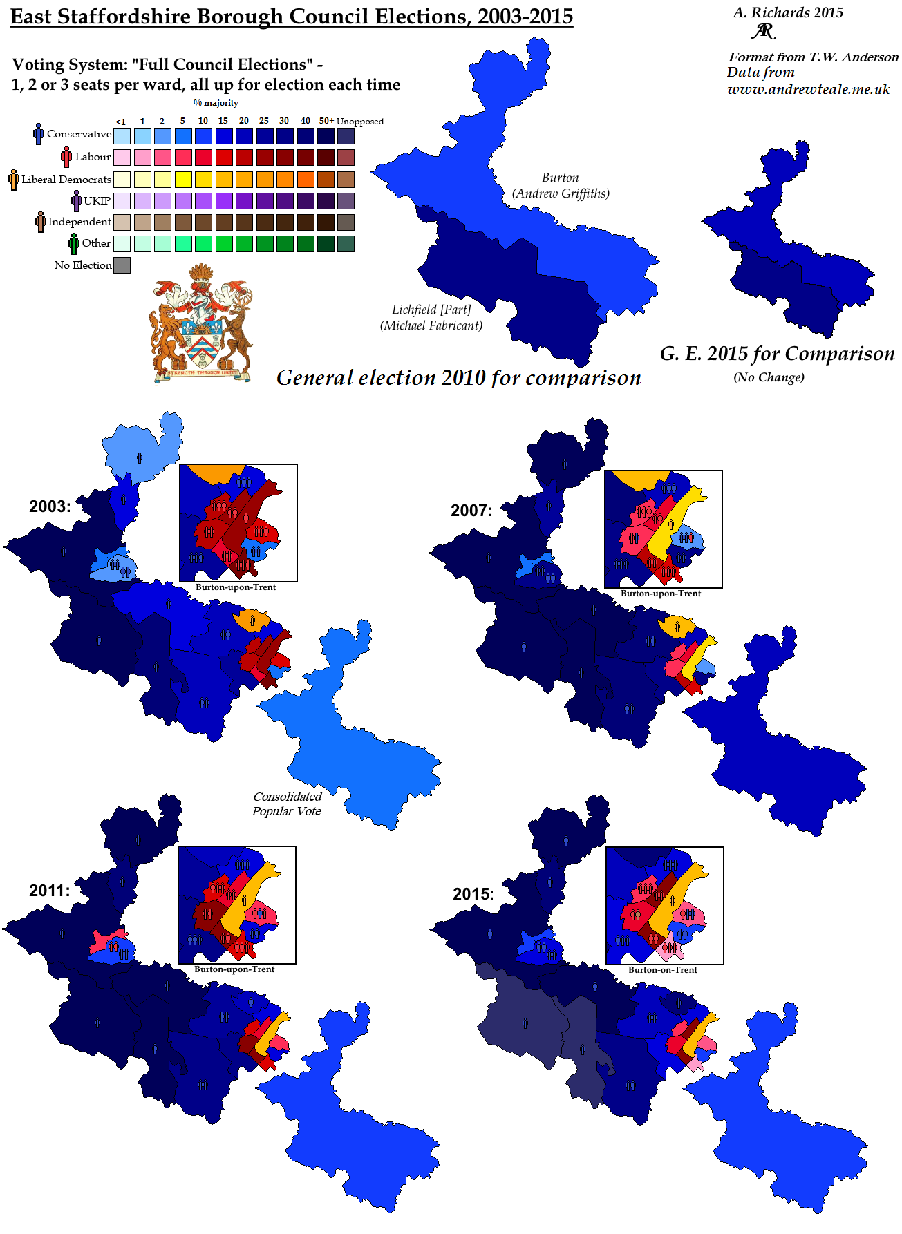
Council Elections in East Staffordshire, 2003-2015
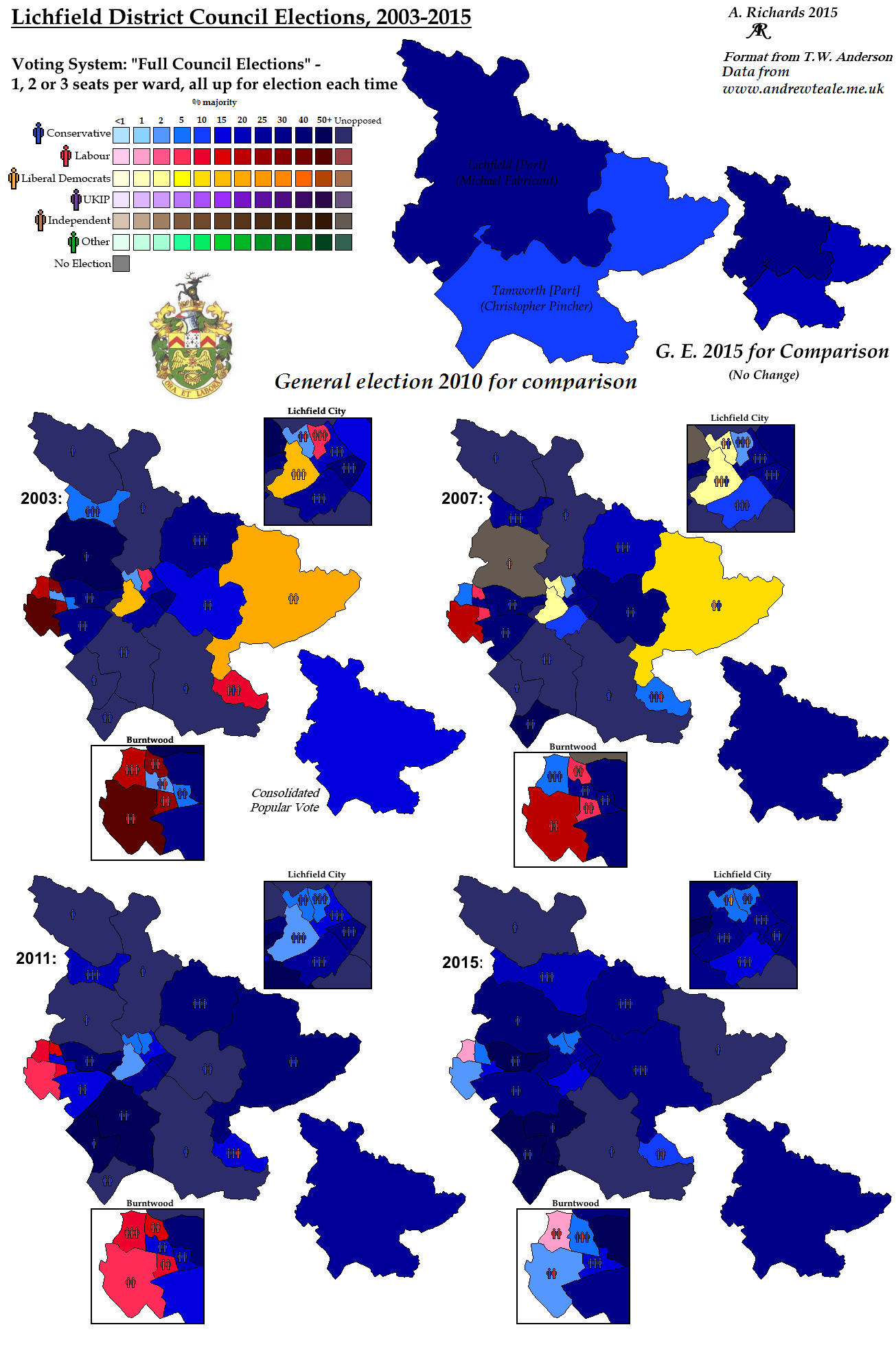
Council Elections in Lichfield, 2003-2015
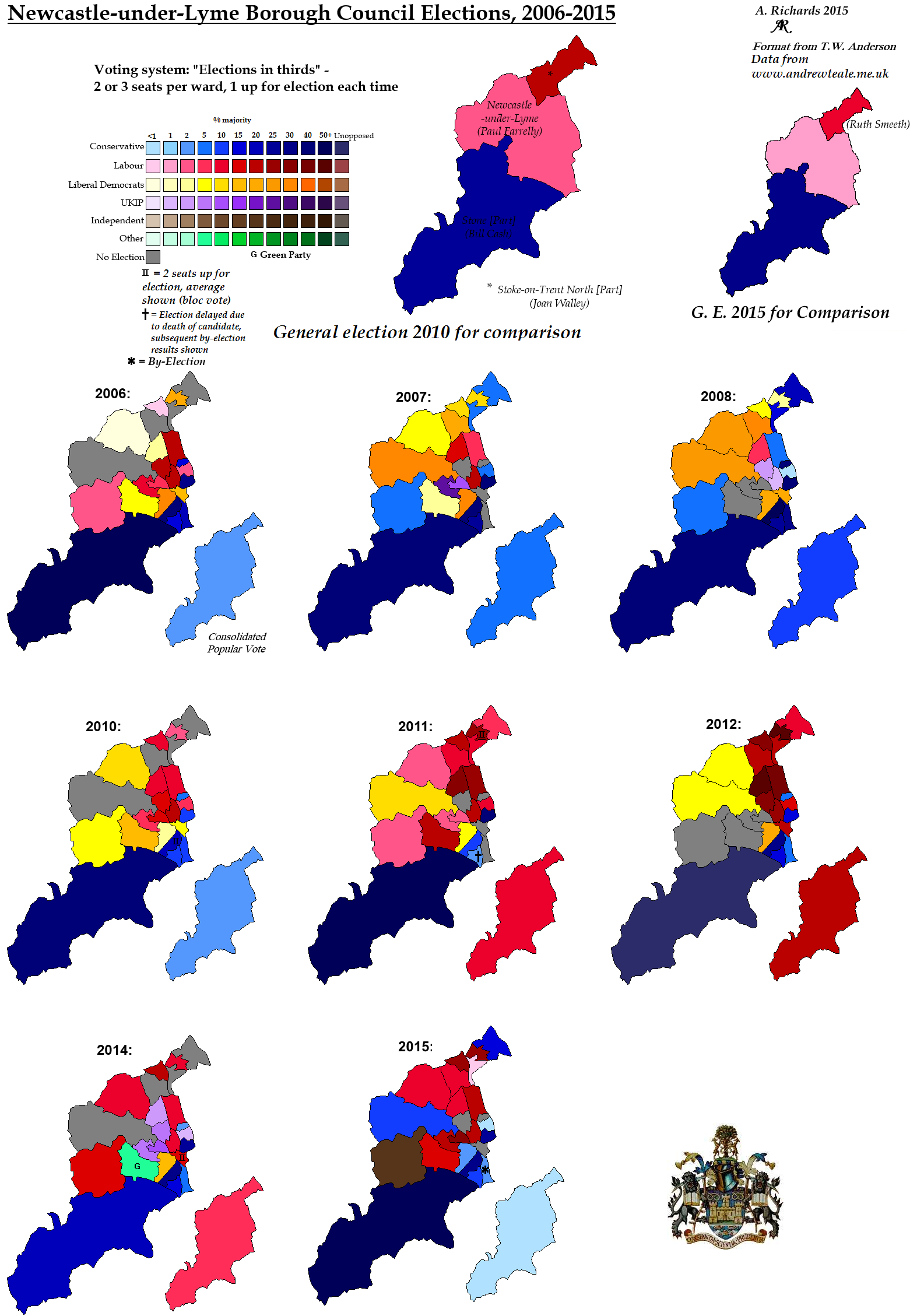
Council Elections in Newcastle-under-Lyme, 2006-2014
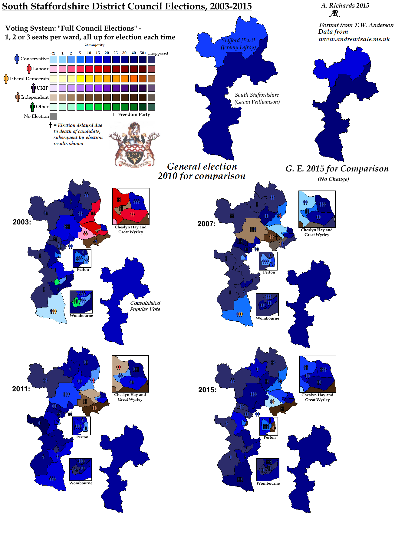
Council Elections in South Staffordshire, 2003-2015
Council Elections in Stafford, 2003-2015
Council Elections in Staffordshire Moorlands, 2003-2015
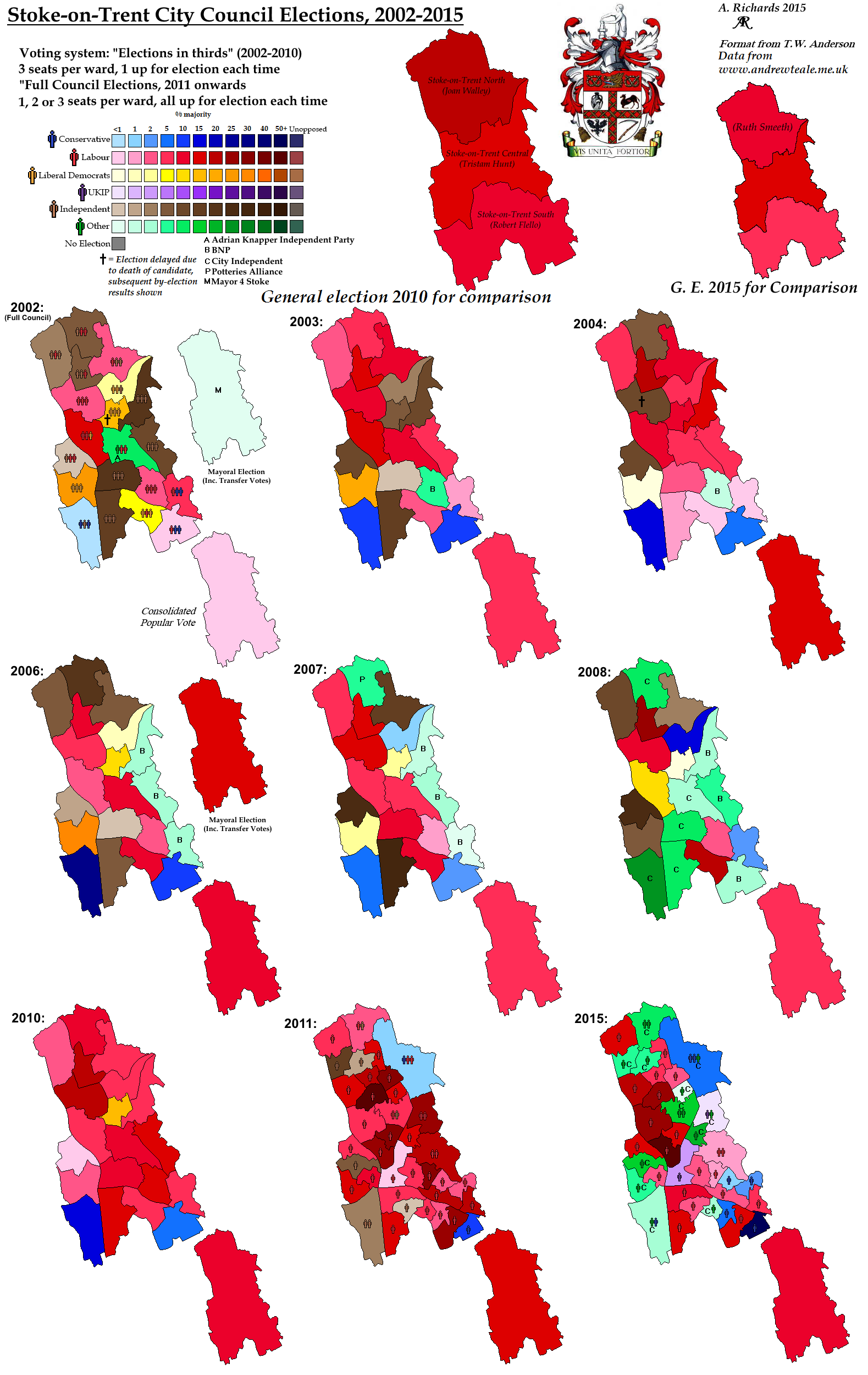
Council Elections in Stoke-on-Trent, 2002-2015
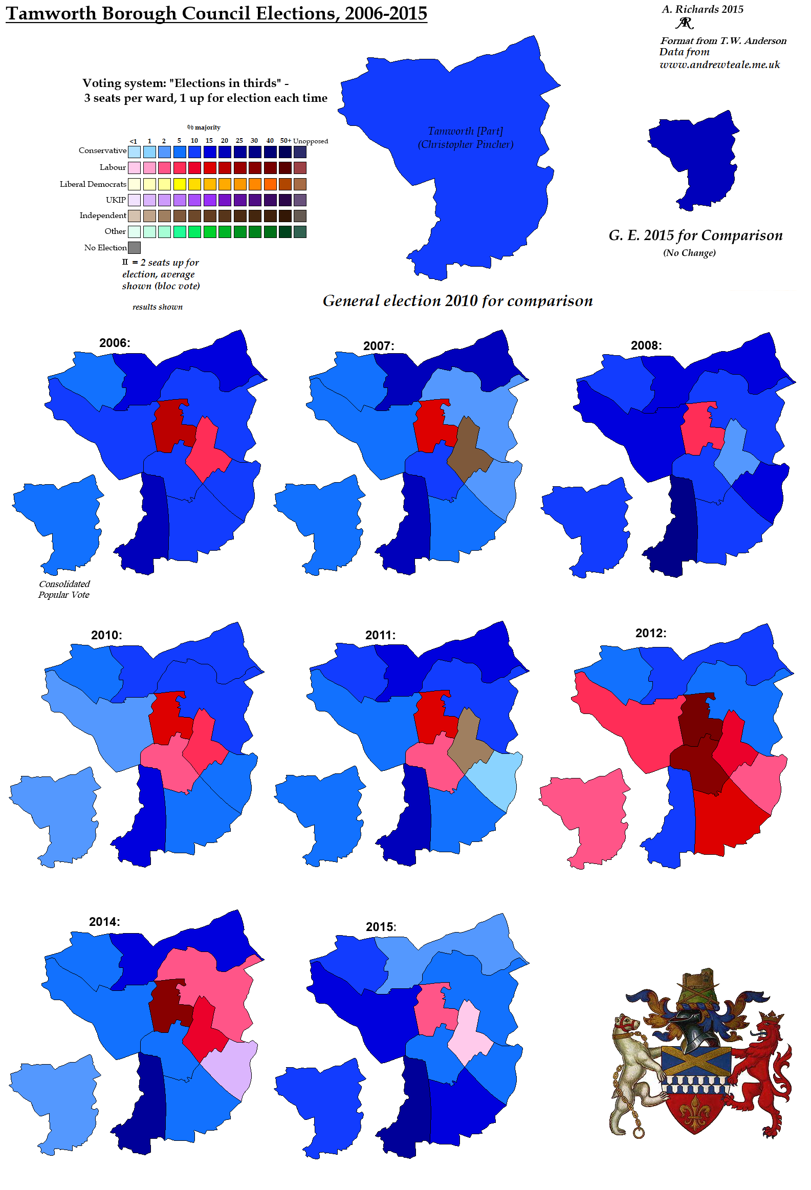
Council Elections in Tamworth, 2006-2014
Warwickshire
Council Elections in North Warwickshire, 2003-2015
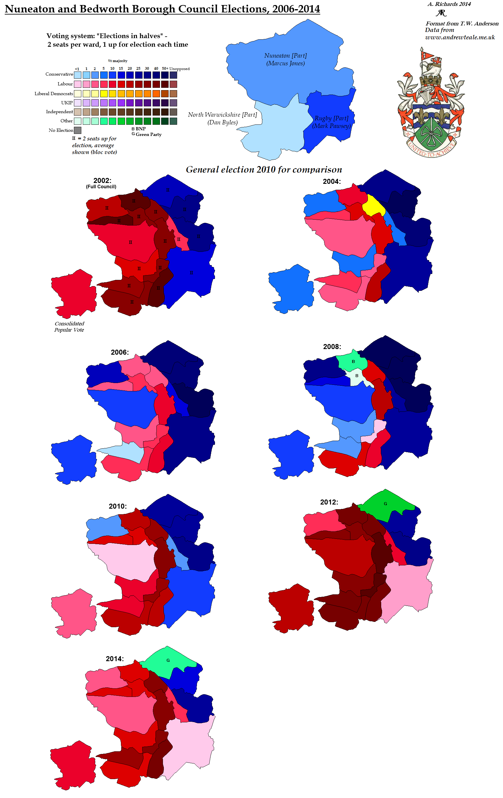
Council Elections in Nuneaton and Bedworth, 2002-2014
Council Elections in Rugby, 2006-2014
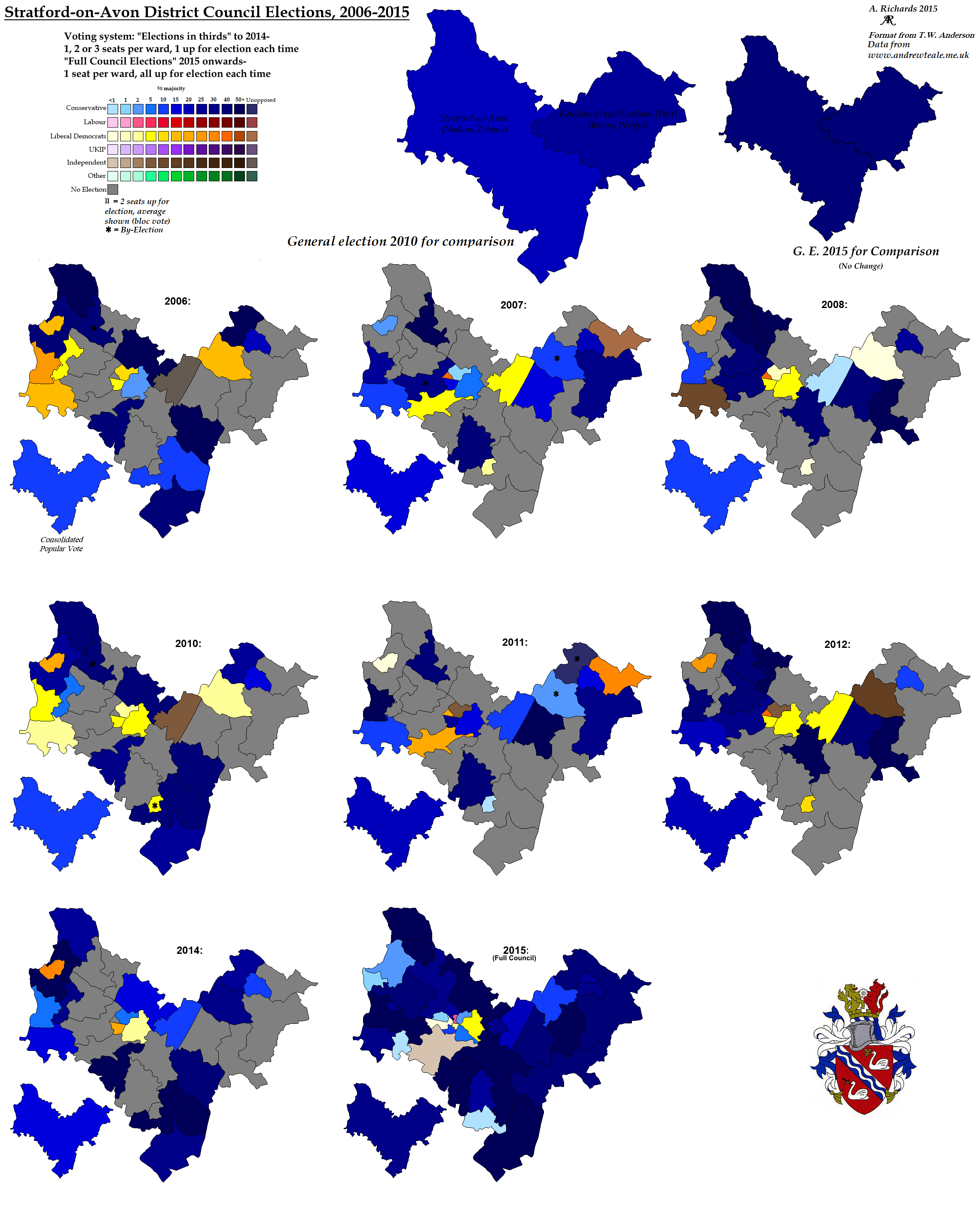
Council Elections in Stratford-on-Avon, 2006-2014
Council Elections in Warwick, 2003-2015
West Midlands
Council Elections in Birmingham, 2006-2015
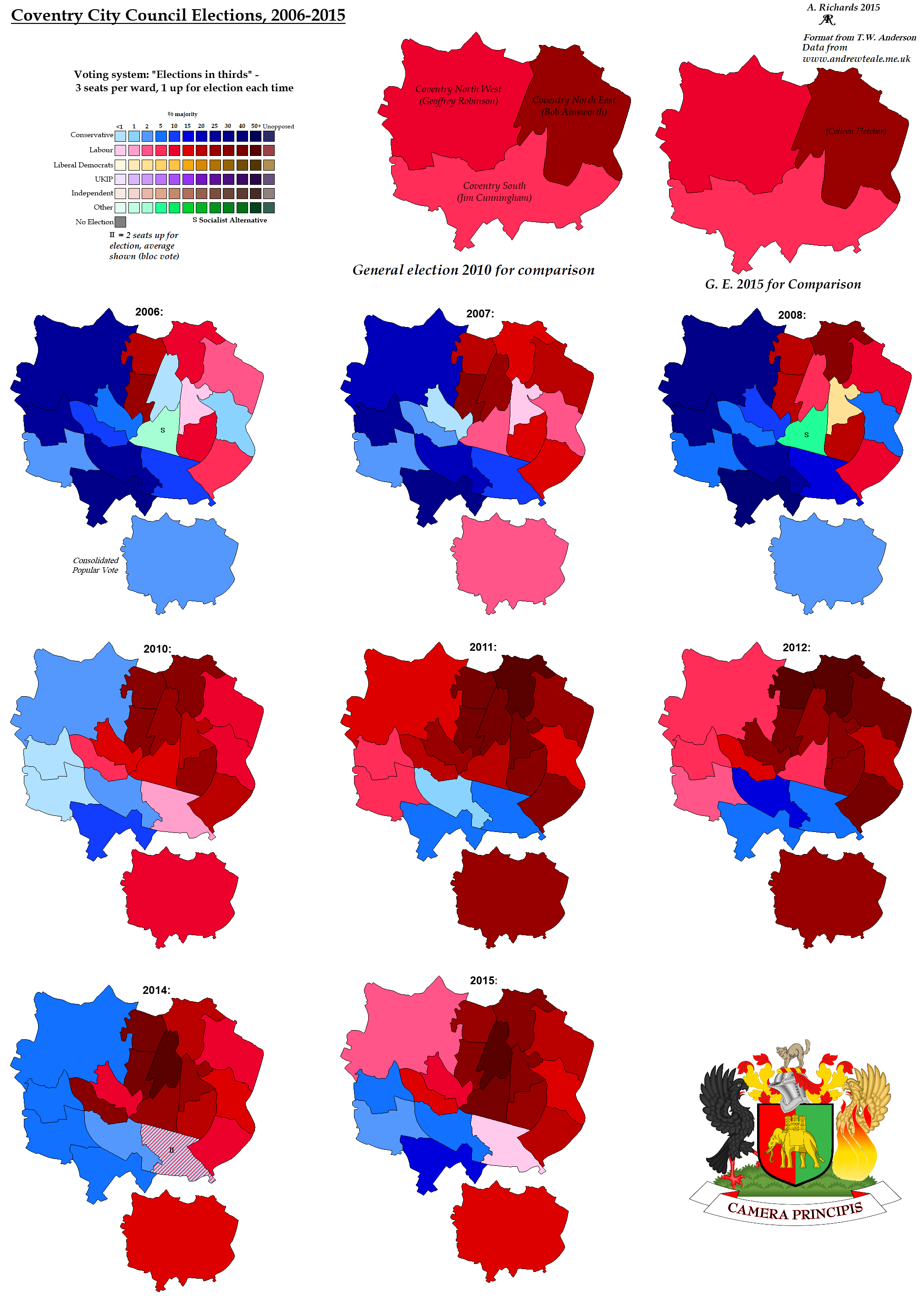
Council Elections in Coventry, 2006-2014
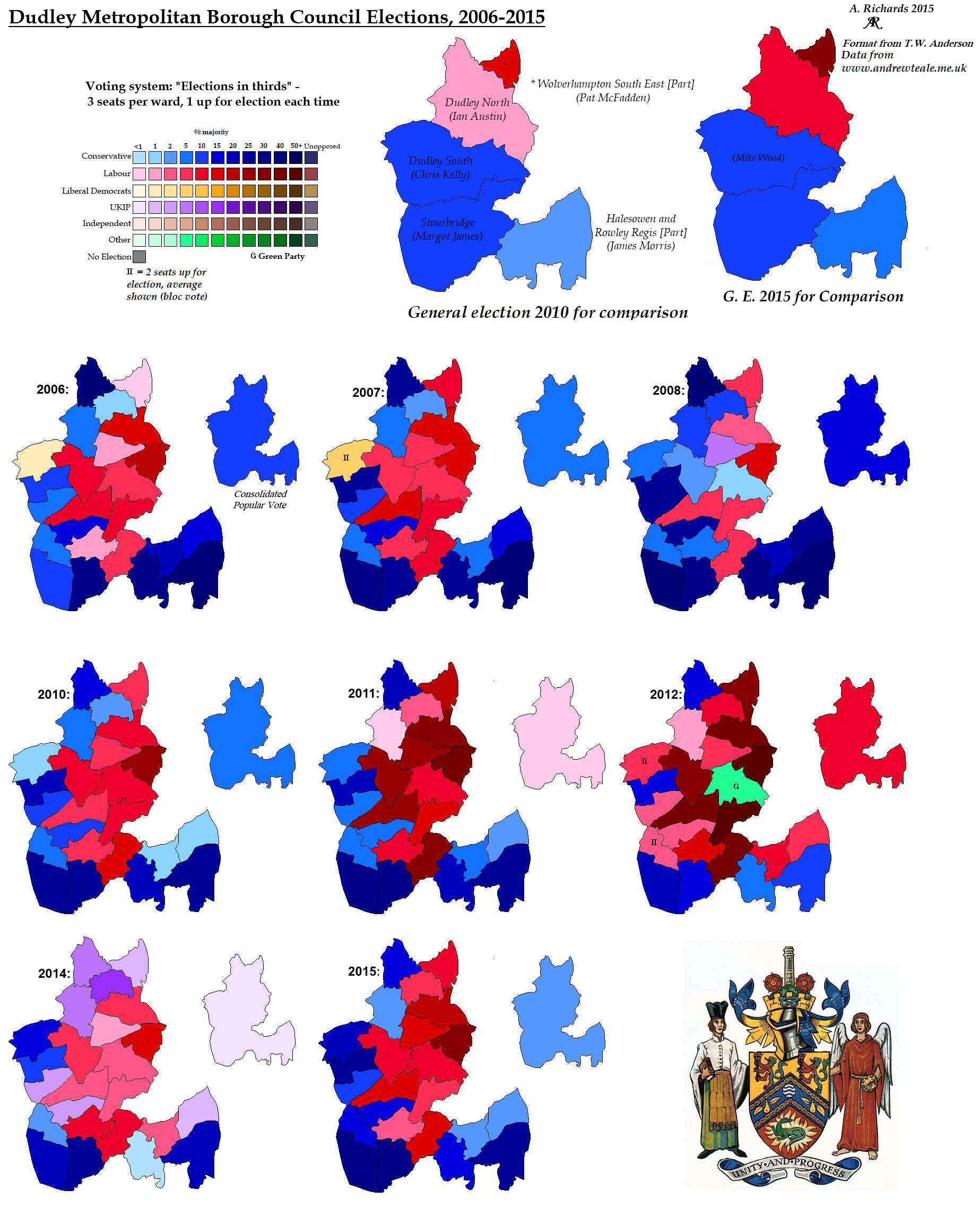
Council Elections in Dudley, 2006-2014
Council Elections in Sandwell, 2006-2014
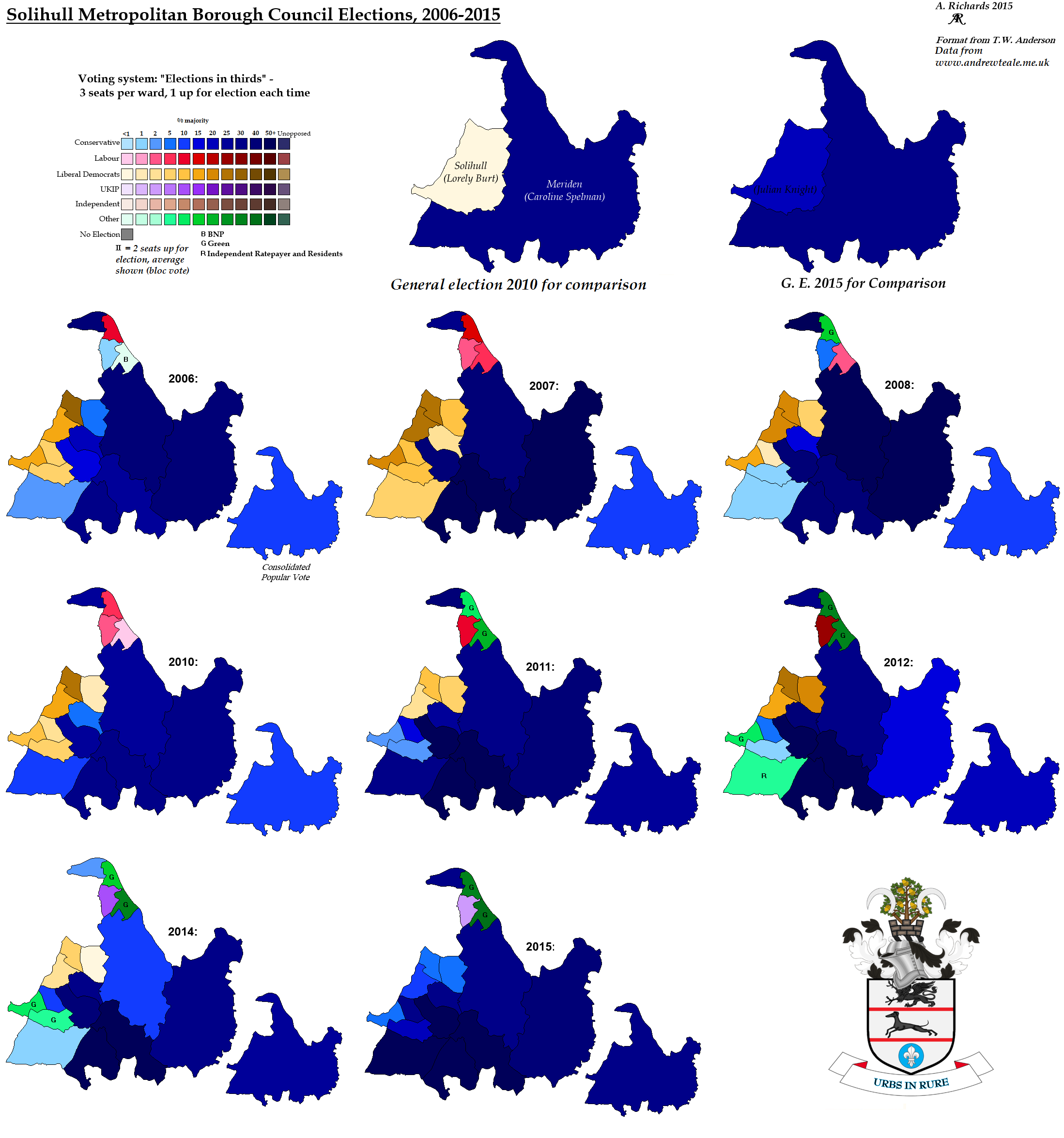
Council Elections in Solihull, 2006-2014
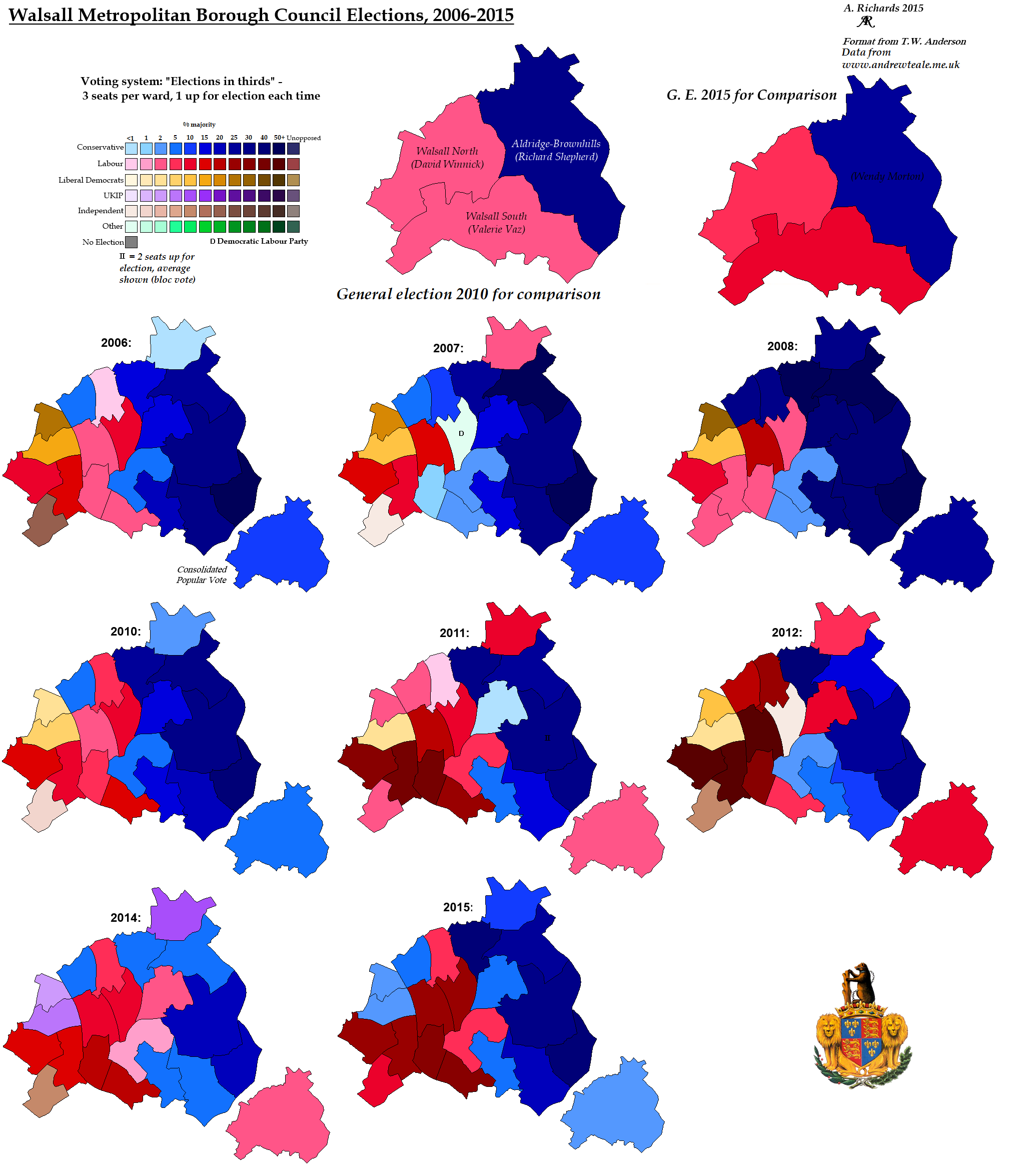
Council Elections in Walsall, 2006-2014
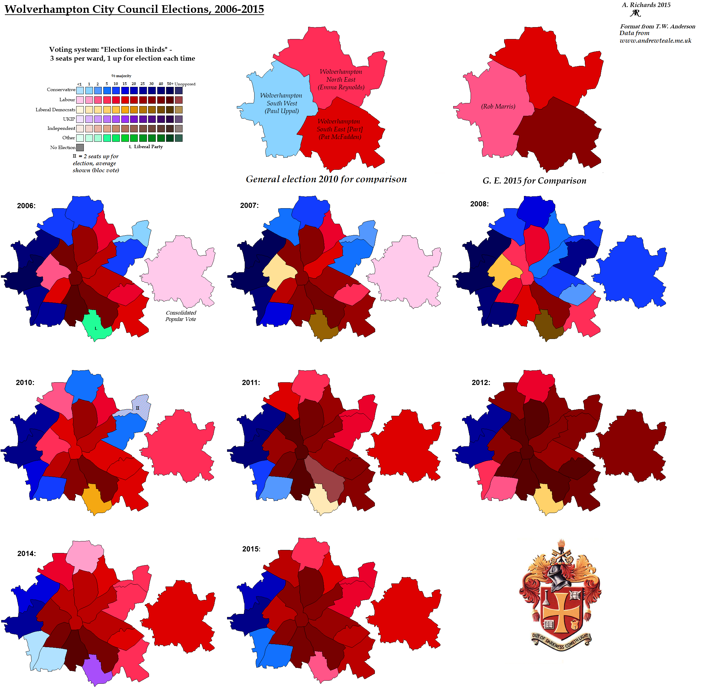
Council Elections in Wolverhampton, 2006-2014
Worcestershire
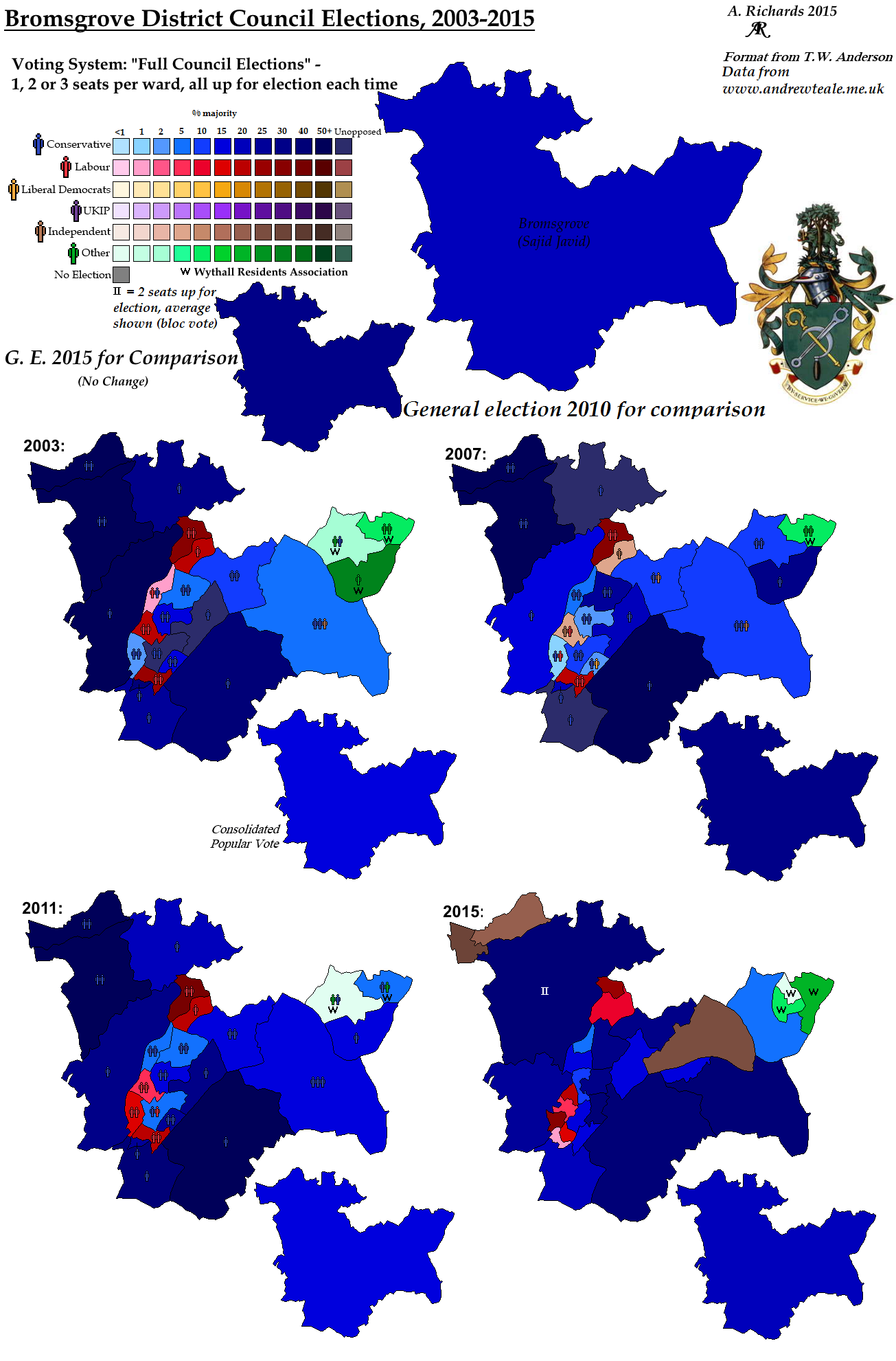
Council Elections in Bromsgrove, 2003-2015
Council Elections in Malvern Hills, 2003-2015
Council Elections in Redditch, 2006-2014
Council Elections in Worcester, 2006-2014
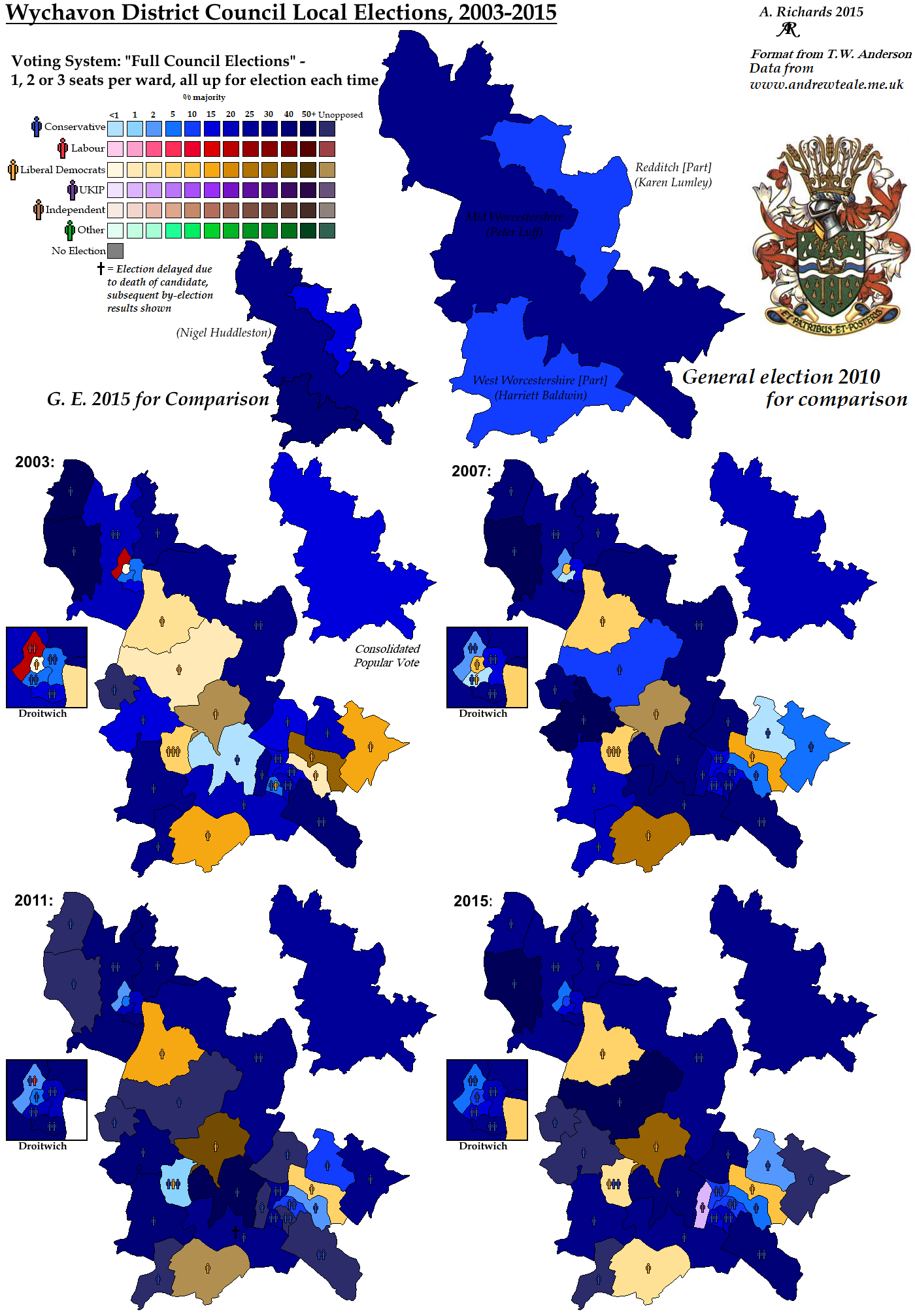
Council Elections in Wychavon, 2003-2015
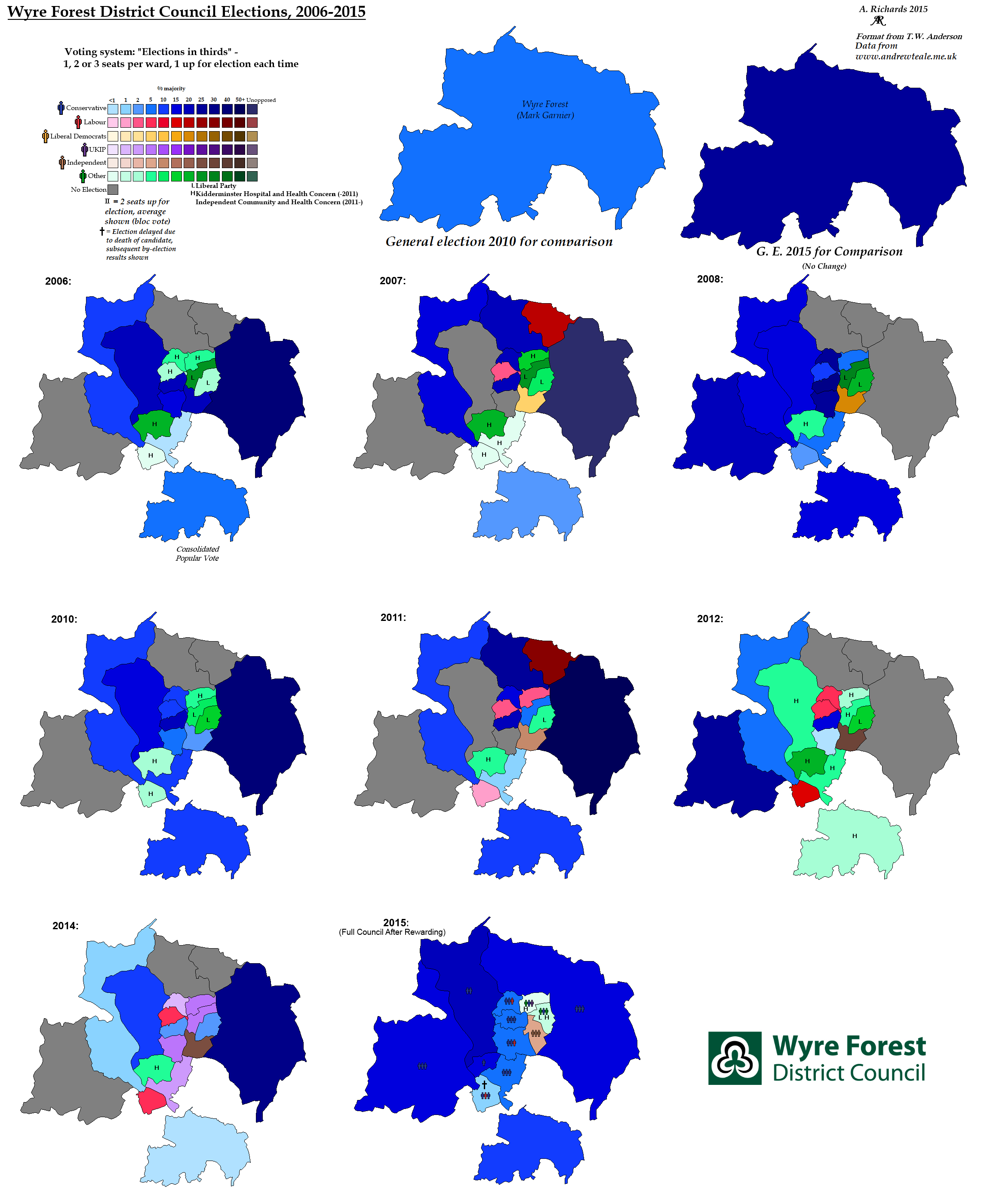
Council Elections in Wyre Forest, 2006-2014
Regional
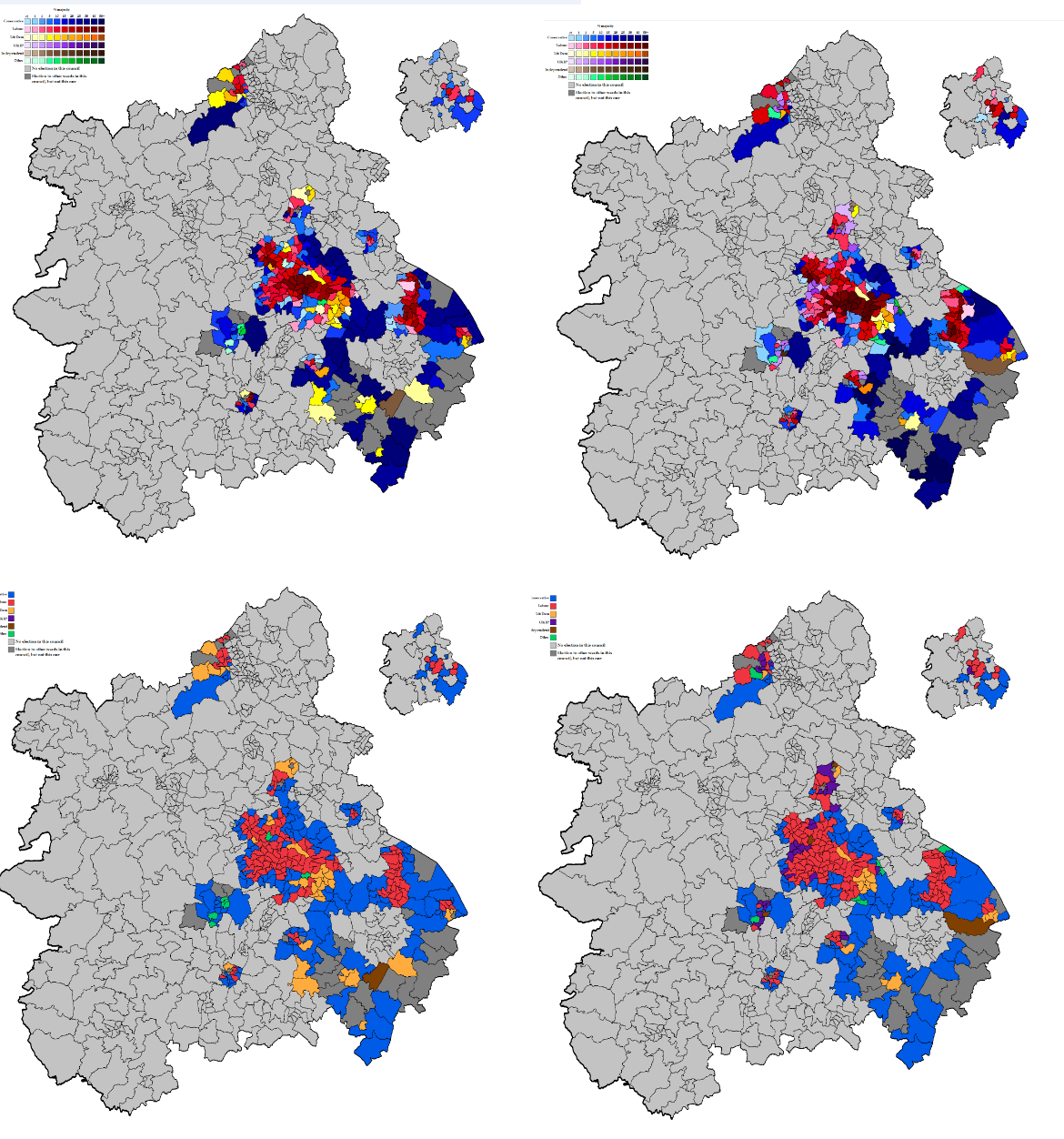
Lowres 2010 vs 2014 Region map
resources/west_midlands_election_maps.1446302845.txt.gz · Last modified: 2019/03/29 15:16 (external edit)

