I've started work on a legend, I've never made one like this before but hopefully it's looking good so far. There are also a couple new infographics/inset maps that I thought would look good, and I'm liking the spacing of that part of the map now.
You are using an out of date browser. It may not display this or other websites correctly.
You should upgrade or use an alternative browser.
You should upgrade or use an alternative browser.
WIP Map Thread
- Thread starter B-29_Bomber
- Start date
-
- Tags
- work in progress
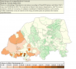
Portugal poured a lot more energy into colonizing Southern Africa because they didn't get much land out of the Americas. Furthermore, the Dutch aren't their own country here and further-furthermore, the wealth of the Caribbean plantations promotes oligarchy at home and immigration to the colonies.How did it come to be? I like the borders, maybe turn Xhosaland-Kwazulu-Natal into protectorates
100 m sea level rise?Still WIP...
View attachment 745337
A map of North America in A Slow and Painful Goodbye, one year after the 2023 nuclear exchange.
Last edited:
Done Italic, Romance and Germanic languages in a project I call "Kaleidoscope Earth".
Here's another WIP. This is intended to be a German WW1 victory combined with socialism and Ottoman wanks.

Hmm, ottoman wank...Here's another WIP. This is intended to be a German WW1 victory combined with socialism and Ottoman wanks.
View attachment 748723
also, France ISN´T socialist? Thats quite unexpected!
That's note ven counting all the little Gallic peoplesView attachment 748920
Oh my god there were a lot of Celtic peoples
")
And literally months later I return again to this. The more I work on this the less plausible it seems. Expect lots of lampshade hangings on the final map. EDIT: I'd be happy to take suggestions on Sub-Saharan Africa and Central Asia.I finally made some more progress on this.
Last edited:
What is this suppose ta be?And literally months later I return again to this. The more I work on this the less plausible it seems. Expect lots of lampshade hangings on the final map. EDIT: I'd be happy to take suggestions on Sub-Saharan Africa and Central Asia.View attachment 749325
A China-Europe, Japan-Britain swap, a la Olaf Stapledon's "East is West".What is this suppose ta be?
The idea has also been discussed in various threads like this one: https://www.alternatehistory.com/forum/threads/wi-europe-and-china-switch-destinies.524858/
Vatican-BAM, part of my new City-BAM series that aims to create major cities, one city at a time.
One pixel is roughly 0.94 m.
As long as it is fun, interesting and/or visually enjoyable, lack of plaussibility isn´t that big problem, I believe...And literally months later I return again to this. The more I work on this the less plausible it seems. Expect lots of lampshade hangings on the final map. EDIT: I'd be happy to take suggestions on Sub-Saharan Africa and Central Asia.View attachment 749325
Share: