You are using an out of date browser. It may not display this or other websites correctly.
You should upgrade or use an alternative browser.
You should upgrade or use an alternative browser.
WIP Map Thread
- Thread starter B-29_Bomber
- Start date
-
- Tags
- work in progress
Oh cool! So many new planets! Are they all supposed to be habitable? Or terraformed?
Isaac Beach
Banned
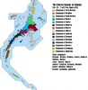
I've got a ton, might post some more if it spurs my imagination. WIP of one my worlds for my 'Concert of Planets' worldbuilding project, trying to show what a frontier planet would look like. I made the climate map first, and then I'm putting the settlements and influence over that. Don't know if I like what I've done so far, might scrap it.
 - Copy.png")
Viyas (Planet 3, colonized 3rd) was slightly modified over the course of five hundred years, making it from a coolish icy world to a paradise continental world.Oh cool! So many new planets! Are they all supposed to be habitable? Or terraformed?
Nozu, Yd Svoz, Kedol, Djan, and Urik are all in other systems, only colonized recently, and are naturally habitable.
Upratzie (Planet 2, colonized 2nd) was naturally habitable, and over time has been made a little better. Terraforming is much harder to do when people already live on the planet...
Ahrel (Planet 4b, colonized 5th) is still quite cold, being at L4 of a gas giant.
Liazyu (Planet 4.3, colonized 4th), Kiiye (Planet 4.2, colonized 7th), Pedeya (Planet 4.1, colonized 6th), Stoyas (Planet 4.4, colonized 1st), and Fenled are all moons, and most have been slightly terraformed.
Boroshi (planet 1, colonized 8th) is too far in to terraform, and is a bit of a frontier world. The bright blue star of Upratzie (yes, unoriginal naming I know) glows even brighter than it does on Upratzie.
Atlantis, the mysterious lost continent described by the ancient, appeared once more in the year 1913 after a terrible storm wreaked havoc for weeks across the Atlantic Ocean. Once first contact had been made, the Atlanteans, who appeared to have racial similarities to the Moors, were met and a long term study of them by the powers of the world began. Perhaps the most surprising thing was the discovery that the languages widely spoken by them all came from one root language, Proto-Atlantean, which in turn bore remarkable similarities to Proto-Indo-European. Their main calendar also appeared to mark the final demise of their core empire, the one written by the Plato, some 7000+ years before. Divided into fifteen individual autocratic monarchies, the people appeared to be roughly at a technological level equivalent of Dark Age Europe save one key detail - they had some minor versions of electrical use, most-heavily used in religious services wherein batteries 'brought the people closer to the Gods' through strong jolts.
Ongoing study continues.
Ongoing study continues.
Attachments
I've made a few changes here. Not too much though, since I haven't worked on it much.

Emperor-of-New-Zealand
Kicked
Another WIP I'm working on, of a disUnited States. The "USA" is just Greater Pennsylvania + Maryland, we've got New England, Virginia, the Ohio Free State, North and South Carolina, and Georgia which is basically Virginia's opposite. To the west there are two white 'trekker' states, a state founded by escaped slaves (strip west of Georgia), rump-Louisiana and a native state. Obviously there's giant Canada too. I'm trying to figure out who to do the Canadian provinces ITTL, but there's no good way to divvy up the Midwest without it looking ugly. I imagine the population would be centred more to the south so perhaps more/bigger territories up north.

Another WIP I'm working on, of a disUnited States. The "USA" is just Greater Pennsylvania + Maryland, we've got New England, Virginia, the Ohio Free State, North and South Carolina, and Georgia which is basically Virginia's opposite. To the west there are two white 'trekker' states, a state founded by escaped slaves (strip west of Georgia), rump-Louisiana and a native state. Obviously there's giant Canada too. I'm trying to figure out who to do the Canadian provinces ITTL, but there's no good way to divvy up the Midwest without it looking ugly. I imagine the population would be centred more to the south so perhaps more/bigger territories up north.
New Jersey? Part of Greater Pennsylvania? Over my dead body.
Emperor-of-New-Zealand
Kicked
I've rethought my WIP above (and by that I mean I closed Paint without saving and had to start again). I'm hoping to get some advice on the Canadian Provinces, because they look dumb (although I think the territories look okay). Anybody have any suggestions? The idea as above would be that the population is more south-focussed with more land available there. Additionally I intend on this alt-Canada to have a smaller population over-all than the OTL USA. The map would be set in 1930 if that's any indication of which areas might be territories.

I've rethought my WIP above (and by that I mean I closed Paint without saving and had to start again). I'm hoping to get some advice on the Canadian Provinces, because they look dumb (although I think the territories look okay). Anybody have any suggestions? The idea as above would be that the population is more south-focussed with more land available there. Additionally I intend on this alt-Canada to have a smaller population over-all than the OTL USA. The map would be set in 1930 if that's any indication of which areas might be territories.
View attachment 329612
I guess you had a Columbia to Okanagon to Continental divide border for Columbia proper? Just looks a little off. That little bit of the Plains Province that extends across the continental divide would probably be given to Not!Idaho. (well, all that, and the 49th seems pretty anachronistic west of the Lake of the Woods is all). Also, the Alaska border seems kinda meandery. Is there any natural border you're following there? That's not the continental divide, either way.
Who is that beast in North America? Also who is managing to hold together the eldest river valleys and all in between?Please ask questions so I can flesh it out more!
In North America is the Empire of Braganza, a successor to the Norman Empire (purple). It has only recently conquered Australia, most of Africa, and Iberia. The purple nation is some sort of Indian state that marched west. The empire is highly cosmopolitan and allows any religion to be practiced in its territory.Who is that beast in North America? Also who is managing to hold together the eldest river valleys and all in between?
Nope. Green's control of North Africa is very new and they have no historical claims over it.Persiawank meets Carthagewank?
Cross-posting from the Map Thread.
This totally isn't an updated version of my (still) WIP map.
View attachment 329728
Feel free to correct me if the European tribes look a bit off, or if the colours need adjusting to make them more distinct.
Emperor-of-New-Zealand
Kicked
I guess you had a Columbia to Okanagon to Continental divide border for Columbia proper? Just looks a little off. That little bit of the Plains Province that extends across the continental divide would probably be given to Not!Idaho. (well, all that, and the 49th seems pretty anachronistic west of the Lake of the Woods is all). Also, the Alaska border seems kinda meandery. Is there any natural border you're following there? That's not the continental divide, either way.
Thanks for the advice. Once again I lost all progress though. This time my computer restarted itself overnight and for some reason didn't save the things I had open like it usually did.

If I restart the map again I'll take what you said into consideration, but I'm beginning to think it's a lost cause.
Inspired by some comments I have received for a recent infobox of mine, I wanted to make a world where the American Civil War happens in 1856 after the election of Frémont to the presidency... And I've decided to be rather silly with it. North America is complete, though I sadly don't have any real clue on what I'm gonna do with the rest of the world (besides some Pacifician colonies in the Pacific).

(and yes, the rump-USA is now Communist)
(and yes, the rump-USA is now Communist)
Thanks for the advice. Once again I lost all progress though. This time my computer restarted itself overnight and for some reason didn't save the things I had open like it usually did.
If I restart the map again I'll take what you said into consideration, but I'm beginning to think it's a lost cause.
No problem. IT's hard to find a good border in the region, I've found. Especially north of the 54 40 (well, a border that isn't a boring straight line, at least).
And yeah, that does suck. I lost a one shot a month or so ago that I had, for some mystery, decided to type up on Wordpad rather than Word. That would be the day that my computer decided to restart for no reason. Good luck with getting it back on track if you do!
Colonization of Atlantis after the London Atlantis Colonization Accords (LACA). Britain, France, Germany and the USA were the biggest winners, but the Dutch, Swedish, Italians, Portuguese, Spanish, Brazilians, Mexicans, Belgians, Russians, Danes, Norwegians and Greeks all got a small slice of the 'new' continent as well (though the Mexican and Belgian holdings were disputed by the Americans for years). Within two generations, the local Atlantean peoples would see much of their culture subverted and oppressed by the colonizers. After the Great War of the 1920's/1930's, colonization efforts globally slowed down and by the 1960's much of the new continent would be free in four independent states - Dominion of Detwas, Republic of Haustra, Republic of Lukdrau and the People's Democratic Union of Ahkvet.
Attachments

Last edited:
Share: