It always annoys me when I see a map where America annexes Canada, and Canada somehow keeps the exact same borders from OTL even though there would never be an Oregon territorial dispute, an Alaskan panhandle dispute, a treaty which sets the US-Canadian border at the 49th parallel, a transcontinental railway, loss of the far northern portion of the Louisiana territory and the population of Canada would be far greater. So, what do you think the states of a larger America would look life if Canada was part of the USA?
You are using an out of date browser. It may not display this or other websites correctly.
You should upgrade or use an alternative browser.
You should upgrade or use an alternative browser.
What would the American states look like if the USA annexed Canada in the 1800s.
- Thread starter VenusUberAlles
- Start date
For one, they would be far smaller. We tend to like our states much smaller than the Cannucks like thier provinces.
As to how... there are several lines the US pretty much uses for state boundries, if I was any good at drawing a map...
As to how... there are several lines the US pretty much uses for state boundries, if I was any good at drawing a map...
damein fisher
Banned
I'd imagine that the districts of the Northwest Territories [Yukon, Mackenzie, Franklin, Keewatin, Unguva, Athabasca, Alberta, Saskatchewan and Assiniboia] would all become their own entities instead of being merged. We will likely see Alberta, Saskatchewan, Assiniboia and maybe Athabasca become states, while the other remain territories
A lot depends on WHEN Canada becomes annexed. I would expect that Ontario and everything east would remain pretty much the same. Between Ontario and the Pacific you get to the western end of the Great Lakes still as a dividing line. In the far west I expect you'd see the Vancouver area and Victoria as part of Washington State. I don't think you'll see a major subdivision of the prairie provinces and the Northwest Territories. Obviously the lines between the prairie provinces and the OTL US states will probably be a bit north, likewise the east/west divisions being different. The reason you'll see the "Canadian" states still close to the size they are now is population. To be admitted as a state a certain population is needed, and the reality is that as you get away from the OTL US border, the population density is incredibly low and often zero. This has to do with geography and climate. If you subdivide the Northwest Territories in to separate entities, none of them will be likely to have enough population to warrant statehood whereas a single "lump" could meet that standard.
I'd imagine that the districts of the Northwest Territories [Yukon, Mackenzie, Franklin, Keewatin, Unguva, Athabasca, Alberta, Saskatchewan and Assiniboia] would all become their own entities instead of being merged. We will likely see Alberta, Saskatchewan, Assiniboia and maybe Athabasca become states, while the other remain territories
I could imagine Athabasca being like a second Alaska for the USA.
It's not just population, the US seems to prefer smaller states than Canada, even when the population of the resultant state is only 600000. The prairie provinces each have a population of nearly 6 million, not even taking into account how being part of the USA will increase all the population of all these states. Using Montana as a model, we could cut out 6 states from these 3 provinces. Also, assume American annexation between 1800 and 1850.A lot depends on WHEN Canada becomes annexed. I would expect that Ontario and everything east would remain pretty much the same. Between Ontario and the Pacific you get to the western end of the Great Lakes still as a dividing line. In the far west I expect you'd see the Vancouver area and Victoria as part of Washington State. I don't think you'll see a major subdivision of the prairie provinces and the Northwest Territories. Obviously the lines between the prairie provinces and the OTL US states will probably be a bit north, likewise the east/west divisions being different. The reason you'll see the "Canadian" states still close to the size they are now is population. To be admitted as a state a certain population is needed, and the reality is that as you get away from the OTL US border, the population density is incredibly low and often zero. This has to do with geography and climate. If you subdivide the Northwest Territories in to separate entities, none of them will be likely to have enough population to warrant statehood whereas a single "lump" could meet that standard.
Last edited:
Thomas1195
Banned
View attachment 363119
I could imagine Athabasca being like a second Alaska for the USA.
It's not just population, the US seems to prefer smaller states than Canada, even when the population of the resultant state is only 600000. The prairie provinces each have a population of nearly 6 million, not even taking into account how being part of the USA will increase all the population of all these states. Using Montana as a model, we could cut out 6 states from these 3 provinces. Also, assume American annexation between 1800 and 1850.
The best time to conquest Canada was actually 1865, because the Union Army at that time was an equivalent to the Soviet Army in 1944-1945. Such an Army would have rolled over all kinds of British/Canadian resistance on land.A lot depends on WHEN Canada becomes annexed. I would expect that Ontario and everything east would remain pretty much the same. Between Ontario and the Pacific you get to the western end of the Great Lakes still as a dividing line. In the far west I expect you'd see the Vancouver area and Victoria as part of Washington State. I don't think you'll see a major subdivision of the prairie provinces and the Northwest Territories. Obviously the lines between the prairie provinces and the OTL US states will probably be a bit north, likewise the east/west divisions being different. The reason you'll see the "Canadian" states still close to the size they are now is population. To be admitted as a state a certain population is needed, and the reality is that as you get away from the OTL US border, the population density is incredibly low and often zero. This has to do with geography and climate. If you subdivide the Northwest Territories in to separate entities, none of them will be likely to have enough population to warrant statehood whereas a single "lump" could meet that standard.
In that case, the US border with Canada might remain the 49th parallel. At that time, Washington was a state, and I don't see the US expanding the states territory. To my knowledge, already established states haven't been given territory since the US first federated. The US will likely keep the 49th parallel as a convenient border for it's already acquired territory and new northern territory.The best time to conquest Canada was actually 1865, because the Union Army at that time was an equivalent to the Soviet Army in 1944-1945. Such an Army would have rolled over all kinds of British/Canadian resistance on land.
damein fisher
Banned
In that case, the US border with Canada might remain the 49th parallel. At that time, Washington was a state, and I don't see the US expanding the states territory. To my knowledge, already established states haven't been given territory since the US first federated. The US will likely keep the 49th parallel as a convenient border for it's already acquired territory and new northern territory.
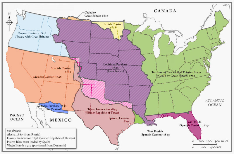
Pennsylvania gained the Erie triangle, Connecticut lost their western reserve, Texas lost a shit ton, Massachusetts lost the Maine district, Louisiana gained their little panhandle, Kentucky gain some land from Tennessee, Missouri made the Platte purchase, etc.
If the US does take Canada in 65, we likely see whole different prairies and BC, I doubt that land will be given to Washington barring maybe Vancouver Island and the Queen Charlotte Islands
The best time to conquest Canada was actually 1865, because the Union Army at that time was an equivalent to the Soviet Army in 1944-1945. Such an Army would have rolled over all kinds of British/Canadian resistance on land.
Phew, for a minute I thought you were talking about pre-Civil War America
Trent War debate flashbacks
The real stopper here would be motivation; why would the war-weary, unstable American government suddenly embark on a war of conquest against a semi-close ally?
Venus:
As I recall both Missouri and Nevada were expanded post statehood while Virginia and Massachusetts contracted.
I stand corrected. But I still don't see huge amounts of territory being awarded to the states on the Canadian border.Pennsylvania gained the Erie triangle, Connecticut lost their western reserve, Texas lost a shit ton, Massachusetts lost the Maine district, Louisiana gained their little panhandle, Kentucky gain some land from Tennessee, Missouri made the Platte purchase, etc.
If the US does take Canada in 65, we likely see whole different prairies and BC, I doubt that land will be given to Washington barring maybe Vancouver Island and the Queen Charlotte Islands
damein fisher
Banned
I stand corrected. But I still don't see huge amounts of territory being awarded to the states on the Canadian border.
agreed, actually at this time, upper and lower Canada were one province, so we might see a large canada state, just with land ceded to unorganized Territory. If we assume 65 [perhaps Britain joins the Civil War on the CSA side and still lose, doesn't really matter how], then the northern US territories are actually more likely to see added territory. Namely Montana and Washington

My guess is that we'll see Vancouver Island and maybe the Queen Charlotte Islands added to Washington, BC admitted as a state [EIther as Columbia, Fraser or New Caledonia], land added to Montana, No manitoba, A Canada State consisting of OTL Lower Canada and the Niagra peninsula of Upper Canada, add 6 territories cut out of Canada [The Southern Prairies, Upper Prairies, Keewain, North of Great Lakes, Unguva and OTL Canadian Territories], When Alaska is purchased, it will likely be added onto Yukon. We also will likely see the southmost of these territories eventually be divided into multiple territories before statehood. Each of the maritimes provinces will likely be states
Would the North border of Louisiana be restored? Or would the US consider it too much trouble.agreed, actually at this time, upper and lower Canada were one province, so we might see a large canada state, just with land ceded to unorganized Territory. If we assume 65 [perhaps Britain joins the Civil War on the CSA side and still lose, doesn't really matter how], then the northern US territories are actually more likely to see added territory. Namely Montana and Washington
My guess is that we'll see Vancouver Island and maybe the Queen Charlotte Islands added to Washington, BC admitted as a state [EIther as Columbia, Fraser or New Caledonia], land added to Montana, No manitoba, A Canada State consisting of OTL Lower Canada and the Niagra peninsula of Upper Canada, add 6 territories cut out of Canada [The Southern Prairies, Upper Prairies, Keewain, North of Great Lakes, Unguva and OTL Canadian Territories], When Alaska is purchased, it will likely be added onto Yukon. We also will likely see the southmost of these territories eventually be divided into multiple territories before statehood. Each of the maritimes provinces will likely be states
Also, that Canadian state seems excessively large, especially considering that that state would consist of most of the Canadian population. I think a state with Toronto as the capital, a state with Ottawa as the capital would be a goal, and what would become Quebec should be split in two. There could also possibly be a state in the North half of what would become Ontario and a state in the north half of what would become Quebec. And I think PEI would be merged with Nova Scotia, it is to small to be considered a state.
Last edited:
damein fisher
Banned
Would the North border of Louisiana be restored? Or would the US consider it too much trouble.
Also, that Canadian state seems excessively large, especially considering that that state would consist of most of the Canadian population. I think a state with Toronto as the capital, a state with Ottawa as the capital would be a goal, and what would become Quebec should be split in two. There could also possibly be a state in the North half of what would become Ontario and a state in the north half of what would become Quebec. And I think PEI would be merged with Nova Scotia, it is to small to be considered a state.
They would probably add more than that to Montana. The problem lies mainly in cultural ties. The colonies in British North America have existed as long as those in America. they have been separate for decades. The best you can expect is for the US to recombine Nova Scotia and New Brunswick, but PEI is staying as is. As for Canada, again, the best I can see is the separation and admission of upper Canada [Ontario] and lower Canada [Quebec], just with lands ceded to Territories outside of those states. It's a thing also of administration, there already exists in each of these entities enough for them to be governed, no more no less. So separating requires the construction of these facilities and combining requires decommission.
Montana is already quite large, I don't think they need much more territory. Also, In regards to PEI, it has just been conquered by the United States, and separated from Britain. I think being combined with Nova Scotia will be the least of their grievances. PEI already relies on the other two provinces economically, so it won't be that big of a stretch to make them the same state. As for Upper and Lower Canada, admitting Upper Canada to the Union as is means that Upper Canada will become America's 5th most populous state, which would rapidly grow as Americans migrate north. The US would have to deal with Canadian insurgents for the next decade, a state this big would be impossible for a single government to run. Combining them is an even worse idea, that make the population of the State of Canada the 3rd most populous in the Union.They would probably add more than that to Montana. The problem lies mainly in cultural ties. The colonies in British North America have existed as long as those in America. they have been separate for decades. The best you can expect is for the US to recombine Nova Scotia and New Brunswick, but PEI is staying as is. As for Canada, again, the best I can see is the separation and admission of upper Canada [Ontario] and lower Canada [Quebec], just with lands ceded to Territories outside of those states. It's a thing also of administration, there already exists in each of these entities enough for them to be governed, no more no less. So separating requires the construction of these facilities and combining requires decommission.
I'd imagine that the districts of the Northwest Territories [Yukon, Mackenzie, Franklin, Keewatin, Unguva, Athabasca, Alberta, Saskatchewan and Assiniboia] would all become their own entities instead of being merged. We will likely see Alberta, Saskatchewan, Assiniboia and maybe Athabasca become states, while the other remain territories
I think this is a pretty decent map of some of the states of this alternate Canada. How about British Columbia, what will happen with that?
Last edited:
I made a basic map of a potential division of states. The North half of what was British Columbia gets the Alaska panhandle and Alaska gets Yukon. This gives us 15 additional states plus 4 additional territories that could potentially become states.

First off, state/provincial boundaries aren't drawn for aesthetic reasons. Unless the population density becomes much greater splitting them up makes no sense. Secondly, some states are already larger in area than some provinces. California and Texas are easily larger than most provinces short of Ontario.For one, they would be far smaller. We tend to like our states much smaller than the Cannucks like thier provinces.
First off, state/provincial boundaries aren't drawn for aesthetic reasons. Unless the population density becomes much greater splitting them up makes no sense. Secondly, some states are already larger in area than some provinces. California and Texas are easily larger than most provinces short of Ontario.
Texas and California are execeptions.
Check out how the Statea got thier shape - there are patterns on how we ahape the states, pattwra that would continue north of the 49th if we had Canada.
I'm not saying the borders would be the same, but states weren't generally made the way they are just because people just felt like states shouldn't be too big.Check out how the Statea got thier shape - there are patterns on how we ahape the states, pattwra that would continue north of the 49th if we had Canada.
Share: