VT-BAM Atlas of the World

My previous mapping efforts were mostly concerned with the Q-BAM. However, the VT_BAM efforts appear to be getting on quite well, so I am thinking of doing of launching this project.
However,nobody ate the whole wisdom of the world.

Dividing the world broadly into a number of macroregions:
  1. Angloamerica
  2. Carribean
  3. Latine America
    1. Mexico​
    2. Central America​
    3. Colombia​
    4. Andean Region​
    5. Southern Cone​
    6. Brazil​
  4. Europe
    1. Scandinavia​
    2. Britain​
    3. Hispania​
    4. Francia​
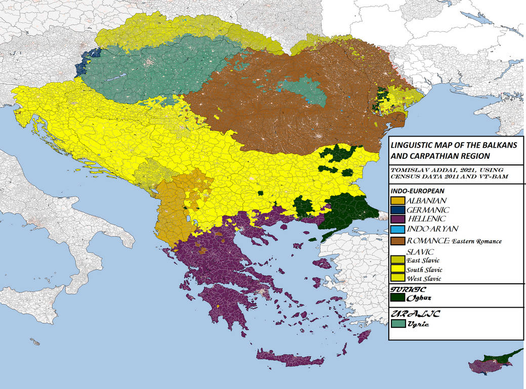
    5. Balkans @Tomislav Addai
  5. Eurasia
    1. Eastern Europe​
    2. Caucasus​
    3. Turkestan​
    4. Russia proper​
    5. Siberia​
  6. Middle East North Africa
    1. Maghreb​
    2. Nile​
    3. Fertile Crescent @Tomislav Addai
    4. Arab Peninsula @Tomislav Addai
  7. Indian Subcontinent
    1. Pakistan​
    2. Himalayas​
    3. Hindustan​
    4. Greater Bengal​
    5. Dravidia​
  8. Indochina
    1. Peninsular SE Asia​
    2. Nusantara​
    3. Philippines​
  9. Far East
    1. China​
    2. Korea​
    3. Japan​
    4. Mongolia​
    5. Vietnam​
  10. Oceania
    1. Australia​
    2. Melanesia​
    3. Micronesia​
    4. Polynesia​
    5. NZ​
Of course anyone is welcome to upload their maps, be they ethnic, linguistic, religious or other.
 
Last edited:
Balkans.png

Here is the first map from this collection. AA religious map of the Balkans
 
Where did you get that subdivisions for Egypt? Those aren't the current borders of the governates, as far as I can find.
Where in Egypt is that big splotch of Coptic?
The VT-BAM, and the map of Egypt as depicted there. Indeed I have seen differing maps also on Wikipedia, in some of them the borders of the Red Sea governorate extending almost to the Nile Valley, in others it extends halfway.

As for the big Coptic splotch: I came across a list of 10 localities which were said to have had a Coptic majority. I searched for each of them at Google maps, and admittingly I had failed to find some of them. The eastern district of the Minya governorate contained two of such localities.

Asyut apparently has largest proportion of Copts but none of its districts is among the Coptic majority communities
 
Hungary.png

A map of the Carpathian Basin. Added more detail to Vojvodina. As for Bucovina, I assumed Poles to be catholic and everyone else Orthodox. For Carpathian Ruthenia, Hungarians were assumed to be Reformed, and Slovaks Catholic. Greek Catholics were assumed to dominate in areas where there were parishes of the Eparchy of Mukachevo (Парафії - МГКЄ (mgce.uz.ua)) and areas where Rusyn languages was prevalent. Enjoy.
 
Is it just religious maps or is everything available? I see that it's an "atlas", so are you wanting maps that you would find in an atlas for example? I would gladly contribute some VT-BAM maps I've made that would go perfect here
 
Is it just religious maps or is everything available? I see that it's an "atlas", so are you wanting maps that you would find in an atlas for example? I would gladly contribute some VT-BAM maps I've made that would go perfect here
Yup all thematic maps are welcome. I have a linguistic map of Peru and Bolivia half-done, so yes, other themed maps will come as well
 
Top