You are using an out of date browser. It may not display this or other websites correctly.
You should upgrade or use an alternative browser.
You should upgrade or use an alternative browser.
The XK-BAM map series
- Thread starter Klime
- Start date
Depends on who you ask, 8K-BAM isn't being systematically patched but rather is kept alive by contributions of users independent from each other
Could someone send the latest 8kbam map
oh. ok.Depends on who you ask, 8K-BAM isn't being systematically patched but rather is kept alive by contributions of users independent from each other
Source?
Sacer Bubonicus
Banned
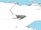
It's the Russian form of Wuyibeiguo(*), the Chinese name for a tribal group mentioned in the Records of the Three Kingdoms, located beyond the Wusun and thus outside of China's direct contact. If we trust that there was something confederacy-shaped in that direction, this tribal confederacy likely corresponds with the Sargat archaeological culture that was thriving in that area at that time. And given the location, this culture would have been Ugric-speaking.
Also, it was the 4th century AD, not BC. It's from the record of the Three Kingdoms after all, not something earlier like the Records of the Grand Historian.
(*): lit. 'north Wuyi country', said to be directly north of Yancai, who are the Alans. The Yancai were located in Kazakhstan, directly south of the Sargat culture.
Last edited:
It's just that I try to take information from Wikipedia, and sometimes I have to look into other language sections to find information about something. BC and AD is just a typo.It's the Russian form of Wuyibeiguo(*), the Chinese name for a tribal group mentioned in the Records of the Three Kingdoms, located beyond the Wusun and thus outside of China's direct contact. If we trust that there was something confederacy-shaped in that direction, this tribal confederacy likely corresponds with the Sargat archaeological culture that was thriving in that area at that time. And given the location, this culture would have been Ugric-speaking.
Also, it was the 4th century AD, not BC. It's from the record of the Three Kingdoms after all, not something earlier like the Records of the Grand Historian.
(*): lit. 'north Wuyi country', said to be directly north of Yancai, who are the Alans. The Yancai were located in Kazakhstan, directly south of the Sargat culture.
Source?
Useful to mention that this map from c. 400 AD contains artificial man-made reservoirs which were not built by the Soviets until over 1000 years later.It's the Russian form of Wuyibeiguo(*), the Chinese name for a tribal group mentioned in the Records of the Three Kingdoms, located beyond the Wusun and thus outside of China's direct contact. If we trust that there was something confederacy-shaped in that direction, this tribal confederacy likely corresponds with the Sargat archaeological culture that was thriving in that area at that time. And given the location, this culture would have been Ugric-speaking.
Also, it was the 4th century AD, not BC. It's from the record of the Three Kingdoms after all, not something earlier like the Records of the Grand Historian.
(*): lit. 'north Wuyi country', said to be directly north of Yancai, who are the Alans. The Yancai were located in Kazakhstan, directly south of the Sargat culture.
Sacer Bubonicus
Banned
*shrug* And it'll need some cleanup. So what?Useful to mention that this map from c. 400 AD contains artificial man-made reservoirs which were not built by the Soviets until over 1000 years later.
It's accurate as far as the bounds of the archaeological culture, so all it would take to get the map to reflect the situation of the living culture in the 4th century AD, as opposed to its dead remains in the 21st, is to remove the anachronistic reservoirs.
I 'll take it into accountUseful to mention that this map from c. 400 AD contains artificial man-made reservoirs which were not built by the Soviets until over 1000 years later.
Any updates on the RoC 1949 subdivisions map?View attachment 782785
My current progress on ROC 1949 map
De Facto Map of the United Mexican States (Cartel controlled areas and Zapatista Army of National Liberation)
Last edited:
by the way, zapatistas aren't currently a single unified rebel group rn, they have local groups and stuff like that, but it's pretty hard to find data about them, so it's all goodDe Facto Map of the United Mexican States (Cartel controlled areas and Zapatista Army of National Liberation)
A map I did that shows mountain slopes (pretty accurate), dunes (eh, accurate enough) and wetlands (exaggerated but that was the only thing i could find :/)
Have you thought of doing these for the 2K-BAM as well? I will try to do it myself, in the most amateur way possible - just simply make them smaller on MS paint and fill out any bad-looking pixels, is there a better way to put these on the 2K?Did a small patch for 8K-BAM
Edit: Also, has there been a more up-to-date modern-day 2K since this one from 2018?
Last edited:

Share: