For most of the people asking questions about updates in here: I am not sure if this map is still regularly updated other than just random people sporadically working on it by themselves, like someone suggested months ago, there could be a new thread about this map that actually gets updated, sucks because this is by far my favorite map of all time.
You are using an out of date browser. It may not display this or other websites correctly.
You should upgrade or use an alternative browser.
You should upgrade or use an alternative browser.
The XK-BAM map series
- Thread starter Klime
- Start date
I'd like to give it a try.Is anyone willing to finish the river map? I will send the raw data rivers if someone responds.
I'd like to give it a try.
Desktop.zip
 drive.google.com
") . Of course, no one is forcing you to remake the river map from scratch, so please do finish East Asia and Asian Russia (and some minor places i dont know), that'll be just about enough!
. Of course, no one is forcing you to remake the river map from scratch, so please do finish East Asia and Asian Russia (and some minor places i dont know), that'll be just about enough!(the more the merrier, hope more than one would finish this, it has been like 3 years already, better finish it.)
Last edited:
Also, here is the recently updated 8k-bam resources complilation by @Apathe , cheers to them! And also cheers to the young enthusiastic talking countries mappers who spent their time doing many many historical maps, and many "visual layers" for the map!
 docs.google.com
xk-bam resource compilation
docs.google.com
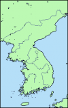
One busy month and one minor power outage later, I've done the bare minimum amount of work. I've finished the nine major Korean rivers, although I don't trust myself yet to produce anything reliably accurate, so use these at your own risk. I mainly based them off the sources Klime linked to a few years ago, using Chilneun's new source as a guide for wherever those weren't viable, so it's a patched-together hotchpotch that conflicts with the political map, and I haven't cross-referenced it with the topographic map at all. I might adjust the rivers sometime later to make them more accurate.
Attachments
Does anyone have an 8K-BAM drainage basins map, covering at least North America and Australia (and showing sub-basins in the Mississippi and Murray-Darling basins, ideally)?
This uses the X2 color scheme, although you're free to use whichever one you want.What colour scheme does XK-Bam use?
yo, would you happen to know of a topography dataset that's compatible with the 8K?Also, here is the recently updated 8k-bam resources complilation by @Apathe , cheers to them! And also cheers to the young enthusiastic talking countries mappers who spent their time doing many many historical maps, and many "visual layers" for the map!
xk-bam resource compilation
Apparently the first level subdivisions use a slighlty different color south of around Sikasso, Mali.
Nasa visible earth downscaled DEM. If you want bathymetry aswell, try out etopo1yo, would you happen to know of a topography dataset that's compatible with the 8K?
Aren't the 8K administrative divisions of Somalia incorrect? it shows the Regions/Gobollo as first-level divisions, and not any Federal Member States.

 en.wikipedia.org
 en.wikipedia.org
States and regions of Somalia - Wikipedia
Administrative divisions of Somalia - Wikipedia

Could someone who knows qgis make 8k-bams with sea level rise? or a map with the first 70-100 or so meters each having a different color so one could remove them one by one? or at least once every 2 or 3 meters. Also does anyone have the topographic 8k-bam but without the border around the coastlines?
Could someone who knows qgis make 8k-bams with sea level rise? or a map with the first 70-100 or so meters each having a different color so one could remove them one by one? or at least once every 2 or 3 meters. Also does anyone have the topographic 8k-bam but without the border around the coastlines?
Join the chilneun's map resources Discord Server!
Check out the chilneun's map resources community on Discord - hang out with 533 other members and enjoy free voice and text chat.
 discord.gg
Way too much.This server has sea level riseJoin the chilneun's map resources Discord Server!
Check out the chilneun's map resources community on Discord - hang out with 533 other members and enjoy free voice and text chat.
Share: