Spain and Portugal 1591TY, I shall work on this
Do you have any data on Tunez, I estimated based on the towns/cities I KNEW were taken, anything else would be appreciated
You are using an out of date browser. It may not display this or other websites correctly.
You should upgrade or use an alternative browser.
You should upgrade or use an alternative browser.
The VT-BAM project
- Thread starter VT45
- Start date

At least it shows the modern borders too, so that you won't lose your mind trying to figure out some village around madridThank you... I think
")
@Anagnod
It's a good map, but I can see several errors (if this is OTL).
·For the Crown of Castille, the internal subdivision was this: https://es.wikipedia.org/wiki/Archivo:Provinces_Crown_of_Castile_1590.svg (although this map has the error of Olivenza y Taliga on the Portugal border)
·Portugal should include the cities of Olivenza and Taliga (currently on Spain)
·The internal divisions of Catalonia, Aragon and Valencia are simply just wrong, also Catalonia includes the Fenolleda, which was part of France: https://ca.wikipedia.org/wiki/Fenolleda
·Valencia is missing the Racó d'Ademús, an exclave (https://ca.wikipedia.org/wiki/Rac%C3%B3_d%27Adem%C3%BAs), and the city of Caudete, another exclave (https://ca.wikipedia.org/wiki/Cabdet), but includes Villena and Sax, which where not part of the Kingdom (except between 1304-1369) (https://ca.wikipedia.org/wiki/Villena, https://ca.wikipedia.org/wiki/Saix) and the Plana de Utiel comarca, which was part of Castille except for the cities of Sinarcas and Chera (https://ca.wikipedia.org/wiki/Plana_d'Utiel) and the small village of Casas del Río (small "triangle" south of Requena).
The Spanish territory held in Oran is exagerated, and the spanish Tunez is just wrong.
Also, the territories of the Hispanic Crown should be marked with different colours or with darker borders, because the relations between the Crown of Castile and the different territories of the Crown of Aragon, and between the territories of the Crown of Aragon among themselves, were to have the same king, but there was no administrative relationship between them.
@Anagnod
Wikipedia has a good list of the cities and the dates on which they were controlled (https://es.wikipedia.org/wiki/Imperio_español#África). In addition, control of cities in the Tunis area was superficial and generally confined to the city limits. The population of the cities were natives of the area.
By 1560 the only controlled territories were: the island of Djerba (which was lost that same year), Bizerte and Tunis (including La Goulette).
Thank you for the input guys, how does this look?Spain and Portugal 1591

It seems pretty good to me, I see that you missed some enclaves, such as the Kingdom of Granada in the Kingdom of Jaén, the Catalonia-Fenolleda border also seems a bit strange to me, and the same with the Villena border (it seems you have put too much territory in Murcia), and you have put the entire Plana de Utiel in Castilla, that was not the case.
Also, I can't identify it well, in Oran have you included Mazalquivir? (https://fr.wikipedia.org/wiki/Mers_el-Kébir), it was also in the hands of the crown.
In Portugal, Olivenza seems a bit small, maybe you have missed Taliga (part of Olivenza in that year).
Also, in France, you have missed Escos as part of Navarre (https://es.wikipedia.org/wiki/Archivo:Tierras_de_Ultrapuertos_(Baja_Navarra)._Siglos_XII-XVI.png) (enclave in the north), and you have put Gestas in Bearn and Esquiule in Zuberoa, while it was the opposite (https://es.wikipedia.org/wiki/Archivo:Zuberoa_(Municipios-Udalerriak).png).
Thank you! That helps a lot to make maps of Iberia!Spain and Portugal 1591
TY for your help with Spain;It seems pretty good to me, I see that you missed some enclaves, such as the Kingdom of Granada in the Kingdom of Jaén, the Catalonia-Fenolleda border also seems a bit strange to me, and the same with the Villena border (it seems you have put too much territory in Murcia), and you have put the entire Plana de Utiel in Castilla, that was not the case.
Also, I can't identify it well, in Oran have you included Mazalquivir? (https://fr.wikipedia.org/wiki/Mers_el-Kébir), it was also in the hands of the crown.
In Portugal, Olivenza seems a bit small, maybe you have missed Taliga (part of Olivenza in that year).
Also, in France, you have missed Escos as part of Navarre (https://es.wikipedia.org/wiki/Archivo:Tierras_de_Ultrapuertos_(Baja_Navarra)._Siglos_XII-XVI.png) (enclave in the north), and you have put Gestas in Bearn and Esquiule in Zuberoa, while it was the opposite (https://es.wikipedia.org/wiki/Archivo:Zuberoa_(Municipios-Udalerriak).png).
Jaen-Granada - Fixed
Catalonia-Fenolleda - per the VT sub-divisions
Villena - ditto
Plana de Utiel - Surely this was Castilian until 1851?
Malzalquivir - yes it is included
Taliga - Fixed
Escos - Fixed
Gestas - Fixed
Esquiule - Can't find any data/ map on this, not even in your link
Progress on the 1560 map

Crazy Boris
Banned
TY for your help with Spain;
Jaen-Granada - Fixed
Catalonia-Fenolleda - per the VT sub-divisions
Villena - ditto
Plana de Utiel - Surely this was Castilian until 1851?
Malzalquivir - yes it is included
Taliga - Fixed
Escos - Fixed
Gestas - Fixed
Esquiule - Can't find any data/ map on this, not even in your link
Progress on the 1560 map
a couple more Italian states are missing: County of Vernio, Republic of Cospaia, Republic of Senarica, Republic of Noli, Duchy of Sora, and Duchy of Castro
also, shouldn't Abkhazia and Svaneti be seperate from Mingrelia?
Last edited:
Prussia doesn't look too right to me but i don't know much about it, also if you are using modern administrative lines to draw ottoman provinces in anatolia they wont work because they are mostly drawn in the 20th centuryTY for your help with Spain;
Jaen-Granada - Fixed
Catalonia-Fenolleda - per the VT sub-divisions
Villena - ditto
Plana de Utiel - Surely this was Castilian until 1851?
Malzalquivir - yes it is included
Taliga - Fixed
Escos - Fixed
Gestas - Fixed
Esquiule - Can't find any data/ map on this, not even in your link
Progress on the 1560 map
You are doing an amazing job here
It was only given to Valencia in that year for trade reasons, as it is separated from Castille by the Gorges of the Magro while the physical separation to Valencia was only a mountain pass. Also, the municipality of Chera (that salient to the northeast) has always been part of Valencia.Plana de Utiel - Surely this was Castilian until 1851?
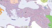
Year 1600 for Ottoman Anatolia, if you would like i can try to send you a bigger version too but can't upload it larger hereTY for your help with Spain;
Jaen-Granada - Fixed
Catalonia-Fenolleda - per the VT sub-divisions
Villena - ditto
Plana de Utiel - Surely this was Castilian until 1851?
Malzalquivir - yes it is included
Taliga - Fixed
Escos - Fixed
Gestas - Fixed
Esquiule - Can't find any data/ map on this, not even in your link
Progress on the 1560 map
Attachments
a couple more Italian states are missing: County of Vernio, Republic of Cospaia, Republic of Senarica, Republic of Noli, Duchy of Sora, and Duchy of Castro
also, shouldn't Abkhazia and Svaneti be seperate from Mingrelia?
Fixed TY, also added Poglizza and re-did the Lucca-Genoa area
Duchy of Prussia or are you talking Brandenburg?Prussia doesn't look too right to me but i don't know much about it, also if you are using modern administrative lines to draw ottoman provinces in anatolia they wont work because they are mostly drawn in the 20th century
Chera
TY
Last edited:
TYYear 1600 for Ottoman Anatolia, if you would like i can try to send you a bigger version too but can't upload it larger here
Now that I realize, Sinarcas (the northern "point" of Utiel-Requena") was also a part of Valencia as was Chera so you'd have to fix that too. Sorry for noticing late.
Now that I realize, Sinarcas (the northern "point" of Utiel-Requena") was also a part of Valencia as was Chera so you'd have to fix that too. Sorry for noticing late.
There is a fine line between Love and Hate.
I Love you ... I think
Share: