The VT-BAM project

Redcoat

Banned
If I fucked up, tell me. Pretty sure I did somewhere
unknown.png
 

Redcoat

Banned
Can I claim the area of the the British Empire (from it's height in 1922) that hasn't been claimed yet or worked on.
 
BTW, I haven't forgotten about that request earlier, just decided I'd better finish at least one of the two before posting it.

It's a Bank Holiday weekend so hopefully Odisha should be done by the end of it.
 

Redcoat

Banned
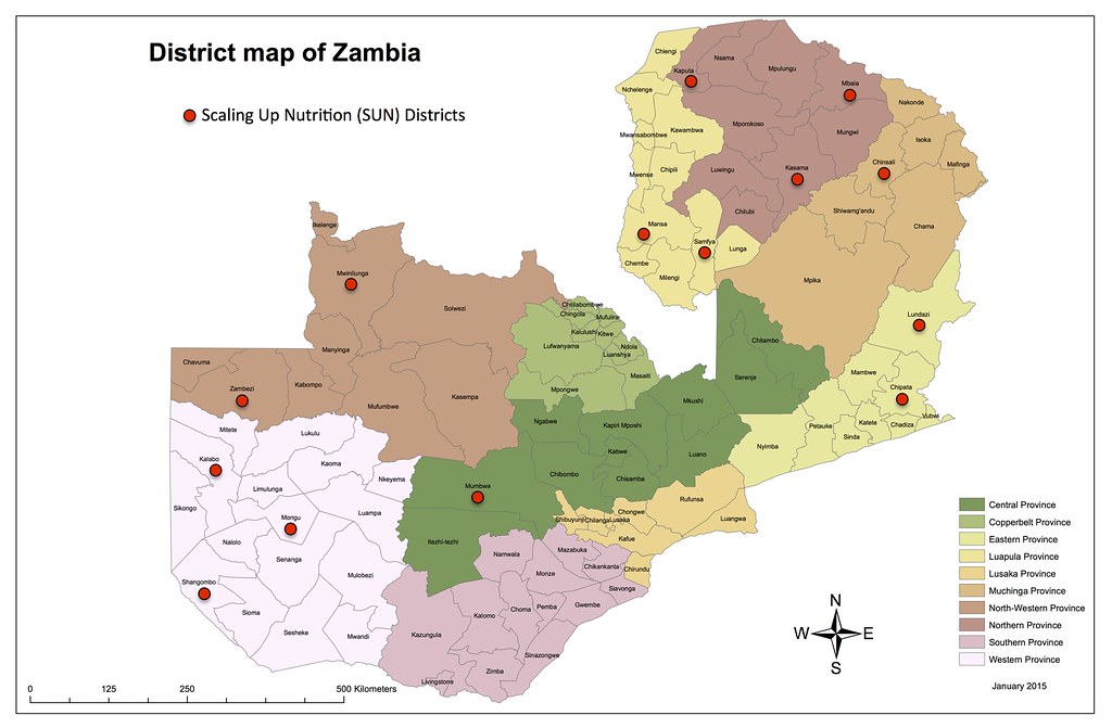
Zambia also seems out of date :/

There are maps of the update version on the internet but IDK how to make overlays for this stuff...
17885437042_a3619860bc_b.jpg


This is accurate, and it seems to be that not too much changed besides splicing districts, so I'll keep working on that, when I'm done I'll edit this post to show the Zambia so far.
 

Redcoat

Banned
upload_2018-5-27_21-34-4.png

Also known as Rhodesia. I hope this is accurate, Zimbabwe might've changed the subdivisions since then.
upload_2018-5-28_9-13-3.png
 
Last edited:

Redcoat

Banned
Thank you :)

upload_2018-5-28_14-14-47.png

It rhymes with Buganda, the country where Ugandan Knuckles comes from. (Lake cut out, obviously fucked up an area of the map)
 
Last edited:

Redcoat

Banned
Can someone send me a detailed map of the British Raj, or at least a series of regional maps? I think that if I could feasibly make a simplified version of the map which could later on be made more accurate. I'd probably map the princely states big enough to be seen on the QBAM and the Presidencies.
 
Can someone send me a detailed map of the British Raj, or at least a series of regional maps? I think that if I could feasibly make a simplified version of the map which could later on be made more accurate. I'd probably map the princely states big enough to be seen on the QBAM and the Presidencies.

Try looking here and here
 
Top