You are using an out of date browser. It may not display this or other websites correctly.
You should upgrade or use an alternative browser.
You should upgrade or use an alternative browser.
The VT-BAM project
- Thread starter VT45
- Start date
Thank you, but it doesn't quite fit; the west and east are slightly off.@erictom333 This is the best I could do
Yeah but can't adjust one without putting other areas off.Thank you, but it doesn't quite fit; the west and east are slightly off.
Using @finnnosam 's Austria-Hungary as a base
I created Habsburg Lands 1560;

Edited, added Schwiebus
Austria HungaryView attachment 559404
I created Habsburg Lands 1560;
Edited, added Schwiebus
Last edited:
Also maybe add Further Austria and the Sundgau ( https://en.wikipedia.org/wiki/Further_Austria )Using @finnnosam 's Austria-Hungary as a base
I created Habsburg Lands 1560;
View attachment 828420
Edited, added Schwiebus
Great to see your maps!
Good idea & thanks ref the mapsAlso maybe add Further Austria and the Sundgau ( https://en.wikipedia.org/wiki/Further_Austria )
Great to see your maps!
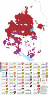
the colours are too close imo, one should use close colours when the map has several families involved, but afaik, Ryukyuan and Japanese are both part of the Japonic family, and hence do not behove such undistinguishable colours.I made a language map of the Ryukyu islands, the colors are based on the language families, criticism is welcome since it's my first real mapView attachment 828479
Also maybe add Further Austria and the Sundgau ( https://en.wikipedia.org/wiki/Further_Austria )
Great to see your maps!
So I added Further Austria and included Wurrtemburg [Habsburg 1520-1534]
Made this using @Crazy Boris 's map [attached]
Attachments
I forgot, the Innviertel was purchased by Austria from Bavaria in the 18. century.So I added Further Austria and included Wurrtemburg

Innviertel - Wikipedia
Also here are a few links with very detailed maps
Further Austria:
Territoriale Entwicklung der österreichischen Länder bis 1797 - Detailseite - LEO-BW
Informationen zum Objekt Territoriale Entwicklung der österreichischen Länder bis 1797 in LEO-BW-Landeskunde entdecken online
 www.leo-bw.de
Baden-Württemberg in 1790
Herrschaftsgebiete und Ämtergliederung in Südwestdeutschland 1790 - Detailseite - LEO-BW
Informationen zum Objekt Herrschaftsgebiete und Ämtergliederung in Südwestdeutschland 1790 mit Karte in LEO-BW-Landeskunde entdecken online
www.leo-bw.de
Last edited:
@erictom333 A friend of a friend saw what you looking for and sent me this map, I had to go upload it.
Here
Here
Thank you for that, I forgot about Innviertel, I'll take it off as I'm aiming for the 1500's.I forgot, the Innviertel was purchased by Austria from Bavaria in the 18. century.
Innviertel - Wikipedia
en.m.wikipedia.org
Also here are a few links with very detailed maps
Further Austria:
Territoriale Entwicklung der österreichischen Länder bis 1797 - Detailseite - LEO-BW
Informationen zum Objekt Territoriale Entwicklung der österreichischen Länder bis 1797 in LEO-BW-Landeskunde entdecken online
Baden-Württemberg in 1790
Herrschaftsgebiete und Ämtergliederung in Südwestdeutschland 1790 - Detailseite - LEO-BW
Informationen zum Objekt Herrschaftsgebiete und Ämtergliederung in Südwestdeutschland 1790 mit Karte in LEO-BW-Landeskunde entdecken online
I have the Further A map and find the B-W almost too detailed to use.
@BBadolato Thank you very much. I've been tracing France's généralités using that map, and I'm over halfway through.

I'm not doing Lorraine because I already have a map for those provinces and the généralités are the exact same.
I'm not doing Lorraine because I already have a map for those provinces and the généralités are the exact same.
Finished, save for Lorraine, Alsace and some exclaves around the Comtat Venaissin, which I'm not doing for reasons already stated.
Share: