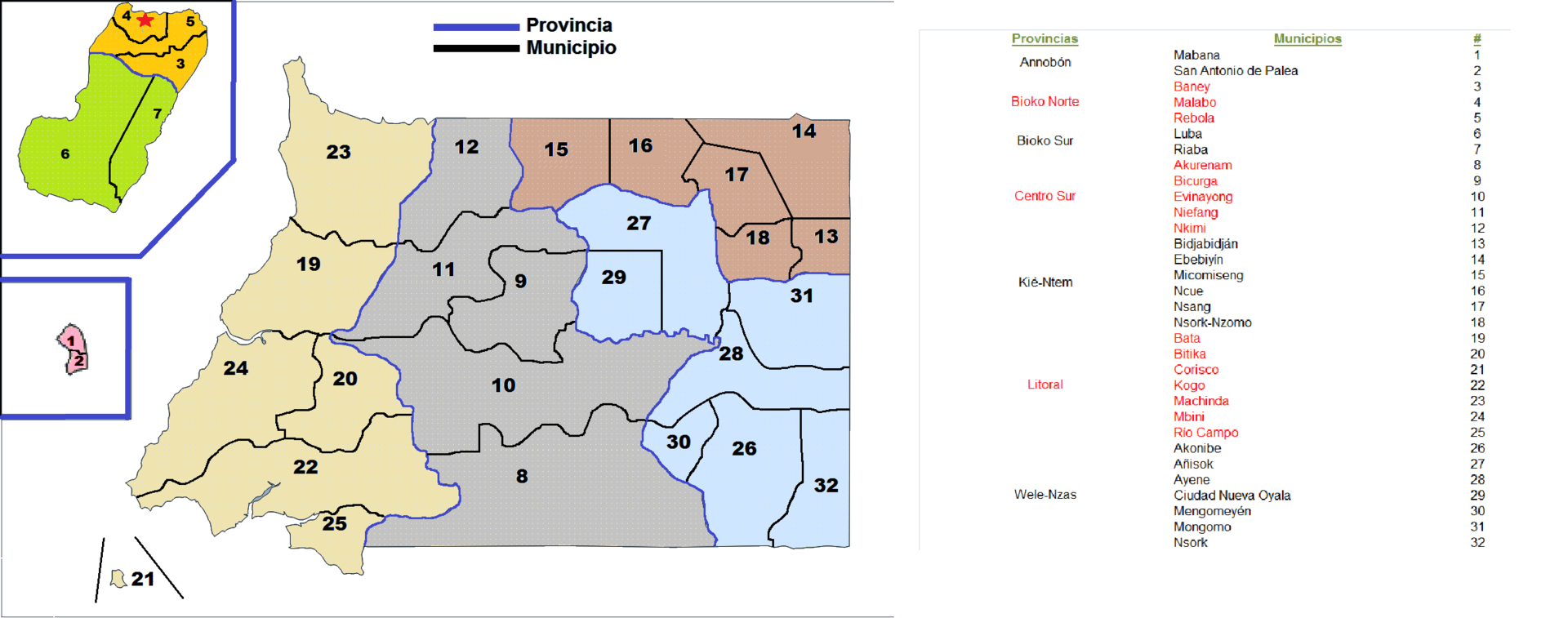
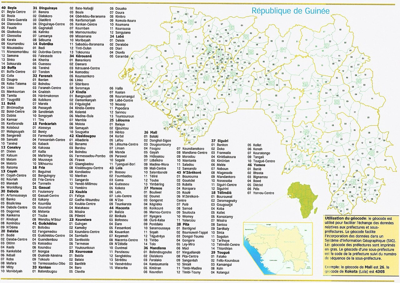
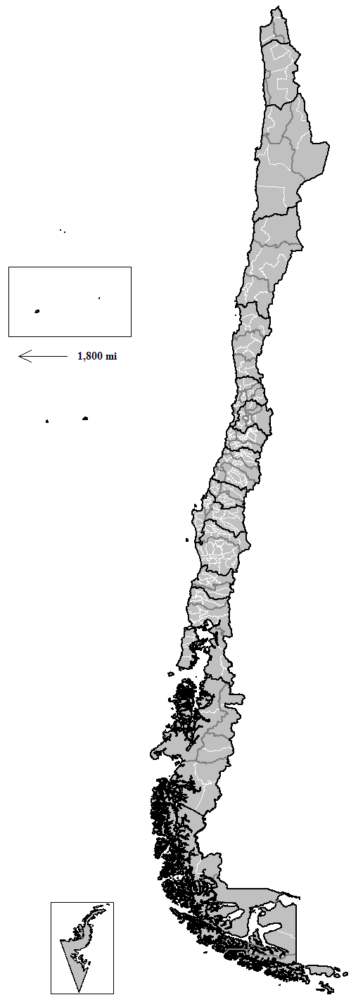
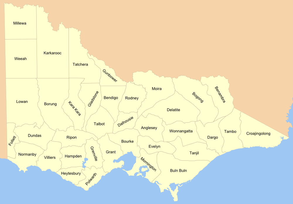
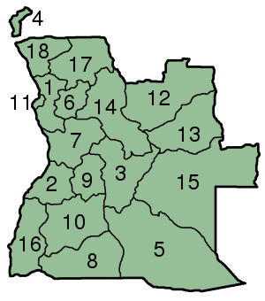
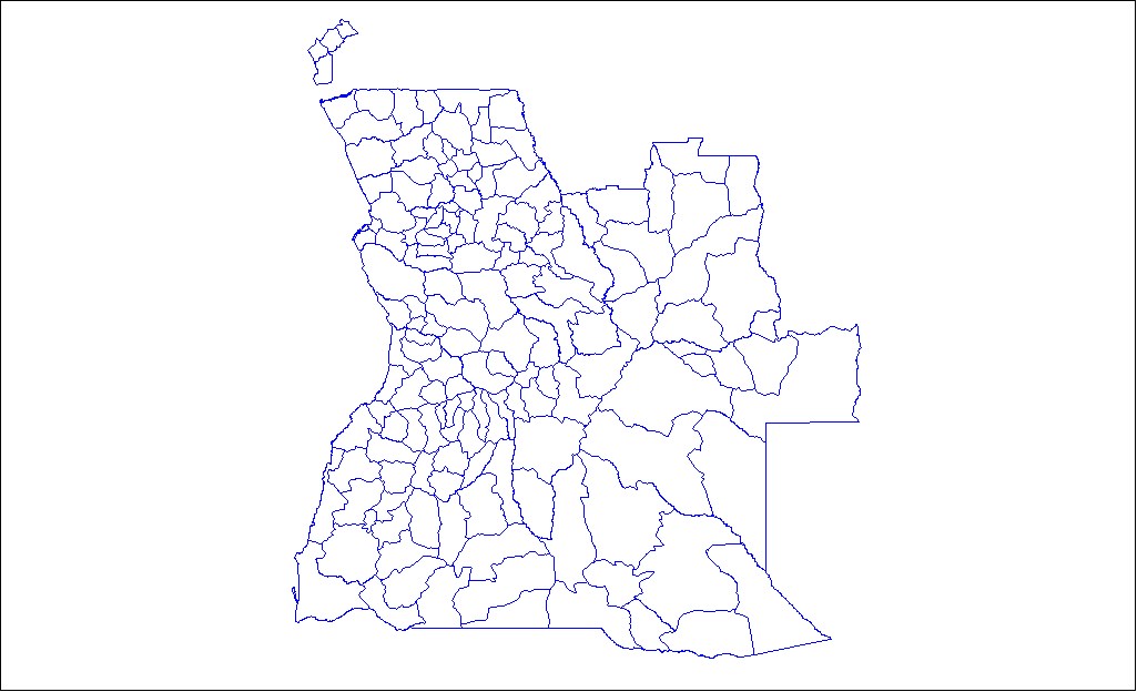
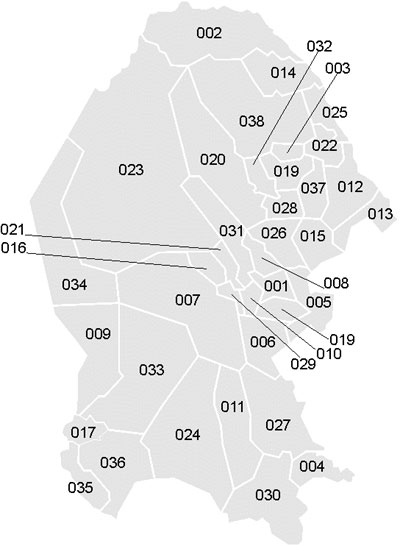
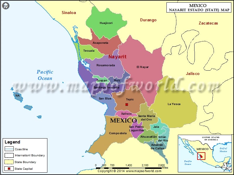
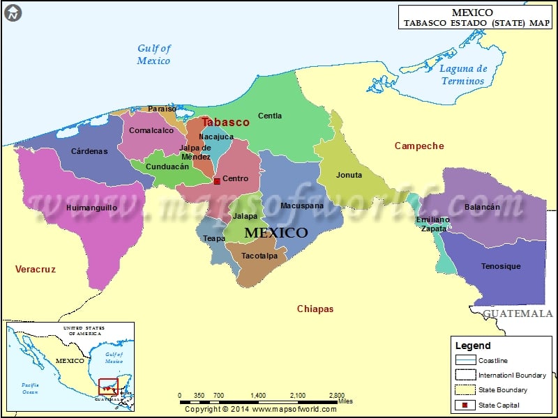
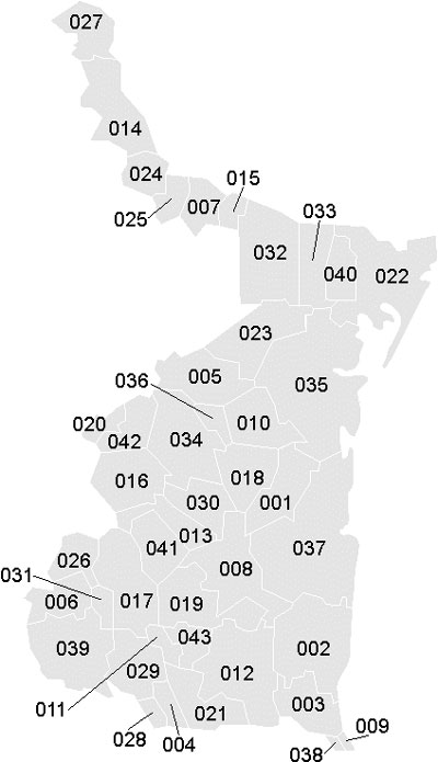
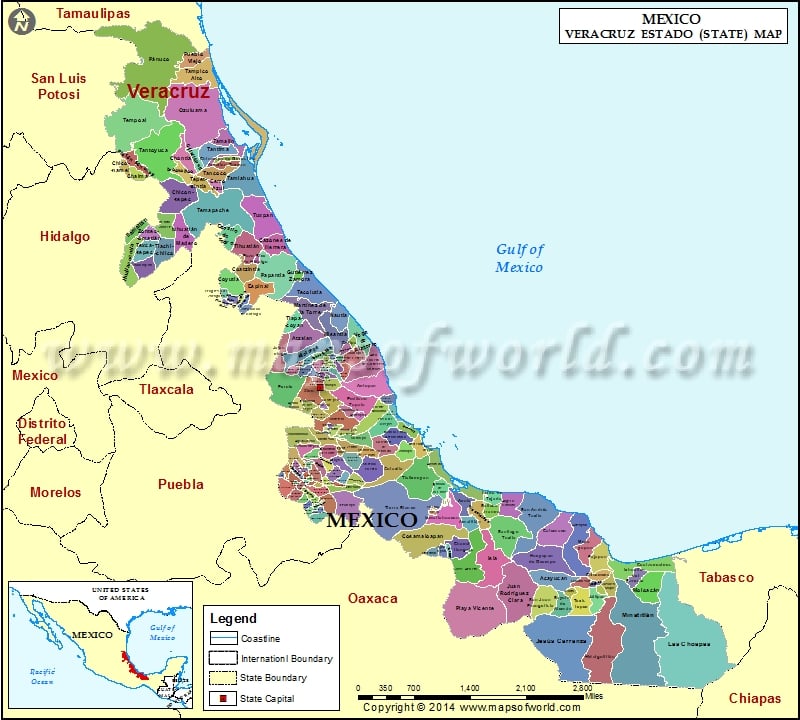
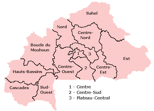
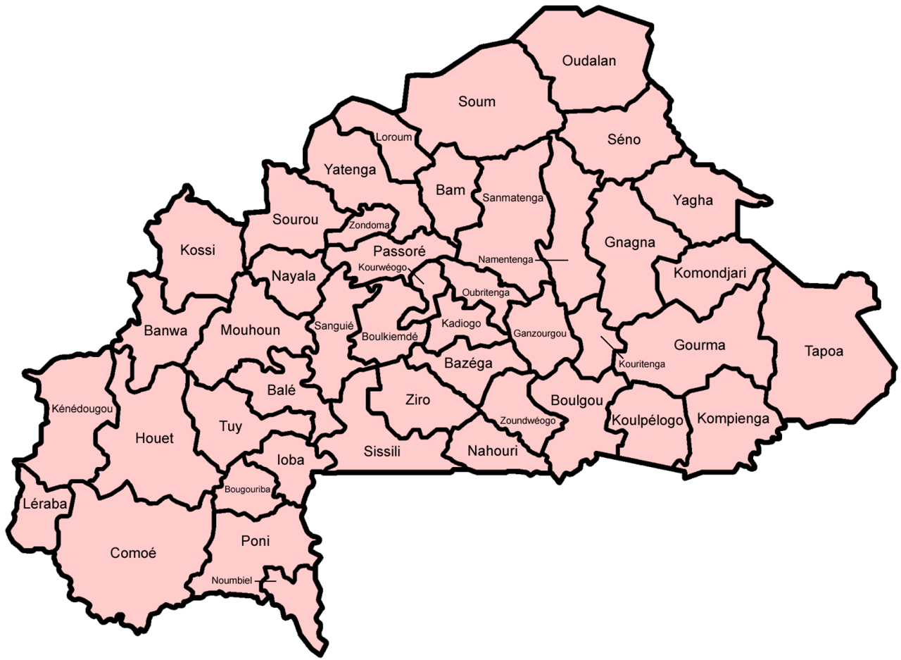
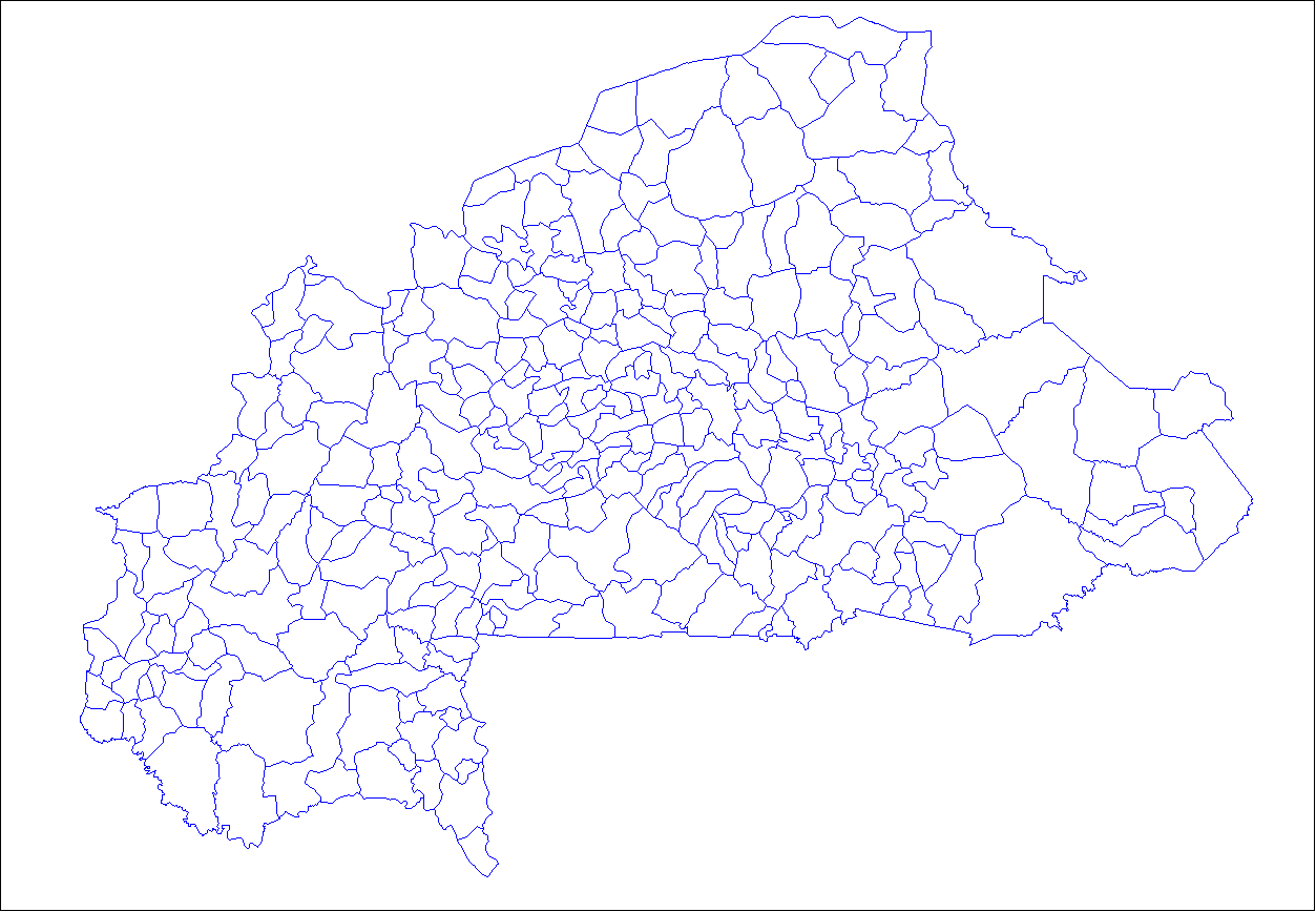
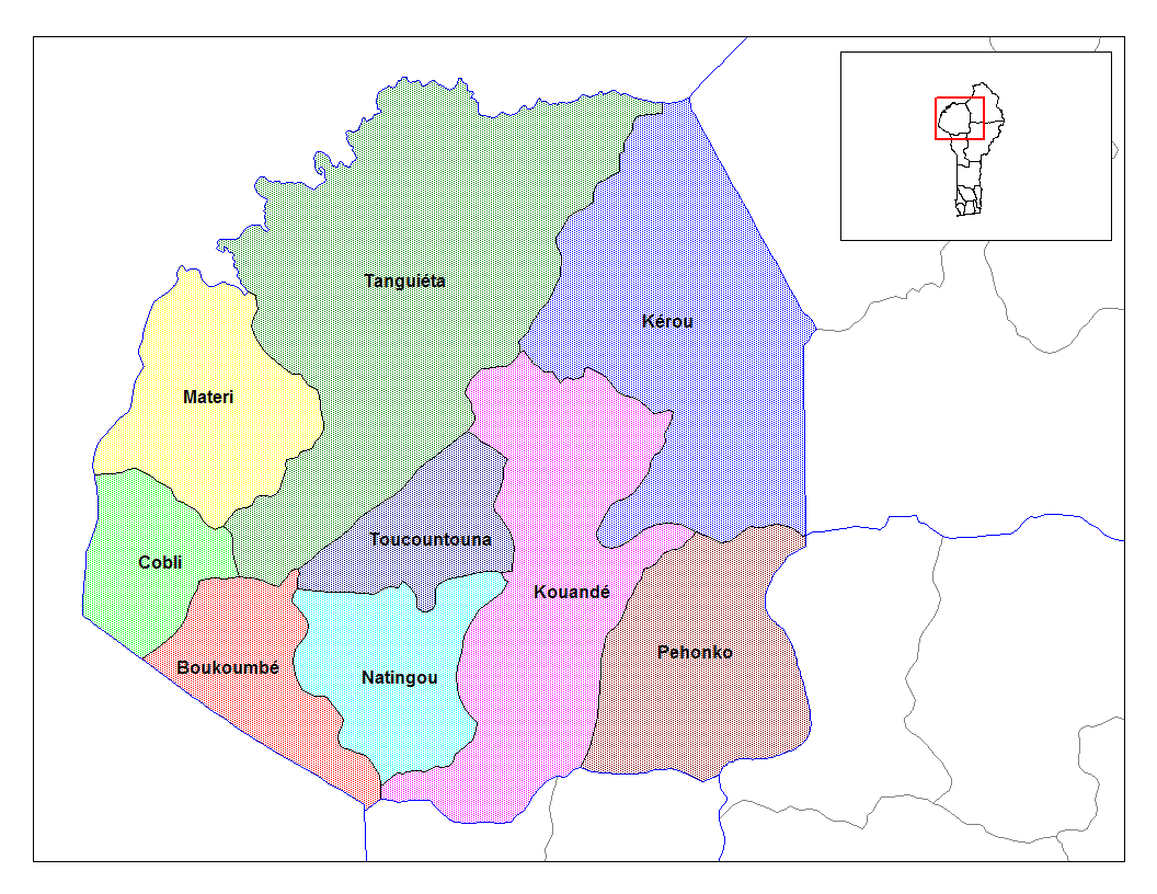
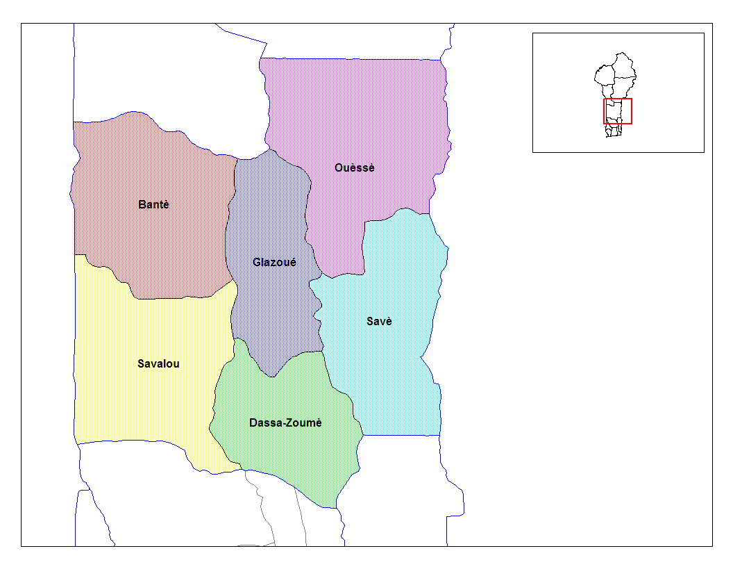
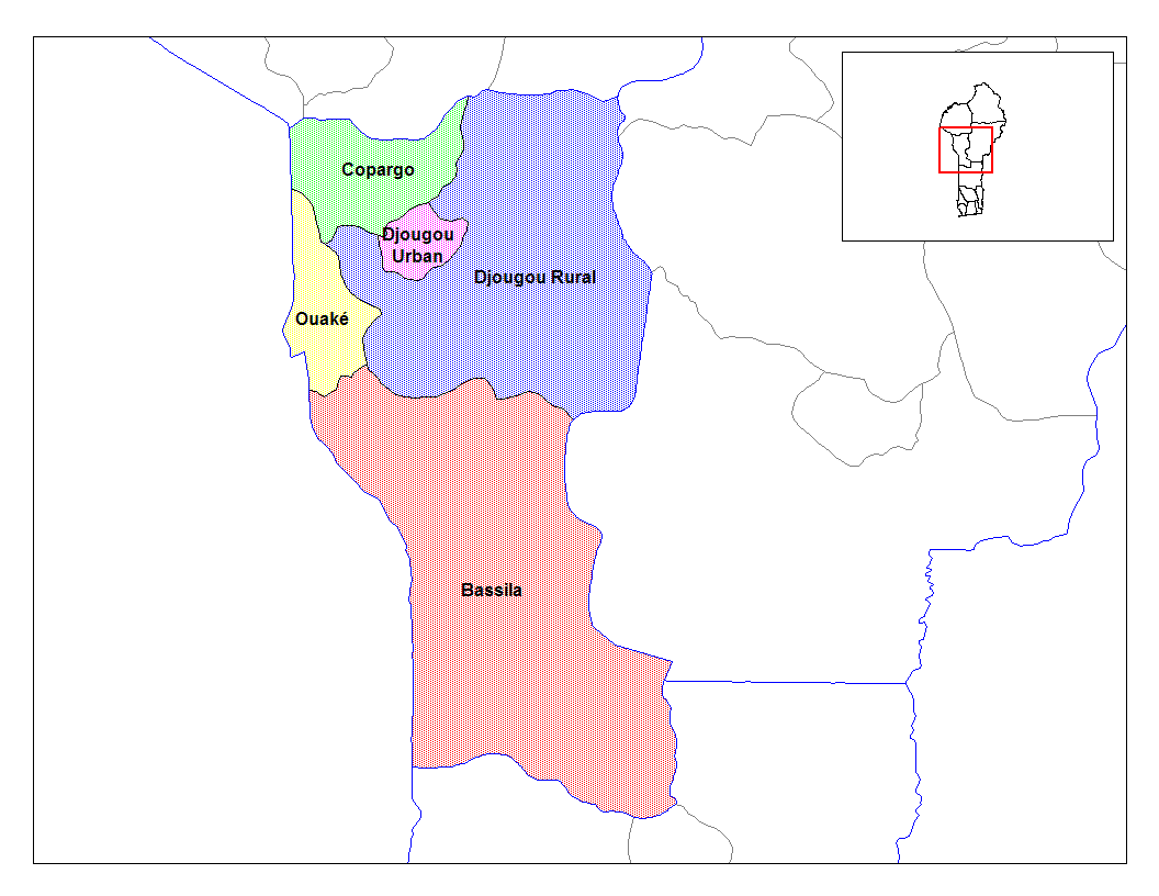
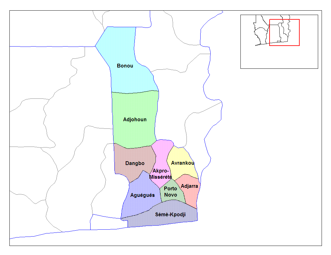
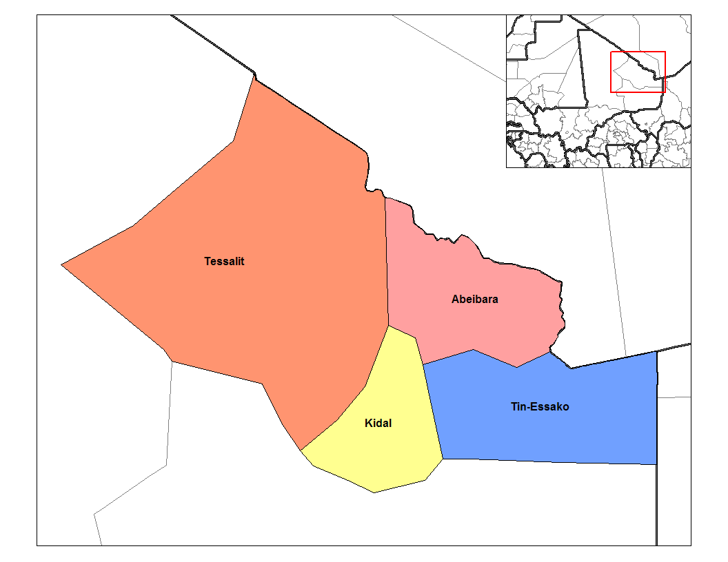
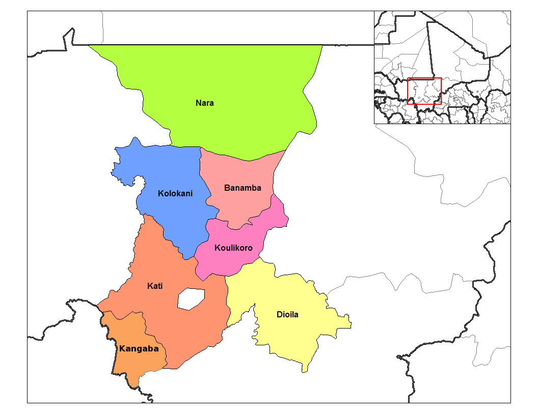
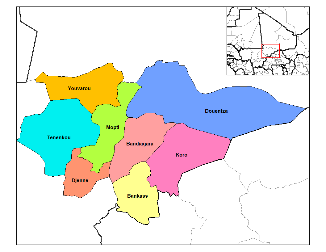
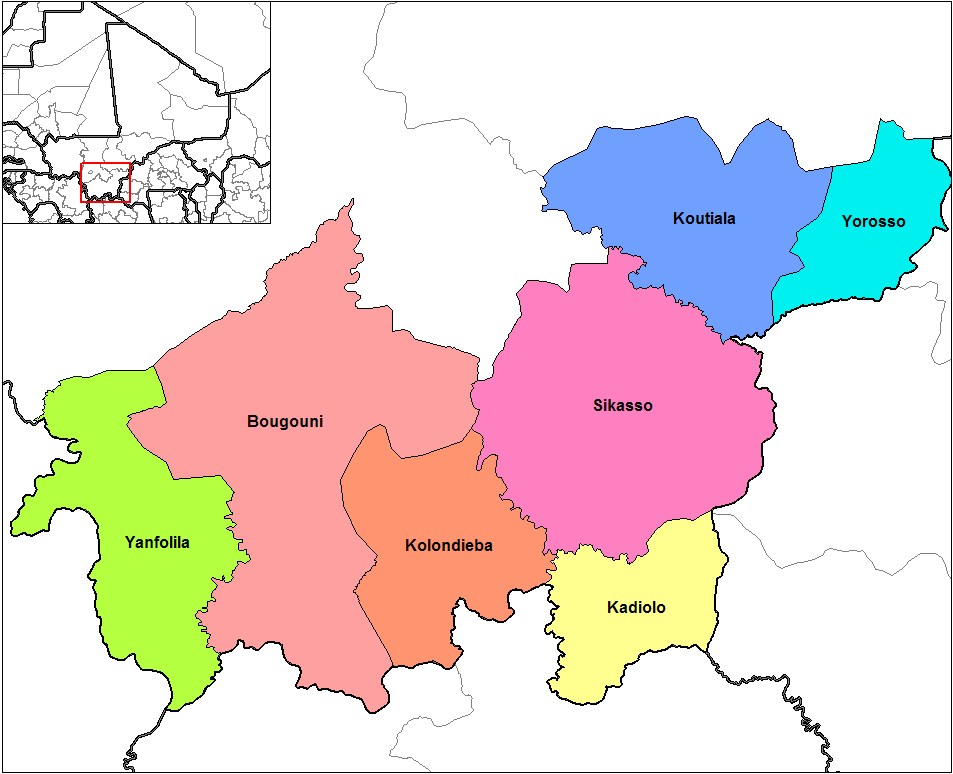
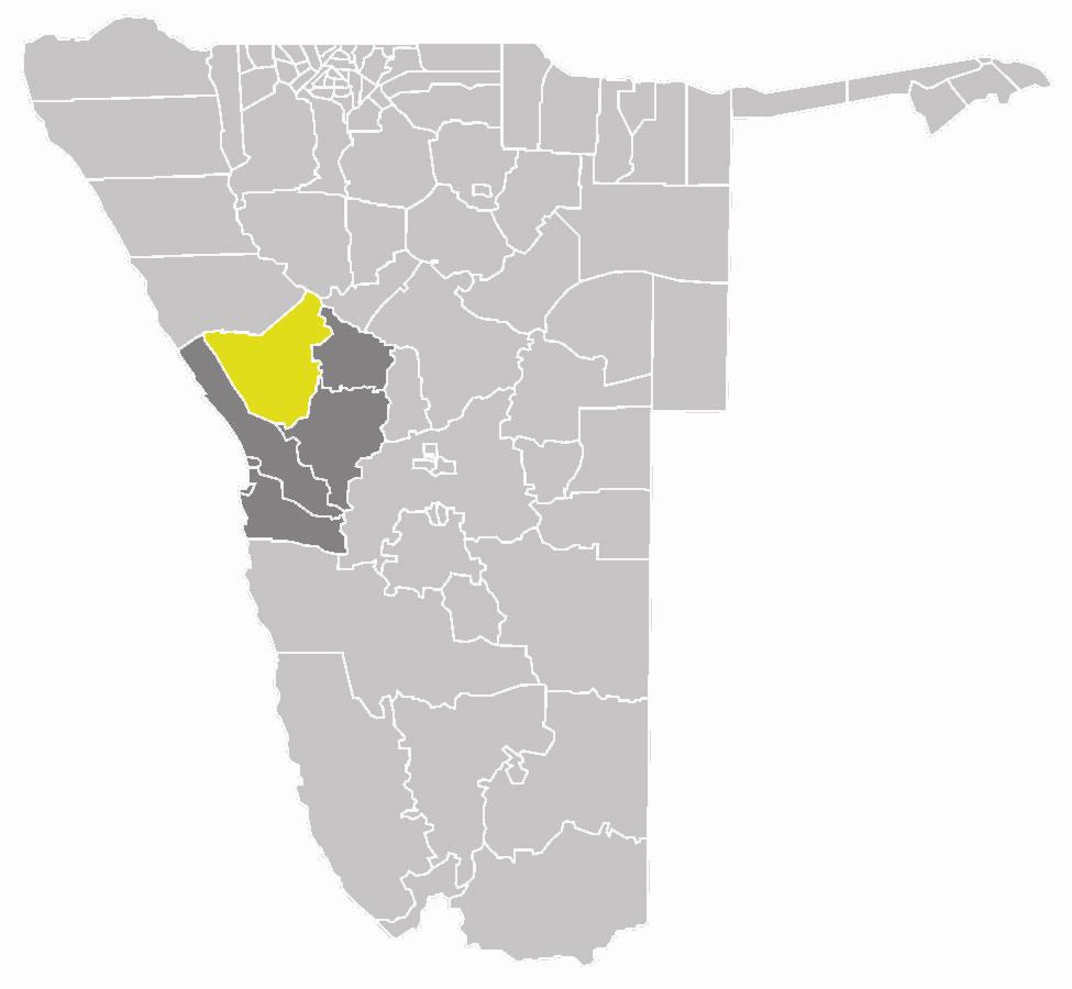
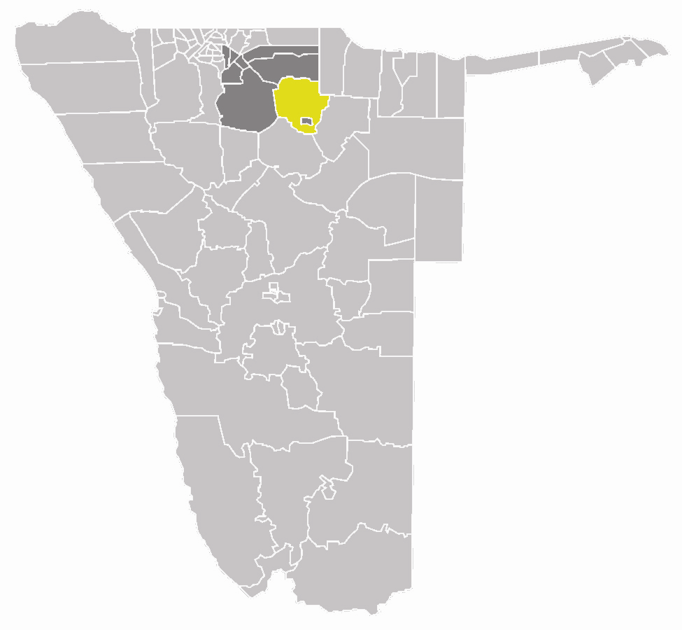
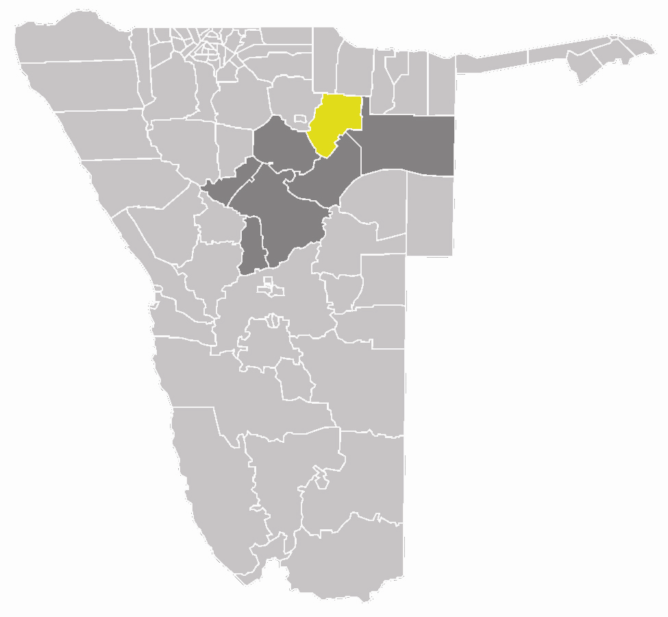
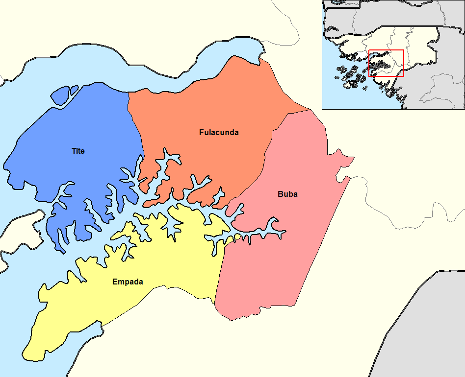
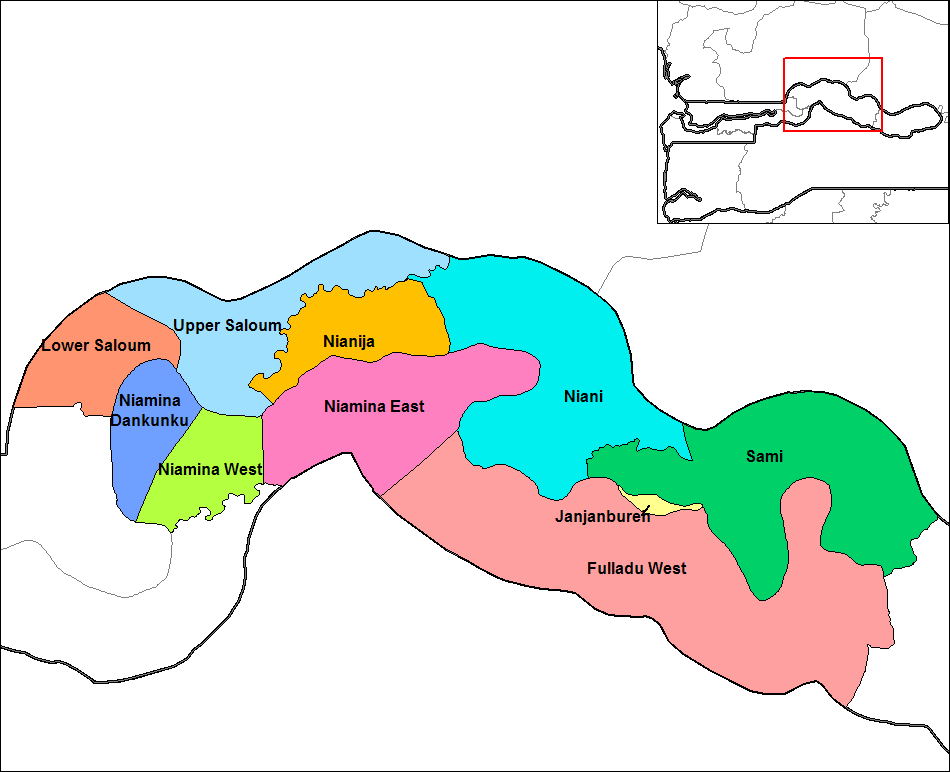
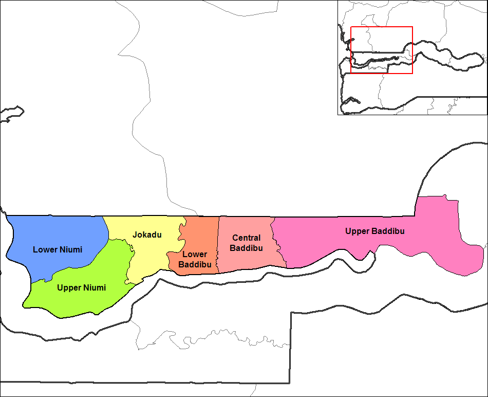
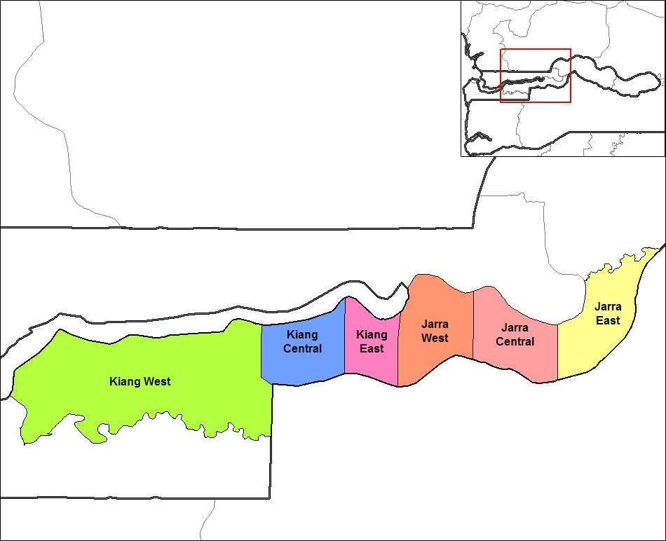
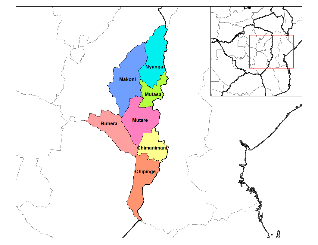
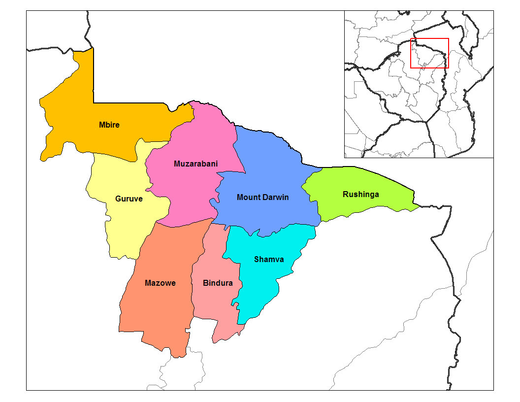
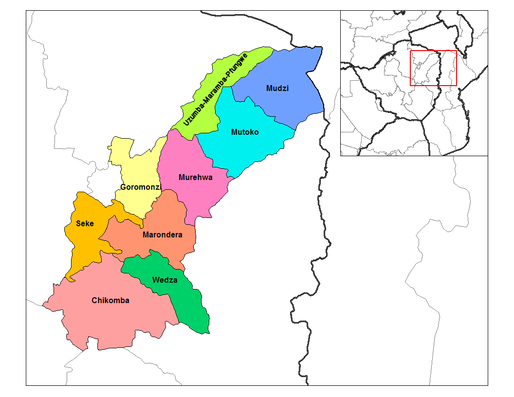
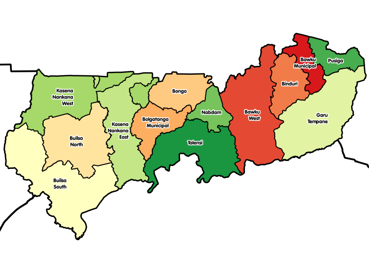
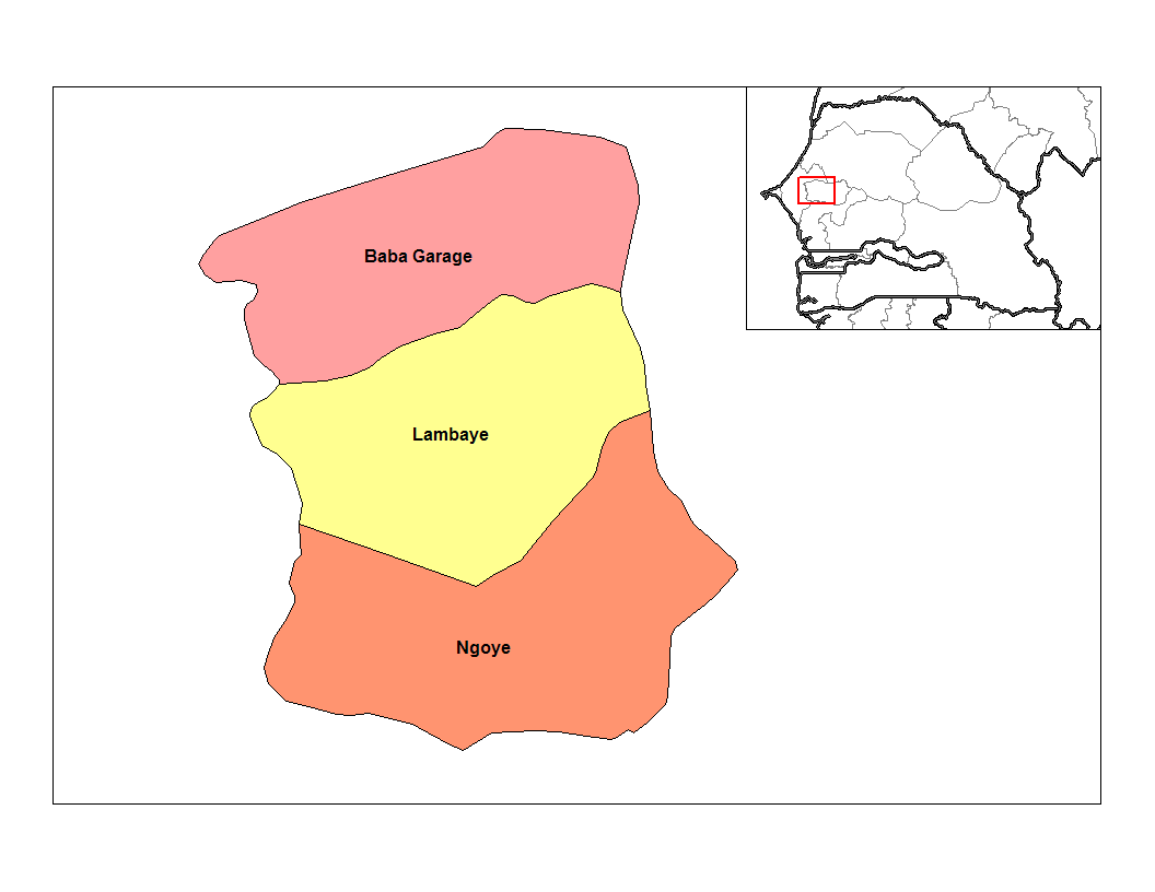
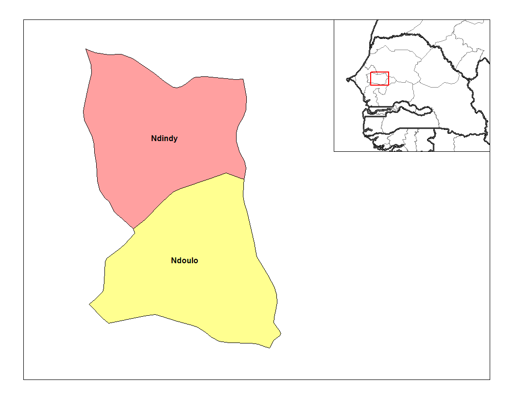
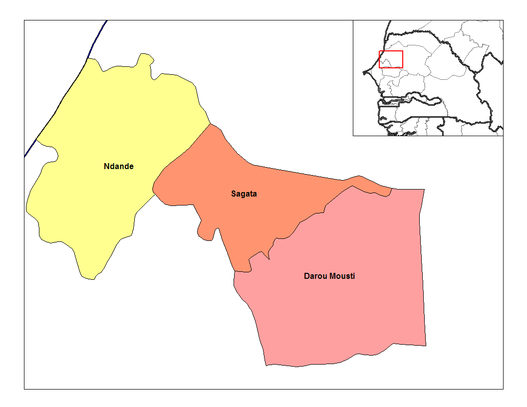
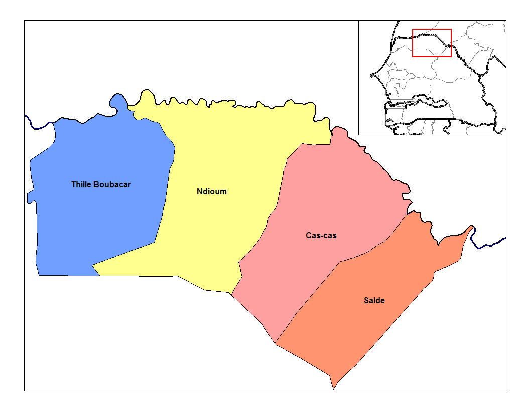
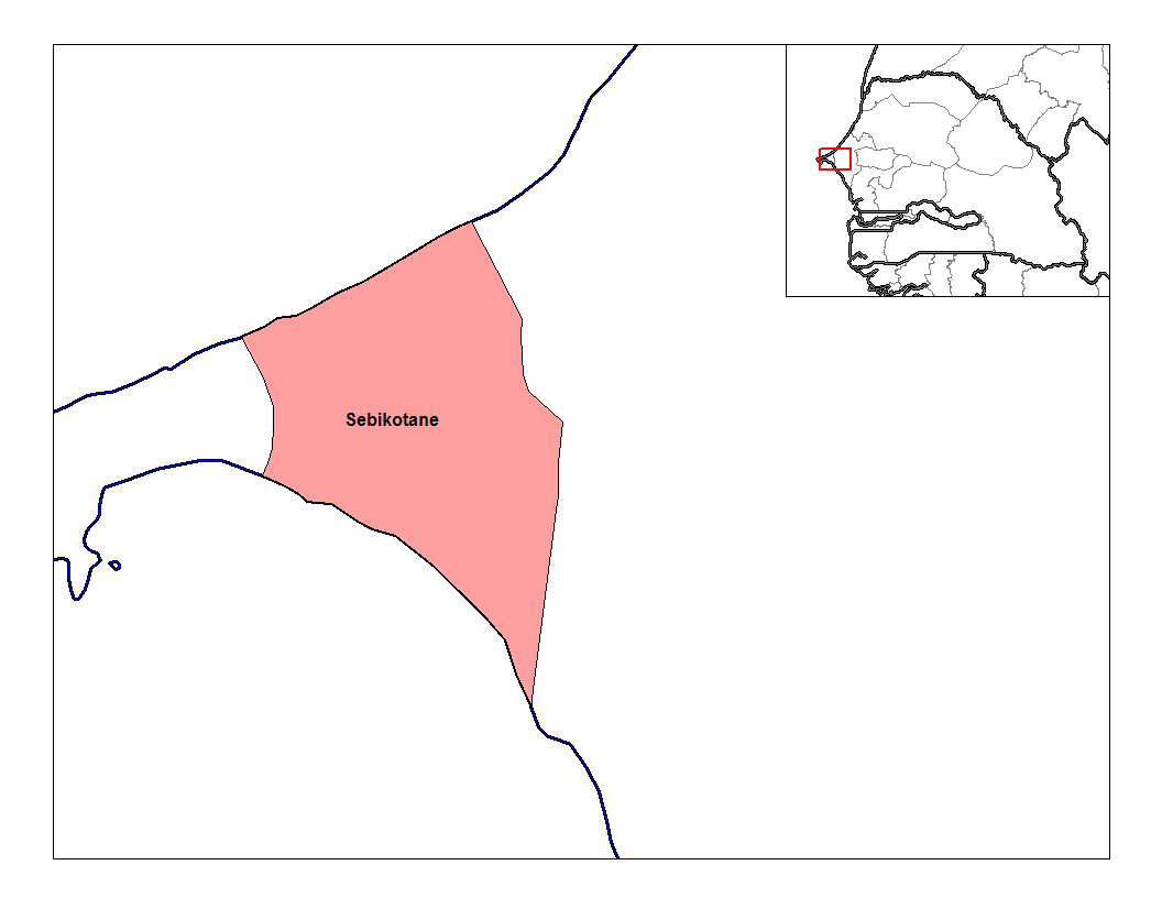
The VT-BAM Project Supplementary Resources

insert the map here

This is in relation to @VT45's VT-BAM Project.

This is to help @VT45, @Klime and many others with the project. The municipal details will flood the forum, but I am not claiming any one of them, just making it easier for anyone who wants to make the claims.

So far, Europe has been claimed, as are Asia and parts of Africa, though I don't remember seeing any details on any of those. In the forum are the nations that have yet to be claimed.
 
800px-Burundi_collines.png
CM-Departements_par_region.png
800px-Provinces_et_Territoires_du_Republique_Democratique_du_Congo.png
1920px-Municipalities_of_Equatorial_Guinea.png
1280px-GabonDepartments.svg.png
1280px-Sub-prefectures_of_Guinea.jpg
1280px-Nigeria_Local_Government_Areas.png
RwandaDists.png
Uganda_sub-counties.png
630px-Administrative_Divisions_of_Zimbabwe.svg.png
308px-Mapa_de_Argentina_%28departamentos%29.png
Chile_municipalities.png
1024px-Municipios_Venezuela_2007.svg.png
 
Last edited:
For anyone who wants to claim Oceania, here's a start:

1280px-Papua_New_Guinea_LLGs_2012.png
800px-NZ_Regional_Councils_and_Territorial_Authorities_2017.svg.png
1024px-New_South_Wales_cadastral_divisions.png
800px-Queensland_cadastral_divisions_1901.png
Tasmania_cadastral_divisions.png
Victoria_cadastral_divisions.png
800px-Western_Australia_land_districts.png
 
Here, we have Madagascar:

296px-MadagascarProvinces001.svg.png

Madagascar-regions.png

Districts_of_Madagascar.png
 
Angola:

Angola_Provinces_numbered_300px.png

Angola_municipalities.png

There is another division, one on its communes, but there are 559, so I can't list them all.
 
I know @VT45 had done first-level divisions on Mexico, but I'd like to help him speed it up.

1024px-Municipios_de_Aguascalientes.svg.png

1024px-Municipios_de_Baja_California.svg.png

1024px-Municipios_de_Baja_California_Sur.svg.png

Municipios_de_Campeche.png

1024px-Municipios_de_Chiapas.svg.png

1024px-Municipios_de_Chihuahua.svg.png

Municipios_de_Coahuila.jpg

1280px-Colima_Municipalities_Labeled.png

Municipios_de_Durango.jpg

guanajuato-map.jpg

Guerrero_divisi%C3%B3n_pol%C3%ADtica.png

1024px-Municipios_de_Hidalgo.svg.png

672px-Municipalities_map_of_Jalisco.svg.png
 
1007px-Municipios_del_estado_de_Mexico.svg.png

Michoacan_Municipios.jpg

1024px-Municipios_de_Morelos.svg.png

nayarit-map.jpg

550px-Municipios_de_Nuevo_Le%C3%B3n.svg.png

602px-Oaxaca_regions_and_districts.svg.png
925px-Asuncion_Cuyotepeji_en_Oaxaca.svg.png

Mexico_Puebla_location_map.svg

Municipios_de_Queretaro.jpg

1024px-Municipios_de_Quintana_Roo.svg.png

slp.gif

683px-Municipalities_of_Sinaloa.svg.png

sonora-map.jpg

tabasco-map.jpg

Municipios_de_Tamaulipas.jpg

MunicipiosdeTlaxcalaNumerad.jpg

veracruz-map.jpg

Municipios_de_Yucatan_con_regiones_7.png

Municipios_de_Zacatecas.png

No doubt that there is some detail involved in Mexico, but many of them are geometrically straight. For me, a worldbuilding Photoshopper who has Magic Wand and Paint Bucket, this is disappointing because geographically, straight does not exist in nature and I don't know any empires that have geometrically straight borders.
 
Anyone who wants to give Antarctica a try can use these:

antarcticarah.gif

antarctica.jpg

61KHYKrm3jL._SY322_BO1,204,203,200_.jpg

Antarctica_Without_Ice_Sheet.png

present_day_big.jpg
 
Top