You are using an out of date browser. It may not display this or other websites correctly.
You should upgrade or use an alternative browser.
You should upgrade or use an alternative browser.
The ULTIMATE Modern OTL Map Challenge
- Thread starter Thande
- Start date
Looks good, although Colombia's missing FARC-land, and IMHO, you should get rid of the internal EU borders.
But... er... no. Any European will tell you that we are still real nations - the difference between a Europhobe and a Europhile is that the first will smile, and the second will burst into tears.
But... er... no. Any European will tell you that we are still real nations - the difference between a Europhobe and a Europhile is that the first will smile, and the second will burst into tears.
Oh come on. If you've got a map with Uberganda on it, you need the EU.
(And I recognise that it isn't a real country, but neither is Puntland.)
Oh come on. If you've got a map with Uberganda on it, you need the EU.
(And I recognise that it isn't a real country, but neither is Puntland.)
We have two options: Ask EU residents, or go with the Canadian with little experience of the political structure of the EU. Can you understand why I don't like b) much?
We have two options: Ask EU residents, or go with the Canadian with little experience of the political structure of the EU. Can you understand why I don't like b) much?
Yeah, yeah, OK. Just, at least part of why I'm on this board is just that I think maps like this are cool:
I'll concede your point. (But I still hold on about the FARC.)
Ok, so, newer version.
Changes made:
Colombia divided into government/FARC control regions (though I feel that the FARC area may be smaller today)
Tuareg controlled area in Niger added (probably smaller, unable to find more accurate information than the Tuaregs having effective control in Agadez)
Acholiland/LRA controlled area of Uganda added
Ogaden National Liberation Front area of control massively reduced to reflect reality
Iraq divided into Sunni, Shia and Disputed control regions
To do:
Shining Path control in Peru
Check for more current data of FARC control in Colombia
ELN control in Colombia
Al Qaeda control in Algeria
Pakistani control (or lack of) in Balochistan
Indonesian control in Aceh and West Papua
Enlarge map to display smaller regions better
I may be ignorant of Centeal African politics, but...what the hell happened to Rwanda?! 
Thande
Donor
I may be ignorant of Centeal African politics, but...what the hell happened to Rwanda?!
That was my response when I first found out about that while researching the Congo wars
Hence why Congo is my first example when ranting about the inaccuracy of 'recognised' maps - it's impossible to comprehend how Rwanda kept kicking Congo's arse unless you know that Kinshasa only rules about a third of what it's supposed to. Otherwise it seems like Luxembourg beating France Great work, s_e. I am glad Nek did the exploding in Mr Z's face as I am getting a headache from over-gahhhing.
How about the Tuareg? And IIRC Armenia occupies the bit between Nag-Kab and Armenia proper, too.
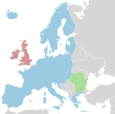
I just really, really like the EU-no-borders maps. I will admit they have nothing to do with facts-on-the-ground, you Eurosceptic, but they look so cool!
Great work, s_e. I am glad Nek did the exploding in Mr Z's face as I am getting a headache from over-gahhhing.
I just really, really like the EU-no-borders maps. I will admit they have nothing to do with facts-on-the-ground, you Eurosceptic, but they look so cool!
Thande
Donor
I just really, really like the EU-no-borders maps. I will admit they have nothing to do with facts-on-the-ground, you Eurosceptic, but they look so cool!
I wouldn't mind so much if our politicians actually said "we want to give all our sovereignty to corrupt unelected bureaucrats because we like maps that are all one colour", it would make more sense than some of the reasons they usually give
Ok, so, newer version.
Changes made:
Colombia divided into government/FARC control regions (though I feel that the FARC area may be smaller today)
Tuareg controlled area in Niger added (probably smaller, unable to find more accurate information than the Tuaregs having effective control in Agadez)
Acholiland/LRA controlled area of Uganda added
Ogaden National Liberation Front area of control massively reduced to reflect reality
Iraq divided into Sunni, Shia and Disputed control regions
To do:
Shining Path control in Peru
Check for more current data of FARC control in Colombia
ELN control in Colombia
Al Qaeda control in Algeria
Pakistani control (or lack of) in Balochistan
Indonesian control in Aceh and West Papua
Enlarge map to display smaller regions better
Excuse me, but we control Aceh ! True that Aceh is a special (more) autonomous province now, but they are by no means de facto independent. They recognize our sovereignty, and our military presence (which is strong) there. And GAM is only a political party without any marshal strength now. As for West Papua, OPM is a very small movement as it has been, and no more than a bunch of thugs and they also aren't really controlling any areas. Most of them are just hiding in the jungles or mountains without controlling any real settlement. Military presence is also strong there and the natives are now the rule there.
Thande
Donor
Excuse me, but we control Aceh ! True that Aceh is a special (more) autonomous province now, but they are by no means de facto independent. They recognize our sovereignty, and our military presence (which is strong) there. And GAM is only a political party without any marshal strength now. As for West Papua, OPM is a very small movement as it has been, and no more than a bunch of thugs and they also aren't really controlling any areas. Most of them are just hiding in the jungles or mountains without controlling any real settlement. Military presence is also strong there and the natives are now the rule there.
Nonetheless, even if they're stuck in the mountains, that should still be indicated unless it's too small to go on a map that size.
Congo, India and "Burmyanmar"
Okay, I like the idea of this thread, but some of the borders showing actual areas of control are a little dated or questionable:
1. Congo - Uganda doesn't control such an area in the Congo anymore as far as I know. The area shown was basically the limit of the advance of Ugandan troops and Congolese rebels allied to them (Movement for the Liberation of the Congo). Likewise the area shown for "Uber-rwanda" was actually the area controlled by Rwandan and Burundian troops (Burundi was allied to Rwanda during the war) and Congolese rebels allied to them (the Rally for Congolese Democracy or RCD-Goma faction since another RCD faction was aligned with Uganda). After about 2002 Uganda, Rwanda and Burundi pulled out (and their withdrawals were confirmed) but there were suspicions that the Rwandans and Ugandans periodically re-entered eastern Congo for limited operations. Although large numbers of soldiers were not left behind, the Rwandans (and Burundians) and Ugandans did leave behind their Congolese militia allies who continued to operate throughout eastern Congo particularly around Goma (and North and South Kivu as a whole) and in Ituri (near Uganda).
2. India - what's up with Assam? Does the map show the area under the control of Assamese secessionists or the area they would like to control? If it is the latter, then it doesn't fulfil the map challenge which is to show actual areas of control. On a related issue the cartographers might want to consider adding the Tamil Tiger controlled Jaffna peninsula in Sri Lanka.
3. Burma/Myanmar - do those areas show the extent of rebel control or the extent of claimed secession movements?
4. Chechnya - do the rebels actually control any extensive areas or are they scattered throughout Chechnya (in which case it would be near impossible to show on an unchanging map)?
5. Basque Country - is this supposed to show the autonomous Basque Country (if so why? the autonomous government in Basque Country does not consider itself a separate country and does apply Spanish law, although it would like more autonomy or even independence), the area under the control of Basque rebels/ETA (which would seem to be minimal) or the area claimed by ETA?
Nonetheless, even if they're stuck in the mountains, that should still be indicated unless it's too small to go on a map that size.
It's too small, and the border cannot be viably indicated, because there is just no obvious border and all...
And yeah, I should've say that we control West Papua as well.
Hendryk
Banned
Here's my version:
Neither of these maps feature Darfur.This is what I've got so far...comments welcome!
Share: