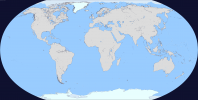
The Q-BAM Improvement and Core Thread

How big do you think a polar projection of the 60º parallel should be to fit the dimensions of the Q-Bam?

I don't know
I'm just a big fan of all the work done since nearly ten years ago on that map and i've never seen a map with such informations than the Q-Bam

I trust you and I'm sure one day there will be a Q-Bam bathymetric map of the world, so do as you please if you want to try the polar projection
I believe in all of you
 
Q-BAM Zelandia cos' why not.
Hey, so I did the rest of the world based on this video. For a sec I thought about posting it in the shitpost thread.
decfmjj-d7f7ca5b-3600-40e1-aec1-8f269f686271.png
 
Updated the natural lake map from the imgur album, I got most of the artificial lakes that were left, but I only added lake Texcoco back in the middle of Mexico and the dry lakes that linger around
 

Attachments

  • Historical Changelog.png
    Historical Changelog.png
    349.9 KB · Views: 827
Here is a map of the projection of Antarctica around the 60º parallel. Its size should fit in the QBam, after making the calculations with the formulas that appear in wikipedia for robinson. It is a projection made with GProjector of the original QBam, so there may be some errors that should be corrected with a direct projection of Antarctica but in general it is quite accurate.
Antarctica QBam.png
 
There is Lake Tulare missing in California on the natural lake map, I don’t know if there are other large drained lakes missing
 
I have modified the map of Antarctica, using a projection of the 8K-Bam in GProjector. I think it is the most accurate map I could do because there are many inconsistencies in most of the maps of Antarctica and it is a real chaos. I will try to make a real topographic map of Antarctica without ice, since this map represents the height of the ice sheet.
Antartida QBAM blank.png


Antartida QBAM topographic.png


Does anyone know if any program can make the 1-pixel boundaries between water and land automatically? (Maybe Gimp or Inkscape?) I use MSPaint. I would appreciate it if someone knew. :)
 

qazse

Gone Fishin'
I don’t even know how to comment this right here but I’m going to warn you guys on this thread about this because I discovered this just now (not that it’s the end of the world or something): the state’s “subdivisions” of Brazil (the “mesoregions” and “microregions”) that are used for statistical purposes by IBGE were "revoked" by the same institute and replaced by "intermediate and immediate geographic regions", and this happened in 2017 and I believe that almost no one knows this.
In summary, the completeness of Brazil's state subdivisions is currently wrong.

There is this IBGE PDF explaining (in portuguese) the change and it contains higher quality maps of these changes, and also includes previous versions of subdivisions than the one that currently exists in QBAM;

View attachment 603713View attachment 603714
Thought I might bring this to everyone's attention again because everyone seems to have forgotten about it.
 
Please can I have a base map with no rivers, borders, state lines. Basically just a base map. I can't find one that has matching borders with other Q-BAM maps.
 
I think that either Monaco or the subdivisions of France are wrong (or the border with Italy..) Monaco should be closer to the border, in most q-bam maps Monaco is located roughly where Nice should be. I tried to fix it:

monaco.png


There are many river versions, but I tried to make my own version of the Rhine river:
rhine1.png

Many of the borders of Germany's districts and other subdivisions match with the river so I just followed those borders and I did the best I could on districts that are crossed by the river...

And about what I said before about British Columbia, I tried to match its borders with the internal divisions of the United States, It's a bit sloppy ... but it would look like that:
BC.png

(The blue line, WIP...)

If anyone better than me at this could check it :confused:
 
Top