You are using an out of date browser. It may not display this or other websites correctly.
You should upgrade or use an alternative browser.
You should upgrade or use an alternative browser.
The Q-BAM Improvement and Core Thread
- Thread starter iori
- Start date
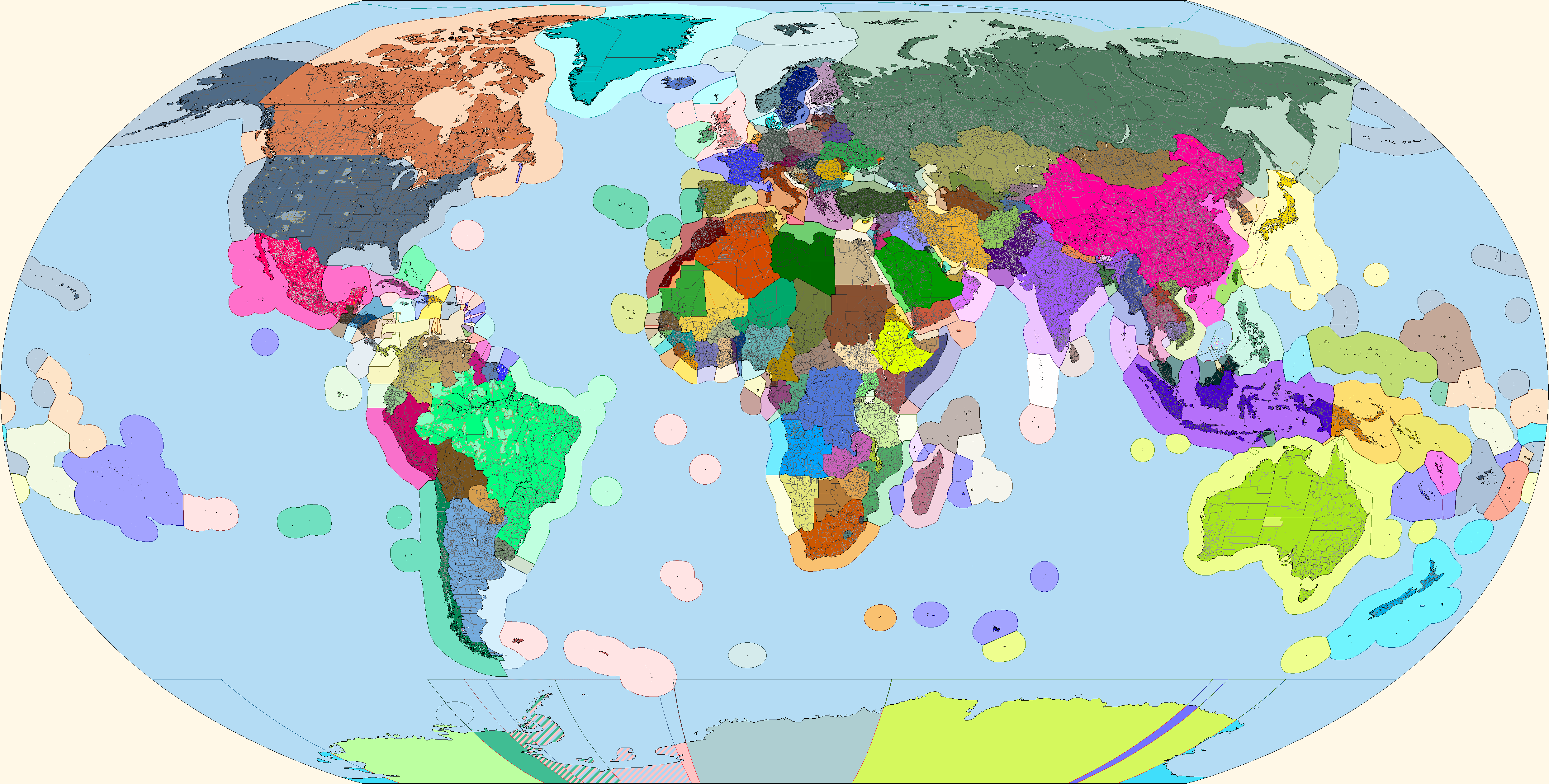
Aren't they already on @Drex 's QBAM?Q: Is anyone interested in doing South African municipalities?
I found only Western Cape
Aren't they already on @Drex 's QBAM?
I just found out that the eastern part of the Oregon-Washington border is one pixel higher than the North-South Dakota border. Both borders are defined along the 46th parallel, and from what I can tell based on the Oklahoma-Kansas (37th parallel), Kansas-Nebraska (40th parallel), Nebraska-South Dakota (43rd parallel), and US-Canada (49th parallel) borders, it's more likely that it's the Oregon-Washington border that is misplaced by one pixel, and therefore also misplaced other historical borders in the borderpool.
Last edited:

Until another patch is posted next week, of course!
Sorry, but the Moluccas patch respects no one.
What place is that patch from ?View attachment 533075
Aight, here's a patch.
Oregon-Washington border, given that it was mentioned in the above post I didn't consider it necessary to specify.What place is that patch from ?
Oh sorry, i didn't read the post above yoursOregon-Washington border, given that it was mentioned in the above post I didn't consider it necessary to specify.
An attempt to fix Eastern Ontario. Somebody butchered up the borders of Ottawa; Prescott and Russell; Stormont, Dundas and Glengarry; and Leeds and Grenville.

Thanks, I appreciate it.@Bob Hope The maps look excellent!
I realized that in China, Wuhan's districts are not shown, leaving the entire city an empty blob.
So I did a patch for Wuhan and Ezhou, adding their districts.

So I did a patch for Wuhan and Ezhou, adding their districts.
Double checked all municipalities in northern Finland. All have a Finnish majorityAre there no majority Sami majority areas in Finland? Livonian areas in Latvia or Estonia?
Mostly correct, but Powiat Hajnowski (that purple coloured part of Poland) has in fact a Polish majority of 60.5%. Belarusians only form 39% of the population.View attachment 540480
Commenced an ethnic map .
Share: