The NextGen OTL Worlda Series

Why is Hungary shown as unoccupied in 1946 (when it was a defeated and occupied Axis power like Bulgaria, Romania and Germany) but Poland is being shown as occupied?
that's the second hungarian republic (after the soviet troops had left but before they established a puppet government)
 
Last edited:
that's the second hungarian republic (after the soviet troops had left but before they established a puppet government)
Oh okay, I see.

Looking a bit more into it, I had thought that the Soviet occupation ended in 1947 with the winding up of the Allied Control Commission for Hungary, but I'm seeing that the commander (Voroshilov) had been absent since Feb 1, 1946 which was also when the second Hungarian Republic was founded.
 
Last edited:
1625521041489.png

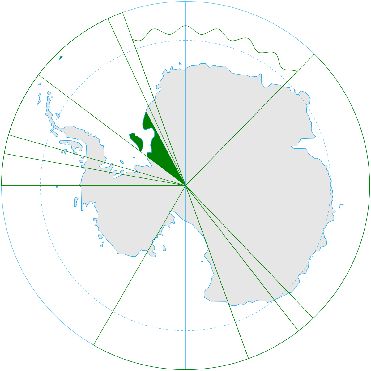
I remade the separate polar region worldas because i was really unsatisfied with how they looked. My versions are on the right. I included the originals for comparison.
 
View attachment 664352
I remade the separate polar region worldas because i was really unsatisfied with how they looked. My versions are on the right. I included the originals for comparison.
Thank you :)

When I made the originals (which was, god, a time that could reasonably be described as a decade ago), I literally just took selections off of SRegan's Dymaxion map because it was the only decent pseudo-polar map I could find in the in-house style, and they've just kind of stuck around ever since due to some combination of inertia and lack of focus; these are amazing updates.

I'm curious, is it possible, using whichever method you applied, to create complete, or at least hemispherical, polar maps?
 
I'm curious, is it possible, using whichever method you applied, to create complete, or at least hemispherical, polar maps?
Like, a map centered on the poles that goes from 90 degrees north to the equator, and another that goes from 90 degrees south to the equator? It's definitely possible, although I don't know if it would look any good considering that I used the polar azimuthal equidistant projection, which seriously warps the rest of the planet the further you go from the pole it's centered on.
 
Like, a map centered on the poles that goes from 90 degrees north to the equator, and another that goes from 90 degrees south to the equator? It's definitely possible, although I don't know if it would look any good considering that I used the polar azimuthal equidistant projection, which seriously warps the rest of the planet the further you go from the pole it's centered on.
Honestly that's half the fun of polar maps, is how funny they get around the fringe.

But yes, editable Worlda-house-style polar maps, would be fantastic for, among other things, several types of colonization and Cold War scenarios, if nothing else.
 
I remade the separate polar region worldas because i was really unsatisfied with how they looked. My versions are on the right. I included the originals for comparison.
1625521041489.png

Fixed the color scheme. Also, since when did Brazil claim part of Antarctica?
 

Attachments

  • 1625632031925.png
    1625632031925.png
    3.1 KB · Views: 295
Its like some parts are correct and others are utterly wrong in both maps (its a bit disconcerting)

EDIT: Also, here's my attempt at editing the 1200 AD map using mainly videos off from youtube and maps from the internet as a source for borders
There's a good reason I don't heavily rely on youtube videos as sources for the maps, especially in regards to Central Asia and India. In my experience all the videos out there are wildly inaccurate, and often aren't backed by any substantiated sources. All the maps I post are compiled from a wide array of sources, with priority given to highly regarded historical atlases. For India, that's the Historical Atlas of South Asia by Joseph Schwartzberg, which is regarded as the definitive source for south asian historical cartography. I use that in conjunction with research into specific polities to cross check the extent of territories.

Anyways, as per the revisions specifically:
- Bulgaria's western frontier wasn't extended that far until at least 1208
- I'll fix the Almohad borders, my initial research was conflicting on the easternmost extent of it.
- Not sure what the subdivisions you added to Silesia are; I don't see them in any other resources for 1200.
- I need to look into the middle east revisions still, that's certainly an area I've been wrong about in the past; I'm looking for some better sources on that.
- Central asia is completely off, defaulting to historical atlases for this one over youtube - see previous comment
- India: see above
- China - I was relying on resources made by Admiral Kolchak, but it seems that the song/jin border is indeed off here.
Also, 17,17,17 should be used for 1st level borders, not 51,51,51
 
1885.png


Edited some stuff

(Add the Boers their own colours)
(Gave Hawaii its own colour, for some reason it's shown as a US territory even though they haven't annex it.)
(EDIT: Added Utah territory.
 
Last edited:
Top