You are using an out of date browser. It may not display this or other websites correctly.
You should upgrade or use an alternative browser.
You should upgrade or use an alternative browser.
The NextGen OTL Worlda Series
- Thread starter hadaril
- Start date
Do you think united and South Korea should have a separate color? It looks weird to see the peninsula united under a red shade in the earlier maps.
Giving that they technically claim to be the one Korean state being split in half, I think the best geopolitical representation is to keep a same colored outline with an inner de facto border.Do you think united and South Korea should have a separate color? It looks weird to see the peninsula united under a red shade in the earlier maps.
(In fact, I think it's how Germany could and should be represented until the Treaty of Moscow where both acknowledged each other)
It's especially weird that the DPRK is the one with a color, because most people consider the ROK the legitimate Korean stateDo you think united and South Korea should have a separate color? It looks weird to see the peninsula united under a red shade in the earlier maps.
Hey, so, I modified the 900 map. Mostly just in Europe, North Africa, and the Caucuses. Also Korea and a small modification in China/Vietnam.
For some reason that whole drama earlier didn't scare me away from trying lmao

For some reason that whole drama earlier didn't scare me away from trying lmao
Hey, so, I modified the 900 map. Mostly just in Europe, North Africa, and the Caucuses. Also Korea and a small modification in China/Vietnam.
For some reason that whole drama earlier didn't scare me away from trying lmao
Whats the thing in North India? Gurjara? I think the Palas of Bengal should be independent here.
I'm not sure, I didn't touch India.Whats the thing in North India? Gurjara? I think the Palas of Bengal should be independent here.
Alright, sorry for the hiatus, I just needed some time off! @LSCatilina, I'm sorry for being harsh in my own response. I hope you know I didn't mean anything against you personally. Anyways, with that whole drama aside, I'm going to begin revising maps to at least revert to LSCatilina's borders, at least outside of Europe, at least for those that there are older editions of.
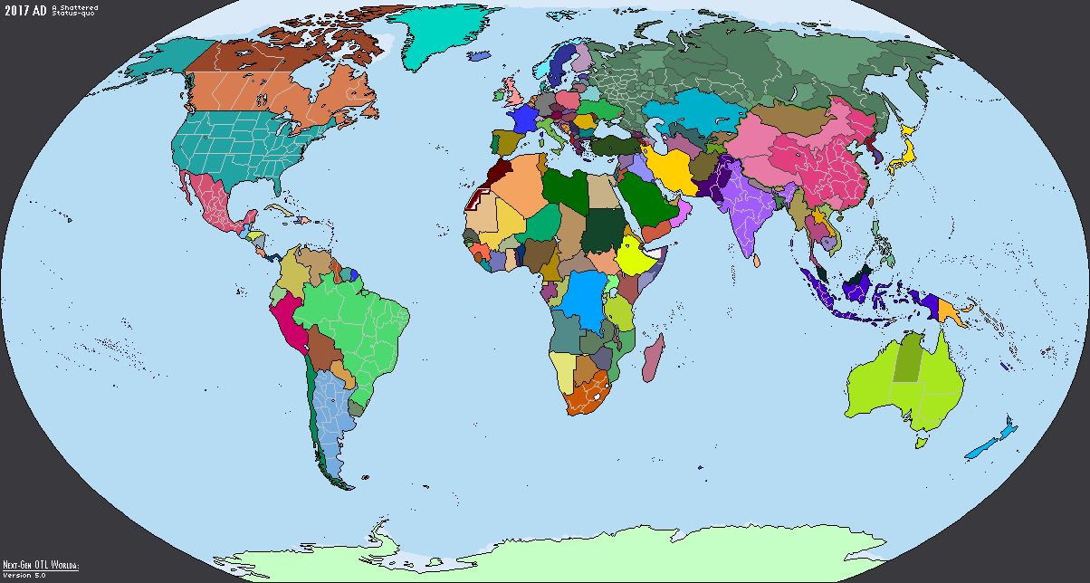
A lot of egregious errors in the 2017 map. Serbia/Montenegro have a red border with Kosovo not even existing, Ryukyu part of China, Guam in white, etc.
Don't know what you're talking about with the Serbia-Montenegro thing, though you're right about the Ryuku Islands:A lot of egregious errors in the 2017 map. Serbia/Montenegro have a red border with Kosovo not even existing, Ryukyu part of China, Guam in white, etc.
I think it might be helpful if borders are added around the various island nations in the Pacific.
This is something I've considered doing on and off, and it is certainly used extensively in previous editions of the worldA project. My exclusion of it is merely down to personal, aesthetic preference, which, I admit, sacrifices utility. If there is enough demand, I can attempt to go back and draw those borders. One question, however, is whether or not using such borders before, say, ww1, is anachronistic. From what I understand, naval borders weren't really defined until really recently in history. I'm sure someone can correct me if I'm wrong on that.I think it might be helpful if borders are added around the various island nations in the Pacific.
@hadaril May I ask on how are these maps created and such, also. Any plans for maps from 1885 to 1914
I might do one for 1880 later, unless anyone else wants to take on the task!Are there any maps between 1861 and 1914?
Share: