The NEW Our TimeLine Maps Thread!

Thande

Donor
JHPier said:
More nitpicks: In 1850 half the Gold Coast shown British was still Dutch (until 1873).

If you look closely you'll see that that map shows the majority of the Gold coast in British pink, but two Dutch forts (which is all my sources said remained by that time) in orange. Unfortunately, those shades of pink and orange are a wee bit more similar than I'd hoped, but that's what I get for using gif format. :eek:

JHPier said:
Rhodesia became a dominion, I think, at some point before WWII.

On the subject of Rhodesia, can anyone clarify the matter of when it became independent? I believe it was only officially severed from Britain in 1980, but had been de facto independent since the 1960s, hence the pink de jure border on a white de facto independent country seen on the 1975 map. But I've seen conflicting information on this.

Wendell said:
May I use your maps?

That's what they're there for! :)
 
Have you got any plans to continue this thread or modify anything Thande? They're really great maps, and a really useful resource.
 

Thande

Donor
Floid said:
Have you got any plans to continue this thread or modify anything Thande? They're really great maps, and a really useful resource.

Hopefully, yes. I'm currently cut off from my Big Base Map Book, but that should change in a few days.

What do you say to some regional map series through time, too? Like Europe through time, etc. (I know Euratlas does these, but it's not like you can easily edit their horrendously detailed maps to make your own)
 
Europe would be great, but it's going to be a huge and exhausting task. When do you propose to start? Ancient Egypt? Ancient Greece? Ancient Rome? I don't know, the timespan is huge.

Another possibility are timelines and maps showing how the Americas have evolved. From pre-European (to the extent that has been recorded) to colonialism to the moden day. It's easier than Europe because there aren't that many nations for two large continents and there's only 500 years of history to work through rather than 5000.

It's up to you though. Seems to me like Europe will be a bitch to complete, hence why I'd leave it last -- because I'm lazy. :eek:
 
Last edited:

Thande

Donor
I think I've already got some maps for America across time somewhere...I'll have to see if I can find them.
 

Thande

Donor
All right, just a question: are people more interested in North American maps of THIS size...?

Nexusian North America 2.GIF
 
Othniel said:
Thats the Edu place map that I inflated to disportional size...:p
Yeah, sorry, didn't mean to not credit you. I was actually trying to find out who posted it right now. :)
 
Floid said:
Yeah, sorry, didn't mean to not credit you. I was actually trying to find out who posted it right now. :)
No prob, I posted it as a source map from an EDUCATION site...as I'm just a beggar telling others where to find food, and you did the same...:p After all imiitation is the highest form of flattery.:)
 
So Thande. Are you still cut off from your Big Base Map Book? Just curious, you badly need to continue this. It's really great work. :)
 

Thande

Donor
Floid said:
So Thande. Are you still cut off from your Big Base Map Book? Just curious, you badly need to continue this. It's really great work.

Until this weekend.

I still want to get my hands on this Oxford one that Oth mentioned...
 
Thande said:
Until this weekend.

I still want to get my hands on this Oxford one that Oth mentioned...
I'll get it at the libary tommorrow, take a picture and put it up here for you to see...:D
 
45765.jpg


Oxford Atlas of World History
From the Orgins of Humanity to the Year 2000
bookflap said:
The first major new history atlas in 20 years, uniquely international in approach, incorporating the latest research on Asian, African, and South American history.
A major new work of reference, Atlas of World History charts the course of human progress around the globe, from prehistory to the present, in hundreds of full-color maps.

Much like our earlier Atlas of Exploration, this attractive, large-format volume features 135 two-page spreads that highlight key moments in world history, each spread blending colorful maps and illustrations with authoritative text. For instance, for the American Revolution, readers will find three maps--British North America before the War, the Colonial economy (indicating which areas specialized in fishing, timber, tobacco, and so forth), and military movements during the War itself--plus an informative discussion of the causes and course of the Rebellion.
The Atlas is divided into five sections: 1. The Ancient World (with spreads on topics such as the move from hunting to farming, the first civilizations in Mesopotamia, Egypt, and China, the Silk Road, and the Roman Empire); 2. The Medieval World (the spread of Islam, the Vikings, the Economy of Europe, and the Inca and Aztec Empires); 3. The Early Modern World (the European discovery of the New World, the Reformation, the growth of science); 4. The Age of Revolutions (including the Industrial Revolution, the American Civil War, and the Modernization of Japan); and 5. The Twentieth Century (the Russian Revolution, the Great Depression, the Second World War, and the USA Since 1945).

Including a 22-page time chart, a 20-page gazetteer of historical events, people, and places, a 20-page index, and a helpful bibliography, here is an informative blend of maps by world-renowned cartographers and text by expert academic consultants that graphically captures the flow of civilizations through time.

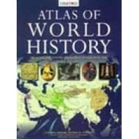
($85 American dollars is the normal cost...I love the libary....))
 
Top