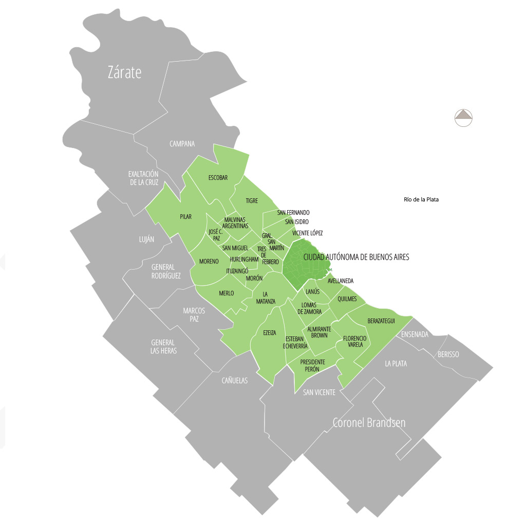
Thanks for catching it and for fixing it too.Yeah, about those Buenos Aires partidos... they're wrong. All of them.
I knew they looked a little weird the first time I saw them, but I didn't had the time to take a closer look, and I thought, well, when I get a mouse I can do some fixes, no biggie. But the thing is, I don't know what source was used for them, but they're completely unrecognizable. I tried my best to fix them, but it's done ad-hoc and it's probably all wrong; size, borders, everything. I'm pretty sure the size and shape of Capital Federal itself is also wrong.
Since I don't want just to come here and complain without any solutions, this is my patch, but I'm not good at this. I would start it all over, at least for this area. But I'm busy with other projects currently so I can't dedicate myself to this (and also I've never made a map from scratch).
View attachment 377097
I also added Martín García Island, which is important enough to be featured.
If you want some sources and try your hand to fix them, here are some I've found: You can see that they don't fit at all with the old one (and only barely with my own fix, for that matter):
http://www.ign.gob.ar/AreaServicios/Descargas/Mapas
http://www.estadistica.ec.gba.gov.ar/dpe/images/cartografia/pdf/Densidad_Poblacion_Censo2010.pdf
The good news is that the rest of the provinces from what I've seen are fine. The only big mistake I've noticed is that some salt flats in Jujuy and Salta are colored as lakes, which they aren't of course.
I would love to do more, since I love this project, so far it's the only that has third level Argentine divisions and so it gets my infinite admiration. But just trying to fix this gave me an headache. Fucking porteños and their tiny-ass partidos.
Since you are interested in working on more you can review this list for anything you think you can contribute on.
I am gonna be starting on the first few maps in the next few days but I decided it would be good to have country names and capitals marked too because those are changes included on that list and so we could include them too.So uhhhhhh @darkfire if you want I'll start working on historical maps using the wikipedia list.
I finished adding the country names and adjusting them properly last night and will be working on the capitals tonight so that should be done soon.
