The Bay Area Thinks Big

kernals12

Banned
Just as I fixed New York, I'm fixing the Bay Area.

November 1965- San Rafael, CA
The Marin County board of supervisors gave its approval to a new development to be located on the Marin Headlands on land previously owned by the military. Known as Marincello, it was designed by developer Thomas Frouge of Bridgeport, CT.
0*TKAQRQpZFFbMnjKC.jpg

It offered stunning views and extremely quick access to San Francisco. It would house 30,000 people among the hills. Construction started in 1967 and was completed in 1972. This was only the first part of a wave of development that would hit the North Bay region.

Next, a freeway was built from Marincello, going along the western coast up through Bolinas all the way to Reyes Station. Bolinas went from being a sleepy resort town to a bedroom community of 32,000.
Screen Shot 2019-10-22 at 11.37.07 PM.png

Down south, more things were happening. The Westbay Community association dug out a huge chunk of the San Bruno Mountain to fill in 27 square miles of the bay. The leveled off portion became a housing project with 60,000 residents while the filled-in bay became home to 160,000. After the Sylmar Earthquake in 1971, special new earthquake retrofitting became mandatory for new homes.


Bay%20Nature%202013%20Map.jpg

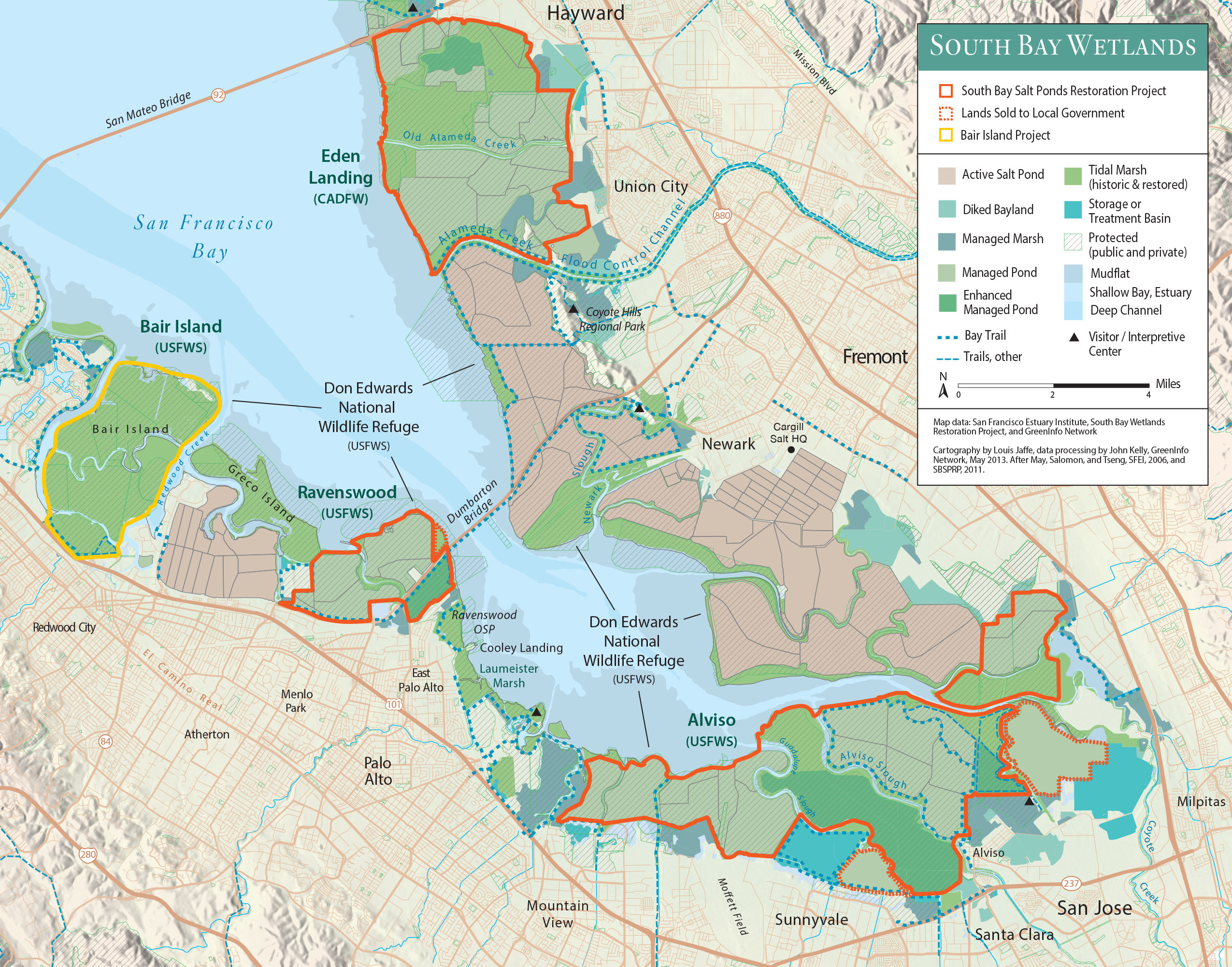
Between 1982 and 1987, the Leslie Salt Company successively sold off its 44 square miles of Salt Ponds to developers. This provided space for 250,000 people and meant you could throw a rock from Fremont to Sunnyvale.

v07n02_176.jpg

Marin County also continued its growth, with Ring Mountain being developed in 1983.

Screen Shot 2019-10-23 at 12.22.31 AM.png

Due to seismic risks, it was decided to limit land reclamation, but still, it would be safe to build a viaduct along the edge of the San Pablo Bay, from McNears Beach to Vallejo. This set the stage for extremely rapid growth in Vallejo and the filling in of the wetlands around San Pablo Bay. The population was surging in the North Bay region, it would reach 900,000 in Solano County, 930,000 in Sonoma, and 630,000 in Marin.

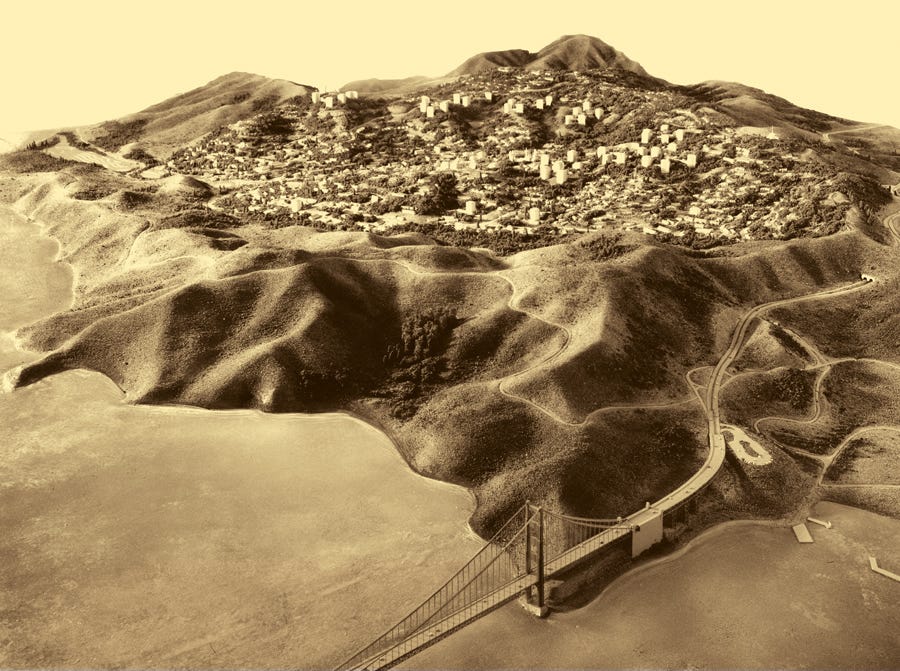
The flow of commuters to and from San Francisco was becoming a problem. The Golden Gate Bridge was just bumper to bumper every day.
4047626058_1420818457_b.jpg

So, in 1987, a second bridge, the Tiburon Bridge, was opened. It managed to survive the 1989 Loma Prieta earthquake with minor damage.
sc05.jpg

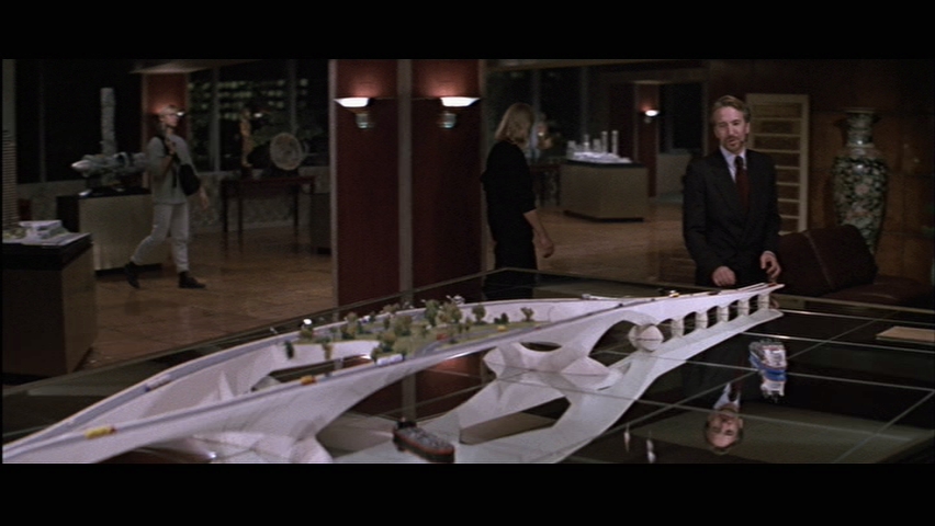
And as traffic on the Bay Bridge kept rising, a new Southern Crossing was built.

Screen Shot 2019-10-22 at 11.54.41 PM.png

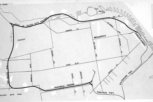
And as the traffic between Marin and San Mateo worsened into the early 90s, San Francisco needed to build new freeways on the West side. The Great Highway, Sunset Boulevard, 19th Avenue, and Park Presidio Boulevard were converted to grade separated highways.

4274564389_fbe7b38ec2_b.jpg

The Bay Area Rapid Transit system, or BART, also was greatly expanded. The line to Concord opened in 1986 and to Novato in 1990. And in the 21st Century, it was expanded to San Jose.

With 11 million people and growing rapidly, the Bay Area is poised for continued success as the tech industry keeps getting bigger. All this comes due to the big ideas of the people in charge in the 60s.
 
Last edited:
So what is the POD that keeps the locals from revolting at the thought of these mega projects as we get into the late 60’s and early 70’s?

As someone who sits in the area’s traffic every day, I wouldn’t mind some new freeways, an expanded BART (with a second Transbay tube), and another SF-Oakland bridge, but it’d be a very hard sell for many of the metro area’s residents to spend taxes on those types of projects

You can straight up forget any of the land reclamation projects—we can’t even get a new runway built at SFO to allow parallel instrument approaches in bad weather, so one of America’s largest airports is terminally fouled up once a passing shower rolls in.

That said, I wonder if there’s a cultural or political POD that would keep the bulk of the massive WWII-era military infrastructure in the Bay in place past the Cold War. With more military economic activity in the area, maybe SF more resembles OTL San Diego on the political scene and is more amenable to the sorts of sprawl-enabling projects you propose.
 

kernals12

Banned
So what is the POD that keeps the locals from revolting at the thought of these mega projects as we get into the late 60’s and early 70’s?

As someone who sits in the area’s traffic every day, I wouldn’t mind some new freeways, an expanded BART (with a second Transbay tube), and another SF-Oakland bridge, but it’d be a very hard sell for many of the metro area’s residents to spend taxes on those types of projects

You can straight up forget any of the land reclamation projects—we can’t even get a new runway built at SFO to allow parallel instrument approaches in bad weather, so one of America’s largest airports is terminally fouled up once a passing shower rolls in.

That said, I wonder if there’s a cultural or political POD that would keep the bulk of the massive WWII-era military infrastructure in the Bay in place past the Cold War. With more military economic activity in the area, maybe SF more resembles OTL San Diego on the political scene and is more amenable to the sorts of sprawl-enabling projects you propose.
I'm leaving out exactly how the POD occurs. Maybe the backers of these projects get much better advertising skills.
 

kernals12

Banned
So what is the POD that keeps the locals from revolting at the thought of these mega projects as we get into the late 60’s and early 70’s?

As someone who sits in the area’s traffic every day, I wouldn’t mind some new freeways, an expanded BART (with a second Transbay tube), and another SF-Oakland bridge, but it’d be a very hard sell for many of the metro area’s residents to spend taxes on those types of projects

You can straight up forget any of the land reclamation projects—we can’t even get a new runway built at SFO to allow parallel instrument approaches in bad weather, so one of America’s largest airports is terminally fouled up once a passing shower rolls in.

That said, I wonder if there’s a cultural or political POD that would keep the bulk of the massive WWII-era military infrastructure in the Bay in place past the Cold War. With more military economic activity in the area, maybe SF more resembles OTL San Diego on the political scene and is more amenable to the sorts of sprawl-enabling projects you propose.
images_10431_d94ec3a136b_original.jpg

I did scale back my ambitions from this which is all the land the army corps of engineers predicted could be filled. I was also trying to hedge my bets on earthquake risk as reclaimed land has a tendency to liquefy in a quake, as residents of the Marina district found out in 1989.

This is a shame because just look how much land could be added. Berkeley would double in size. Hayward and San Mateo would be only 2 miles apart. The former San Pablo Bay probably could've become a massive metro area. In total, the ACE estimated that 360 square miles could've been reclaimed.
 

kernals12

Banned
One idea I had was dredging out San Pablo bay to relocate the Port of Oakland. That would open up a lot of real estate, but I didn't think it was realistic, even by the fanciful standards of the rest of the thread.
 

kernals12

Banned
You remember this "Indonesian" bridge model from Die Hard?
latest

It's actually Frank Lloyd Wright's idea for a Southern Crossing
 

kernals12

Banned
@kernals12 can new orleans think big too?
I chose the 2 most expensive and congested urban areas in the country for a reason. Megaprojects are for accommodating new growth, they have never been able to bring a city back from the dead. I think the next city to think big will be London.
 

Riain

Banned
For anything like this the Bay area probably needs to reorganise like New York, with the counties (boroughs) merging into a super-municipality. This would give the municipality more power than Counties and different power balance vis a vis the State.
 

kernals12

Banned
For anything like this the Bay area probably needs to reorganise like New York, with the counties (boroughs) merging into a super-municipality. This would give the municipality more power than Counties and different power balance vis a vis the State.
San Mateo County (744 square miles) alone is twice as big as all of New York (306 square miles). All told, the 9 Counties of the Bay Area (San Francisco, San Mateo, Santa Clara, Alameda, Contra Costa, Solano, Sonoma, and Napa) are 7,000 square miles. That's more than all of Connecticut.

There is no way they all would merge into one municipality.
 

Riain

Banned
What about the contiguous municipalities in the area rather than the counties? They could integrate and be a super-county.
 

kernals12

Banned
What about the contiguous municipalities in the area rather than the counties? They could integrate and be a super-county.
That would be one giant county. I don't know of any precedent for a county that big which has multiple distinct population centers.
 

CalBear

Moderator
Donor
Monthly Donor
Another thing I would do is build a tunnel under the Santa Cruz mountains connecting Half Moon Bay to San Mateo.
ACROSS the San Andreas Fault? and UNDER Crystal Springs Reservoir?

Wow. And people though Khufu was ambitious.
 

kernals12

Banned
I'm genuinely surprised Sunset Boulevard was never turned into a Freeway. It'd be exceedingly easy to do just by providing overpasses for all the cross streets. You wouldn't have to displace any residents.

And while I think the Embarcadero Freeway was a mistake, I think San Francisco needs more freeways. As it is, traffic coming off the Golden Gate Bridge winds up clogging up surface streets. Perhaps if they had done the Embarcadero Freeway as a parkway a la Chicago's Lake Shore Drive, it would've worked fine.
 

CalBear

Moderator
Donor
Monthly Donor
There used to be several train tunnels going through the mountains.
http://goodtimes.sc/santa-cruz-news/isnt-train-san-jose/
Through a couple short tunnels is not under 7 klicks of rock and THE water source for San Francisco and the primary source for most of the Peninsula, all of it at right angles to and active, and let me emphasize GREAT fault where to major plated meet.

I'm genuinely surprised Sunset Boulevard was never turned into a Freeway. It'd be exceedingly easy to do just by providing overpasses for all the cross streets. You wouldn't have to displace any residents.

And while I think the Embarcadero Freeway was a mistake, I think San Francisco needs more freeways. As it is, traffic coming off the Golden Gate Bridge winds up clogging up surface streets. Perhaps if they had done the Embarcadero Freeway as a parkway a la Chicago's Lake Shore Drive, it would've worked fine.
San Francisco needs to BE a freeway, with ample parking for Pac Bell/AT&T/Whatever the hell they are calling the place these days Park and probably the Zoo (although the one really impressive SF Zoo is a shadow of its former self). However, that is simply the opinion of a aging Bear who never liked the damned place to begin with.
 

kernals12

Banned
Through a couple short tunnels is not under 7 klicks of rock and THE water source for San Francisco and the primary source for most of the Peninsula, all of it at right angles to and active, and let me emphasize GREAT fault where to major plated meet.


San Francisco needs to BE a freeway, with ample parking for Pac Bell/AT&T/Whatever the hell they are calling the place these days Park and probably the Zoo (although the one really impressive SF Zoo is a shadow of its former self). However, that is simply the opinion of a aging Bear who never liked the damned place to begin with.
Don't flatter it. It's not that great of a fault. The maximum magnitude it can produce is 8.3. And because it's a transform fault, it can't even produce any volcanoes. Sad!
 

kernals12

Banned
In the 60s, plans to provide freeway access from the Golden Gate Bridge to Downton San Francisco were flatly rejected. But by the 90s, the traffic had become untenable and the city had no choice but to build them.
gallery_medium.jpg

One stretch of highway snaked along Golden Gate Park and through the Panhandle.
IMG_1474.jpg

To make sure it wasn't ugly, most of it was built as a tunnel with parkland on top.
6920053374_12ce7495ba_c.jpg

Same thing with the Golden Gate Freeway up north. At the same time, the Embarcadero Freeway, badly damaged by the 1989 earthquake, was demolished and replaced by a sunken parkway, just like Chicago's Lake Shore Drive. This transformed the downtown area.
 

kernals12

Banned
In 2012, as employers complained more and more about the shortage of office space downtown, it was decided to build a 2nd downtown, this one on the many golf courses occupying the land around Lake Merced. The Lake would be filled in as well using rubble from San Bruno Mountain.
Screen Shot 2019-10-31 at 9.55.06 PM.png

screen-shot-2019-10-31-at-9-55-06-pm-png.498913

It would offer space for 300,000 workers and 100,000 residents with a location much closer to SFO airport.
 
Last edited:
Top