You are using an out of date browser. It may not display this or other websites correctly.
You should upgrade or use an alternative browser.
You should upgrade or use an alternative browser.
Return of Horrible Educational Maps
- Thread starter Westphalian
- Start date
Hmm, TIL that there is an Isthmus of Tehuantapec, and both Italy and Florida are islands, and New Zealand is fictional. Same with Sri Lanka. Huh....
/s.
Ah yes, dark airless jungle in *checks map* Poland!?
Crazy Boris
Banned
Ah yes, dark airless jungle in *checks map* Poland!?
Of course that’s where it is, why else would this song exist
The strange thing is that they've been able to do the islands of Madagascar, Sumatjava and Borneo, and the peninsulas of Malaya and Kamchatka, so it's not really clear what they've got against Italy, Korea, Florida and Nova Scotia.Hmm, TIL that there is an Isthmus of Tehuantapec, and both Italy and Florida are islands, and New Zealand is fictional. Same with Sri Lanka. Huh....
At least, I think those Atlantic islands off the NE American coast south of Newfoundland are meant to be Nova Scotia...
I'm not sure how "educational" that map was meant to beAh yes, dark airless jungle in *checks map* Poland!?
I did like that the listed hazards of that uncharted desert island off the coast of New Zealand include "underarm bowlers".
Poland's eastern border is its pre-WWII border, yet its western border is from after WWII.
Also the West Bank appears on the map; so I presume Israel already exists.
Anything else I missed outside of badly drawn borders?
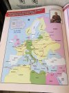
Most of the borders are post-WWII, but at least they (and the coastlines) are correct. There are much worse WWII maps. It took me a while to find where I had stashed it in my PC, but I finally dug it out.
Warning: eye-gougingly bad. Enlarge Thumbnail at your own risk.

From an Indonesian textbook, I'm guessing?Most of the borders are post-WWII, but at least they (and the coastlines) are correct. There are much worse WWII maps. It took me a while to find where I had stashed it in my PC, but I finally dug it out.
Warning: eye-gougingly bad. Enlarge Thumbnail at your own risk.
View attachment 833237
Urgh, where to even start with this one.Most of the borders are post-WWII, but at least they (and the coastlines) are correct. There are much worse WWII maps. It took me a while to find where I had stashed it in my PC, but I finally dug it out.
Warning: eye-gougingly bad. Enlarge Thumbnail at your own risk.
View attachment 833237
Seriously, how hard is it for textbook makers to just look up suitable source maps?
Crazy Boris
Banned
Most of the borders are post-WWII, but at least they (and the coastlines) are correct. There are much worse WWII maps. It took me a while to find where I had stashed it in my PC, but I finally dug it out.
Warning: eye-gougingly bad. Enlarge Thumbnail at your own risk.
View attachment 833237
Shoutout to inexplicably independent Saxony
Shoutout to inexplicably independent Saxony
I think it is supposed to be Czechia.
Where is Japan? Is it safe? Is it alright?At first glance I noticed that the depicted area is the old Soviet Union and not the Russian Federation.
At second glance I then noticed a slight oddity in the Pacific.
View attachment 834627
(as minor quibble Greece vanished but to compensate for it the Baltic seems to have silted up)
South America or Australia, pick one.No Taiwan or the Philippines.... not sure if it is worth wondering if South America exists...
More like a choice of all the biodiverse parts of Oceania or South America and I refuse to make the decision lolSouth America or Australia, pick one.
Whatever you do, don't overlay them. You'd get all the deadliness of Australian fauna mixed with the Amazon.South America or Australia, pick one.
And also llamas.
If it was Australian, it would never have existed in the Domesticated form, only Guanaco would exist (and they'd have venom."That's not a llama. *This* is a llama."
#llamadundee
I think the mix of curvy and angular lines is contributing a lot to how disgusting it looks. Most countries look like melted ice cream (probably going for wiggly lines as a substitute for detail), but then Central Europe looks like it got a bad case of colonization. Probably the weirdest thing on this whole map is how it looks like they drew Greece in blobs first, and then covered it up later with jagged trapezoids.Most of the borders are post-WWII, but at least they (and the coastlines) are correct. There are much worse WWII maps. It took me a while to find where I had stashed it in my PC, but I finally dug it out.
Warning: eye-gougingly bad. Enlarge Thumbnail at your own risk.
View attachment 833237
Well... weirdest aside from an inexplicable second Corsica, a mysterious country that appears to be a mutant second Austria (which has participated in a partition of Hungary along with Yugoslavia and Romania), Mega-East-Prussia, Russian Finnmark, drained Sea of Azov, the relocation of Kyiv to Lviv, and the relocation of Stalingrad to Kharkiv.
Share: