Serbia është Kosova!!!!!!!!!
Ah yes, Kosovo finally has back it's rightful clay
Serbia është Kosova!!!!!!!!!
And the PhillipinesOH GOD WHAT DID DER BOLSHEWISMUS DO TO EUROPE
AND ARABIA
AND THE HORN OF AFRICA
AND AUSTRALIA
Well, they outlined the color in the key, so there is at least that.Why you should twice before turning a color labeled map into a monochrome one:
View attachment 439047
Well, they outlined the color in the key, so there is at least that.
Why does France look like it has an STD?Well, yes, but on the other hand you can't really tell whether the darkest black is now the -50 or the 80+ category.
(admittedly this map seems to be about average life expectancy so we can guess which black is which but that's then more due to basic knowledge and not to actually being able to discern the different grey/black hues)
Map slightly related (also lack of colors)
View attachment 439076
Why does France look like it has an STD?
Well, they outlined the color in the key, so there is at least that.

This deserves an infinite facepalm.
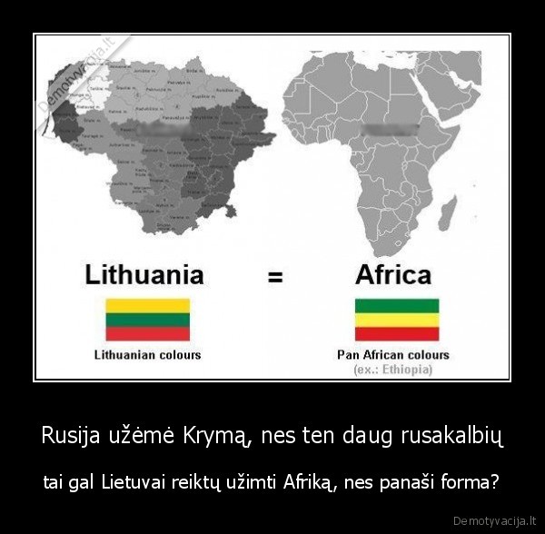
Dutch? No, no, the Afrikaners are descendants of Lithuanian colonists! Just look at the OFS and Transvaal's flags!
Lithuanian Africa? @AugenisMan, wouldn't that make for one hell of an AH scenario, though?
Just how do you be so ignorant of history yet know enough to write about the Boer Republics? The dates all check out. The only nitpick I have bar the obvious are that the Union Jack is used for the British colonies instead of the colonial flag and that it would be Southern Rhodesia then.
Dutch? No, no, the Afrikaners are descendants of Lithuanian colonists! Just look at the OFS and Transvaal's flags!
The SPD electoral program for the German 2017 election in "Simple German".
View attachment 441076
But the map? Independent East Austria? Ukraine and Belarus still part of the USSR? Independent Sardinia and Sicily?
United Ireland and independent Scotland?
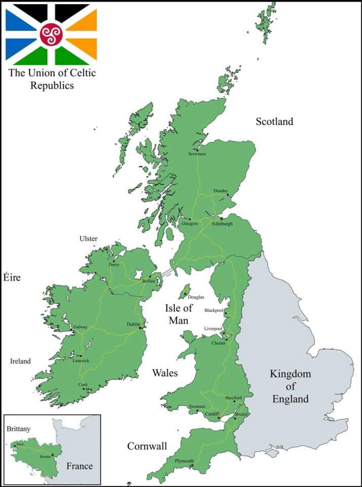
Please enjoy this dreadful Celtic ultranationalist map (with absolutely horrible flag included at no extra charge). New and magically Celtic 9-county Ulster (which even the DUP have given up as a pipe dream), another massive Cornwall with some of Gloucestershire attached, Celtic Lancashire and Cumbria, Brittany (which is, funnily enough, the only constituent country not massively wanked) and all sorts of other Anglophobic fun.